Table of Contents
- Introduction
- Why Boaters Need a Water Depth App
- What Makes the Best Water Depth App?
- Wavve Boating: The Best Water Depth App for Every Boater
- How Wavve Boating Compares to Other Water Depth Apps
- How to Use Wavve Boating as a Water Depth App
- Who Benefits Most From a Water Depth App Like Wavve Boating?
- Why Wavve Boating is the Best Choice for Depth and Beyond
- FAQs About the Best Water Depth App
- The Best Water Depth App for Today’s Boaters
Best Water Depth App for Safer and Smarter Boating
Introduction
Boating is all about freedom, whether you’re cruising a lake, exploring a coastline, or fishing your favorite spot. But that freedom comes with one constant challenge: knowing exactly how much water is under your boat. Misjudge it, and you risk running aground, damaging your prop, or worse, putting yourself and your passengers in danger.
That’s where technology comes in. The best water depth app for boating gives you instant visibility into changing conditions beneath the surface, so you can navigate with confidence instead of guesswork. With tides shifting, sandbars moving, and hidden hazards lurking, the difference between a great day on the water and an emergency often comes down to preparation.
If you’re wondering what the best app to check water depth for boating is, the answer depends on what matters most to you: accuracy, real-time updates, or ease of use. But increasingly, boaters want an app that does it all, showing depth, tides, weather, and safe routes in one place. That’s where Wavve Boating has emerged as a favorite.
Why Boaters Need a Water Depth App
For generations, boaters relied on paper charts, onboard depth sounders, or simply local knowledge to avoid shallow water. While those tools still have their place, they don’t always keep up with changing conditions. Tides can drop faster than expected, sandbars shift with storms, and not every hazard is marked on traditional charts.
A boating depth app solves these gaps by putting live, layered data directly in your pocket. Instead of guessing, you can see:
- Current depth adjusted to your boat’s draft, so you know where you can safely travel.
- Real-time tide charts and water levels, showing how conditions will look in an hour versus right now.
- Community updates, like newly marked hazards, recommended routes, and shared safe anchor spots.
The best part? Apps like Wavve Boating combine this practical information with simple, intuitive design. You don’t have to be a professional captain to use it, it’s built for everyday boaters, whether you’re driving a fishing skiff, a pontoon, or a Sea-Doo.
In short, a marine depth app isn’t a luxury anymore; it’s an everyday safety tool. And as boating becomes more popular and waterways more crowded, having that kind of visibility isn’t optional, it’s essential for safety, planning, and peace of mind.
What Makes the Best Water Depth App?
Not all boating apps are created equal. Some are little more than digital versions of paper charts, while others overwhelm you with cluttered screens and technical jargon. The best water depth app strikes a balance, it gives you the critical information you need in a format that’s simple, clear, and designed for real-life use on the water. Here are the features to look for:
Accurate Depth Data
Reliability is everything. If depth information isn’t accurate, it’s useless. The best apps use official hydrographic sources, combined with updated data streams, so boaters can trust what they see.
Tide and Water Level Adjustments
Depth doesn’t stay static, what’s safe at high tide might be impassable a few hours later. The best apps integrate tide stations to automatically adjust charted depths to current conditions.
Ease of Use and Customization
You shouldn’t need a captain’s license to read a chart. Look for apps that let you set your boat draft customization so charts are tailored to your vessel, and offer map styles (satellite, 3D, dark mode) that match how you like to navigate.
Community Data and Spot Sharing
Even the most detailed charts can’t replace local knowledge. The best apps bring a social element, letting boaters mark hazards, recommend destinations, and share safe anchorages, so you benefit from the collective experience of other mariners.
Integrated Weather and Navigation Tools
Depth alone is helpful, but pairing it with weather forecasts, wave height predictions, and smart routing makes the app a true boating companion. That’s where depth apps cross over into being full-feature marine navigation platforms.
Wavve Boating: The Best Water Depth App for Every Boater
When you combine all those must-have features, Wavve Boating stands out as the clear choice. Built from the ground up as a community-powered navigation tool, it does far more than simply tell you how to check water depth with an app, it helps you boat smarter and safer in every condition.
Here’s what makes Wavve Boating the best water depth app today:
- Custom Depth Charts: Automatically adjusts maps based on your boat’s draft so you always know where it’s safe to travel.
- Real-Time Tide Data: Integrated with local water level stations to keep your charts up-to-date throughout the day.
- Smarter Nautical Charts: Award-winning maps that clearly show hazards, with options for satellite, dark, and 3D views.
- Community-Powered Maps: Share and discover the best boating spots, anchorages, and sandbars, all rated and marked by fellow boaters.
- Navigation & Autorouting: Get safe, fuel-efficient marine routes and autorouting that factor in channels and obstacles, complete with ETA reporting.
- Weather Forecast Integration: Multi-day forecasts and small vessel warnings keep you ahead of changing conditions.
It’s like having Google Maps for the water, but designed specifically for boaters, anglers, and paddlers who want both safety and adventure in one app.
How Wavve Boating Compares to Other Water Depth Apps
There are a handful of apps that claim to help with depth and navigation, Navionics, Garmin ActiveCaptain, Fishbrain, even free tide chart apps. Each has strengths, but they also come with trade-offs.
- Navionics is detailed and trusted by many seasoned boaters, but its interface can feel overwhelming for casual users and it often requires pricey subscriptions.
- Garmin ActiveCaptain integrates well if you already own Garmin hardware, but it’s less intuitive as a standalone app.
- Fishbrain is popular with anglers for fishing spots, yet its water depth tools aren’t built for broader navigation.
- Tide-only apps might show you when the tide is in or out, but they don’t combine that data with navigation or community updates.
What sets Wavve Boating apart is its balance. It’s powerful enough to provide real-time depth, tides, and navigation accuracy, but it’s wrapped in a clean, simple interface that anyone can use. Plus, with boating community maps, you’re not limited to what’s printed on a chart; you benefit from the knowledge of boaters who were just on the water. That makes Wavve more dynamic and reliable than traditional apps that only update on long cycles.
If you’re looking for the best water depth and navigation app for iPhone that works for weekend boaters, seasoned captains, and everyone in between, Wavve Boating delivers where others fall short.
How to Use Wavve Boating as a Water Depth App
Getting started with Wavve Boating doesn’t require advanced setup or expensive hardware, it’s designed for everyday boaters who want clarity fast. Here’s how you can use it as your go-to marine GPS app:
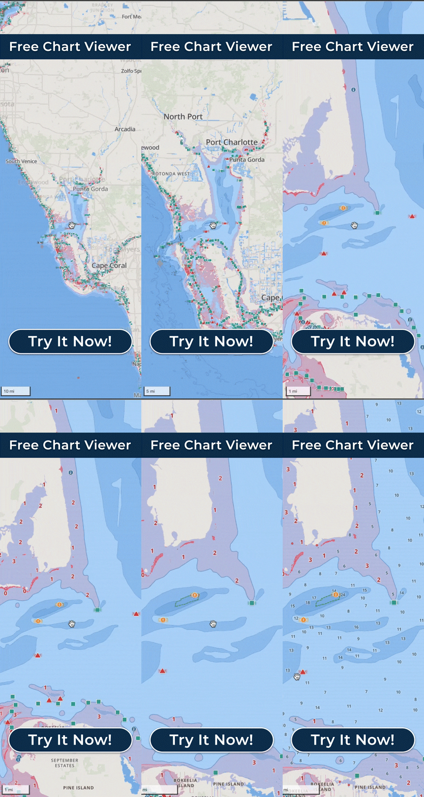
- Download the app: Available on iOS and Android. Start with the free chart viewer or jump straight into premium features.
- Set your boat’s draft: Enter how deep your vessel sits in the water. This customizes the charts so you’ll instantly see which areas have shallow water hazards and which are safe to travel.
- Explore the charts: Zoom into your local waterways and check depth readings adjusted for tides in real-time.
- Plan your trip: Use the auto-routing feature to map a safe course, complete with ETA and time-to-complete estimates.
- Leverage community spots: Check out highly rated destinations, anchorages, and sandbars marked by fellow boaters.
- Stay ahead of conditions: Monitor tides and weather forecasts, including wave height warnings, so you’re never caught off guard.
What’s most refreshing is that Wavve strips away the complexity found in traditional chartplotters. Instead of staring at a cluttered screen, you get an interface that feels familiar, more like using Google Maps on your phone than deciphering an old-school marine chart.
Who Benefits Most From a Water Depth App Like Wavve Boating?
A depth finder app is useful for every type of boater, but certain groups get the biggest payoff from having this kind of tool at their fingertips:
- Recreational Boaters – Weekend cruisers and family boaters no longer have to guess where sandbars or shallow patches might be. Depth data tailored to your boat means more time enjoying the ride and less worrying about scraping the bottom.
- Anglers – Fishermen rely on depth to find productive waters, but also to avoid damaging shallow areas near reefs or flats. With real-time tide adjustments, anglers know exactly when it’s safe to reach their favorite fishing holes.
- Personal Watercraft Riders (Sea-Doos, Jet Skis, PWCs) – Shallow water can be a hidden hazard for smaller craft that often zip closer to shore. Wavve Boating, already integrated with BRP Sea-Doo displays, gives PWC riders a smarter way to explore.
- Kayakers and Paddleboarders – Even small vessels can benefit from knowing when an inlet will be passable or when tides will expose rocks and mudflats. Having a boating GPS app with depth improves both safety and route planning.
- Travelers and Explorers – Visiting a new coastline or lake? A community-powered depth app gives you instant access to local knowledge, so you don’t have to rely solely on guesswork or asking around at the dock.
Whether your boat has a motor or a paddle, the best water depth app gives you one thing everyone on the water wants: confidence.
Why Wavve Boating is the Best Choice for Depth and Beyond
Plenty of apps can tell you how deep the water is. What makes Wavve Boating stand out is how it transforms that raw data into a complete, easy-to-use boating experience.
- It doesn’t just show depth, it adapts charts to your vessel so you instantly see safe versus unsafe zones.
- It doesn’t just report tides, it syncs depth data to live tide conditions so you’re never surprised when water levels drop.
- It doesn’t just show a map, it layers in navigation, weather, and community insights so you can make smarter decisions on every trip.
In other words, Wavve Boating is more than a tool; it’s a full marine navigation companion. It reduces stress, helps avoid costly accidents, and makes discovering new places exciting instead of intimidating.
When people search for the best app to check water depth for boating, they’re often really looking for peace of mind. Wavve delivers that by combining accuracy, simplicity, and innovation into one award-winning package trusted by both everyday boaters and major marine brands.
FAQs About the Best Water Depth App
Does a water depth app work offline?
Some apps do, but not all. Wavve Boating allows you to download chart areas so you can access depth and navigation info even when you’re out of cell range.
How accurate is Wavve Boating’s depth data?
Wavve combines official hydrographic office data with real-time tide updates and community reports. That means charts are both professionally sourced and dynamically updated for accuracy.
Can a water depth app replace a depth finder?
While a depth finder measures conditions directly under your boat, a depth app gives you a broader view of waterways, tides, and hazards ahead. Used together, they make for the safest setup, but many boaters rely on apps like Wavve as their primary tool.
Is Wavve Boating free to use?
Yes, there’s a free chart viewer version to get started. For full features like autorouting, community maps, and real-time tide data, premium plans unlock the complete experience.
The Best Water Depth App for Today’s Boaters
When it comes to staying safe and exploring with confidence, the best water depth app is the one that goes beyond numbers on a chart. It should combine accuracy, real-time updates, and an intuitive design with the kind of features boaters actually use.
That’s exactly what Wavve Boating delivers. From customized depth charts and automatic tide adjustments to community-powered maps and smart navigation, Wavve has become the go-to app for anyone who wants more than a basic chart. It’s like having a personal guide on the water, one that updates constantly and makes every trip smoother, safer, and more enjoyable.
If you’re looking for a way to avoid grounding, plan better trips, and discover new destinations, it’s time to download Wavve Boating and see why so many boaters are calling it the best water depth app of 2025.


