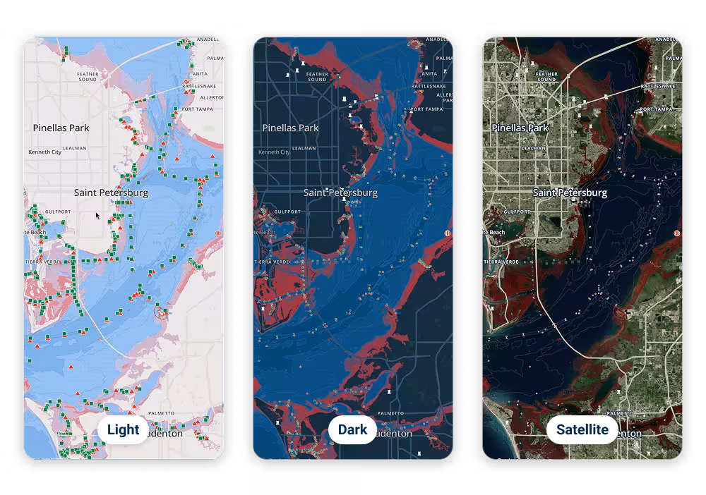
Navigation
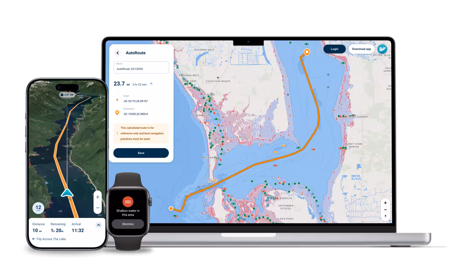
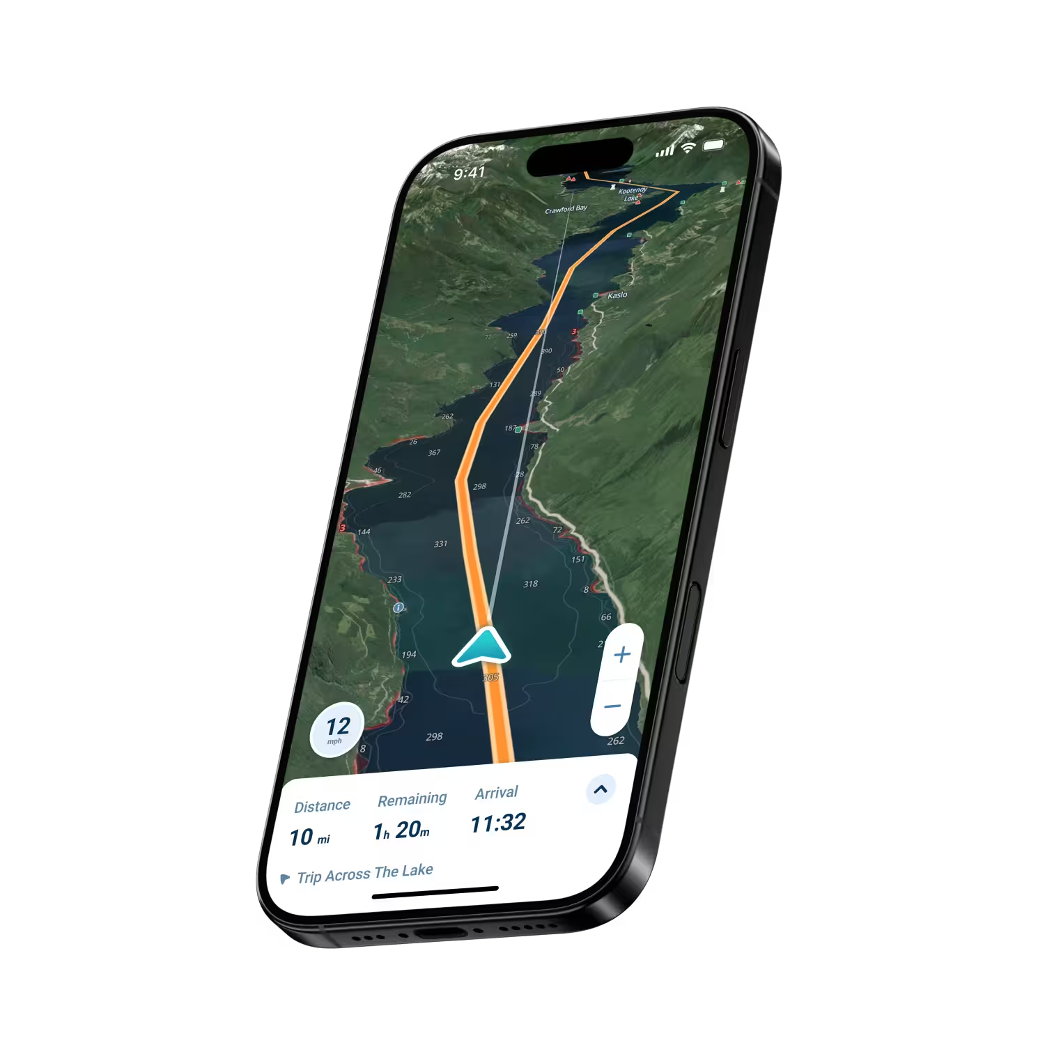
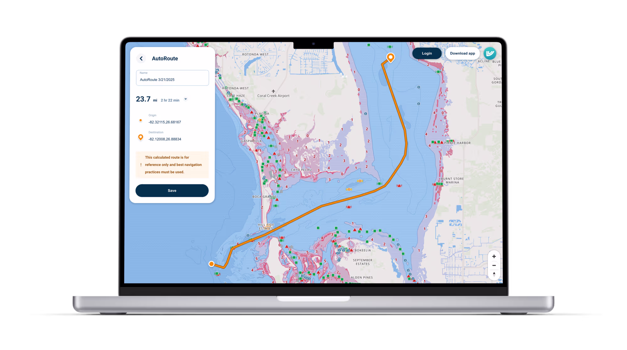
Industry leading auto-routing
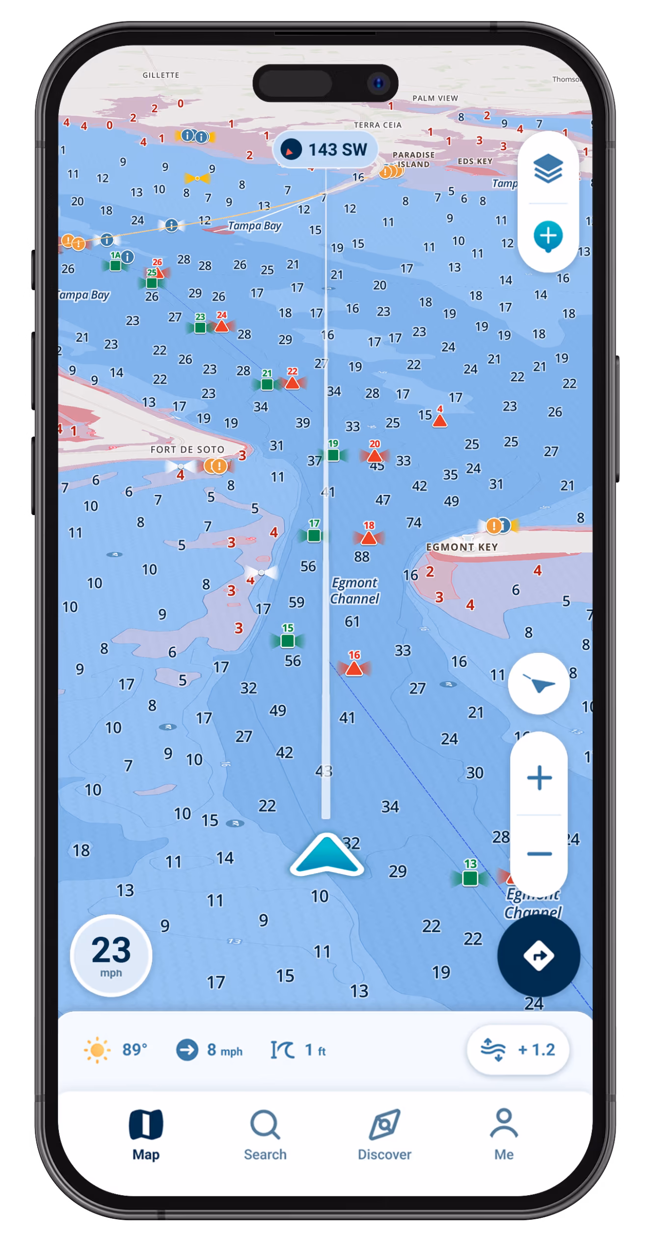
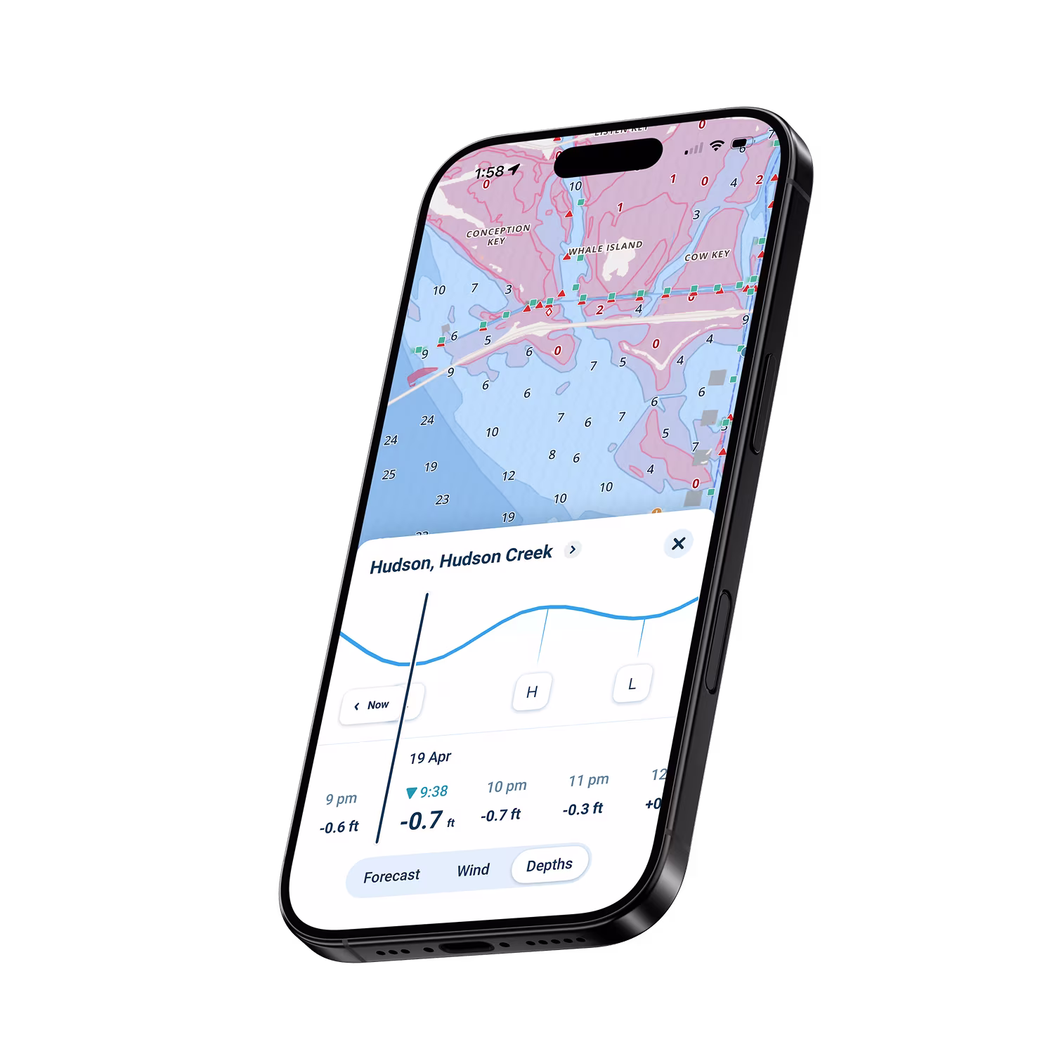
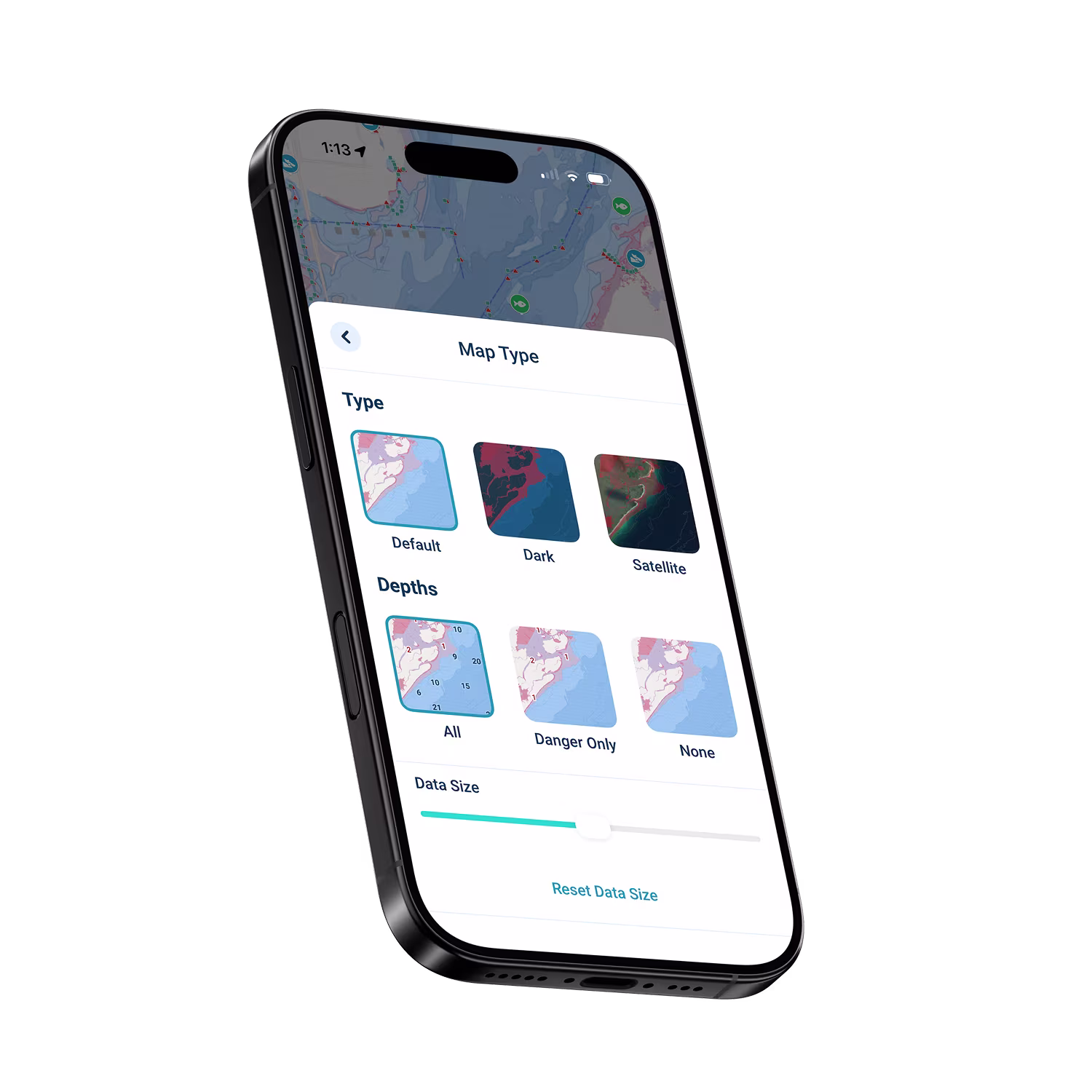
View depth data that adjusts to the tide
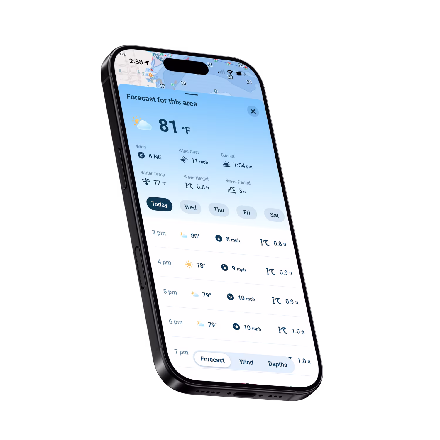
View weather conditions, wave height & wind overlays
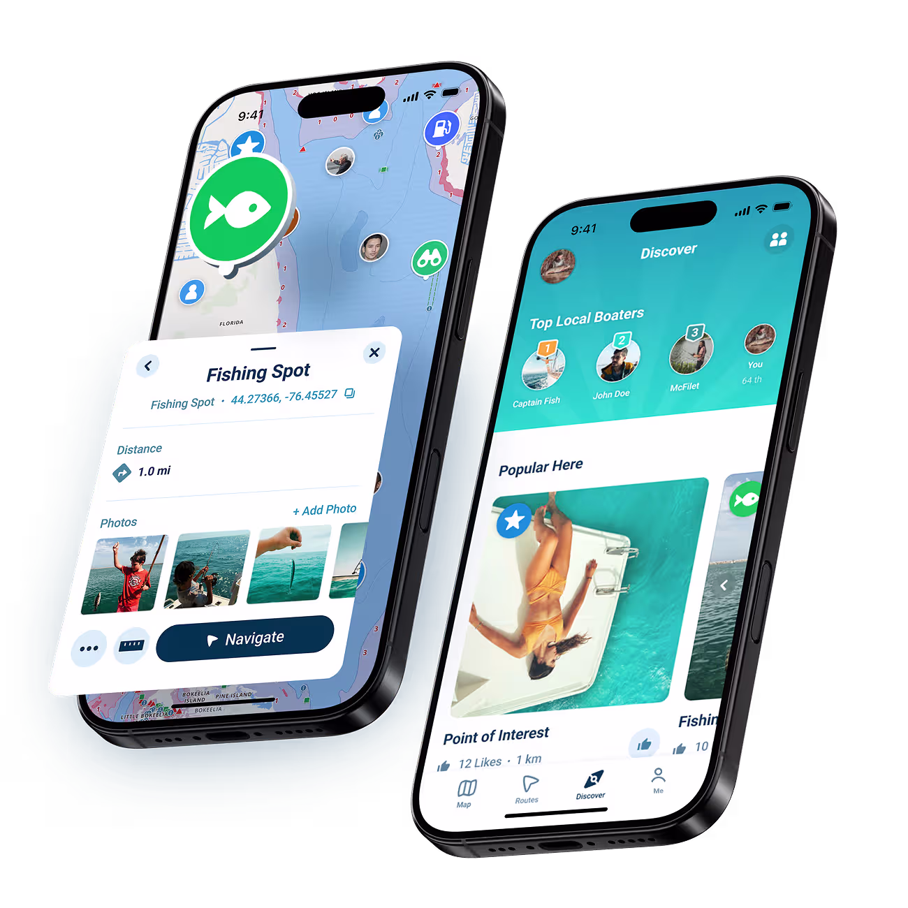
Find friends, share spots, and explore together
Plan ahead, navigate with confidence, discover new spots, and make better decisions on the water.
Know Before You Go
Plan a perfect day before you leave the dock
Know exactly where you are, and what to avoid
Discover, share, and explore with the help from fellow boaters
All the information you need, in one easy-to-use app
Start Your Boating Journey
Join thousands of boaters using Wavve Boating to explore, plan, and navigate with confidence.