Table of Contents
Boating Spot Sharing App
Wavve Boating makes it easy to discover, save, and share the best boating spots, from sandbars and coves to ramps and dock-and-dine stops, on charts personalized to your boat and updated with the tide.
Download Wavve Boating on iOS and Android to start exploring smarter today.
Trusted by thousands of boaters, powered by 17,000+ official nautical charts, and recognized with industry awards.
Trusted by Leading Boaters and Marine Brands
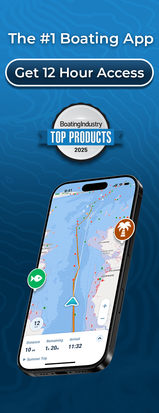
Wavve Boating is recognized as one of the most innovative apps in the marine industry. Featured in Boating Industry’s Top Products and publications like Powerboat World and Trade Only, the app continues to be the go-to choice for boaters who want smarter navigation and real community insights.
Supporting line: From major brands like April Marine to thousands of everyday boaters, Wavve is relied on to make time on the water easier, safer, and more fun.
Discover and Share Real Boating Spots
Wavve Boating turns your chart into a living map. The community is constantly adding and reviewing locations, so you always know where to go and what to expect.
Sandbars and Social Hotspots
Find the most popular gathering places on the water. Each sandbar includes ratings, depth notes for high and low tide, and recent updates from fellow boaters.
Dock-and-Dine Favorites
See where boaters tie up for waterfront dining, fuel, or a quick stop. With firsthand notes from the community, you’ll know which restaurants and marinas are worth the trip.
Boat Ramps and Marinas
Plan your launch ahead of time by browsing ramps and marinas near your destination. Community tips help you avoid surprises and choose the most convenient option.
Hidden Coves and Quiet Anchorages
Discover tucked-away spots that locals love. Whether you’re looking for a calm swimming hole or a peaceful place to anchor, Wavve’s boating spot sharing app helps you find them.
Instead of guessing where to go, use the knowledge of the Wavve community to make every trip smoother, safer, and more enjoyable.
Why Choose Wavve as Your Boating Spot Sharing App
Not all boating apps are built the same. Wavve Boating stands out because it combines the power of official nautical charts with real community knowledge. Instead of generic maps, you get tide-aware, draft-specific navigation layered with the best boating spots shared by boaters like you.
- Community-powered spots: Discover sandbars, coves, marinas, and dock-and-dine locations with ratings and notes from other boaters.
- Personalized depth data: Charts adapt to your boat’s draft, so hazards are clearer and routes feel safer.
- Tide awareness: Spot information updates in real time with local water levels, giving you a complete picture before you head out.
- Safe autorouting: Navigate confidently with routes that respect channels and obstacles.
- Integrated weather forecasts: Multi-day predictions, wave height data, and small-vessel alerts to help you choose the right time to explore.
- Trip recording: Save your path and revisit favorite destinations later.
When you choose Wavve Boating, you’re choosing an app that blends navigation, safety, and community into one seamless boating spot sharing experience.
Chart Coverage You Can Count On
Wavve Boating brings together more than 17,000 official nautical charts into one seamless map. Every chart is automatically updated, so you always have the most accurate information for planning and navigating your trips.
Search by Region
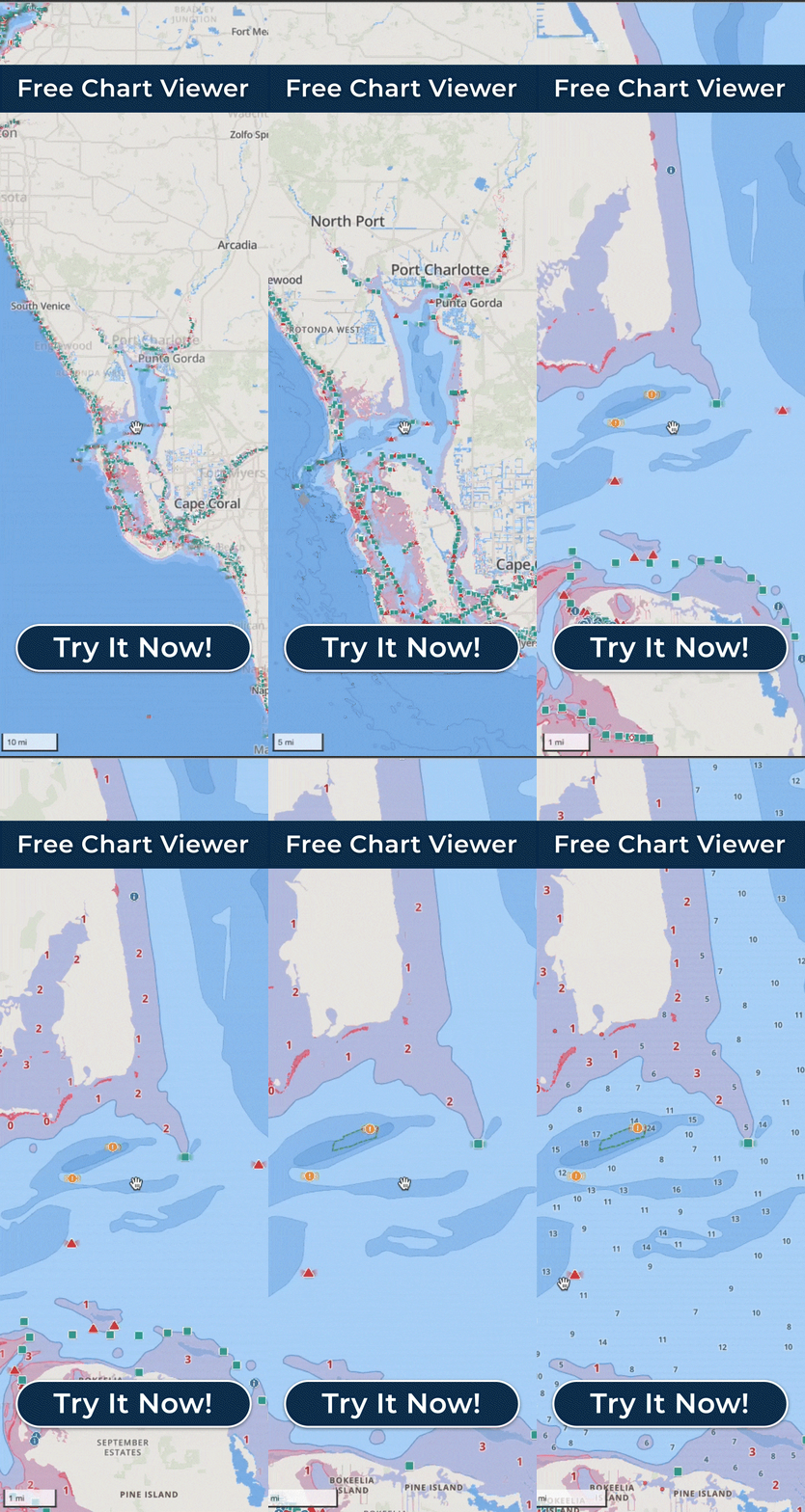
Check our coverage viewer to explore popular boating regions like Florida, Ontario and Québec, or Australia. With just a few taps, you’ll see exactly which areas are included before heading out.
Tide-Aware Depth Data
Unlike generic maps, Wavve’s boating spot sharing app adjusts depth data in real time using local water level stations. This means you’ll know how much clearance you have when approaching marinas, ramps, or sandbars, even at low tide.
Reliable Sources
All base data comes directly from official hydrographic offices. By combining trusted charting data with community spot sharing, Wavve gives you a more complete picture of the water than either source alone.
From inland lakes to coastal waterways, Wavve Boating provides coverage you can trust and insights you can act on.
How Boaters Use Our Spot Sharing App
Wavve Boating isn’t one-size-fits-all. Whether you’re planning a family outing, chasing adventure, or heading out on your Sea-Doo, the app adapts to the way you boat.
Weekend Explorers
Discover sandbars, anchorages, and hidden coves that other boaters recommend. Plan a loop with safe autorouting and make it back before the tide shifts.
Dock-and-Dine Fans
Browse restaurants and marinas with community reviews. Know in advance where to tie up, where to refuel, and where to enjoy a great meal on the water.
Families and New Boaters
Feel confident with tide-aware depths, clear channel routes, and weather cues designed for small vessels. Sharing tips from the community helps you avoid rookie mistakes.
How Wavve Compares to Alternatives
When choosing a boating spot sharing app, it helps to see how Wavve stacks up against other options.
| Feature/Benefit | Wavve Boating | Generic Map Apps | Traditional Chartplotters |
|---|---|---|---|
| Community Spot Sharing | ✔️ Yes – share & discover sandbars, coves, docks, restaurants | ❌ No | ❌ No |
| Draft-Aware Depths | ✔️ Personalized to your boat’s draft | ❌ Not available | ✔️ Yes |
| Tide-Aware Charts | ✔️ Real-time depth updates from local stations | ❌ Not available | ✔️ Yes (manual updates often required) |
| Safe Autorouting | ✔️ Routes that follow channels & avoid hazards | ❌ No marine-specific routing | ✔️ Yes (hardware-based) |
| Weather & Wave Forecasts | ✔️ Multi-day with wave height & vessel alerts | ❌ Basic weather only | ❌ Rarely integrated |
| Trip Recording | ✔️ Save & revisit breadcrumb trails | ❌ No | ✔️ Some models |
| Ease of Use | ✔️ Mobile-friendly, intuitive | ✔️ Easy but not designed for water | ❌ Steeper learning curve |
| Cost | Affordable subscription | Free (but limited) | High upfront equipment cost |
With Wavve Boating, you don’t have to choose between accurate charts and community knowledge, you get both, in one easy-to-use app.
What Boaters Are Saying
“Wavve Boating made our weekends easier. We found new sandbars and dock-and-dine spots we never would have discovered on our own.” — Jamie S., Florida
“As a new boater, I feel more confident knowing the app shows tide-aware depths and safe routes. The community tips are a bonus.” — Chris R., Ontario
“I love that I can use Wavve right on my Sea-Doo display. It’s like having local knowledge built into every ride.” — Taylor M., PWC rider
Boating Spot Sharing App FAQs
What is a boating spot sharing app?
It’s an app where boaters discover and share locations like sandbars, marinas, ramps, and coves, enhanced with navigation features.
How does Wavve differ from Google Maps or Waze?
Unlike generic map apps, Wavve is built for the water with draft-aware depths, tide updates, safe autorouting, and community spot sharing.
Can I preview spots before downloading the app?
Yes. Our Free Chart Viewer lets you see coverage and check out local areas before starting your subscription.
Does Wavve work with Sea-Doo?
Yes. You can connect your phone and use Wavve directly on select Sea-Doo onboard displays.
Where does Wavve’s chart data come from?
All charts are sourced from official hydrographic offices and updated automatically.
Start Exploring With Wavve Boating
Share. Discover. Navigate Smarter.
Whether you’re chasing new sandbars, finding the best dock-and-dine restaurants, or exploring hidden coves, Wavve Boating gives you the tools and community knowledge to make the most of your time on the water.
Download Wavve Boating on iOS or Android today and see why it’s the leading boating spot sharing app.


