Table of Contents
- Real-Time Tides On Your Chart
- Set Your Draft, See Your Risks
- Autorouting in the Boating Tides App
- Marine Weather in the Boating Tides App
- Marine Weather in the Boating Tides App
- Built For How You Boat With a Boating Tides App
- Try the Free Chart Viewer in the Boating Tides App
- 17,000+ Official Nautical Charts in the Boating Tides App
- Sea-Doo Ready: Boating Tides App Integration
- Tide Tables vs. a Boating Tides App
- From Tide Data to Confident Trips
- Smart Tools, Skippered By You
- Start Free, Upgrade When You’re Ready
- FAQs About the Boating Tides App
- Boat the Tides With Confidence
Trusted On The Water
Recognized as a Top Product 2025 and backed by 17,000+ official nautical charts, Wavve Boating has become the boating tides app trusted by thousands of boaters worldwide. From inland waterways to coastal trips, it delivers accurate tide data and reliable mapping when it matters most.

Real-Time Tides On Your Chart
The power of a boating tides app is seeing how tides actually change the water you navigate. Wavve Boating brings tide data onto your chart so you can make decisions with clarity instead of guesswork.
Live water-level stations
Stay updated with real-time readings pulled from local tide and water-level stations.
Depth shading that updates automatically
Watch your chart shift as water levels rise or fall, shallow zones are highlighted instantly so they’re easy to avoid.
Preview high and low tide windows
Plan ahead with interactive previews that show how depth will change throughout the day. Perfect for timing launches, bar crossings, or returns.
Set Your Draft, See Your Risks
Unlike generic tide tables, this boating tides app adapts to your exact boat. Enter your vessel’s draft once, and Wavve Boating recalculates the map to reveal what really matters.
Personalized hazard highlights
Hazards and shallow spots are flagged according to your boat’s draft, not just general depth.
Clear shallow-water thresholds
Color-coded cues make it easy to see where your boat can and cannot go at a glance.
Navigation tailored to you
Every map feels specific to your vessel, turning complex tide and depth data into personalized guidance.
Autorouting in the Boating Tides App
Wavve Boating goes beyond static charts with autorouting that respects tides, channels, and known obstacles. The boating tides app calculates practical paths based on real-time conditions and your boat’s draft, giving you safer, more efficient routes.
You’ll see estimated time of arrival and trip duration, making it easier to plan your day. Routes are designed to reduce fuel use while keeping you clear of shallow or restricted areas, but every suggestion can be verified visually for added peace of mind.
Marine Weather in the Boating Tides App
Tides are only part of the picture. Wavve Boating also delivers a built-in marine weather layer to help you decide when it’s safe to head out. The boating tides app provides multi-day forecasts, including wave height, so you know what to expect on open water.
Color-coded small-vessel warnings make conditions easy to interpret at a glance, green means good, red means think twice. By combining tide data with accurate weather insights, Wavve Boating gives you a complete view of your boating environment.
Built For How You Boat With a Boating Tides App
Every boater uses tide data differently, and Wavve Boating is designed to adapt. This boating tides app provides personalized value no matter what type of vessel or waterway you’re navigating.
- Inshore and ICW boating: Time shoals, bridges, and channel markers with tide-aware depth updates.
- Sandbar navigation: Know if your favorite gathering spot will be accessible at low tide before you set out.
- Sea-Doo riders: Connect your phone to the built-in GPS display and use Wavve Boating directly from the dash.
- Anglers and paddlers: Read tidal currents, flats, and eddies to plan safer trips and reach the best fishing or paddling grounds.
With tailored insights, the app ensures every trip feels easier and safer, whether you’re out for a quick ride or a full day on the water.
Try the Free Chart Viewer in the Boating Tides App
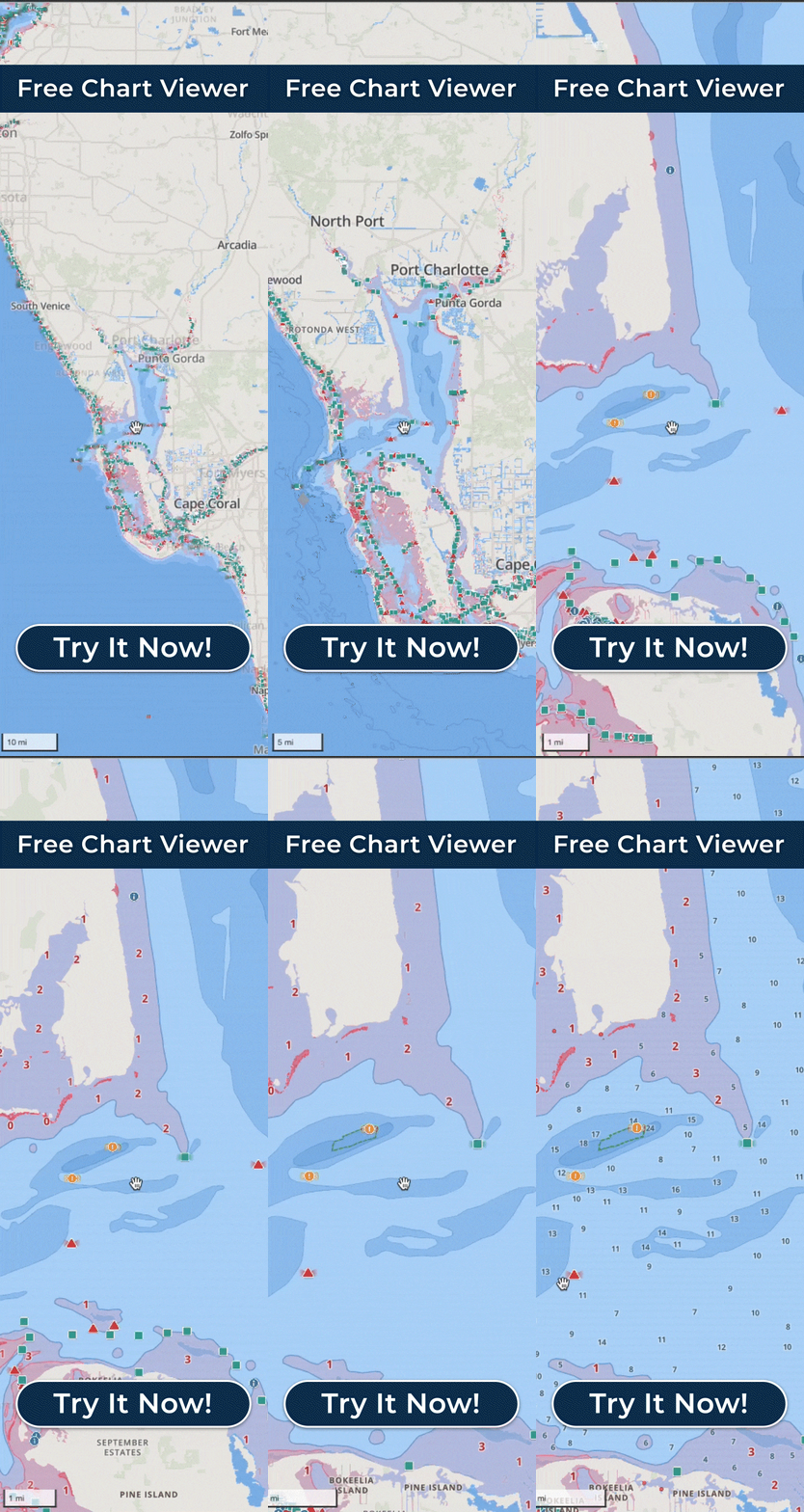
Get hands-on experience before you launch. The free chart viewer inside Wavve Boating lets you explore interactive tide maps without committing to a subscription. Toggle between high and low tide scenarios, see depth shading adjust in real time, and understand how offline nautical charts work when you download an area in advance.
This boating tides app makes it simple to preview how your favorite route or sandbar will look at different tide levels. With one tap, you’ll see how the water transforms throughout the day, so you can plan with confidence.
17,000+ Official Nautical Charts in the Boating Tides App
Scale matters when you’re navigating. Wavve Boating gives you access to more than 17,000 official nautical charts, sourced directly from hydrographic offices and updated automatically. The result: accurate depth information and tide-aware visuals you can rely on every trip.
This boating tides app integrates live station data with official maps, so you’re not just reading a static chart, you’re seeing how the water is changing right now. From coastal inlets to inland lakes, you’ll always know the true picture of the waterways you navigate.
Sea-Doo Ready: Boating Tides App Integration
Wavve Boating isn’t limited to your phone screen, it’s fully integrated with select Sea-Doo GPS displays. Connect your device and see tide data, real-time depths, and routes directly on your dash.
This feature transforms the boating tides app into an onboard navigation system, eliminating the need to switch between devices while you’re riding. Setup is quick, and once connected, you’ll have seamless access to tide-aware charts, weather, and trip tracking right from your handlebars.
Tide Tables vs. a Boating Tides App
Traditional tide tables list numbers. The boating tides app from Wavve shows what those numbers actually mean on a live map. Here’s how it compares:
| Feature | Tide Tables | Wavve Boating Tides App |
|---|---|---|
| Map context | Separate from charts | Integrated into interactive charts |
| Draft personalization | Generic depth info | Draft-aware hazard highlighting |
| Route impact | No route guidance | Autorouting with tide + obstacle awareness |
| Weather & wave data | Not included | Built-in forecasts with wave height |
| Community POIs | None | Shared sandbars, ramps, and dock-and-dine spots |
| Offline availability | Paper or PDF only | Downloadable areas with offline charts |
With Wavve Boating, tides aren’t numbers on a page, they’re real-time conditions shaping your actual route.
From Tide Data to Confident Trips
Using Wavve Boating is simple. The boating tides app turns tide and depth information into a clear step-by-step process:
- Set your boat draft so the app knows your safe depth.
- Toggle tides to see live water-level changes on the map.
- Preview high and low tide scenarios before you launch.
- Autoroute and verify visually with channels and obstacles factored in.
- Record breadcrumb tracks to review your day or repeat a safe route later.
With this flow, boaters move from raw tide data to reliable, real-world navigation in just a few taps.
Smart Tools, Skippered By You
Even the best boating tides app is designed to support, not replace, good seamanship. Wavve Boating combines accurate data with practical tools, while reminding every skipper to navigate responsibly.
- Charts and sources are updated automatically to reflect the latest hydrographic data.
- Local markers and buoys remain the final word for safe passage.
- Offline chart downloads keep you covered when cell service drops; live tide and weather updates refresh when you’re back online.
With Wavve Boating, you get smart tools that strengthen your decision-making, while still keeping you in full control of your vessel.
Start Free, Upgrade When You’re Ready
Getting started with Wavve Boating is simple. The boating tides app lets you explore its features at no cost, then upgrade when you’re ready for more advanced tools.
- Free Chart Viewer to preview coverage and interactive maps.
- Offline areas so charts stay with you when cell service doesn’t.
- Advanced routing and weather for boaters who want the complete package.
Choose the plan that fits your boating style and unlock safer, more confident navigation with Wavve Boating.
FAQs About the Boating Tides App
Does Wavve show future high and low tides on the map?
Yes. The boating tides app lets you preview future tide conditions so you can plan your launch or return with confidence.
How accurate are depth visuals for my draft?
Charts are sourced from official hydrographic offices and paired with live station data. Depth shading is adjusted for your boat’s draft to highlight real risks.
Will routes avoid shallow areas automatically?
Autorouting considers channels, obstacles, and tide data. Always verify suggested routes visually before heading out.
What works offline vs. online?
Charts can be downloaded for offline use. Live tide and weather updates refresh when you’re back in range.
Which areas are covered today?
Wavve Boating includes over 17,000 official nautical charts across North America, Australia, and beyond.
Does it work with my Sea-Doo display?
Yes. Connect your phone to compatible Sea-Doo models and view the app directly on the built-in GPS display.
Boat the Tides With Confidence
Don’t rely on static tables or guesswork. The Wavve Boating app transforms raw tide data into clear, draft-aware navigation that’s ready when you are.
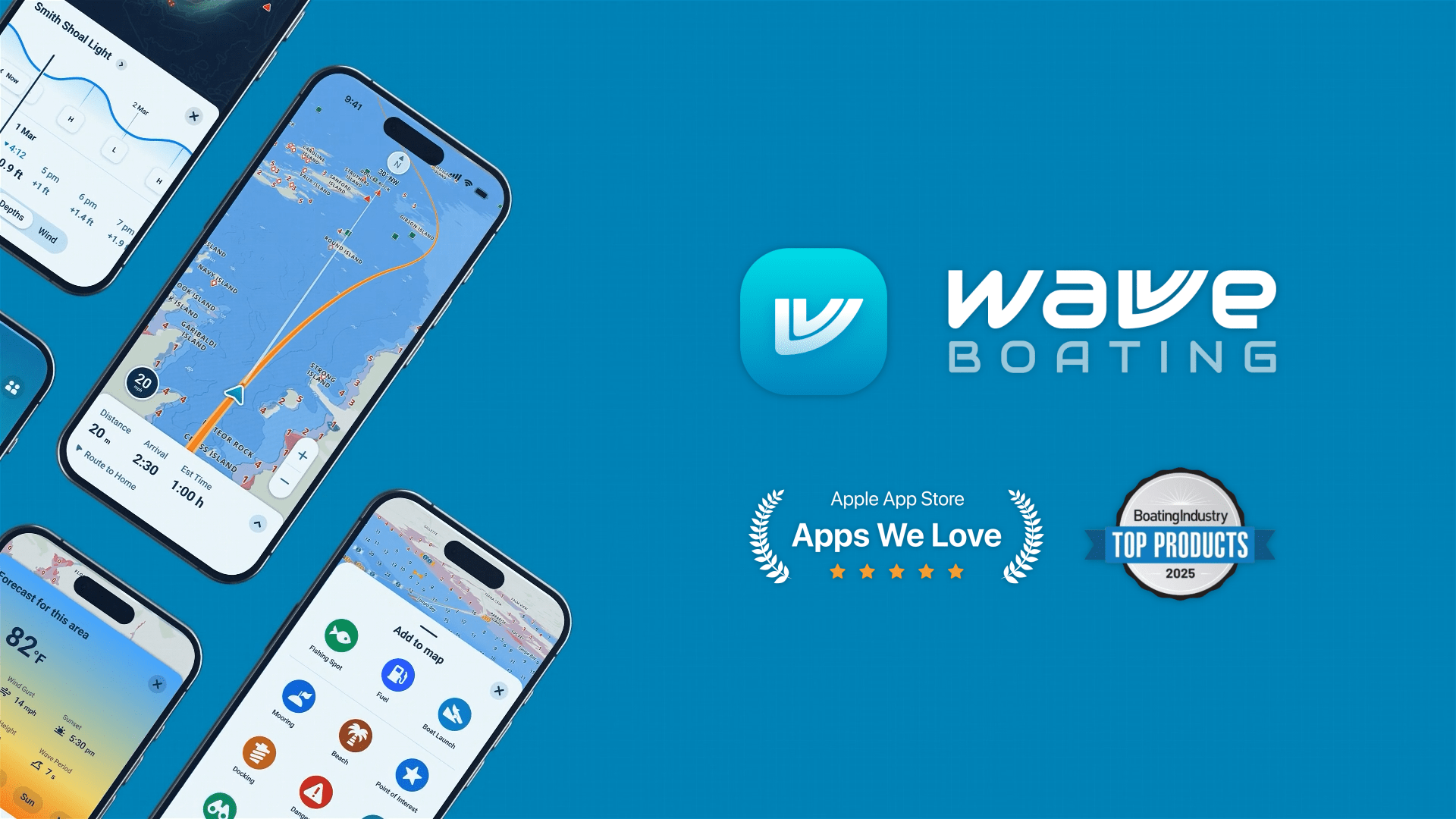
Or preview the Free Chart Viewer to see how tides transform your waterways.


