Gulf of Mexico Navigation

Navigate Gulf Waters Safely with Automated Draft-Aware Depth Shading & Real-Time Tides

Gulf of Mexico boating demands navigation accounting for strong currents, variable tides, offshore oil infrastructure, shifting sandbars, and rapidly changing weather. Wavve automatically shows safe versus shallow water for YOUR boat with draft-aware depth shading that updates hourly with tides, eliminating grounding risks in unfamiliar Gulf waters.

Key Benefits:

  • Automatic Draft-Aware Safety: See blue (safe) vs red (shallow) zones instantly based on your draft and current tides
  • Complete Gulf Coverage: Texas, Louisiana, Mississippi, Alabama, Florida Gulf Coast with official NOAA charts
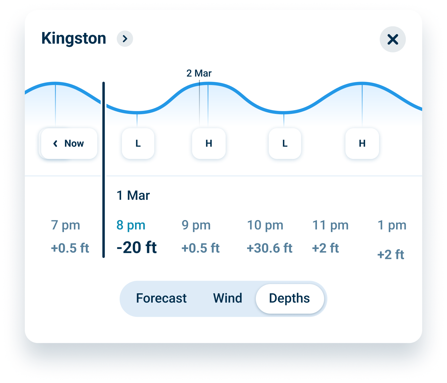
  • Real-Time Tide Integration: Depths update hourly as Gulf tides change throughout the day
  • Offshore Capability: Navigate beyond sight of land with reliable GPS tracking and waypoint management
  • Works Offline: Download charts, navigate without cell service in remote Gulf areas
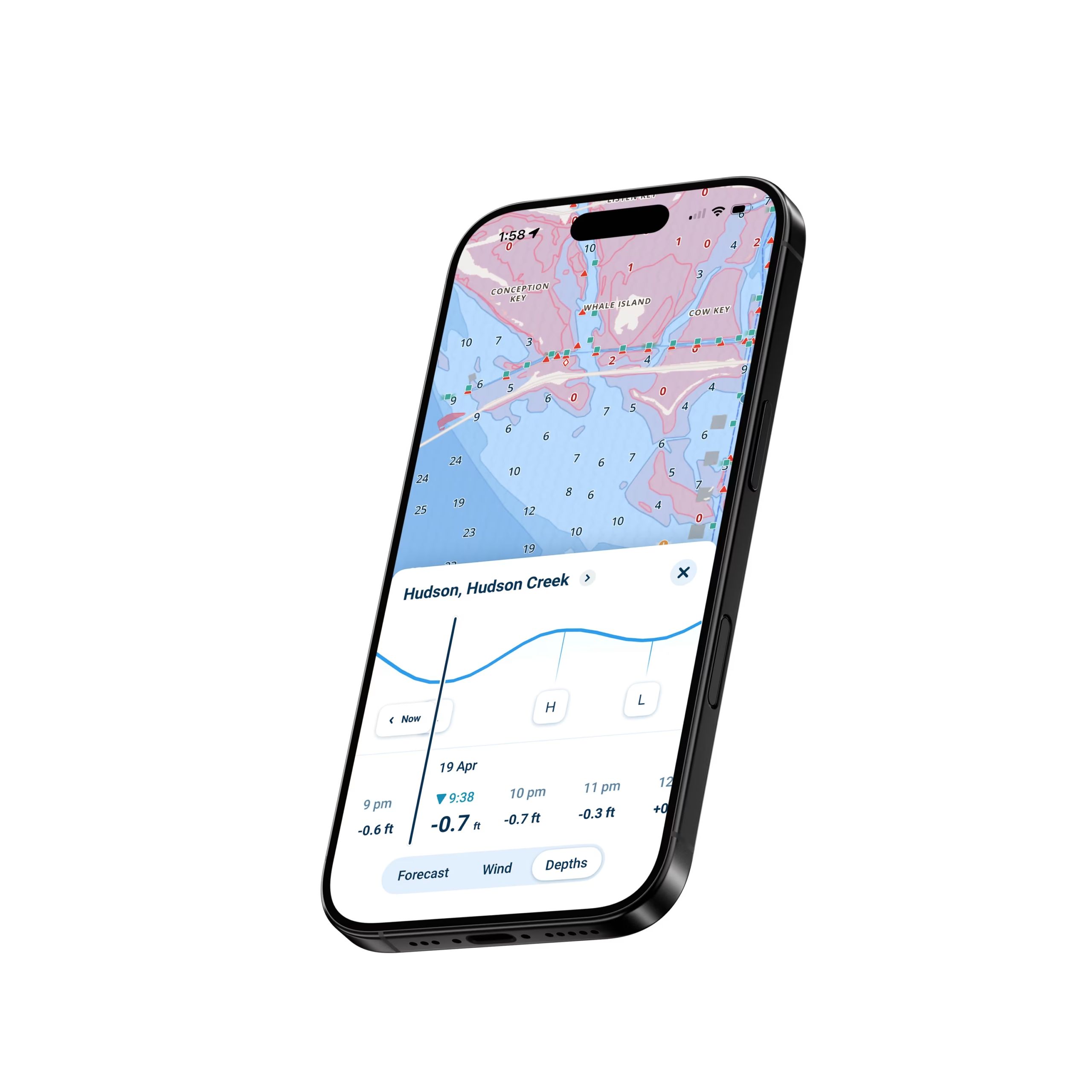
Wavve boating app tides

Why Wavve for Gulf of Mexico Navigation

Gulf waters present unique challenges from shallow coastal bays to deep offshore passages. Traditional GPS shows position but doesn’t warn when approaching shallow water dangerous for your specific draft at current tide. Offshore oil infrastructure creates navigation obstacles. Strong currents affect actual progress. Weather changes rapidly requiring immediate awareness.

Wavve solves this through automated safety features designed for Gulf conditions. Enter your draft once, charts instantly show where you can safely navigate right now based on current tides. The system updates hourly as water levels change with Gulf tidal flows.

Over one million boaters worldwide trust Wavve for confident navigation. Gulf Coast operators particularly value automated depth safety preventing groundings in the shallow bays, passes, and coastal waters characterizing much of the Gulf shoreline.

How To Get Started

Download_icon

Download the App

Available free on iOS and Android with 30-second install. Instant access to complete Gulf of Mexico charts and draft-aware navigation.

no cost icon

Start Your 14-Day Free Trial

Start your 14-day free trial and unlock full access with no restrictions. Explore personalized maps, auto-routing, and marine weather completely risk free.

Enter Your Draft & Navigate Confidently

Type your draft measurement once. Wavve shows safe water instantly. Download offshore charts for trips beyond cell coverage.

Draft-Aware Depth Shading for Gulf Shallows

Gulf coastal waters hide shallow spots that ground boats daily. Wavve automatically shows which areas provide adequate depth for YOUR boat at current tide levels. Navigate confidently into passes, bays, and coastal flats knowing exactly where you can safely go right now.

Water Level Card

Real-Time Tides for Gulf Navigation

Gulf tides create dramatically different navigable areas between high and low water. That pass showing adequate depth at high tide becomes a grounding hazard hours later. Wavve integrates real-time tide predictions updating depth displays hourly throughout the day.

Offshore Capability Beyond Sight of Land

Gulf offshore fishing and cruising demands reliable navigation beyond sight of land. Wavve tracks position accurately, manages waypoints for rigs and fishing spots, shows distance to destination, and maintains all features using only GPS signals.

FAQs

Yes. Wavve handles offshore navigation excellently. Mark waypoints for oil rigs, fishing spots, or offshore destinations. Track distance and bearing to waypoints. Monitor position relative to planned routes. All features work completely offline using GPS signals anywhere satellites reach, essential for offshore trips beyond cell coverage.

Absolutely. Gulf passes experience strong currents and shifting sandbars. Wavve’s draft-aware feature shows safe depths at current tide accounting for your specific draft. Real-time tide integration helps time pass transits for optimal water levels. The automated safety prevents grounding on sandbars common in Gulf passes.

The system uses official NOAA chart depths combined with real-time tide predictions and your entered draft. Accuracy depends on chart quality and tide prediction reliability, both excellent for charted Gulf waters. Always maintain visual awareness. The feature provides excellent guidance but doesn’t replace seamanship, particularly after storms when sandbars shift.

Yes. Official NOAA charts include oil platforms, rigs, and major infrastructure marked as navigation hazards. Plan routes avoiding platforms. Mark frequently visited rigs as custom waypoints for easy return navigation on fishing trips.

Trial includes full access with no credit card required upfront. After 14 days, continue using Wavve for $69.99/year or $11.99/month. Cancel anytime before trial ends with no charges. No commitment, no hidden fees.

Yes. Download coverage for Texas, Louisiana, Mississippi, Alabama, and Florida Gulf Coast. Offshore charts extend to deep water. Storage space on modern phones accommodates extensive Gulf chart libraries. Download generously for your cruising areas.

Wavve continues functioning using GPS signals in any weather GPS satellites can reach. However, safe navigation during severe weather demands much more than any app provides. Monitor NOAA weather forecasts, avoid boating in dangerous conditions, and prioritize crew safety over any navigation technology.

Best Gulf of Mexico Navigation App with Automated Safety

Gulf waters from Texas to Florida demand depth awareness traditional GPS doesn’t provide. Wavve automatically shows safe versus shallow areas for your specific draft with real-time tide updates. Navigate coastal bays, passes, and offshore waters confidently without manual tide calculations.

Navigate Gulf Passes and Coastal Waters Safely

Gulf passes experience strong currents and shifting sandbars creating grounding risks. Wavve’s draft-aware navigation shows exactly where you can go right now based on YOUR boat and current tides. Perfect for navigating Galveston Bay, Mobile Bay, Tampa Bay, passes, and shallow coastal waters.

Offshore Gulf Navigation Without Expensive Hardware

Marine GPS and chartplotters cost thousands. Wavve delivers professional offshore navigation on your phone for $69.99/year. Get draft-aware safety, official NOAA charts, waypoint management, and weather without hardware investments. Perfect for Gulf fishing and cruising.

Real-Time Tide Integration Gulf Boaters Need

Gulf tides affect navigation dramatically in coastal waters and passes. Wavve integrates tide predictions with chart depths showing current navigable areas hourly. Plan trips around tides and navigate safely as water levels change in passes and shallow bays.

Complete Gulf Coast Coverage Texas to Florida

One app handles all Gulf of Mexico waters. Texas coast, Louisiana marshes, Mississippi Sound, Alabama bays, Florida Gulf Coast from Pensacola to the Keys. Official NOAA charts provide reliable depth and navigation aid information across the entire Gulf region.

Offline Navigation for Remote Gulf Waters

Gulf boating beyond sight of land requires navigation without cell service. Download charts covering your offshore areas over WiFi before trips. All features including draft-aware depths, waypoints, and routes work completely offline anywhere GPS satellites reach.

Wavve Boating Logo

Navigate Gulf of Mexico Waters Safely with Automated Depth Awareness

Join over one million boaters who trust Wavve for safe navigation. See exactly where your boat can go with automatic depth shading updated with real-time Gulf tides.

QR Code