Florida Marine Charts & Navigation

Official Florida Charts with Automatic Draft-Aware Depth Shading & Real-Time Tides

Florida’s shallow bays, shifting sandbars, strong tidal currents, and complex waterways from the Keys to the Panhandle demand accurate charts combined with automated safety features. Wavve provides official NOAA charts for all Florida waters plus draft-aware depth shading that updates hourly with tides, preventing groundings in challenging Florida conditions.

Key Benefits:

  • Official NOAA Florida Charts: Complete coverage Keys to Panhandle, Atlantic to Gulf Coast, ICW
  • Automatic Draft-Aware Safety: Blue (safe) vs red (shallow) zones update hourly with Florida tides
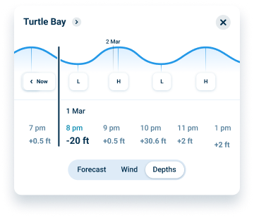
  • Real-Time Tide Integration: Depths adjust automatically as water levels change throughout the day
  • Works Offline: Download charts, navigate without cell service in remote Florida waters
  • No Separate Chart Purchases: All Florida charts included, no regional fees or subscriptions
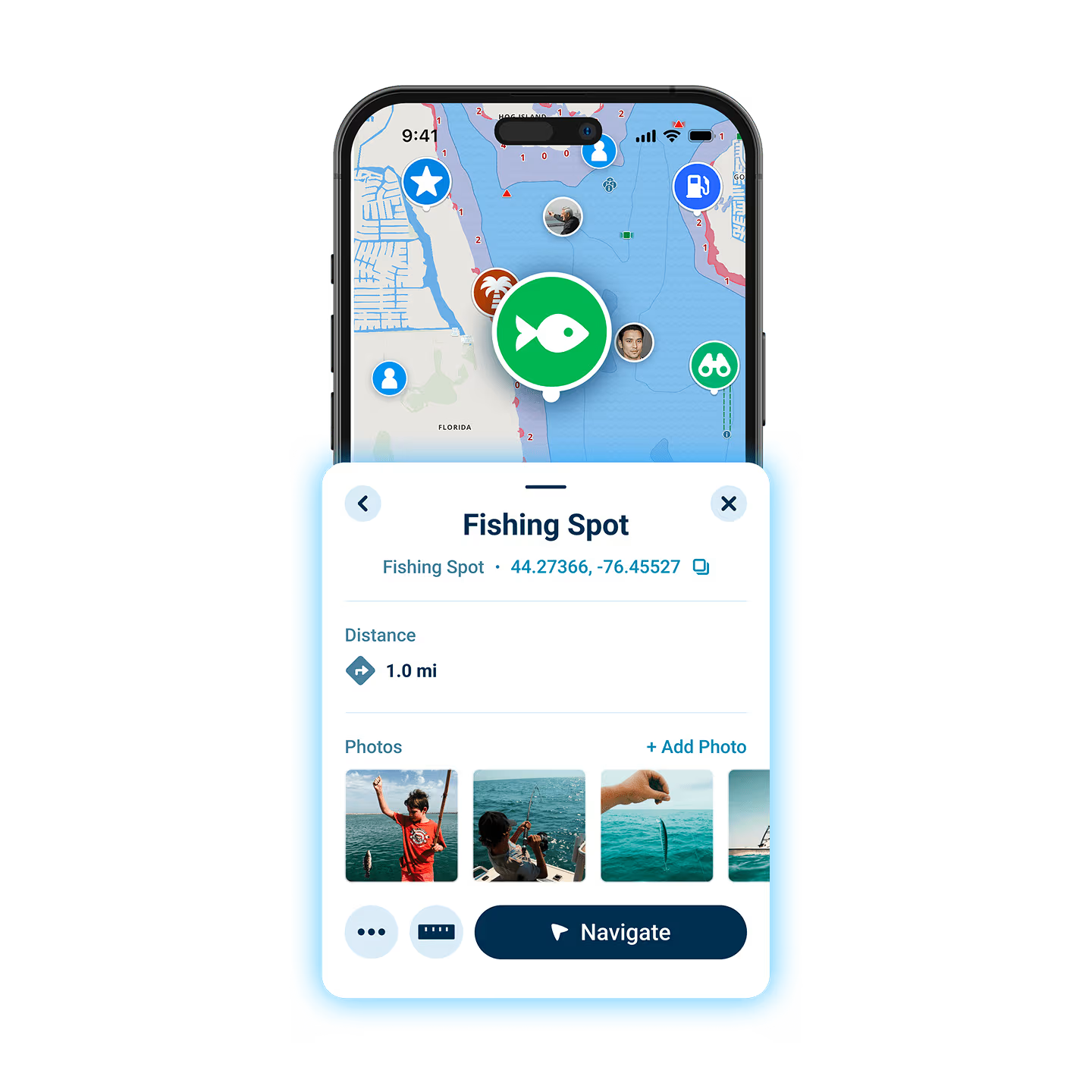
Wavve boating app points of interest feature

Why Wavve for Florida Marine Charts

Florida boating spans diverse waters requiring different navigation approaches. The Keys demand precise depth awareness navigating coral and channels. The ICW snakes through shifting sandbars. Gulf Coast bays hide shallow spots. Atlantic coastal waters experience strong tidal flows. Traditional paper charts can’t show current conditions. Basic GPS marks position but doesn’t warn about shallow water.

Wavve solves this by combining official Florida charts with automated real-time features. Enter your draft once, charts show where you can safely navigate right now based on current tides. No manual calculations. No guessing about clearance. The system updates hourly as Florida water levels change.

Over one million boaters trust Wavve for confident navigation. Florida operators particularly value the automated safety preventing costly groundings in the shallow, tidal waters characterizing much of Florida’s coastline.

How To Get Started

Download_icon

Download the App

Available free on iOS and Android with 30-second install. Instant access to complete Florida marine charts and navigation features.

no cost icon

Get 14 Days Free

Full access to all features with no commitment. Test on actual Florida trips before deciding.

Navigation icon

Enter Your Draft & Navigate Confidently

Type your draft measurement once. Wavve shows safe water instantly. Download Florida chart regions for offline use anywhere.

Complete Official Florida Chart Coverage

Data from NOAA charts cover every Florida waterway, Keys channels, ICW passages, Gulf Coast bays, Atlantic coastal waters, and inland rivers. All charts included with subscription. No separate regional purchases required.

Draft-Aware Depth Shading for Florida Shallows

Florida’s shallow waters ground boats daily. Wavve automatically shows safe versus shallow areas for YOUR specific draft at current tide levels. Navigate Keys coral, ICW sandbars, and coastal flats confidently knowing exactly where you can go.

Real-Time Tide Updates for Florida Waters

Florida tidal ranges create dramatically different navigable areas between high and low water. Wavve integrates real-time tide predictions updating chart depths hourly. See current safe zones, not yesterday’s conditions.

FAQs

Yes. Complete coverage includes all Florida Keys channels and navigation, the entire Florida ICW (Intracoastal Waterway) from Georgia border to Miami, Gulf Coast from Pensacola to Marco Island, Atlantic coast, inland rivers, and offshore waters. One subscription covers all Florida boating areas with no regional restrictions.

Wavve uses official NOAA chart data, the same charts professional mariners and commercial vessels use. Charts update regularly reflecting channel changes, marker updates, and newly identified hazards. Accuracy matches paper charts and dedicated chartplotters but adds real-time tide integration paper charts can’t provide.

Absolutely. Download chart regions covering your Florida cruising areas over WiFi before trips. All navigation features including charts, draft-aware depths, waypoints, and routes work completely offline using only GPS signals. Essential for remote areas like Everglades backcountry or offshore passages beyond cell coverage.

Yes. Complete Florida coverage spans both coasts, Gulf side from Pensacola through Tampa Bay to the Keys, Atlantic side from the Keys through Miami, Fort Lauderdale, Palm Beach to Jacksonville and the Georgia border. Navigate anywhere in Florida waters with one app.

Florida’s shallow waters create constant grounding risks. Draft-aware shading automatically shows which areas provide adequate depth for YOUR boat at current tide. Blue zones mean safe navigation, red zones warn of shallow water too tight for your draft. The system updates hourly as tides change, eliminating manual calculations about clearance.

Trial provides full access with no credit card required upfront. After 14 days, continue using Wavve for $69.99/year or $11.99/month. Cancel anytime before trial ends with no charges. No commitment, no hidden fees. All Florida charts remain included.

Yes. One subscription works across all your devices and boats. Use Wavve on your phone, tablet, and backup devices without separate subscriptions. Perfect for families boating together or maintaining redundant navigation capability.

Official NOAA Florida Marine Charts: Complete Coverage Included

Navigate Florida waters with official NOAA charts covering Keys to Panhandle, Atlantic to Gulf Coast. All charts included with subscription, no separate regional purchases, no chart update fees. Professional-grade navigation for recreational boating.

Draft-Aware Florida Charts That Update with Real-Time Tides

Florida’s tidal waters demand depth awareness. Wavve’s draft-aware charts automatically show safe versus shallow zones for YOUR boat at current tide heights. Navigate Keys channels, ICW sandbars, and coastal bays confidently with automated safety.

Florida Keys Marine Charts with Automated Depth Safety

Keys navigation demands precision avoiding coral heads and navigating tight channels. Wavve shows exactly where you can safely go based on your draft and current tides. Perfect for Keys cruising, fishing, and exploring backcountry waters.

Florida ICW Charts with Shifting Sandbar Awareness

The Florida ICW’s shifting sandbars create grounding risks even for experienced boaters. Wavve’s draft-aware navigation updates hourly with tides showing current safe passages. Community hazard reporting adds real-time sandbar warnings from other boaters.

Gulf Coast Florida Charts from Panhandle to Keys

Navigate all Gulf Coast Florida waters, Pensacola, Panama City, Apalachicola, Cedar Key, Tampa Bay, Fort Myers, Naples, Marco Island to the Keys. Official charts plus automated safety features in one app.

Offline Florida Charts for Remote and Backcountry Navigation

Everglades backcountry, remote Keys areas, and offshore waters lack cell coverage. Download Florida chart regions for complete offline navigation. All features work anywhere GPS reaches maintaining safety beyond cellular service.

Wavve Boating Logo

Navigate Florida Waters Safely with Official Charts & Automated Depth Awareness

Join over one million boaters who trust Wavve for safe Florida navigation. Get official NOAA charts plus draft-aware depth shading that updates with real-time tides.

QR Code