The Easiest Marine Navigation App Built for Real Boaters
Best User Friendly Marine Navigation App for Recreational Boaters
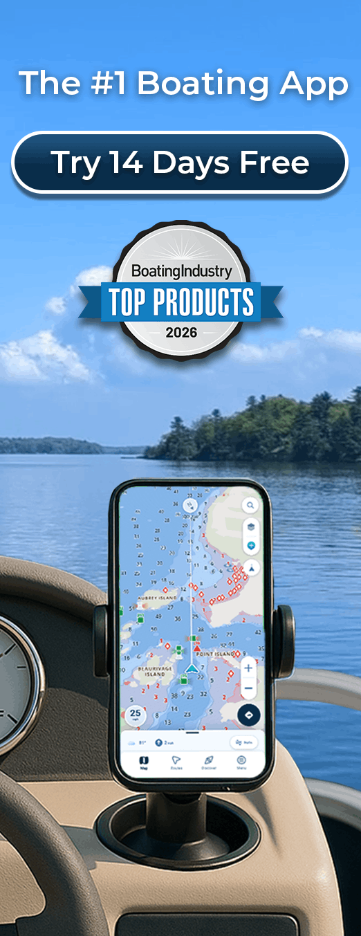
Navigation shouldn’t require a technical degree. We built Wavve specifically for recreational boaters who want powerful navigation without complexity, confusion, or overwhelming data. No hidden menus. No confusing interfaces. Just clear, visual navigation that makes sense immediately. Whether you’re exploring new waters or navigating familiar routes with confidence, Wavve delivers the simplicity you need.
Key Benefits
- Clean visual interface displaying speed, position, and depth clearly
- Automatic draft-aware map to help avoid shallow waters
- Navigate confidently within minutes with minimal setup required
- Works completely offline without cell service
- Intuitive touch controls designed for actual boating conditions
- Real-time tide integration updating depths hourly
- Simple waypoint management for fishing spots and destinations
- Community hazard reports from 50,000+ boaters
Why Choose Wavve for Simple, Confident Navigation
Recreational boaters shouldn’t battle complex interfaces or confusing navigation systems. We’ve designed Wavve with one principle: simplicity without sacrificing power. Here’s why over one million boaters trust Wavve:
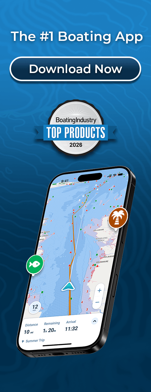
The Wavve Boating app customizes nautical charts to the draft of the user’s vessel, and real time water levels, to provide an intuitive and easy to read map. Wavve Boating is constantly working for you so you can focus on making boating memories.
We’ve spent years learning what recreational boaters actually need versus what feature lists claim to offer. That focus on real-world simplicity is why boaters trust Wavve for confident, stress-free navigation.
How To Get Started

Download the App
Free to download on iOS and Android. Create your account to get started.

Start Your Free 14-Day Trial
You get full access to all features with no upfront commitment. Test everything on actual boating trips before any commitment.
Enter Your Draft and Navigate
Type your boat’s draft measurement once. Download charts for your area. Boom. You’re navigating with automatic safety features active.
Intuitive Navigation Interface Built for Mobile Devices
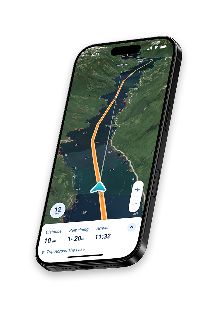
Navigation apps designed on desktop software don’t translate well to actual boating. We built Wavve specifically for phones and tablets with large readable text, finger-friendly buttons, and touch-optimized layouts. Everything in Wavve responds instantly to touch. Pinch to zoom, drag to pan, tap waypoints.
Draft-Aware Depth Shading Designed for Beginners
Reading depth numbers while steering stresses new boaters. Wavve eliminates that completely. Enter your draft once, and the app automatically shows where you can go with color-coded zones.
Real-Time Tide Integration
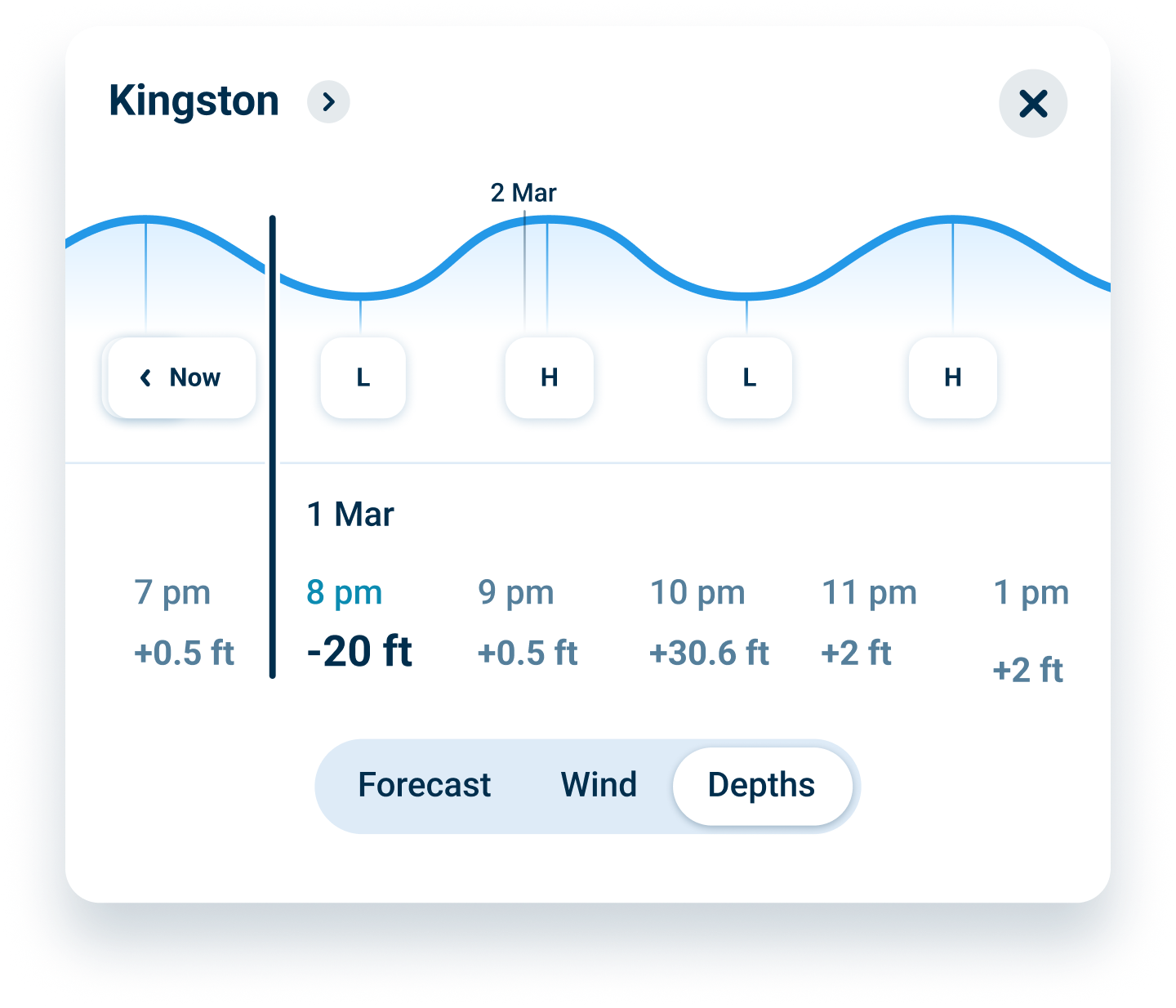
Water doesn’t stay the same depth for long. Tides create dramatic variations in navigable areas, especially in shallow water. Wavve integrates real-time tide predictions directly into your charts so depths update automatically showing current conditions, not historical predictions.
FAQs
You enter your boat’s draft once. Wavve automatically shows blue zones for adequate depth at your boat’s draft at current tides and red zones that are too shallow. The system updates hourly as water levels change, eliminating manual calculations about clearance.
No. Zero credit card required. You get 14 days of full access with no commitment. Cancel anytime before day 14 with zero charges. We built trust by making the trial genuinely risk-free.
Yes, completely. Download chart regions over WiFi before trips. All navigation features work using GPS alone. Charts, waypoints, routes, and safety features all function without cellular service. Perfect for remote areas and offshore passages.
All of them. Sailboats, powerboats, fishing boats, kayaks, PWCs, pontoons, and cruisers all benefit from draft-aware safety and intuitive navigation. Works for day boaters through long-distance cruisers.
Our charts are based on official NOAA data updated regularly. You receive updates automatically. We also integrate community-reported hazards in real-time, so you know about obstacles other boaters just encountered.
Cancel anytime before your 14 days end. No questions asked, no cancellation fees, no holdups. If you want to continue, you’re charged just $69.99/year or $11.99/month. Simple.
Automatic Draft-Aware Safety That Updates with Tides
Grounding represents the single biggest risk recreational boaters face. Water depth changes constantly with tides, weather, and seasonal variations. Manual calculations about whether your boat has adequate clearance are prone to error. Wavve eliminates this uncertainty through automatic draft-aware visualization. Enter your draft once and the system handles all complexity invisibly.
Your boat shows safe blue zones and dangerous red zones updated hourly as tides change. This visual feedback transforms navigation from guesswork into confident decision-making based on real-time depth conditions. No more grounding anxiety. Navigate knowing exactly where you can safely go at current water levels.
Simple Waypoint Marking for Your Favorite Fishing Spots
Memorable fishing and boating locations scatter across your favorite waters. You remember where you caught fish or found perfect anchorages but struggle to navigate back to exact locations season after season. Traditional navigation requires tedious coordinate entry during trips. Wavve simplifies waypoint creation through intuitive one-tap marking while actually boating.
Tap once to mark your current position while navigating. Name your waypoint descriptively such as “Best Walleye Hole” or “Protected Anchorage”. Save it permanently in your personal location library. Return to marked spots instantly whenever you want. Unlimited waypoints let you build comprehensive location libraries organized by season, trip type, or favorite areas.
Offline Navigation Capability Without Cell Service Requirements
Recreational boating frequently ventures into areas without cell coverage. Offshore passages lose signals immediately. Remote backcountry lakes lack connectivity. Traditional apps depending on constant cellular data become useless exactly when reliable navigation matters most. You’re stranded without navigation capability when you need it most.
Wavve works completely offline using only GPS positioning. Download chart regions covering your boating areas over WiFi before trips and store these permanently on your device. Once downloaded, every navigation feature functions independently with charts displaying perfectly, waypoints operating normally, and draft-aware safety working reliably. Everything works offline.
Community Hazard Reports From Other Recreational Boaters
NOAA charts show permanent features like depth contours and navigation aids but miss temporary conditions. Recently reported shallows, submerged obstacles, debris, and temporary hazards don’t appear on static charts. Individual boaters encountering these dangers lack effective ways to warn other boaters. This information gap creates unnecessary grounding risks.
Wavve’s community connects 50,000+ boaters sharing real-time hazard information. See shallow spots other boaters recently encountered in your area. Learn about submerged obstacles just discovered and temporary navigation challenges affecting your intended route. This crowdsourced hazard layer adds massive safety value beyond nautical charts. Benefit from thousands of recent boating experiences in areas you’re navigating.
Clean Visual Interface Displays Navigation Data Intuitively
Navigation apps overwhelm users with unnecessary data cluttering screens. Wavve displays information intuitively showing what matters right now. Your boat’s speed appears prominently with large readable numbers during navigation. Position updates continuously on charts with your boat icon moving smoothly. Distance and bearing information displays when relevant without creating visual clutter.
This design discipline ensures you focus on actual boating rather than fighting app complexity. Every feature responds intuitively to touch. Every element serves a clear navigation purpose. The interface gets out of your way so you concentrate on the water and your boat.
Real-Time Data Integration Throughout Your Boating Trip
Navigation data evolves continuously as you move across the water. Your position updates in real time reflecting your boat’s actual movement. Tide information refreshes hourly changing depth displays across your charts. Weather data integrates continuously showing developing conditions affecting your route. Community hazard reports appear as other boaters share discoveries about current conditions in your specific area.
This real-time responsiveness transforms navigation from a static planning tool used before trips into a living, breathing system that evolves with actual boating conditions throughout your journey. You always navigate with current information, not historical data from yesterday or last week.
Start Your
Boating Journey
Join over one million boaters worldwide using Wavve Boating to explore, plan, and navigate with confidence.