Best Florida Marine Navigation App
Navigate Florida Waters with Confidence – Shallow Bays, Keys, Intracoastal & Gulf Coast
Stop worrying about grounding in Florida’s shallow waters. Wavve Boating automatically shows safe versus shallow areas for your boat with real-time draft-aware depth shading that updates with tides. Navigate the Intracoastal, Florida Keys, Tampa Bay, Ten Thousand Islands, and coastal waters safely.
Key Benefits:
- Draft-Aware Depth Shading – Automatically color-codes safe vs shallow water based on YOUR boat’s draft + real-time Florida tides
- 17,000+ NOAA Charts – Complete Florida coverage from Pensacola to Key West, Atlantic to Gulf coasts
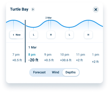
- Real-Time Tide Integration – Depths update hourly as Florida tides change throughout the day
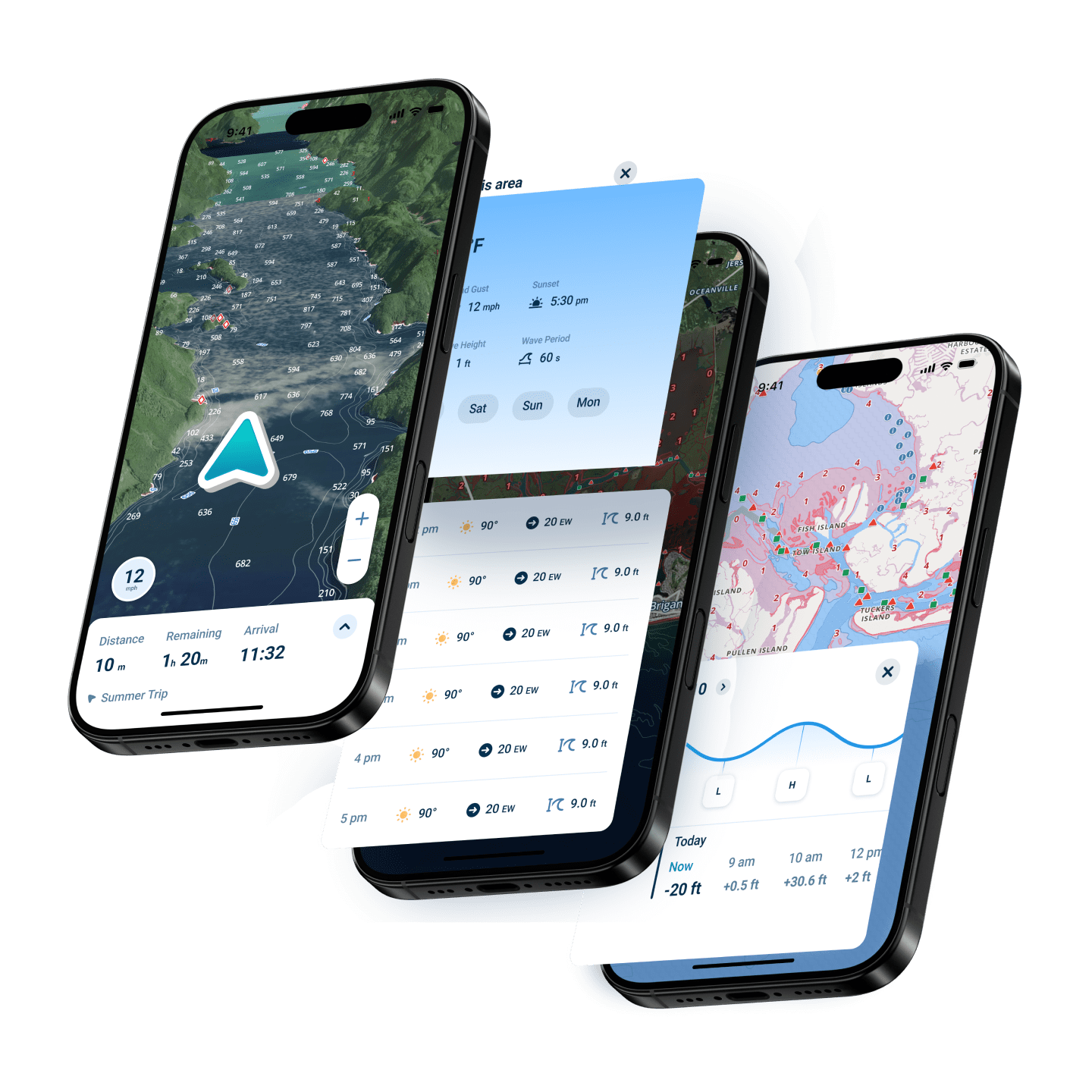
- 7-Day Marine Weather – Hourly forecasts layered on your route for smarter trip planning
- Offline Navigation – Download Florida charts, navigate without cell service in remote areas
Why Wavve Boating Is the Smart Choice for Modern Marine Navigation
Traditional GPS apps weren’t designed for boating. They don’t understand draft, don’t account for tides, and can’t show which shallow areas will ground your boat. Generic chartplotters cost hundreds or thousands of dollars, require professional installation, and charge extra for chart updates.
Wavve Boating delivers professional navigation capability on devices you already own, no expensive hardware, no installation, no chart card purchases. Enter your boat’s draft once, and the app automatically adjusts what you see based on real-time water levels.
Over one million boaters worldwide trust Wavve for confident navigation. Whether you’re exploring shallow bays and inlets, cruising coastal waterways, fishing productive flats, or making offshore runs, Wavve provides the real-time intelligence modern boating demands. One subscription covers all your boating, no regional restrictions, no hidden fees, no surprise charges.
How To Get Started

Download the App
Free to download on iOS and Android. Create your account to get started. Get set up in minutes and access full Florida chart coverage right away.

Start Your 14-Day Free Trial
Enjoy full access to every feature with no upfront commitment. Explore Florida waters risk-free and see how draft-aware navigation works for your boat.
Enter Your Boat’s Draft & Navigate
Enter your draft once, and Wavve instantly shows safe versus shallow water based on real-time conditions. Download charts for offline use, plan routes with weather, and navigate confidently wherever you go.
Draft-Aware Navigation Designed for Florida’s Shallow Waters
Florida’s shallow flats and shifting sandbars demand real-time awareness, but traditional charts don’t account for tides or your boat’s draft. Enter your draft once, and Wavve instantly shows where you can safely go with live that update as tides change.
Complete Florida Coverage – Atlantic, Gulf, Keys & Intracoastal
Navigate all of Florida with NOAA charts, from Pensacola to the Dry Tortugas, all in one subscription. Whether it’s the Intracoastal, Gulf bays, Atlantic coast, or the Keys, everything is mapped with detailed depth data and real-time awareness.
Real-Time Weather + Tides = Smarter Florida Trip Planning
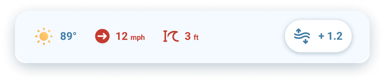
Florida weather and tides shift fast, making timing everything. Wavve layers 7-day marine weather and real-time tide data directly onto your charts, so you can plan routes, avoid rough conditions, and move through passes at the right time, all without switching apps.
FAQs
Yes. Download chart regions covering your cruising area (Everglades, Keys backcountry, etc.) over WiFi before departure. All navigation features work without cell service after downloading. GPS operates independently of cellular connectivity, providing position tracking anywhere. The app continues showing draft-aware depths, waypoints, routes, and tracks throughout trips in remote areas.
Enter your boat’s draft measurement once in settings (measure actual loaded draft including props, drives, transducers). This visualization updates hourly as Florida tides change, showing real-time navigable areas rather than static chart depths. Different boats see different safe zones based on their specific draft requirements.
Absolutely. The same subscription covers shallow backcountry creeks, coastal bays, nearshore reefs, and deep offshore waters. Mark fishing spots, record productive trolling tracks, navigate to wrecks or artificial reefs. Integrated weather helps plan offshore trips. Worldwide chart coverage includes Bahamas for South Florida boaters making crossings to Bimini or beyond.
Yes. Complete ICW coverage from Georgia border to the Keys, continuing around to Fort Myers on the Gulf side. All bridges, markers, anchorages, and channels shown with detailed bathymetry. Real-time draft awareness shows safe passage depths accounting for tides. Mark favorite stopping points, marinas, or anchorages along your route.
Trial includes full access to all features with no credit card required upfront. After 14 days, continue using Wavve for $59.99/year or $11.99/month. Cancel anytime before trial ends with zero charges. No commitment, no hidden fees. Most Florida boaters choose to continue after experiencing draft-aware navigation’s safety benefits.
Yes. One subscription works on all your devices simultaneously, iPhone, iPad, Android phone, Android tablet. Download the app on each device, sign in with your account, and access all charts and features. Waypoints, routes, and settings sync between devices automatically. Perfect for families with multiple devices or boaters using different platforms.
Yes. Seven-day marine weather forecasts layer directly on charts showing hourly wind speed, gusts, wave height, wave period, and conditions. See predictions for your planned route without switching apps. Weather updates hourly from official NOAA sources. Essential for planning around Florida’s afternoon thunderstorms, Gulf sea breezes, and rapidly changing conditions.
Best Florida Marine Navigation App for Shallow Water Confidence
Grounding isn’t a maybe in Florida, it’s a matter of when if you’re guessing. Wavve shows exactly where your boat can safely go using draft-aware shading that updates with real-time tides. That’s why boaters trust it as the best Florida marine navigation app for navigating shallow flats, bays, and inlets without second-guessing.
Navigate with Real-Time Depth, Not Static Charts
Most marine navigation apps show fixed depths that don’t reflect what’s actually happening on the water. Wavve updates your charts based on your boat’s draft and live tide conditions, so what you see is what you can run. It’s a smarter, safer way to navigate, built for real boating, not theory.
Best Florida Marine Navigation App for Everyday Boating
Whether you’re cruising the coast, heading out for a quick run, or exploring new spots, navigation should feel simple. Wavve combines charts, tides, and weather into one clean interface so you’re not bouncing between tools. It’s built to make everyday boating easier, faster, and far more predictable.
Plan Smarter with Weather and Tides Built In
Conditions change fast, and reacting late can cost you. Wavve layers real-time weather and tide data directly onto your charts, so you can plan routes around what’s actually happening, not what you hope will happen. That’s what makes it a smarter marine navigation app for safer trips.
Best Florida Marine Navigation App Without Expensive Hardware
Traditional chartplotters cost thousands and still require updates and extra purchases. Wavve delivers the same level of navigation directly on your phone or tablet, no installs, no hardware, no hidden fees. It’s the best Florida marine navigation app for boaters who want performance without the overhead.
Full Offline Navigation, Anywhere You Boat
Losing signal shouldn’t mean losing control. Wavve lets you download charts and navigate with full GPS functionality, even in remote areas with no coverage. It’s one of the most reliable marine navigation apps for boaters who go beyond the usual routes.
Navigate Florida Waters Safely – Start Your Free Trial Today
Join over one million boaters who trust Wavve for safe Florida navigation. See exactly where you can go with draft-aware depth shading designed for Florida’s challenging shallow waters.