Florida Keys Marine Charts
Charts with Draft-Aware Coral and Channel Navigation for the Florida Keys
The Florida Keys demand precision navigation. Tight channels weave through coral heads. Water depths shift dramatically. Tides move fast and change water levels unpredictably. Paper charts and GPS alone won’t prevent groundings on coral or sandbars. We’ve built Wavve specifically for Keys navigation with NOAA charts covering all Keys channels and areas, plus automatic draft-aware depth safety showing exactly where you can safely navigate at current tide levels.
Key Benefits
- NOAA Keys charts with complete channel and coral coverage
- Automatic draft-aware map to help avoid shallow waters
- Real-time tide updates changing depths hourly as water levels shift
- Works completely offline without cell service
- Intuitive interface with no confusing menus or complexity
- Community hazard reports from boaters
- Simple waypoint marking for fishing spots and anchorages
- Multi-device access across phone, tablet, and backup devices
Why Keys Boaters Choose Wavve
Keys navigation is unforgiving. A moment of inattention grounds boats on coral or sandbars. Tide changes alter which passages remain navigable. Channels shift after storms. We’ve designed Wavve specifically for Keys navigation challenges. Here’s why Keys boaters trust us:
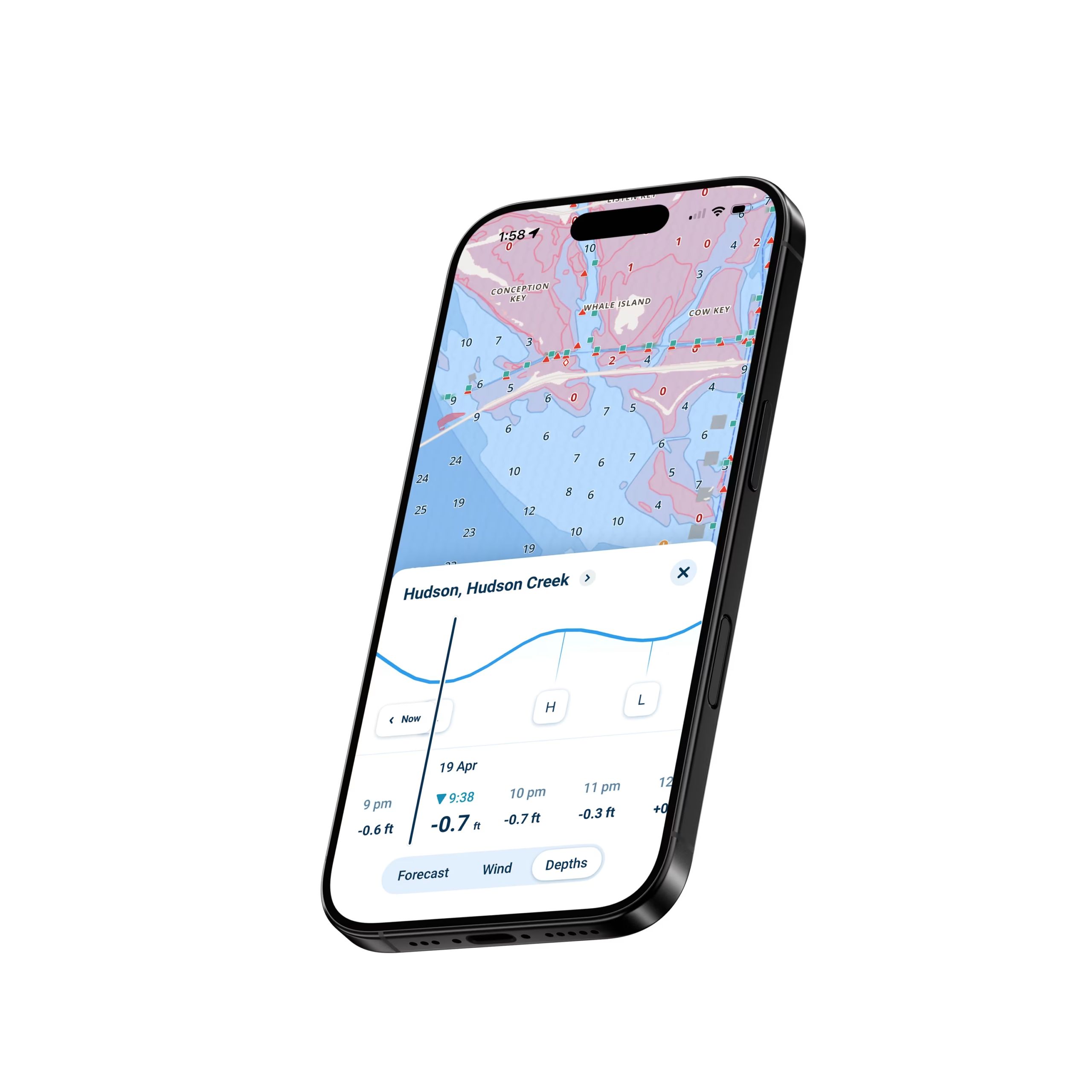
Enter your draft once. Automatic depth safety shows visually where you can navigate right now. Blue zones show safe water. Red zones warn of shallows. The system updates hourly as tides change. For Keys boaters, this automation transforms navigation from stressful uncertainty into confident simplicity. You understand visually where you can navigate.
Over one million boaters trust Wavve for safe navigation. Keys boaters particularly value the automated safety preventing costly coral strikes and grounding damage. Community features connect you with other Keys boaters sharing real-time hazard information about current conditions.
How To Get Started

Download the App
Grab Wavve from the App Store or Google Play. 30 seconds to install with no complex setup required.

Start Your Free 14-Day Trial
Try out all Wavve Boating features free for 14 days. Test everything on the Florida Keys before making any commitment.

Enter Your Draft and Navigate Keys Confidently
Type your boat’s draft once. Download Keys chart regions. You’re immediately navigating with automatic coral and shallow-water awareness active.
Feature 1: NOAA Charts Covering All Florida Keys Channels and Reefs
Safe Keys navigation demands charts covering every channel, reef, coral area, and navigation mark. Wavve includes complete NOAA charts for all Florida Keys areas. These are the same professional-grade charts commercial vessels and professional mariners use, providing accurate depths, marked hazards, and underwater features essential for safe navigation.
Draft-Aware Navigation Through Tight Keys Channels
Keys channels are tight, technical passages where coral borders most routes. Shallow water lurks throughout Keys waters and single groundings cost thousands in boat damage and towing fees. Enter your draft once in Wavve and the app handles all safety complexity invisibly. Automatic draft-aware visualization shows blue zones for adequate depth and red zones that are too shallow for safe navigation.
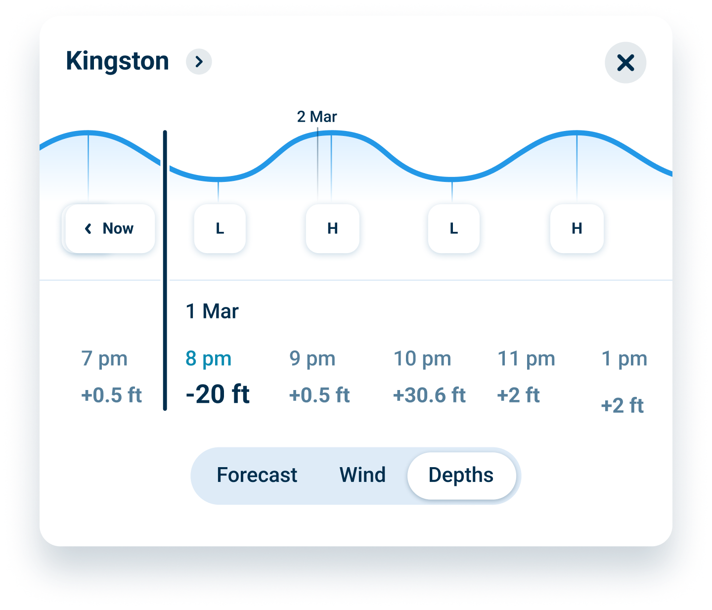
Real-Time Tide Updates for Keys Water Level Changes
Keys water depths change constantly with tide cycles. High tide opens passages impassable at low tide. Low tide closes previously safe routes. Wavve integrates real-time tide predictions directly into your charts so depths update automatically showing current conditions, not historical averages or predictions.
FAQs
Yes. Official NOAA charts cover every Florida Keys channel, reef, coral area, and navigation mark. All charts are included with your subscription. No regional purchases or separate chart fees required.
Keys water depths change dramatically with tide cycles. Our integration updates depths hourly showing current conditions across all Keys areas. You navigate based on actual current water levels, not static predictions that become outdated.
Absolutely. Download Keys chart regions over WiFi before trips. Once downloaded, all features work using GPS alone. Charts, waypoints, draft-aware safety, everything works. Essential for remote Keys areas and backcountry exploration.
Charted coral locations appear on official NOAA charts. Our draft-aware system adds real-time safety feedback showing which coral areas create navigation challenges at current tide levels. Understand depth safety around every coral hazard.
Yes. Mark unlimited waypoints for fishing locations, anchorages, fuel docks, or any destination. Name each waypoint and navigate back to exact locations season after season. Build your personal library of Keys fishing and boating spots.
Your first 14 days are completely free with no credit card required. After that, it’s $69.99/year or $11.99/month if you continue. Cancel anytime before your trial ends with zero charges.
NOAA Keys Charts with Complete Reef and Channel Coverage
Safe Keys navigation demands professional-grade charts covering every underwater hazard. NOAA charts for the Keys include detailed reef locations, channel markers, depth contours, and coral areas marked as hazards. These are the same charts commercial vessels rely on. Wavve provides complete NOAA coverage for all Keys areas from Key West to the northern Keys.
Our chart library includes offshore reefs, backcountry shallows, channels through coral, and remote anchorage areas. Every major boating destination in the Keys appears on comprehensive charts. Download Keys regions for offline access covering multiple seasons of Keys boating.
Draft-Aware Safety Through Tight Channels and Shallow Water
Keys channels present technical navigation challenges with coral on both sides. A few feet off track means grounding. Water depths change constantly with tides. Automatic draft-aware safety transforms this challenge into confident navigation. Enter your draft once and the system shows visually where you can navigate at current tide levels.
Blue zones indicate adequate depth for safe passage. Red zones warn of shallows and coral hazards. The visualization updates hourly as tides change. This real-time feedback prevents costly groundings and coral strikes. Navigate through tight channels knowing exactly which routes provide safe clearance for your specific draft.
Real-Time Tides Transform Keys Water Navigation
Keys tidal cycles create dramatic depth variations. High tide opens passages impassable at low water. Channels accessible in morning high tide become blocked by midday low tide. Planning trips around tides and understanding current water depths becomes critical for Keys navigation. Wavve integrates real-time tide predictions updating hourly throughout the day.
Your charts update automatically showing current navigable areas at existing tides. Plan passages around favorable tides. Understand how water levels are changing throughout your boating day. This real-time tide integration provides the depth information Keys boaters need for confident navigation.
Backcountry Keys Navigation with Shallow-Draft Awareness
The Keys offer incredible backcountry opportunities such as mangrove-fringed bays, shallow flats, remote anchorages, and narrow passages accessible only to shallow-draft vessels. Traditional navigation can’t provide safety feedback for these tight spaces. Draft-aware navigation reveals backcountry possibilities safely.
Mark unlimited waypoints for backcountry discoveries and navigate to remote fishing spots and anchorages confidently knowing draft-aware safety shows current water depth. Explore mangrove passages understanding depth safety for your specific vessel and download chart regions for complete offline capability in remote areas.
Community Hazard Reports from Other Keys Boaters
NOAA charts show permanent features such as depth contours, navigation aids, and charted depths. They don’t show temporary conditions like recently reported shallows, submerged obstacles, debris, or temporary hazards. 50,000+ boaters using Wavve report real-time hazards sharing shallow spots encountered, submerged obstacles discovered, and temporary navigation challenges.
This crowdsourced safety layer adds massive value beyond charts. You benefit from hundreds of recent boating experiences in the areas you’re navigating. Real-time information keeps you aware of current conditions beyond what static charts alone can provide. Keys boaters share knowledge about current drift patterns and temporary hazards.
Offline Navigation for Remote Keys Areas and Offshore Passages
Keys boating frequently takes you beyond cell coverage into remote islands and offshore passages. Download Keys chart regions over WiFi before trips and store these permanently on your device. Once downloaded, all navigation features function independently with charts displaying perfectly and draft-aware safety operating normally. Everything works using GPS alone.
Offline capability proves essential for offshore passages to remote islands losing signals immediately. Backcountry area connectivity disappears. Cellular-dependent apps become useless when you need them most. Wavve delivers complete functionality offline throughout your Keys adventures.

Start Your
Boating Journey
Join over one million boaters worldwide using Wavve Boating to explore, plan, and navigate with confidence.