Canada’s Most Trusted Marine Weather App

Navigate Canadian Waters with Confidence – Real-Time Weather, Tides & Marine Forecasts

Stop switching between weather apps and charts. Wavve layers 7-day marine weather forecasts directly on your navigation charts with hourly wind, wave, and tide predictions. Plan trips around Great Lakes conditions, coastal storms, and tidal currents across all Canadian waters.

Key Benefits:

  • 7-Day Marine Weather on Charts – Hourly wind, waves, and conditions layered directly on your route for smarter planning
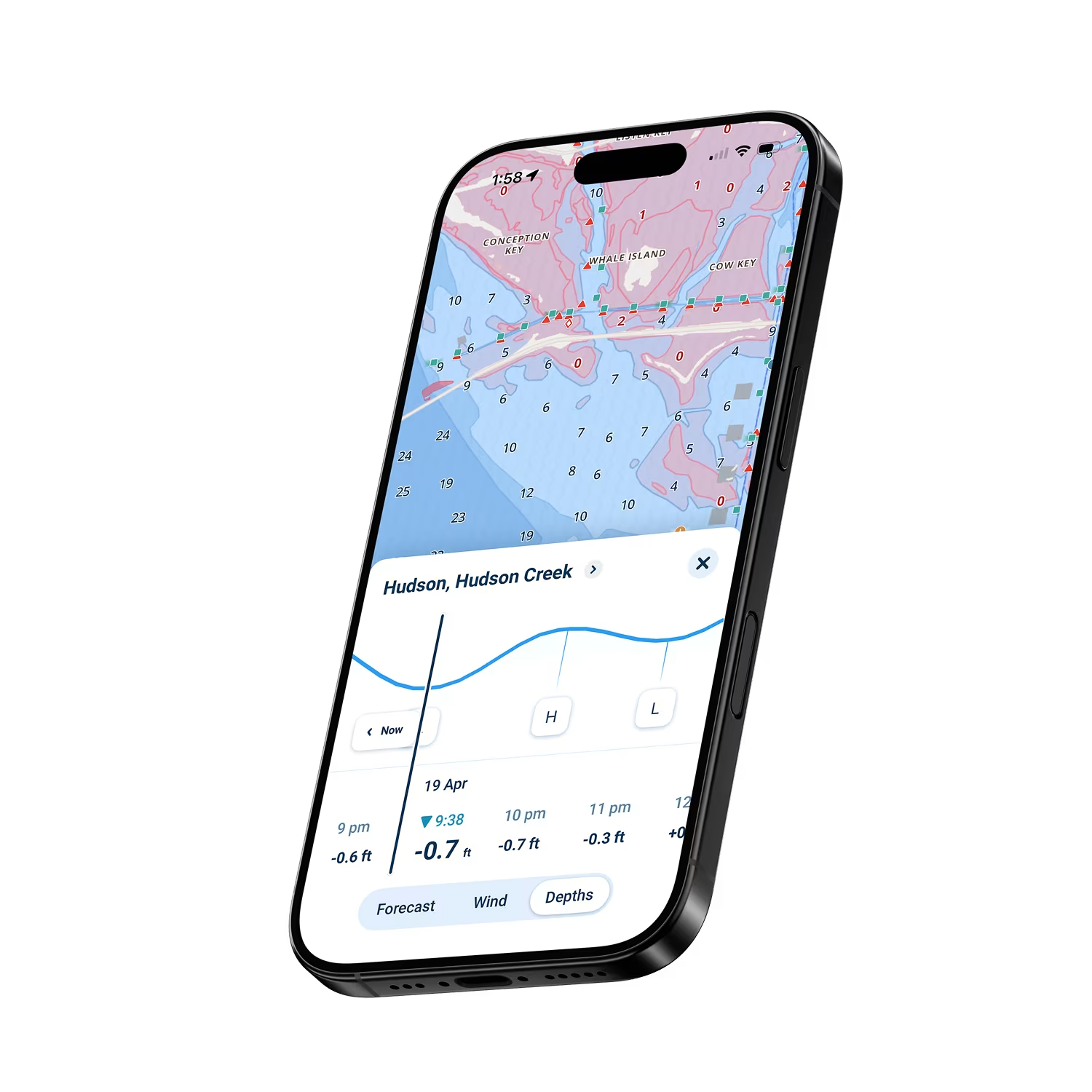
  • Real-Time Tide Integration – Coastal tide predictions update depths hourly for safe navigation
  • CHS Chart Coverage – Complete Canadian waters from Great Lakes to Pacific, Atlantic, and Pacific coasts
  • Great Lakes Water Level Updates – Real-time lake levels integrated with depth displays
  • Offline Forecasts – Download weather data and charts for remote Canadian cruising
Why Wavve Is the Smart Choice for Canadian Marine Weather

Checking multiple apps while planning trips wastes time and creates confusion. Wavve integrates everything boaters need in one place. Seven-day marine forecasts layer directly on your charts showing hourly predictions for your exact route. Real-time tides update depth displays for coastal navigation. Great Lakes water levels integrate automatically. This isn’t piecing together information from multiple sources, it’s complete marine intelligence designed for Canadian boating.

Over one million boaters worldwide trust Wavve for confident navigation. Whether you’re cruising Georgian Bay, exploring BC’s Inside Passage, navigating Maritime harbors, or fishing inland lakes, Wavve provides the integrated weather and navigation intelligence modern boating demands.

How To Get Started

Download_icon

Download the App

Available free on iOS and Android with a quick 30-second install. Get instant access to Canadian marine weather and complete CHS chart coverage.

no cost icon

Get 14 Days Free

Full access to weather forecasts, tide data, and all navigation features with no upfront commitment. Explore Canadian waters risk-free.

Navigation icon

Plan Routes with Integrated Weather

View 7-day forecasts layered on your charts, check real-time tides, and navigate with confidence. Download charts and weather for offline use in remote areas.

Marine Weather Forecasts Layered Directly on Canadian Charts

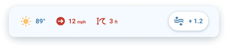
Planning routes shouldn’t mean switching between weather apps and charts. Wavve layers 7-day marine forecasts directly on your navigation, showing hourly wind speed, gusts, wave height, and conditions for your planned route. See exactly what weather you’ll face before departure.

WeatherBar

Real-Time Tides for Coastal Canadian Waters

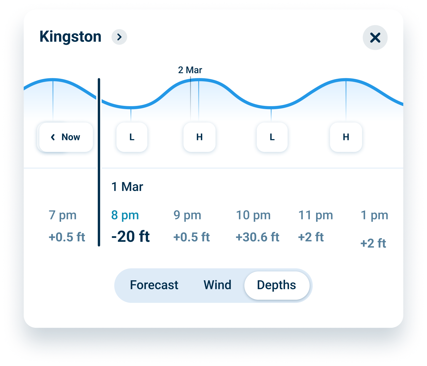
Tidal ranges in Canadian waters, from the Bay of Fundy’s 50+ foot tides to BC’s Inside Passage currents, demand precise timing. Wavve integrates real-time tide predictions with chart depths, showing when passages become navigable and when currents run strongest. No separate tide table lookups needed.

Water Level Card

Great Lakes Water Levels + Complete CHS Coverage

Great Lakes water levels fluctuate seasonally, affecting navigable depths significantly. Wavve automatically integrates current lake levels with chart displays, showing real-time safe versus shallow areas. Complete official CHS coverage spans all five Great Lakes, coastal waters, and major inland waterways.

FAQs

Yes. Marine weather forecasts update hourly from official meteorological sources including Environment Canada feeds. Seven-day predictions show wind speed, gusts, wave height, wave period, and conditions. Forecasts layer directly on charts for your planned routes, eliminating need for separate weather apps.

Great Lakes water levels integrate automatically with chart depths. The app shows real-time navigable areas accounting for current lake levels, which fluctuate seasonally by several feet. This integration prevents groundings in bays and channels where static chart depths don’t reflect actual conditions.

Yes. Download chart regions and weather forecasts over WiFi before departure. All navigation and weather features work without cell service after downloading. GPS operates independently of cellular connectivity, providing position tracking anywhere in remote areas like Northern Ontario lakes or BC’s Inside Passage.

Yes. Real-time tide predictions integrate with chart depths for Atlantic Canada, British Columbia, and St. Lawrence waters. See when passages become navigable, when currents run strongest, and how tides affect available depth. Critical for areas like Bay of Fundy, Reversing Falls, and BC’s tidal passages.

Trial includes full access to all features with no credit card required upfront. After 14 days, continue using Wavve for $59.99/year or $11.99/month. Cancel anytime before trial ends with zero charges. No commitment, no hidden fees.

Yes. One subscription works on all your devices simultaneously, iPhone, iPad, Android phone, Android tablet. Download the app on each device, sign in with your account, and access all charts and weather features. Settings sync automatically between devices.

Absolutely. Complete coverage includes Great Lakes, Atlantic coast, Pacific coast, St. Lawrence River, major inland lakes, and Arctic waters. Same subscription covers all Canadian boating, no regional restrictions or additional purchases needed.

Best Marine Weather App Canada for Integrated Forecasting

Checking separate weather apps while planning trips creates gaps and wastes time. Wavve layers marine forecasts directly on navigation charts, showing exactly what conditions you’ll face on your route. That’s why Canadian boaters trust it as the best marine weather app Canada has for integrated planning.

Navigate Great Lakes Safely with Real-Time Weather and Water Levels

Great Lakes conditions change fast, squalls develop in hours, water levels affect depths seasonally. Wavve combines marine weather forecasts with real-time lake level data, showing safe navigation zones that update as conditions change. It’s the marine weather app Canada Great Lakes boaters rely on.

Best Marine Weather App Canada for Coastal Navigation

Coastal waters from BC to the Maritimes demand precise tide and weather awareness. Wavve integrates both with chart depths, showing when passages open, when currents peak, and how weather affects your route. Built for Canadian coastal boating, not generic forecasting.

Plan Smarter with Weather Layered on Canadian Charts

Weather matters most when you can see it relative to your route. Wavve shows 7-day forecasts directly on charts, wind, waves, and conditions for every segment of your trip. It’s the best marine weather app Canada boaters use for route planning that actually accounts for conditions.

Marine Weather App Canada Boaters Trust for Remote Areas

Losing cell service in Northern Ontario, BC’s remote coast, or Atlantic coves shouldn’t mean losing weather data. Wavve lets you download forecasts and charts for complete offline functionality. It’s the marine weather app Canada’s remote cruisers depend on.

Real-Time Updates for Safer Canadian Boating

Conditions don’t wait, and neither should your weather data. Wavve updates hourly with current forecasts, tides, and water levels so you’re never planning based on yesterday’s information. That’s what makes it the most reliable marine weather app Canada boaters choose.

Wavve Boating Logo

Navigate Canadian Waters Safely – Start Your Free Trial Today

Join over one million boaters worldwide who trust Wavve for integrated marine weather and navigation. See forecasts layered on your charts with real-time tides and water levels designed for Canadian conditions.

QR Code