Navigate South Florida with NOAA chart data, depth shading, and real-time tides on your phone.
South Florida Marine Charts | Online Chartplotter & Marine Navigation App
South Florida’s marine environment demands precision. Shallow water surrounds boating routes. Sandbars shift unpredictably. Tidal ranges create dramatic depth changes. Coral reefs require exact navigation. Professional-grade charts and real-time navigation intelligence transform South Florida boating from risky to safe.
- NOAA chart data covering all South Florida coastal waters
- Automatic depth shading updating with real-time tides
- Online chartplotter functionality accessible from phone or tablet
- Real-time tide integration showing current water depths
- Community hazard reporting from thousands of South Florida boaters
- Complete offline capability for remote areas without cell service
Why Choose Wavve for South Florida Navigation
South Florida boating presents constant navigation challenges. Wavve represents the strongest online chartplotter option for South Florida because it combines professional-grade charts with unique safety features dedicated hardware cannot match.
NOAA chart data: Complete coverage of all South Florida coastal areas with professional-grade accuracy. Same charts commercial mariners use. Your online chartplotter displays depths, navigation aids, hazards, and underwater features with precision.
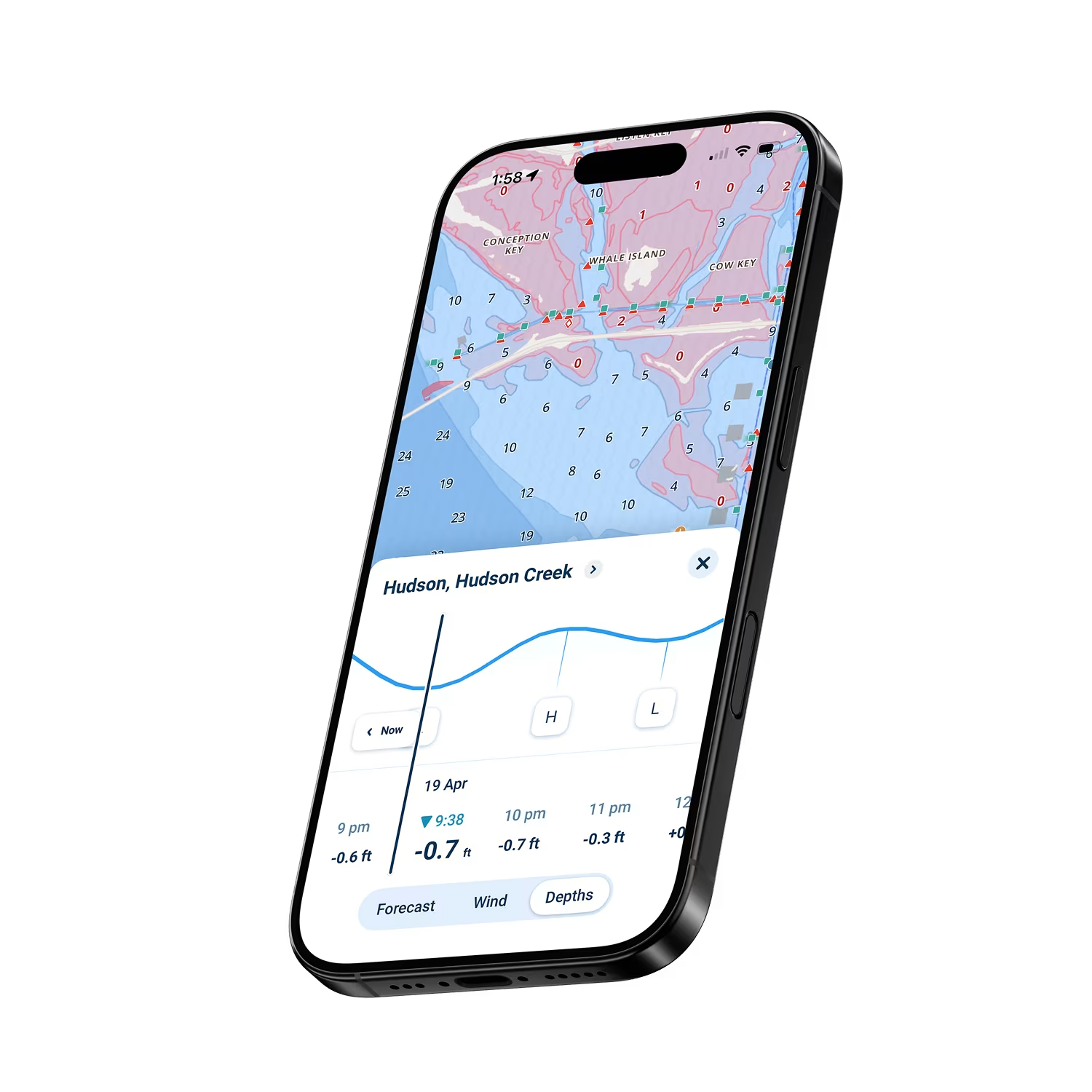
Automatic depth shading: Unlike traditional chartplotters showing static depths, Wavve automatically shows safe versus shallow zones based on your draft and current water levels. This visualization updates hourly as tides change. See immediately where you can safely navigate.
Online functionality: Access your charts on phone, tablet, or any device with screen. The online chartplotter brings professional navigation capability anywhere. No expensive dedicated hardware required.
Real-time tide integration: South Florida tidal changes dramatically affect water depth. Your online chartplotter shows actual water depth at current tide levels. Navigate based on real conditions, not historical predictions.
Community hazard reporting: See real-time hazard information from thousands of South Florida boaters. Learn about recently discovered obstacles, shifted sandbars, and current challenges.
Pricing: $69.99 annually or $11.99 monthly after your 14-day free trial.
How To Get Started

Download the App
Get Wavve Boating on iOS or Android and create your free account in seconds. It only takes a minute to get started. Access your online chartplotter immediately.

Get 14 Days Free
Start your 14-day free trial and unlock full access with no restrictions. Test everything on actual South Florida boating before any commitment.

Start Navigating South Florida Waters
Download South Florida chart regions. Enter your boat’s draft. You’re immediately navigating with professional-grade online chartplotter capability. Ready to continue? Just $69.99/year or $11.99/month. Cancel anytime.
NOAA Chart Data in Your Online Chartplotter
Your online chartplotter displays NOAA chart data and information with accuracy commercial mariners depend on. Complete South Florida coverage from Miami to Key West.
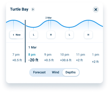
Automatic Depth Safety Updates with Tides
South Florida water levels change hourly with tides. Your online chartplotter automatically shows where you can safely navigate based on your draft and current water levels. Watch this update throughout your boating day.
Real-Time Tides Show Current Depth Conditions
Reading depth numbers while steering stresses new boaters. Wavve eliminates that completely. Enter your draft once, and the app automatically shows where you can go with color-coded zones.
FAQs
Online chartplotters provide comparable functionality at lower cost without expensive hardware. Your phone becomes a fully capable navigation device. Its intuitive navigatione experience and real-time data provide capabilities many dedicated systems lack.
Yes. This online chartplotter provides top tier navigation capability. Thousands of South Florida boaters navigate confidently using mobile devices with NOAA chart data and real-time safety features.
Your online chartplotter continues functioning using downloaded charts and GPS positioning alone. Download South Florida chart regions before boating for complete offline capability. Everything works independently without cellular service.
Yes. From small boats to larger cruisers, the online chartplotter serves all boating styles. Automatic water depth safety benefits all vessels navigating shallow South Florida waters.
NOAA Chart Data in Your Online Chartplotter
South Florida navigation demands professional-grade chart information. Your online chartplotter features NOAA chart data covering all South Florida coastal areas. These are the same charts commercial vessels use. Accuracy, depth information, and hazard marking meet professional standards. Complete chart coverage eliminates regional purchases or separate chart fees.
Boat Draft Feature Prevents Costly Groundings
A single South Florida grounding costs thousands in repairs and potential coral damage. The Wavve Boating app’s intuitive navigation experience prevents groundings through instant visual feedback. See exactly where you can navigate based on your boat and current conditions. This single feature often pays for annual subscription through prevented groundings.
Real-Time Tides Integrated Into Your Charts
South Florida tidal ranges create dramatically different navigable areas between high and low water. Your online chartplotter integrates real-time tide predictions updating depths automatically throughout your boating day. Plan passages around favorable tides. Understand depth changes as water levels fluctuate. This real-time integration transforms navigation from guesswork into informed decision-making.
Community Hazard Intelligence from South Florida Boaters
Charts show permanent features. They don’t show recently shifted sandbars or obstacles discovered by other boaters. Your online chartplotter connects you with thousands of other boaters sharing real-time hazard information. Learn about shallow spots, debris, and challenges other South Florida boaters just encountered. This crowdsourced intelligence layer provides information charts cannot show.
Complete Offline Navigation for Remote Areas
South Florida boating ventures into remote areas lacking cell coverage. Backcountry exploration, offshore passages, and remote anchorages often mean no signals. Download chart regions for complete offline online chartplotter capability. Your navigation continues using GPS alone when signals disappear. All chartplotter features work independently without cellular service.
Chartplotter Without the Expensive Hardware
Professional marine chartplotters cost thousands and require installation. Your online chartplotter delivers comparable capability on your laptop or tablet for free, and acts as a companion to the Wavve Boating mobile app with a $69.99 annual subscription. No hardware expenses, no physical installation required, no mounting challenges. Navigate professionally without hardware investments. This democratizes professional-grade navigation making it accessible while reducing costs dramatically.
Start Your
Boating Journey
Ready to navigate South Florida with professional-grade charts? Download Wavve free and test all features for 14 days.