When you’re out on the water, confidence matters more than anything. But not every boater wants to spend $700–$2,000 on a full GPS chartplotter, especially if you’re navigating smaller lakes, running a jet ski, paddling coastal routes, or boating casually on weekends. That’s why chartplotters under $300 have become so popular: they cover the fundamentals without overwhelming you with complicated menus or expensive add-ons.
But here’s the honest truth: while these entry-level units do their job, they’re limited by outdated hardware, small screens, and charts that don’t always reflect real-time depth or water-level changes. That gap is exactly why so many boaters, especially new boaters, rental users, and PWC riders, turn to modern mobile apps instead.
If you already follow the Wavve Boating Blog, you’ve probably seen how quickly technology is shifting the boating world. Wavve Boating’s entire platform is built around giving boaters clearer, safer navigation without bulky equipment, and that makes it a natural comparison point when evaluating the “best chartplotters under $300.” As you’ll see in this list, the hardware holds its own… but the convenience, clarity, and confidence of Wavve often surpasses what budget chartplotters can deliver.
Best Chartplotters Under $300
Chartplotters under $300 can be incredibly useful, but they all share the same constraints: smaller screens, fewer charting features, and limited real-time updates. Below are the top performers in this category, along with how they stack up against modern mobile navigation. This comparison naturally highlights where an app like Wavve Boating delivers more flexibility, clarity, and on-the-water confidence.
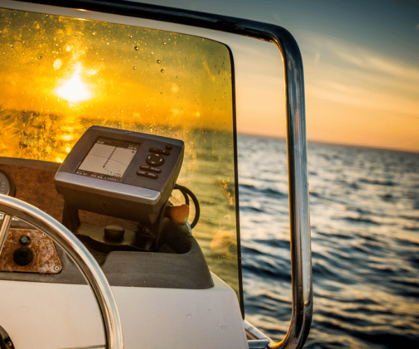
Garmin Striker 4
A well-loved option for anglers and small-boat owners, the Striker 4 focuses on high-quality sonar rather than advanced charting.
- Why people choose it:
- Accurate GPS
- Excellent CHIRP sonar
- Compact and affordable
- Reliable Garmin build quality
- Where it falls short:
- Not a real chartplotter, it has no built-in charts, meaning you still need another source for navigation.
- The 3.5-inch screen can feel cramped, especially when you’re trying to maintain awareness in busy waterways.
This is where a modern app like Wavve Boating fills the gap beautifully, giving boaters full chart visibility, depth awareness, and hazard markers without needing to buy multiple devices.
Lowrance Hook2 4x
The Hook2 4x is one of the simplest units on the market, perfect for boaters who want sonar with zero setup complexity.
- Strengths:
- Auto-tuning sonar
- Easy, intuitive interface
- Reliable depth readings
- Limitations:
- Very limited cartography
- Small display
- Not ideal for navigation unless paired with another tool
Many boaters use the Hook2 for depth but rely on something like Wavve for actual routing and charting because it’s faster, clearer, and always up to date.
Humminbird PiranhaMAX 4
A tough, dependable sonar unit with great performance in shallow water.
- Pros:
- Strong, bright screen
- Excellent durability
- Great for fishermen and nearshore boaters
- Cons:
- Provides no navigation charts at all
- Requires pairing with another navigation source
In practice, this means most PiranhaMAX users end up using their phone for real navigation, making apps like Wavve an almost automatic complement to this device.
Garmin eTrex Series
Compact, handheld, and ideal as a backup GPS.
- What it does well:
- Lightweight
- Uses minimal power
- Works anywhere
- What it lacks:
- Not a marine unit
- Very small screen
- Charts lack marine-specific detail
The eTrex is dependable, but when paired with a modern marine navigation app, it becomes far more practical.
Natural Positioning Summary
All of these chartplotters have strengths, and for the price, they’re solid tools. But they also show the same limitations:
- tiny screens
- minimal charting
- outdated or incomplete data
- no real-time depth or hazard awareness
That’s why, for many boaters, an app like Wavve Boating ends up becoming the primary navigation tool, with the hardware acting as a backup rather than the main solution.
Chartplotter vs. App: When Your Phone Might Be Better
A sub-$300 chartplotter can absolutely get the job done, but as soon as you compare it side-by-side with a modern marine navigation app, the difference becomes obvious. Chartplotters rely on fixed hardware, older chipsets, and charts that may not update frequently. Apps like Wavve, on the other hand, update instantly, reflect real-time changes, and give you a cleaner view of shallow areas, hazards, and tides.
Wavve was built on the belief that boating should feel intuitive, not technical. That mission is clear on the Wavve About Page, the entire platform focuses on safety, clarity, and ease of use for everyday boaters. It’s a major reason people choose apps over hardware: you get smarter navigation without installing anything, wiring anything, or learning complicated menus.
For jet skis, rentals, paddle craft, small boats, and even cruisers that already have built-in electronics, a phone-based navigation system often becomes the tool boaters trust most, especially because it’s always in your hand, always updated, and always easy to read.
How to Choose the Right Navigation Tool for Your Boat
Every boater’s needs are different, so the right tool depends on how and where you travel:
You’ll prefer a chartplotter under $300 if you:
- Want basic GPS positioning with simple functionality
- Only need sonar for fishing or depth checks
- Prefer a device mounted permanently on the console
- Don’t mind smaller screens or limited chart data
You’ll prefer an app-based navigation system if you:
- Want clear, modern maps that adjust to real-time water levels
- Prefer a big, bright screen (your phone or tablet)
- Want automatic routing without complicated settings
- Need tide, hazard, and depth awareness built in
- Don’t want to update hardware or buy new equipment
Many boaters end up using both: a budget chartplotter for sonar or backup positioning, and the Wavve Boating App for the actual navigation experience.
Money-Saving Tips When Shopping for a Chartplotter
If you decide a physical chartplotter is the right choice, here’s how to stretch your budget:
- Buy previous-year models. Marine electronics update slowly, last year’s version often has the exact same features for much less money.
- Look for refurbished or certified-used units. They can save you 20–40% and still come with warranties.
- Check transducer compatibility. Some units don’t include a transducer, meaning the “cheap” option becomes expensive fast.
- Compare charting add-ons. Even “affordable” plotters sometimes require extra purchases for coastal charts, inland lakes, or updates.
- Use a free navigation tool as a backup. Before committing to hardware, many boaters preview their waterways with the Wavve Chart Viewer to decide what level of chartplotter they truly need.
Risks & Limitations of Budget Chartplotters
Chartplotters under $300 are useful, but they’re not without compromises:
- Small screens make it harder to read charts quickly
- Limited chart updates can overlook hazards or shifting depth
- No real-time awareness of tide changes or local conditions
- Older processors lead to slower map redraws
- No community data, unlike apps where users share hazards & points of interest
These devices work, but they can’t match the dynamic, constantly updated environment you get from an app that evolves with real boater input, something Wavve is uniquely strong at.
FAQs
1. Are chartplotters under $300 worth it?
Yes. Entry-level chartplotters under $300 offer reliable GPS and basic depth or sonar features, making them a good fit for new boaters, anglers, and small-craft users. However, they do have limitations, such as small screens, slower processors, and limited chart updates, so many boaters use an app like Wavve for more accurate, real-time navigation.
2. What features should I look for in an affordable chartplotter?
Focus on GPS accuracy, clear screen visibility in sunlight, compatibility with charts, simple menu navigation, and optional sonar depth readings. Since budget devices have smaller displays, some boaters prefer supplementing them with mobile charts for better clarity.
3. Do budget chartplotters include marine charts?
Some models include basic charts, but many sub-$300 options either have limited cartography or none at all. It’s common for boaters to pair these devices with a mobile navigation app for full chart coverage and up-to-date information.
4. Can a phone replace a chartplotter?
For many boaters, especially jet ski riders, kayakers, inflatables, and weekend boaters, the answer is yes. A mobile app provides clear charts, automatic routing, depth awareness, and real-time updates. This is why apps like Wavve Boating Features increasingly serve as a primary navigation tool.
5. Do I need sonar if I already use a navigation app?
Not necessarily. Sonar is helpful for fishing or understanding bottom structure, but for general navigation, most boaters rely on chart data. A budget sonar unit paired with a navigation app often delivers the best combination of depth visibility + safe routing.
6. What’s the most affordable way to navigate safely?
Many boaters use a simple GPS or sonar device under $300 and rely on a mobile app like Wavve Boating for real-time chart data, tides, hazards, and routing. This combination keeps costs low while maximizing safety and clarity on the water.