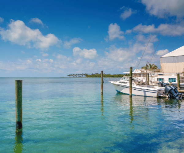
Florida boating presents navigation challenges unlike anywhere else in the United States. The Intracoastal Waterway winds through shallow coastal bays. The Florida Keys demand precise depth awareness navigating coral heads and grass flats. Tampa Bay’s sandbars shift with tides. The Ten Thousand Islands create maze-like conditions where one wrong turn leaves you grounded. Strong tidal ranges affect depths throughout the day, turning safe passages into hazards within hours.
Traditional paper charts can’t keep pace with Florida’s dynamic conditions. Sandbars migrate after storms, channels shoal gradually, and tidal currents create depth variations hourly. Modern marine navigation apps provide real-time updates, community-reported hazards, and automated features designed specifically for Florida’s challenging shallow-water environment. This guide examines the best apps for Florida boating, comparing features, pricing, and capabilities to help you navigate safely.
Wavve Boating: Best for Florida’s Shallow Water Navigation
Wavve Boating addresses Florida’s primary navigation challenge, depth awareness in constantly changing tidal conditions. The app’s draft-aware depth shading automatically shows safe versus shallow water for your specific boat based on real-time tide levels.
Enter your boat’s draft measurement once in settings. Wavve immediately color-codes all charts showing blue for safe navigable water and red for areas too shallow for your vessel. This visualization updates hourly as Florida tides change, eliminating dangerous manual calculations while steering through tricky passages.
Florida’s extreme tidal ranges make this feature invaluable. A channel showing adequate depth at high tide may leave you hard aground three hours later as water falls. Wavve’s real-time tide integration prevents this scenario by continuously updating depth displays based on predicted water levels at your location.
The app includes complete official NOAA chart coverage for all Florida waters, Atlantic coast, Gulf coast, Florida Keys, Intracoastal Waterway, Lake Okeechobee, and the St. Johns River system. Seven-day marine weather forecasts layer directly on charts showing hourly wind, wave, and condition predictions. Community hazard reporting lets Florida boaters share real-time information about new shoaling, marker changes, or dangers official charts don’t capture.
Offline capability proves essential for remote Florida areas. Download chart regions covering the Everglades backcountry, Dry Tortugas, or Ten Thousand Islands before departure. GPS continues working without cell service, providing accurate position tracking and draft-aware depth shading throughout trips in areas where cellular coverage disappears.
Pricing: $69.99/year or $11.99/month with 14-day free trial (no credit card required)
Best For: Recreational Florida boaters navigating shallow bays, coastal waters, backcountry areas, and anyone wanting automated depth safety without complexity.
Navionics Boating: Detailed Charts with Community Data
Navionics has served boaters for decades with detailed nautical charts and extensive coverage. The app provides particularly strong Florida coverage with SonarChart HD overlays showing community-sourced bathymetry data.
Daily chart updates keep navigation information current, important in Florida where storms and strong currents constantly reshape underwater features. Auto-routing plans courses between waypoints while avoiding shallow areas and hazards. Tidal current predictions help time passages through inlets and narrow channels where flows run strongest.
The ActiveCaptain community integration provides reviews and information about Florida marinas, anchorages, and local services. Boaters share fishing spots, favorable anchorages, and hazard warnings supplementing official chart data. SonarChart contributions from users add bottom detail in areas where official surveys lack resolution.
Navionics works well for Florida anglers seeking productive fishing spots and cruisers navigating familiar waters repeatedly. The detailed chart overlays and community fishing information appeal to those prioritizing bottom structure and proven productive areas.
Pricing: $49.99-$59.99/year with 14-day free trial
Best For: Florida anglers, cruisers wanting detailed bottom contours, boaters who value community fishing spot data.
Argo Navigation: Free Option with Draft-Aware Routing
Argo provides a capable free navigation app appealing to budget-conscious Florida boaters. The free tier includes basic charts, manual routing, and shallow-water awareness for all Florida waters. Social features let boaters share local knowledge about marinas, anchorages, hazards, and favorite spots.
Premium tier ($39.99/year) adds auto-routing based on your boat’s draft and size, customizable depth shading, offline charts, and extended weather forecasts. The auto-routing considers your vessel’s dimensions when planning courses, helping avoid areas too shallow for your boat with real-time calculations.
Pricing: Free (basic), $39.99/year (premium)
Best For: Budget-focused Florida boaters, those exploring new areas who value community recommendations, beginners learning Florida waters.
Garmin ActiveCaptain: Free for Garmin Owners
Garmin’s ActiveCaptain app serves primarily as a companion to Garmin chartplotter hardware but functions independently for basic navigation. The free app provides Garmin Navionics+ charts with daily updates and community point-of-interest data.
Community reviews for Florida marinas, anchorages, boat ramps, and services help trip planning. Boaters share information about facilities, pricing, and local conditions. The social aspect creates a knowledge base about Florida boating destinations.
Chart detail and features remain limited compared to dedicated navigation apps. ActiveCaptain works best as a planning tool or backup navigation rather than primary on-water guidance. For Garmin hardware owners, the app provides seamless synchronization between devices.
Pricing: Free (basic features), chart subscriptions available for enhanced coverage
Best For: Garmin chartplotter owners in Florida, trip planning and marina research, backup navigation.
Savvy Navvy: Smart Routing with Weather Integration
Savvy Navvy uses a Google Maps-style interface making navigation intuitive for users familiar with smartphone map apps. Smart auto-routing plans courses considering tidal currents, wind, and weather conditions, useful for Florida’s strong Gulf Stream currents and afternoon thunderstorm patterns.
Departure scheduling identifies optimal timing for passages where tidal windows matter. In areas like Government Cut, Haulover Inlet, or Sebastian Inlet where currents run strong, timing departures around slack water or favorable flows improves safety and efficiency.
The app provides 14-day weather forecasts (Premium tier) helping plan around Florida’s notoriously changeable weather patterns. Summer afternoon thunderstorms develop rapidly, extended forecasts help identify weather windows for offshore trips or extended cruises.
Free tier restricts to US charts with limited saves and no offline capability. Premium subscription ($129/year) unlocks global coverage, offline charts, unlimited saves, and full routing features.
Pricing: Free (US-only, limited), $129/year (Premium)
Best For: Boaters making passages where weather routing provides value, those wanting departure timing optimization, sailors in Florida waters.
Aqua Map: Strong ICW and Coastal Coverage
Aqua Map draws data from U.S. Army Corps of Engineers surveys and Waterway Guide information, providing detailed coverage for Florida’s Intracoastal Waterway and coastal routes. The app appeals to cruisers traveling the ICW through Florida or making the run to the Bahamas.
Offline charts work after downloading regions, essential for extended cruising in areas with spotty cellular coverage. Route planning tools help organize multi-day trips along the ICW with waypoints for anchorages, marinas, and fuel stops.
Integration capabilities let Aqua Map connect with boat instruments displaying AIS, depth sounder, and other data on the app interface. The feature appeals to boaters wanting consolidated information displays.
Pricing: Subscription model (comparable to Navionics)
Best For: ICW cruisers, Great Loop participants traveling through Florida, coastal passage makers.
What Florida Boaters Need Most
Florida’s unique conditions demand specific app capabilities beyond basic chart display:
Draft-Aware Depth Visualization: Florida’s shallow waters make real-time depth awareness critical. Apps showing how current tides affect navigable areas for your specific boat prevent groundings. Color-coded safe/shallow zones eliminate constant mental calculations while steering.
Real-Time Tide Integration: Florida’s tidal ranges, from the Bay of Fundy-like extremes in the Panhandle to the Keys’ moderate but crucial variations, affect every passage. Hourly tide updates showing current water levels and predictions prevent dangerous timing mistakes.
Offline Capability: The Everglades backcountry, Ten Thousand Islands, Dry Tortugas, and many remote coastal areas lack reliable cell coverage. Apps must function completely offline after downloading charts and weather data.
Community Hazard Reporting: Florida’s dynamic conditions mean official charts lag behind reality. Storms shift sandbars, markers drag off station, and channels shoal. Real-time community reports about changing conditions provide safety intelligence official sources can’t match.
Weather Integration: Florida afternoon thunderstorms, Gulf sea breezes, and tropical weather systems demand accessible marine forecasts. Apps layering weather directly on charts show conditions for planned routes without switching between multiple applications.
Comparing App Costs and Value
Understanding total costs over typical ownership periods helps evaluate value:
Three-Year Cost Comparison:
- Wavve Boating: $210 (3 years × $70/year)
- Navionics: $150-180 (3 years × $50-60/year)
- Argo Premium: $120 (3 years × $40/year)
- Savvy Navvy Premium: $387 (3 years × $129/year)
- Argo Free: $0
All paid apps cost substantially less than traditional chartplotter installations ($500-2000+ hardware plus professional installation). Apps provide automatic updates, portability between boats, and modern features like draft-aware navigation unavailable on older chartplotter systems.
For Florida boaters navigating primarily shallow coastal waters, bays, and the ICW, apps delivering automated depth safety and real-time tidal integration provide better value than premium-priced options emphasizing open-ocean passage planning features rarely used in Florida conditions.
Practical Tips for Florida App Navigation
Download Before Departure: Always download chart regions and weather data over WiFi before leaving the dock. Even with cellular coverage, bandwidth on the water often proves slow and unreliable.
Test During Trials: Most apps offer 7-14 day free trials. Take your phone or tablet on actual boating trips during trial periods, testing features in real conditions before committing to subscriptions.
Waterproof Protection: Invest in quality waterproof cases designed for marine use. Florida’s sun, spray, and humidity destroy unprotected electronics quickly. RAM mounts provide secure attachment for helm viewing.
Backup Power: Carry portable battery banks or connect devices to boat power. Navigation apps drain batteries, ensure sufficient power for entire trips plus reserve capacity.
Verify Critical Information: Cross-reference app data with visual observations, depth sounders, and common sense. Technology aids navigation but doesn’t replace situational awareness and seamanship.
Update Charts Regularly: Enable automatic chart updates so apps download the latest information whenever connected to WiFi. Florida’s rapidly changing conditions make current charts essential for safe navigation.
Choosing the Right App for Your Florida Boating
Selecting the best navigation app depends on your specific boating patterns and priorities:
Choose Wavve Boating if you navigate shallow Florida waters frequently, want automated draft-aware depth shading eliminating manual calculations, value real-time tidal integration showing current navigable areas, and prefer straightforward usability over complex features.
Choose Navionics if you fish extensively and want community bottom contours and fishing spots, cruise repeatedly in familiar areas benefiting from detailed SonarChart data, or prefer the long-established reputation of traditional chart providers.
Choose Argo if budget constraints matter significantly, you want functional free navigation without subscriptions, or community social features for sharing local knowledge appeal to your boating style.
Choose Garmin ActiveCaptain if you already own Garmin chartplotter hardware and want synchronized trip planning, need a free backup navigation option, or primarily use apps for marina research and planning rather than primary on-water navigation.
Choose Savvy Navvy if you make passages where weather routing provides tangible benefits, value departure scheduling for optimal tidal timing, or want 14-day extended forecasts for trip planning.
Most Florida recreational boaters navigating shallow bays, coastal waters, the ICW, and backcountry areas find apps emphasizing automated depth safety, real-time tides, and straightforward usability deliver better value than premium-priced options designed for offshore passage making. Florida’s primary navigation challenges, shallow water, shifting sandbars, tidal variations, demand features addressing these specific conditions rather than open-ocean routing capabilities.
Conclusion
Modern marine navigation apps provide Florida boaters with powerful tools preventing groundings, improving trip planning, and enhancing safety at costs far below traditional chartplotter installations. The best app for your needs depends on matching features to your actual boating patterns.
For shallow-water navigation in Florida’s challenging tidal environments, apps providing automated draft-aware depth visualization and real-time tidal integration address fundamental safety concerns traditional charts and basic GPS cannot solve. Community hazard reporting supplements official data with real-time intelligence about Florida’s constantly changing conditions.
Download trial versions of multiple apps, test them on actual boating trips in your local waters, and evaluate which interface, features, and capabilities best serve your navigation needs. The right app makes Florida boating safer, more enjoyable, and far less stressful when navigating the state’s unique shallow-water environments.
Content
- Wavve Boating: Best for Florida’s Shallow Water Navigation
- Navionics Boating: Detailed Charts with Community Data
- Argo Navigation: Free Option with Draft-Aware Routing
- Garmin ActiveCaptain: Free for Garmin Owners
- Savvy Navvy: Smart Routing with Weather Integration
- Aqua Map: Strong ICW and Coastal Coverage
- What Florida Boaters Need Most
- Comparing App Costs and Value
- Practical Tips for Florida App Navigation
- Choosing the Right App for Your Florida Boating
- Conclusion