
With that in mind, We’ve compiled a list of the best marine navigation apps to ensure you captain at your best every time you’re on the water. If you have a great suggestion to add to our list, please reach out to us or send an email to community@wavveboating.com so we can keep this helpful app selection as updated as possible.
Best Marine Navigation Apps
Any time you are out on the water it’s a good idea to have a navigation app to help you avoid dangerous issues. These apps include everything from updated weather reports to nautical charts that directly relate to your excursion goals. These are the best map apps that give you all the features and reliability you need while on the water.
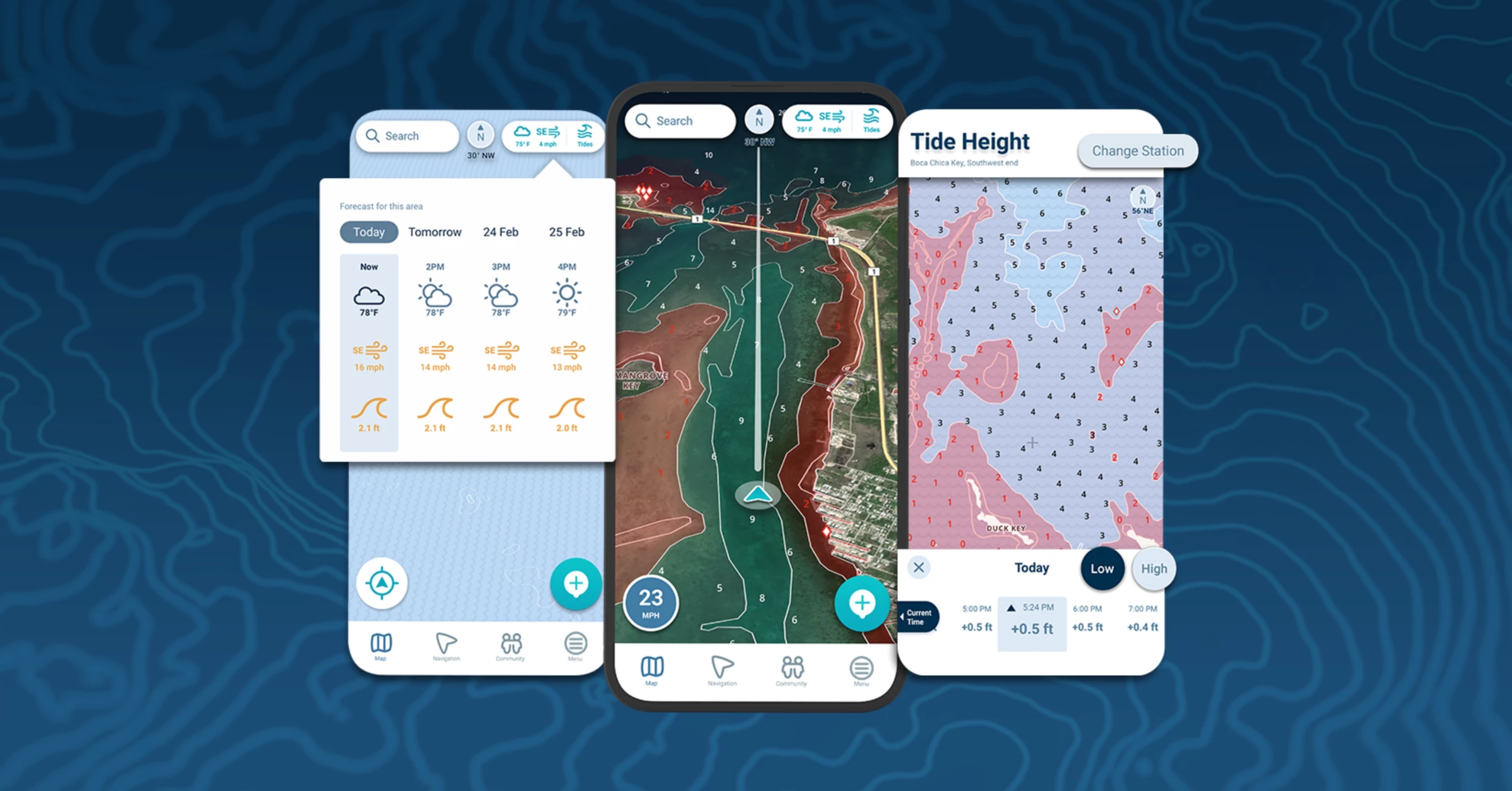
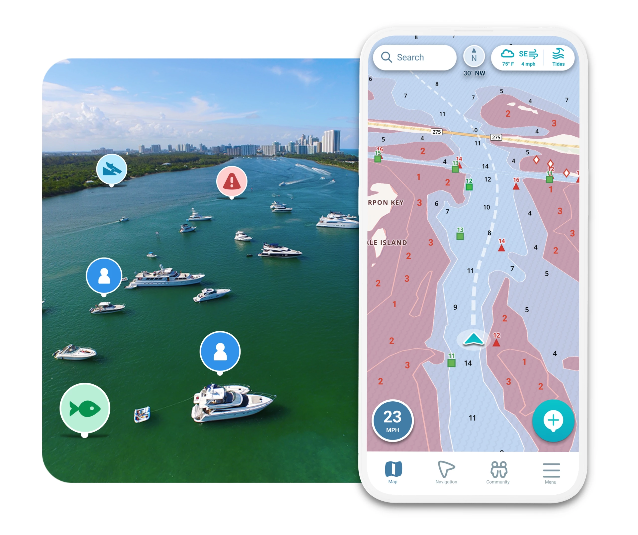
This is undoubtedly the best marine navigation app available today. Wavve Boating helps boaters navigate and explore with ease, while connecting to their boating community. The app customizes nautical charts to the draft of the user’s vessel, and current water levels, to provide an intuitive and easy to read map. Boaters can see their friends on the water, share their favorite spots, and discover new restaurants, routes, and other great locations. Wavve Boating is fully compatible with both iOS and Android devices, and best of all, this is so easy to use. You don’t get the endless clutter with too many options on the screen, or confusing color schemes that can leave you overwhelmed when you just need clear guidance. We highly recommend giving Wavve a test run before trying any other mobile navigation app.
Price: a 14-day free trial with a fantastic annual plan that is $69.99 per year. Readers can get a free preview of the app…no sign up or account needed. Come see why it’s the preferred boating app.
iNavX:
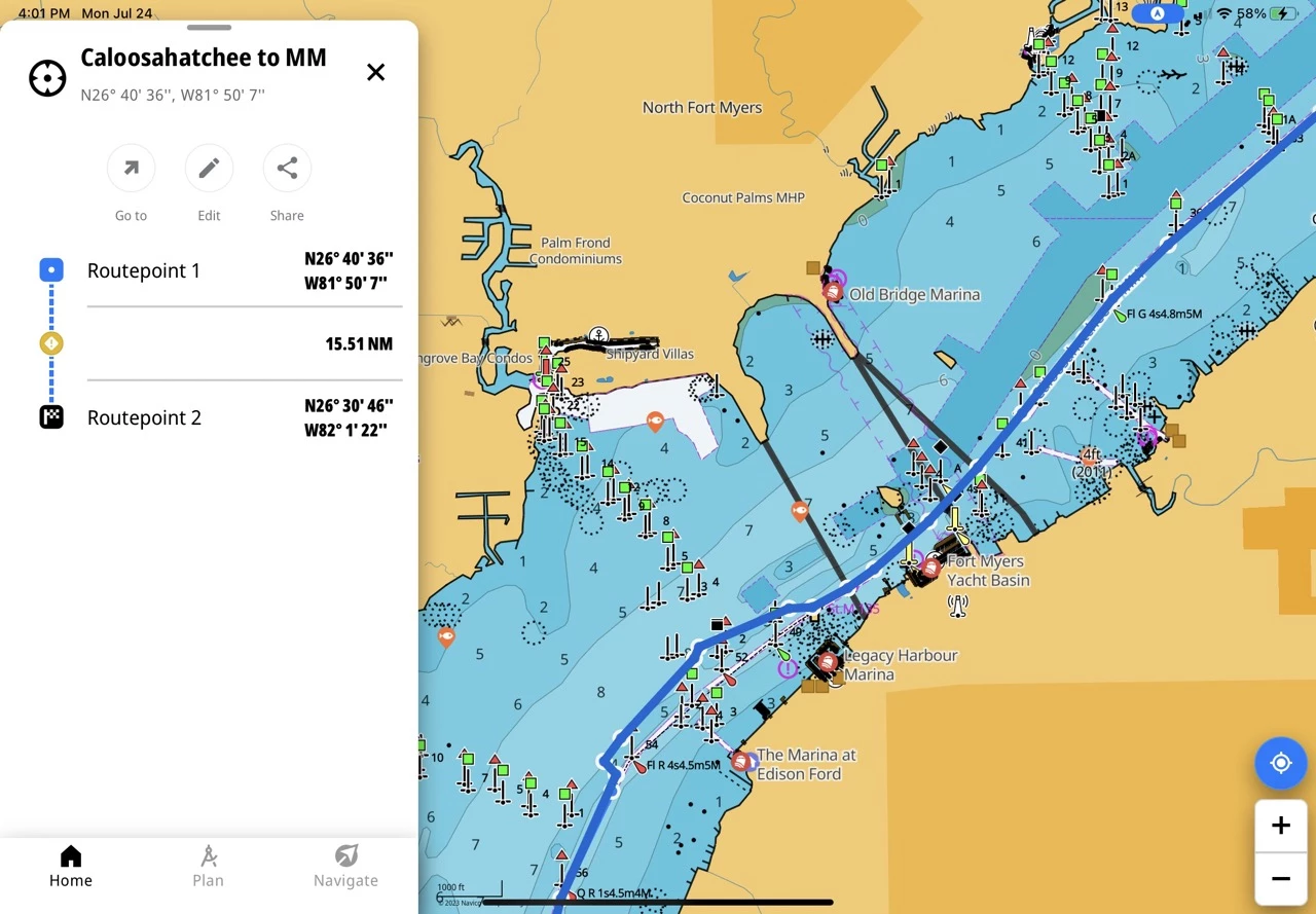
This app is the grandfather to many of the apps on our list and is still used by sailors because of its extensive library of charts and ability to overlay multiple nautical maps simultaneously. Many people that enjoy fishing will find that feature particularly useful. The chart plotter screen can work with GRIB files or connect directly with NMEA instruments for quick displaying of critical boating and systems information. That makes iNavX more complex than other apps, but for seasoned mariners or those looking to integrate with on-board systems this may be the right choice
Price: $9.99/monthly if you are an iOS user, a free basic version for Android, and a $29.99/year price for the enhanced version.
Navionics is a part of our best GPS app list because it has many of the same features you would expect from the competitors. The reason we like this particular company so much is because the app includes Navionics’ auto-routing capabilities, Active Captain Community data, Sonar Charts, and more. Navionics has a full set up features for your device (https://www.navionics.com/usa/apps/navionics-boating) to ensure you can utilize their custom overlays and map options.
Price: There is a free trial available, but then you will need to invest in a subscription. For example, the US & Canada maps are $79.99 per year.
Best Marine Navigation Apps for iPhones
Looking for the top boat navigation apps for iPhones? We’ve reviewed all the top options in the app store and did our iPhone research. Did you know that Apple users are well known for preferring high UI/UX features of their apps? It’s just one of the factors we consider in our list. That being said, if you’re an iPhone user and need a quality sampling of the best marine navigation apps, take a look at these choices:
As mentioned earlier, Wavve Boating is an excellent choice for iOS devices. It has one of the best map app designs with a highly user-friendly interface, accurate data points for navigation, and comprehensive features that are easy to find. Plus, you can mark your favorite destinations for revisiting based on goals like mooring, anchorage, fishing, and getting that fantastic tuna melt you tried at the local dock shack. Get a feel for the map with this in-app preview.
iNavX, available on iOS, is also a highly regarded marine navigation app It provides access to a vast library of charts, offers advanced waypoint management, and supports various external accessories, enhancing the overall boating experience.
Aqua Map is a user-friendly and reliable marine navigation app specifically designed for iPhones. It offers offline chart access, customizable features, and incorporates USACE data. Boaters traveling the ICW, or attempting the great loop, will want to consider checking this one out.
Best Marine Navigation Apps for Android
Don’t Worry; we know not everyone isn’t an Apple fan. We wanted to be sure to feature the best boat navigation apps for our Android readers as well. That way, you have all the options you want to find fuel, avoid sand bars, and reach those high target fishing spots you heard about at the local pub the night before. Check out this list of the best marine navigation apps for boating adventures with an Android phone/tablet:
Best Marine Navigation Apps for Android
Wavve Boating, available on Android devices, delivers the same exceptional features and reliability as its iOS counterpart. With its user-friendly interface and comprehensive functionality, we believe Wavve Boating to be a top choice for Android users, especially with the hazard highlights that show up that help you proactively avoid any dangers. If you’re an android user, get a free in-app preview of Wavve Boating here.
C-Map features vector maps, which make customizing and zooming in a seamless experience for anyone. This best boat navigation app can get a little cluttered if you don’t change the layers when you first start it up (according to this review: https://casualnavigation.com/c-map-app-reviewed-by-a-professional-navigator/). However, once you have that default setting adjusted, you’ll get all the features you’d expect like smooth navigation, boating hotspots, updated maps, and more.
Navionics Boating offers a more traditional approach to nautical charts, mixed with real-time weather updates, and optimized for Android devices. It provides a user-friendly interface and reliable navigation tools, making it a popular choice among Android users.
Best Boat Navigation Apps That Are Free
Being a better boater doesn’t mean you have to pay big dollars for a marine navigation tool. If you’re new to boating, or on a budget, it’s not a bad idea to try out some free options to get a feel for the features that mean most to you. If you’re looking for free boating maps, then consider some of these exceptional options:
Navionics Boating offers a more traditional approach to nautical charts, mixed with real-time weather updates, and optimized for Android devices. It provides a user-friendly interface and reliable navigation tools, making it a popular choice among Android users.
C-Map features vector maps, which make customizing and zooming in a seamless experience for anyone. This best boat navigation app can get a little cluttered if you don’t change the layers when you first start it up (according to this review: https://casualnavigation.com/c-map-app-reviewed-by-a-professional-navigator/). However, once you have that default setting adjusted, you’ll get all the features you’d expect like smooth navigation, boating hotspots, updated maps, and more.
Argo is a free marine navigation app that provides access to local charts, route planning tools, and a captain’s log to track routes. Although it offers in-app purchases for additional features, the free version is still helpful for basic navigation needs.
Best Free Marine Navigation Apps for iPhone
Best Free Marine Navigation Apps for iPhone
Best Free Marine Navigation Apps for Android
Best Free Marine Navigation Apps for Tablet Samsung Devices
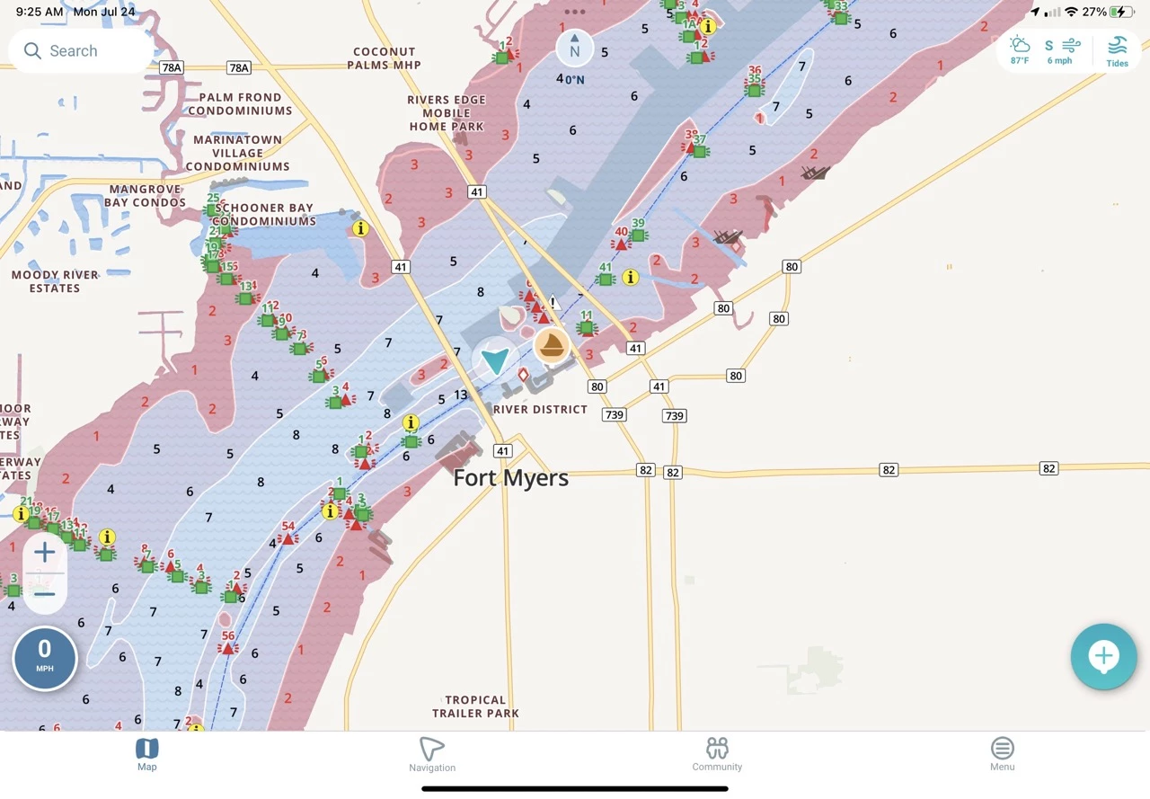
When using nautical chart apps, it’s important to choose tools that function both online and offline, especially when you’re far from shore and cell service disappears. This ensures you’re always viewing the correct charts instead of relying on outdated or irrelevant maps. The following apps offer extensive nautical chart coverage along with powerful navigation tools to help boaters travel safely and confidently.
Best Nautical Chart App
Wavve Boating excels in nautical chart capabilities, offering detailed and up-to-date access for over 15,000+ nautical charts. It’s seamless integration with thousands of community-sourced points of interest makes it a simple and super powerful chart-based navigation app. One of the best ways to get a feel for how easy this app is to use is by giving it a try. Check out this free preview to get started (no account needed).
iNavX provides access to a vast library of charts worldwide. With its ability to overlay multiple charts, support for raster and vector charts, and advanced navigation features, iNavX offers a comprehensive solution for boaters relying on nautical charts. Just watch out for the additional fees if you are a globetrotting sailor.
Navionics:
We wanted to include Navionics on our list because of the history of the company. They have been supporting nautical chart information for over 30 years, so you know you’ll get a strong blended mix of public and private map sources or surveys. (Ref: https://www.navionics.com/usa/charts/features/nautical-chart).
Top Marine Navigation Apps of 2026
In 2026, marine navigation apps have taken a leap forward with smarter, more connected, and real-time features. Apps like Wavve Boating now integrate live tide, wind, and wave data directly onto nautical charts, giving boaters instant access to essential conditions without switching tools. Offline chart access has expanded, map rendering is faster, and battery efficiency has improved for longer trips offshore. Community-reported hazards, anchorage notes, and route suggestions are now updated in real time, allowing boaters to make safer, faster, and more informed decisions. These 2026 advancements make modern navigation apps not just tools, but full-fledged on-water assistants that combine convenience, safety, and accuracy.
FAQ
Q: What is the best marine navigation app overall?
In our experience, the best marine navigation app overall is Wavve Boating. It offers comprehensive features, accurate data, and an intuitive interface, making it a top choice for boaters. Ease of use is the big kicker for our team because that cuts way down on confusion when you need data as quickly as possible. We also love Wavve’s free in-app preview, which gives you full access to the app…no account needed.
Q: Are there any free marine navigation apps?
Yes, there are free marine navigation apps available. Just keep in mind these tend to have a free trial period and then offer upgrades that require a monthly subscription. Some notable options include Navionics Boating, C-Map, and Argo, which provide essential navigation tools and limited chart access without requiring a purchase. If you’d like free access to premium features, then download Wavve Boating’s free preview.
Q: Can I use marine navigation apps on tablets?
Absolutely! Many marine navigation apps are optimized for tablets. Almost all the apps on our list are available for tablets, which is great if you require a larger screen or have a strong mount next to the helm.
Q: Do marine navigation apps work offline?
Yes, several marine navigation apps, including Wavve Boating, iNavX, and Navionics, offer offline functionality – especially for nautical charts. While you may not get the most updated tidal data, you will get plenty of details to safely navigate your next outing.
Q: Which marine navigation app provides the most extensive chart coverage?
Wavve Boating, iNavX, and Navionics are known for their extensive chart coverage. These apps provide access to charts from various public, private, and community-driven sources and ensure comprehensive coverage for boaters in different regions.
Please note that the availability and features of specific boat GPS apps may vary over time. Therefore, we always recommend checking the latest information and reviews before choosing a marine navigation app for your particular needs.
Wrapping it Up
If you’ve browsed our extensive list of the best marine navigation apps and still feel a bit overwhelmed, we strongly suggest starting with Wavve Boating. It’s sure to provide you a better boating experience with the easiest marine navigation app. If you’re interested in a more hands on preview, check out this month’s Top Boating Destination – Shell Key Island for a free preview with no strings attached. Happy boating!
Content
- Best Marine Navigation Apps
- Best Marine Navigation Apps for iPhones
- Best Marine Navigation Apps for Android
- Best Boat Navigation Apps That Are Free
- Best Free Marine Navigation Apps for iPhone
- Best Free Marine Navigation Apps for Android
- Best Free Marine Navigation Apps for Tablet Samsung Devices
- Best Nautical Chart App
- Choosing the Right Marine Navigation App
- Top Marine Navigation Apps of 2026
- FAQ
- Wrapping it Up


