A Clear, Real-World Comparison of Charts, Depth Features, Tides, and On-Water Experience.
Choosing the right marine navigation app isn’t just about charts, it’s about clarity, confidence, and how easily you can understand the water beneath and ahead of you. Many boaters compare C-MAP vs Wavve Boating because both offer strong marine charting, but they take very different approaches. C-MAP delivers a traditional, detail-heavy charting style Wavve Boating focuses on real-time simplicity, adaptive depth information, and an intuitive, modern interface that makes navigation easier for everyday boaters.
Whether you’re navigating narrow channels, mapping a weekend route, or running a jet ski offshore, this guide breaks down the key differences so you can choose the app that actually fits how you boat.
Why Boaters Compare C-MAP vs Wavve Boating
Charting, Tides, Depth, Routing, All Boating Apps Aren’t Built the Same.
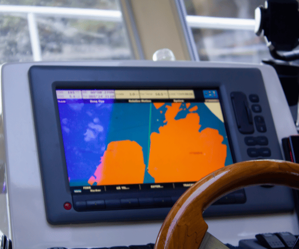
C-MAP has decades of legacy behind it, offering traditional cartography, dense detail, and chart formats familiar to experienced mariners. It’s powerful, but it can feel technical, symbol-heavy, and geared toward users who already understand advanced chart systems.
Wavve Boating was created from the opposite philosophy: make navigation clear, approachable, and personalized for real boaters, without sacrificing accuracy. Instead of decoding symbols or switching layers, users get clean charts, adaptive depth shading based on their vessel, and real-time tide and water level updates baked directly into the map.
Both apps help you navigate. But they’re built for very different types of boaters.
C-MAP vs Wavve at a Glance (High-Level Comparison)
A quick overview of how the two apps differ where it counts:
| Feature | C-MAP | Wavve Boating |
| Chart Visuals | Traditional, detailed | Clean, simplified, modern |
| Depth Awareness | Static charts | Real-time depth shading + vessel draft |
| Tides & Water Levels | Separate layers | Integrated directly into the chart |
| Ease of Use | Steeper learning curve | Beginner-friendly |
| Device Use | Often tied to plotters | Mobile-first, Sea-Doo compatible |
| Community Data | Limited | Active boater community |
| Routing | Technical, feature-rich | Smart auto-routing, simple |
Bottom line: C-MAP provides traditional charting power. Wavve Boating delivers real-time clarity for modern, everyday boaters.
Chart Clarity & Ease of Use
C-MAP
C-MAP uses traditional marine symbols and complex layers built for advanced navigators. The charts are highly detailed but can feel cluttered, especially on a phone. Boaters often need to zoom, toggle layers, or interpret symbols to understand what the map is showing.
Wavve Boating
Wavve streamlines the entire experience with charts designed for fast, confident decision-making. Depth zones are color-coded, hazards are clearly marked, and the interface is built for clean visibility on phones and tablets. New boaters can understand it instantly, and experienced boaters appreciate how quickly they can plan a route without deciphering layers.
Result: If you want technical detail, C-MAP delivers. If you want clarity at a glance, Wavve wins.
Real-Time Depth & Tide Intelligence
C-MAP
C-MAP charts provide strong baseline hydrographic depth data, but adapting to tidal changes or water levels often requires switching views or using additional layers. Depth isn’t always personalized to the vessel, which means you need to mentally account for your boat’s draft.
Wavve Boating
Wavve makes depth awareness effortless. Enter your vessel’s draft once, and the app automatically shades safe vs. shallow areas in real time. Charts adjust dynamically to tides and water levels, so you always see the true depth relevant to your boat, no manual calculations, no extra steps.
Result: Wavve offers a dynamic, personalized depth experience that static charts simply can’t match.
Routing & Trip Planning
C-MAP
C-MAP supports advanced routing features, but they tend to be technical and better suited to experienced mariners or those using full chartplotter systems. Routes can require more configuration, and new boaters may feel overwhelmed by the options.
Wavve Boating
Wavve focuses on making route planning fast and intuitive. Auto-routing instantly creates an efficient path based on your boat’s draft, depth conditions, and hazards. The interface prioritizes simplicity, so you can plan trips in seconds rather than managing complex settings.
Result: C-MAP is robust for professionals; Wavve is optimized for recreational and everyday boaters who want simplicity and speed.
Community Insight & Local Knowledge
C-MAP
C-MAP charts rely primarily on official hydrographic data. While reliable, they lack real-time local insight from boaters actively using the water. Hazards, shifting channels, temporary markers, or new anchorages may not appear until the next chart update, which can leave recreational boaters without on-the-ground context.
Wavve Boating
Wavve adds a powerful community layer that brings charts to life. Boaters share hazards, anchorages, points of interest, sandbars, and local tips, creating living charts that reflect what’s happening right now. This makes navigation safer, especially in dynamic or shallow regions where conditions shift quickly.
Result: If you value real-world knowledge, Wavve provides a richer, more adaptive view of your waterway.
Device Compatibility & On-Water Experience
C-MAP
C-MAP is often used through fixed marine chartplotters, multifunction displays, or partner electronics. While powerful, this hardware-based approach limits portability and requires installation. Using C-MAP on mobile devices is possible but not its primary use case.
Wavve Boating
Wavve Boating is mobile-first, designed for phones and tablets that boaters already use. It’s perfect for all vessel types, from jet skis and tenders to pontoons and day cruisers. Wavve is also integrated with Sea-Doo displays, giving PWC riders seamless access to maps directly on their dash.
Result: Wavve delivers flexible, modern navigation without needing extra hardware.
Offline Access & Reliability
C-MAP
C-MAP allows chart downloads depending on region and subscription level. Once offline charts are installed, the system works reliably on compatible hardware. However, updates aren’t designed to refresh frequently in real time.
Wavve Boating
Wavve lets you download maps, routes, and all essential navigation data for offline use. Whether you’re boating beyond cell range or exploring remote areas, the app keeps your charts stable and accessible. When signal returns, updates sync automatically, giving you the freshest data without any effort.
Result: Wavve offers offline simplicity paired with real-time intelligence when reconnected.
Simplicity vs. Complexity
C-MAP
C-MAP is feature-rich, but the density of its charts can overwhelm new or casual boaters. It’s built for mariners who already understand traditional symbology, depth contours, and multiple chart layers.
Wavve Boating
Wavve takes the opposite approach: charts are simplified, depth is color-coded, and key information is prioritized visually. Boaters don’t need formal training or chart experience, the interface is engineered to give instant clarity.
Result: If you want a navigation tool that’s easy, intuitive, and fast to learn, Wavve stands out clearly.
Comparison Summary Section
Which App Is Better for You?
Choose C-MAP if:
- You prefer traditional chart formats
- You use fixed chartplotters and multifunction displays
- You’re an experienced navigator who likes dense chart detail
- You want a professional-style mapping system on large hardware
Choose Wavve Boating if:
- You want real-time depth and tide awareness
- You prefer clean, simplified charts that reduce clutter
- You want navigation built for phones, tablets, and Sea-Doo displays
- You like routes that adapt to your boat and conditions
- You value real-world insight from an active boating community
- You want fast, intuitive navigation you can understand at a glance
The truth is simple: C-MAP is built for traditional, technical navigation. Wavve is built for modern, everyday boating.
If you want clarity, confidence, and real-time data in a format that makes sense instantly, Wavve delivers a more approachable and adaptive experience.
Choose the Navigation Experience Built for Modern Boaters
Wavve Boating brings together smart depth awareness, real-time tides, clean maps, community insight, and intuitive routing in one powerful app. No complicated hardware. No technical learning curve. Just simple, safe, confident navigation built for how people boat today.
Download Wavve Boating and experience a modern alternative to traditional chart systems, engineered for clarity, designed for safety.
Download Wavve Boating – Navigate With Confidence
FAQs
What is the main difference between C-MAP and Wavve Boating?
C-MAP uses traditional, symbol-heavy marine charts designed for advanced navigators, while Wavve Boating offers simplified, real-time charts with adaptive depth shading and built-in tide intelligence. Wavve is designed for everyday boaters who want clarity and fast decision-making without switching layers or interpreting complex symbols. You can explore Wavve’s chart style in the Wavve Chart Viewer.
Is Wavve Boating easier to use than C-MAP?
Yes. Wavve is intentionally designed for intuitive navigation, clean visuals, and real-time awareness. C-MAP is powerful but requires more chart-reading experience. New boaters, jet ski riders, and weekend cruisers often prefer Wavve’s simplicity. More information is available on the Wavve app features page.
Does Wavve have real-time tides and depth updates?
Yes. Wavve automatically updates depth shading and water-level awareness based on your GPS location and vessel draft. This makes it easier to avoid shallow areas and changing conditions. You can preview how this works through the Wavve Chart Viewer.
Can I use Wavve Boating offline like C-MAP?
Absolutely. Wavve Boating allows you to download marine charts for offline use, ensuring reliable navigation even without signal. Once your maps are saved, depth information, routes, and chart data remain fully accessible.
Which app is better for beginners, C-MAP or Wavve Boating?
Beginners typically find Wavve more approachable due to its clean interface and simplified depth visualization. C-MAP is powerful but designed for users familiar with traditional nautical charts. New boaters can also learn through resources available on the Wavve Boating Blog.
Does Wavve Boating work on jet skis and Sea-Doo models?
Yes. Wavve is mobile-first and integrates with Sea-Doo displays, making it one of the best navigation tools for jet skis, PWCs, and small vessels. Learn more through the Wavve Boating homepage.
Can Wavve replace a chartplotter like the ones used with C-MAP?
For many recreational users, yes. Wavve offers real-time charts, smart routing, tide awareness, and offline functionality directly on a phone or tablet. While pros may still prefer hardware-based chartplotters, everyday boaters often replace them with Wavve for convenience and clarity.
Where can I learn more about Wavve’s mission and technology?
You can explore the company’s approach to modern marine navigation on the Wavve About Page, which explains the philosophy behind its clean design, real-time data, and safety-first innovations.
Content
- A Clear, Real-World Comparison of Charts, Depth Features, Tides, and On-Water Experience.
- Why Boaters Compare C-MAP vs Wavve Boating
- C-MAP vs Wavve at a Glance (High-Level Comparison)
- Chart Clarity & Ease of Use
- Real-Time Depth & Tide Intelligence
- Routing & Trip Planning
- Community Insight & Local Knowledge
- Device Compatibility & On-Water Experience
- Offline Access & Reliability
- Simplicity vs. Complexity
- Comparison Summary Section
- FAQs
- What is the main difference between C-MAP and Wavve Boating?
- Is Wavve Boating easier to use than C-MAP?
- Does Wavve have real-time tides and depth updates?
- Can I use Wavve Boating offline like C-MAP?
- Which app is better for beginners, C-MAP or Wavve Boating?
- Does Wavve Boating work on jet skis and Sea-Doo models?
- Can Wavve replace a chartplotter like the ones used with C-MAP?
- Where can I learn more about Wavve’s mission and technology?