Walk into any marine electronics store and salespeople immediately steer you toward chartplotter displays costing $500, $1000, $2000 or more, plus professional installation fees adding hundreds to the total. The pitch emphasizes bright screens, marine-grade construction, and integrated capabilities with radar, sonar, and autopilot systems.
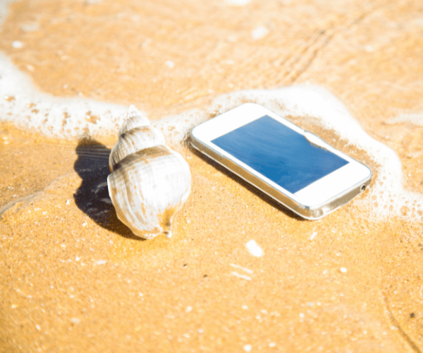
Meanwhile, your smartphone sits in your pocket running navigation apps providing detailed charts, real-time updates, weather integration, and automated safety features chartplotters lacked just five years ago. Apps cost $0-100 annually with no installation required, updating automatically whenever connected to WiFi.
Do recreational boaters genuinely need dedicated chartplotter hardware, or have modern navigation apps made expensive marine electronics unnecessary for most situations? This guide examines both options honestly, comparing costs, capabilities, and real-world performance to help determine what actually serves your boating needs.
The Answer: Most Recreational Boaters Don’t Need Chartplotters
For the vast majority of recreational, coastal, and inshore boaters, including most navigating Florida’s Gulf Coast, Keys, Intracoastal Waterway, Great Lakes, and inland waters, the answer is no. Modern smartphone and tablet navigation apps deliver 90-95% of chartplotter functionality at roughly one-quarter the cost.
Apps provide detailed official charts updated automatically, GPS position tracking working anywhere, weather forecasts integrated with navigation, offline capability for areas without cell coverage, and modern features like draft-aware depth shading unavailable on traditional plotters. Mount a tablet in a waterproof case at the helm and functionality rivals dedicated hardware for typical recreational use.
Dedicated chartplotters remain worthwhile primarily for offshore passages beyond 20 miles from shore, commercial fishing or charter operations, boaters wanting integration with radar/autopilot/advanced sonar systems, and those who strongly prefer large always-on helm displays never requiring battery management.
Understanding when you actually need expensive hardware versus when capable apps suffice saves substantial money while potentially providing better safety features for your specific boating conditions.
Smartphone Navigation Apps: Modern Capability at Budget Prices
Navigation apps transformed recreational boating by delivering professional-grade capability on devices most boaters already own. Understanding what apps actually provide helps evaluate whether dedicated hardware adds meaningful value.
Complete Official Chart Coverage: Modern apps include the same official NOAA, CHS, UKHO, and AHO charts installed on expensive chartplotters. Coverage spans United States waters, Canada, Great Lakes, and international regions. Charts update automatically whenever devices connect to WiFi, unlike chartplotters requiring annual subscription fees for updates.
Draft-Aware Safety Features: Advanced apps like Wavve Boating provide automated draft-aware depth shading traditional chartplotters cannot match. Enter your boat’s draft once, charts automatically color-code safe versus shallow water based on your specific vessel and real-time tide levels. This feature prevents groundings in shallow coastal waters, bays, and tidal rivers where depth constantly changes.
Real-Time Updates: Apps receive daily or hourly chart updates, weather forecasts, tide predictions, and community-reported hazards. Traditional chartplotters show static information current only when last updated, often months or years old unless expensive annual subscriptions maintain currency.
Weather Integration: Marine forecasts layer directly on charts showing wind, wave, and condition predictions for planned routes. See exactly what weather you’ll encounter without switching between navigation and separate weather applications.
Offline Capability: Download chart regions and weather data over WiFi before departure. GPS position tracking and all navigation features work completely offline without cellular coverage, essential for remote areas, backcountry exploration, or offshore passages.
Portability: Use the same app across multiple boats, move between different vessels easily, and take navigation capability wherever you go. One subscription works on phone, tablet, and multiple devices simultaneously.
Cost Reality: Quality navigation apps cost $0-100 annually. Wavve Boating provides complete features for $69.99/year. Navionics costs $49.99-59.99/year. Argo offers functional free navigation. These prices deliver full capability for less than chartplotter manufacturers charge for single-region chart updates.
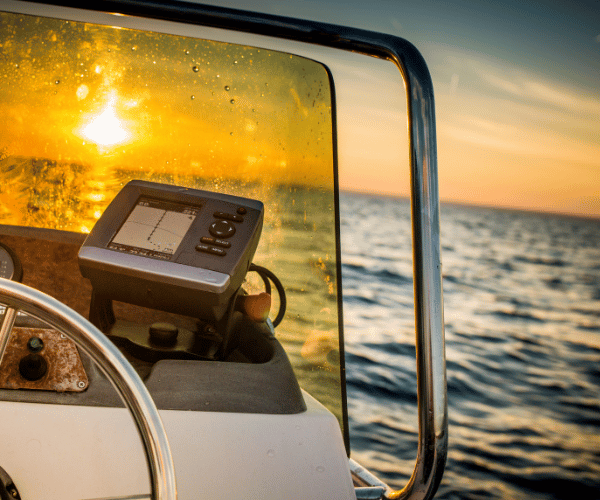
Dedicated Chartplotters: When Hardware Makes Sense
Chartplotters serve specific purposes well and remain the better choice for certain boating situations. Understanding genuine advantages helps identify when spending $500-2000+ actually provides value.
Always-On Helm Display: Dedicated screens remain visible constantly without battery management concerns. No charging cables, no power banks, no checking battery levels mid-trip. The display simply works whenever the boat’s electrical system provides power.
Extreme Weather Visibility: Marine-grade screens provide superior visibility in direct sunlight, heavy spray, and rough conditions. While quality tablet cases offer decent protection, chartplotters excel at maintaining readability when conditions deteriorate.
Integration Capabilities: Chartplotters connect directly with radar systems, advanced sonar/fish finders, AIS transponders, autopilot controls, and NMEA instrument networks. This integration creates unified systems displaying all information on single screens with seamless interaction between components.
Rugged Reliability: Purpose-built marine electronics withstand constant vibration, saltwater exposure, extreme temperatures, and physical impacts better than consumer devices in waterproof cases. Commercial operations and serious offshore sailors value this reliability.
Large Screen Real Estate: 9-inch, 12-inch, or larger multifunction displays show more information simultaneously than typical tablets. Split-screen views displaying charts, radar, sonar, and instruments benefit from generous screen space.
No Connectivity Required: Chartplotters function completely independently of cellular networks, WiFi, or internet connectivity. GPS satellite reception provides position tracking anywhere on Earth without any other infrastructure.
These advantages matter significantly for offshore sailors making multi-day passages, commercial fishing operations running equipment hard in tough conditions, and boaters who’ve invested in integrated electronics suites where chartplotters serve as central command displays.
For weekend coastal cruising, inland lake boating, day fishing trips, and typical recreational use, these advantages rarely justify the substantial cost premium over capable smartphone apps.
Real Cost Comparison: Apps vs Chartplotters
Understanding total ownership costs over realistic timeframes reveals the dramatic price difference:
Smartphone/Tablet Navigation Apps (3-Year Cost):
- Wavve Boating: $210 (3 × $70/year)
- Navionics: $150-180 (3 × $50-60/year)
- Argo Premium: $120 (3 × $40/year)
- Argo Free: $0
- Waterproof tablet case + RAM mount: $50-100 one-time
Total 3-Year App Cost: $50-310 depending on app choice and accessories
Dedicated Chartplotter System (3-Year Cost):
- Entry-level 7″ chartplotter: $400-800
- Mid-range 9″ multifunction display: $800-1500
- Premium 12″ integrated system: $1500-3000+
- Professional installation: $200-500 (wiring, mounting, integration)
- Chart updates: $50-150/year × 3 years = $150-450
- Transducer/accessories: $100-400
Total 3-Year Chartplotter Cost: $850-4000+ for basic to premium setups
The price difference funds years of app subscriptions, waterproof cases for multiple devices, backup power banks, and still leaves money remaining. For coastal and inland recreational boating, apps deliver necessary navigation capability at dramatically lower investment.
Hybrid Approach: Best of Both Worlds
Many experienced boaters adopt a practical middle ground combining advantages of both options:
Chartplotter at Helm + App for Planning: Mount a mid-range chartplotter providing always-on navigation at the helm. Use smartphone apps for trip planning, checking weather, researching destinations, and backup navigation. This approach provides reliability while leveraging app advantages for planning and redundancy.
App Primary + Paper Charts Backup: Navigate primarily using tablet apps in waterproof cases mounted at the helm. Carry updated paper charts for critical areas as backup. Total investment remains under $300 while providing two completely independent navigation systems.
Existing Chartplotter + Modern App: If your boat already has a functional chartplotter, keep using it while adding a modern app subscription. Apps provide features like draft-aware depth shading and real-time community updates older plotters lack. Combined cost stays reasonable while maximizing capability.
The hybrid approach recognizes that chartplotters and apps solve different problems effectively. Rather than forcing a choice between them, use each for situations where it excels.
What Florida and Shallow Water Boaters Actually Need
Specific boating environments influence whether chartplotters or apps better serve navigation needs. Florida’s shallow coastal waters, bays, and backcountry exemplify conditions where modern apps often provide advantages over traditional hardware.
Draft-Aware Depth Visualization: Florida’s shallow waters demand constant depth awareness accounting for tidal changes. Apps like Wavve automatically show safe versus shallow areas for your specific boat based on real-time tides. Traditional chartplotters display static depths requiring mental calculations adjusting for current tide stage and vessel draft, dangerous when navigating tight channels or unfamiliar grass flats.
Real-Time Tidal Integration: Florida’s tidal ranges vary dramatically from the Panhandle’s multi-foot extremes to the Keys’ moderate but crucial variations. Hourly tide updates integrated with chart depths prevent timing mistakes that leave boats grounded. Apps update this information automatically while chartplotters require manual tide calculations.
Community Hazard Reports: Florida’s dynamic conditions mean sandbars shift after storms, channels shoal gradually, and markers occasionally drag off station. App-based community reporting shares real-time hazard information official charts can’t capture. Chartplotters show only what manufacturers included during last update cycles, often months old.
Automatic Updates: Florida boaters benefit from daily chart updates reflecting changing conditions. Apps download current information automatically over WiFi. Chartplotter updates require purchasing annual subscriptions, downloading update files, and manually installing them, a process many boaters skip, leaving them navigating with outdated information.
For shallow-water environments like Florida, the Great Lakes, Chesapeake Bay, or Pacific Northwest inland waters, modern apps frequently provide better safety features than traditional chartplotters costing ten times more.
Practical Considerations for App-Based Navigation
Successfully using smartphones and tablets for primary navigation requires addressing practical challenges:
Screen Visibility: Mount devices where helm operators see them clearly without glare. Anti-glare screen protectors improve daytime readability. Position mounts allowing angle adjustment for changing sun conditions. Quality waterproof cases with clear windows maintain touchscreen functionality.
Battery Management: Navigation apps drain batteries steadily. Solutions include USB power connections to boat electrical systems, portable battery banks providing backup power, or keeping devices charged via cigarette lighter adapters. Plan for all-day power needs rather than assuming single charges suffice.
Device Protection: Marine environments destroy unprotected electronics. Invest in genuinely waterproof cases rated for submersion, not merely splash-resistant covers. Test waterproof seals regularly. Consider cases with lanyard attachments preventing loss overboard.
Backup Navigation: Technology fails. Carry backup navigation capability, either a second device running apps, updated paper charts for your cruising area, or basic GPS providing coordinates you can plot manually. Never depend solely on a single electronic device.
Mounting Solutions: RAM mounts provide adjustable, vibration-resistant mounting for tablets and large smartphones. Install mounts within easy reach of helm operators. Consider spring-loaded quick-release systems allowing rapid device removal when leaving boats.
Offline Preparation: Download all necessary chart regions, weather data, and tide information before leaving WiFi coverage. Test offline functionality ensuring everything works without cellular connection before depending on it during actual trips.
These practical considerations require modest investment and planning but make app-based navigation reliable and functional for serious boating.
Making Your Decision
Determining whether you need a chartplotter involves honest assessment of your actual boating patterns:
Choose Smartphone/Tablet Apps If You:
- Boat primarily in coastal, inland, or Great Lakes waters
- Make day trips or weekend cruises rather than extended offshore passages
- Navigate shallow areas where draft-aware features prevent groundings
- Want automatic chart updates and modern safety capabilities
- Boat on a budget prioritizing value over premium features
- Use multiple boats and want portable navigation
- Appreciate real-time community hazard information
Choose Dedicated Chartplotters If You:
- Make regular offshore passages beyond 20 miles from shore
- Operate commercially for fishing, charter, or professional purposes
- Want radar, advanced sonar, or autopilot integration
- Prefer large always-on displays never requiring battery management
- Already own integrated marine electronics benefiting from chartplotter addition
- Boat in extremely rough conditions where rugged hardware proves essential
- Have budget supporting premium equipment investments
For most recreational boaters reading this, honest evaluation points toward apps. The exceptions, offshore sailors, commercial operators, those wanting integrated electronics suites, represent a minority of the boating population despite being well-represented in marine electronics marketing.
Conclusion
Modern marine navigation apps have fundamentally changed what recreational boaters actually need for safe, confident navigation. Smartphones and tablets running quality apps provide official charts, real-time updates, advanced safety features, and weather integration rivaling or exceeding chartplotter capabilities, at roughly one-quarter the total cost.
Dedicated chartplotters retain advantages for specific use cases: offshore passages, commercial operations, integrated electronics systems, and boaters who strongly value always-on helm displays. For these applications, chartplotters justify their premium pricing.
However, the majority of recreational boaters, those navigating coastal waters, inland lakes, bays, and rivers on day trips or weekend cruises, find modern apps deliver everything necessary for safe navigation without expensive hardware investments. Features like draft-aware depth visualization and real-time tidal integration often provide better shallow-water safety than traditional chartplotters.
The question isn’t whether chartplotters work well, they do. The question is whether they provide meaningful advantages over capable modern apps for your specific boating patterns. For most recreational situations, the honest answer is no. Save the substantial cost difference, invest in quality apps and accessories, and enjoy navigation capability that updates automatically while costing less than a single chartplotter update subscription.
Your money. Your boat. Your decision. But make it based on what you actually need for the boating you actually do, not marketing designed to sell expensive marine electronics.
Content
- The Answer: Most Recreational Boaters Don’t Need Chartplotters
- Smartphone Navigation Apps: Modern Capability at Budget Prices
- Dedicated Chartplotters: When Hardware Makes Sense
- Real Cost Comparison: Apps vs Chartplotters
- Hybrid Approach: Best of Both Worlds
- What Florida and Shallow Water Boaters Actually Need
- Practical Considerations for App-Based Navigation
- Making Your Decision
- Conclusion