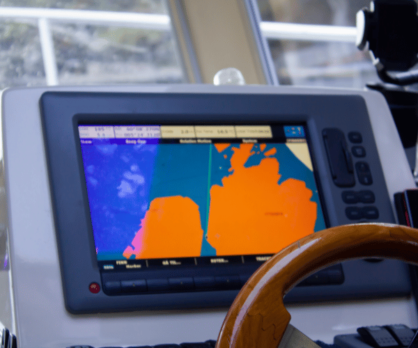
The Garmin EchoMap series occupies a practical middle ground in marine electronics, delivering capable chartplotting and fishfinding without the premium pricing of flagship GPSMAP models. For recreational boaters and anglers wanting dedicated hardware at the helm, these touchscreen units combine navigation with advanced sonar in packages designed for everyday use on smaller to mid-size vessels.
Understanding what the EchoMap actually delivers, where it excels, and where limitations appear helps determine whether these units justify their cost for your specific boating patterns. This review examines the current lineup honestly, comparing features against both premium chartplotters and alternative navigation approaches.
EchoMap Lineup: UHD2 vs Ultra 2 Series
Garmin currently offers two main EchoMap families differing primarily in screen size, resolution, and advanced feature availability.
ECHOMAP UHD2 Series targets smaller boats and budget-conscious buyers with 6-inch, 7-inch, and 9-inch display options. These units provide sunlight-readable touchscreens backed by physical keys for operation in rough conditions or with gloves. Preloaded Garmin Navionics+ charts cover United States coastal and inland waters with detail sufficient for typical recreational navigation.
ECHOMAP Ultra 2 Series expands to 10-inch, 12-inch, and larger displays appealing to boaters wanting premium screen real estate and advanced networking capabilities. The larger formats provide split-screen versatility showing charts, sonar, and instrument data simultaneously without constant view switching.
Both series support Ultra High-Definition scanning sonar including ClearVü (down-looking) and SideVü (side-scanning) providing detailed bottom structure visualization. Traditional CHIRP sonar delivers fish arches and separation. Compatible models integrate LiveScope forward-facing sonar, a significant feature for serious anglers seeking real-time underwater views.
Multi-band GPS provides solid positioning accuracy. Wireless networking allows data sharing between multiple EchoMap units on the same boat. Quick-release mounting simplifies installation and seasonal removal.
Sonar Performance: What You Actually See Underwater
The sonar capabilities distinguish EchoMap units from basic GPS chartplotters, making them particularly appealing to anglers and boaters navigating unfamiliar waters.
ClearVü Scanning Sonar produces photographic-quality images of bottom structure, submerged objects, and fish directly below the boat. The detail helps identify drop-offs, ledges, wrecks, and vegetation with clarity traditional sonar cannot match. Anglers use this information to pinpoint productive fishing structure.
SideVü Scanning extends visibility to both sides of the boat’s path, covering significantly wider areas than down-looking sonar alone. This capability helps locate offshore structure, survey channels, and identify hazards beyond the boat’s immediate track. The combined view accelerates learning new waters.
Traditional CHIRP Sonar complements scanning views by providing continuous vertical water column information. Fish appear as distinct arches when passing through the sonar cone. Adjustable frequency ranges optimize performance for different depths and target species.
LiveScope Compatibility (on select models) adds forward-facing and down-looking real-time sonar showing fish movement as it happens. This advanced capability appeals to serious anglers willing to invest in the additional transducer hardware LiveScope requires.
The sonar performance genuinely impresses for the price point. Recreational anglers find adequate detail for locating structure and fish without requiring professional-grade systems costing thousands more. The vivid color palettes and adjustable sensitivity help interpret bottom composition and target separation.
Chartplotting and Mapping Features
Navigation capability forms the other core function. EchoMap units handle basic to intermediate chartplotting needs effectively.
Preloaded Garmin Navionics+ Charts provide comprehensive coverage of United States waters with depth contours, navigation aids, harbors, marinas, and coastal detail. The charts update automatically when connected to WiFi (on WiFi-capable models) or via manual downloads, keeping information reasonably current.
Quickdraw Contours creates custom depth maps from your own sonar data as you boat. The feature records bottom depths, building personalized 1-foot contour maps of areas you frequent. For anglers repeatedly fishing specific lakes or bays, this crowd-sourced mapping reveals structure official charts miss.
Depth Range Shading color-codes charts based on customizable depth ranges, providing quick visual reference for navigable areas. The feature helps identify suitable fishing depths or avoid shallow hazards.
Autorouting plans courses between waypoints while attempting to avoid land and shallow water. The routing works adequately for basic trip planning though it lacks sophisticated features like weather integration or tidal current optimization found in premium systems.
Waypoint Management allows marking unlimited locations for fishing spots, hazards, boat ramps, and destinations. Organizing waypoints into groups helps manage large databases accumulated over seasons.
The chartplotting performs reliably for recreational coastal navigation, lake fishing, and bay cruising. Limitations become apparent for complex passage planning, international cruising, or boaters wanting advanced routing considering weather and currents.
Installation and Real-World Usability
Practical considerations often matter more than specifications when equipment lives in harsh marine environments.
Physical Installation proves straightforward with included bail mounts and quick-release mechanisms. Running power and transducer cables requires basic marine wiring knowledge or professional help for cleaner results. Flush-mount installation options provide integrated appearances on modern consoles.
Screen Visibility holds up well in direct sunlight, a critical factor for daytime boating. The bright displays remain readable without excessive glare, though polarized sunglasses occasionally create rainbow effects requiring head position adjustment.
Touchscreen Responsiveness works smoothly for marking waypoints, switching views, and adjusting settings. Physical buttons supplement touch controls for essential functions like zoom and page switching, valuable when wearing gloves or operating in rough conditions.
Power Consumption stays reasonable for the functionality provided. Smaller UHD2 models draw modest current suitable for boats with limited electrical systems. Larger Ultra 2 units require adequate battery capacity for all-day operation.
Menu Organization follows Garmin’s established interface logic. Experienced Garmin users navigate settings intuitively while newcomers face moderate learning curves understanding customization options and sonar adjustments.
Real-world operation reveals the units’ strengths during actual boating trips. Marking productive fishing spots happens quickly. Switching between chart and sonar views occurs seamlessly. Reviewing tracks and planning return routes works efficiently. The dedicated helm display eliminates juggling smartphones or tablets in rough conditions.
Pricing Reality and Value Assessment
Understanding total costs helps evaluate whether EchoMap units represent good value for your situation.
Hardware Costs:
- ECHOMAP UHD2 6-7 inch models: $700-1,300 with transducer
- ECHOMAP UHD2 9 inch models: $1,200-1,800 with transducer
- ECHOMAP Ultra 2 10-12 inch models: $1,900-3,500 with transducer
- ECHOMAP Ultra 2 15+ inch models: $4,000-5,500+ with transducer
Additional Expenses:
- Professional installation: $200-500 (wiring, mounting, transducer placement)
- Chart updates: Included with WiFi/Garmin Express (no annual fees for standard charts)
- LiveScope system (if desired): $1,500-2,500 additional
- Transducer upgrades: $200-800 depending on capabilities
Three-Year Ownership Cost:
- Entry UHD2 setup: $900-1,800 total (hardware + installation)
- Mid-range Ultra 2: $2,100-4,000 total
- Premium Ultra 2 with LiveScope: $6,500-8,000+ total
These figures position EchoMap as mid-tier marine electronics, more expensive than basic GPS fishfinders but substantially less than integrated systems combining chartplotters, radar, autopilot, and premium sonar.
For comparison, smartphone navigation apps cost $0-100 annually with no installation required. Apps provide official charts, GPS tracking, and weather integration for recreational navigation needs. However, apps lack the integrated sonar, always-on helm display, and marine-grade durability dedicated hardware provides.
The value equation depends on your priorities. Boaters fishing frequently, navigating unfamiliar waters regularly, or wanting dedicated sonar capability find EchoMap units justify costs. Casual weekend cruisers in familiar areas may find smartphone apps adequate, saving substantial money.
Strengths: Where EchoMap Units Excel
Honest assessment requires acknowledging genuine advantages these units provide:
Integrated Sonar and Charts eliminates managing separate devices for navigation and fishfinding. One screen displays everything needed, reducing helm clutter and simplifying operation.
Always-On Reliability means the unit works whenever the boat’s electrical system provides power. No charging phones, managing battery life, or protecting consumer electronics from spray.
Bright Sunlight Visibility maintains readability in conditions where phone and tablet screens wash out completely. Daytime fishing and navigation benefit significantly.
Customizable Mapping through Quickdraw Contours creates personalized depth information for frequently fished waters. This crowd-sourced data reveals structure official charts don’t capture.
Physical Controls supplement touchscreens allowing operation with gloves, in rough conditions, or when touch responsiveness suffers from water contact.
Garmin Ecosystem Integration connects smoothly with other Garmin marine electronics, watches, and accessories for users already invested in the brand.
Durable Construction handles marine environments better than consumer devices. Sealed housings resist water intrusion. Mounting systems withstand constant vibration.
For boaters spending significant time on the water, these advantages deliver genuine value improving the overall experience.
Limitations: Where EchoMap Falls Short
Balanced assessment requires acknowledging where these units don’t compete favorably:
High Initial Investment compared to smartphone navigation apps providing official charts and GPS tracking for under $100 annually. The hardware cost alone funds years of app subscriptions.
Installation Requirements add expense and complexity. Professional installation ensures proper transducer placement and wiring but increases total investment significantly.
Limited Advanced Features compared to flagship chartplotters. The EchoMap lacks radar integration, sophisticated weather routing, autopilot control, and extensive NMEA networking found in premium systems.
No Draft-Aware Depth Visualization means boaters manually calculate whether shown depths provide adequate clearance for their vessel at current tide stages. Some modern navigation apps automate this safety feature.
Static Tidal Information requires users to separately check tide predictions and mentally adjust charted depths. Real-time tidal integration found in certain apps eliminates this manual process.
Screen Size Constraints on smaller UHD2 models limit split-screen effectiveness. Viewing charts and sonar simultaneously requires sacrificing detail or constantly switching views.
No Community Hazard Reporting means information comes only from official charts and your own observations. Apps with active user communities share real-time hazard warnings, new shoaling, and changing conditions.
Understanding these limitations helps set realistic expectations and identify situations where alternative or supplementary navigation tools provide value.
EchoMap vs Alternative Navigation Approaches
Deciding whether to invest in dedicated hardware requires comparing against realistic alternatives.
Smartphone/Tablet Navigation Apps deliver official charts, GPS position tracking, weather forecasts, and automated safety features for $0-100 annually. Modern apps include capabilities like draft-aware depth shading showing safe versus shallow water for your specific boat based on real-time tides. Community reporting shares hazards traditional charts miss. Portability means the same app works across multiple boats.
Apps lack integrated sonar and always-on helm displays EchoMap provides. Battery management becomes necessary. Screen visibility suffers in bright sunlight despite anti-glare measures. For navigation-only needs without sonar requirements, apps often suffice at dramatically lower cost.
Entry-Level Fishfinders ($200-500) provide basic sonar without chartplotting. Boaters navigate using separate GPS or smartphone apps while relying on the fishfinder for underwater structure. The two-device approach costs less than integrated units but requires managing multiple screens.
Premium Chartplotters ($3,000-8,000+) integrate radar, advanced sonar, autopilot, extensive NMEA networks, and sophisticated passage planning. These systems appeal to offshore sailors, commercial operators, and serious cruisers wanting integrated command centers. The EchoMap occupies a practical middle ground between budget options and premium systems.
Hybrid Approaches combining EchoMap hardware with smartphone apps provide layered capability. Use the dedicated unit for primary helm navigation and sonar while employing apps for trip planning, draft-aware safety features, and backup navigation. This combined approach costs more than apps alone but less than premium integrated systems while maximizing strengths of both technologies.
Who Should Buy EchoMap Units
Specific boating profiles benefit most from these units:
Frequent Anglers navigating lakes, bays, or coastal waters who value integrated sonar for locating fish and structure find the combination of charts and scanning sonar worth the investment. Quickdraw mapping capabilities add personalized knowledge over time.
Inshore and Coastal Boaters operating in variable depths benefit from the visual awareness sonar provides, helping identify channels, drop-offs, and hazards. The dedicated helm display improves situational awareness compared to handheld devices.
Boaters Wanting Simplicity who prefer single-purpose devices over managing smartphones, power banks, and waterproof cases appreciate the always-on reliability and marine-grade construction.
Garmin Ecosystem Users already owning Garmin watches, instruments, or other marine electronics value the seamless integration and unified interface across devices.
Weekend Warriors on Smaller Boats seeking capability between basic fishfinders and premium systems find the UHD2 series offers practical functionality without excessive investment.
EchoMap units make less sense for casual boaters in familiar waters needing only basic navigation, budget-focused buyers prioritizing value over convenience, and those comfortable relying on smartphone apps with waterproof cases and backup power.
Final Verdict: Making Your Decision

The Garmin EchoMap series delivers capable chartplotting and sonar integration in user-friendly packages designed for recreational use. Whether the UHD2 or Ultra 2 better fits your needs depends on screen size preferences, sonar requirements, and how much you value dedicated marine hardware versus portable alternatives.
The units genuinely excel at combining navigation and fishfinding in sunlight-readable, marine-grade displays. Installation proves straightforward. Operation becomes intuitive after initial familiarization. The sonar performance impresses for the price point.
However, the substantial cost compared to smartphone navigation apps requires honest evaluation of whether integrated sonar justifies the investment for your boating patterns. Boaters fishing frequently or navigating unfamiliar waters regularly find clear value. Casual cruisers may find apps adequate at far lower cost.
Consider these questions before purchasing:
- Do you fish regularly enough to utilize advanced sonar capabilities?
- Will the always-on helm display significantly improve your boating experience?
- Does your boat’s electrical system support the power requirements?
- Are you comfortable with the total investment including installation?
- Would portable navigation apps with modern safety features serve your needs adequately?
Visit marine electronics retailers for hands-on demonstrations. Many boaters find that seeing the screens in simulated conditions and testing the interface firsthand clarifies whether EchoMap units match their expectations.
For those deciding the investment makes sense, the EchoMap series provides reliable performance improving navigation confidence and fishing success. Choose the screen size matching your boat’s console space and budget, ensure proper professional installation, and spend time learning the customization options maximizing the unit’s capabilities for your specific waters.
Your money. Your boat. Make the decision based on the features you’ll actually use during the boating you actually do, not marketing emphasizing capabilities you’ll rarely access.
Content
- EchoMap Lineup: UHD2 vs Ultra 2 Series
- Sonar Performance: What You Actually See Underwater
- Chartplotting and Mapping Features
- Installation and Real-World Usability
- Pricing Reality and Value Assessment
- Strengths: Where EchoMap Units Excel
- Limitations: Where EchoMap Falls Short
- EchoMap vs Alternative Navigation Approaches
- Who Should Buy EchoMap Units
- Final Verdict: Making Your Decision