“How shallow can my boat run?” represents one of the most important questions for safe boating, especially in areas featuring shallow water like the Florida Keys, Intracoastal Waterway, or coastal flats. Misunderstanding your boat’s safe operating depth leads directly to grounding. Groundings cause expensive hull damage, stranded boaters, emergency towing costs, and potentially dangerous situations. Understanding draft, calculating under-keel clearance, and accounting for real-time conditions prevents these problems completely.
Many casual boaters think they understand how shallow their boat can run, but they operate on incomplete information or misunderstandings. They might know their boat’s stated draft but not account for how it changes when loaded with fuel, supplies, and people. They might ignore tidal changes that reduce available water depth. They might not understand the difference between charted depth and actual safe operating depth. These knowledge gaps lead directly to groundings that proper understanding prevents.
This guide walks through exactly how to determine safe operating depth for your specific boat in real-world conditions, providing the knowledge to navigate confidently in shallow water.
Understanding Boat Draft
Draft represents the vertical distance from your boat’s waterline to the lowest point of the hull, propeller, or any other underwater appendage. Understanding your boat’s draft forms the foundation for shallow water navigation.
Static vs. loaded draft:
Your boat’s stated “draft” typically refers to the static draft when the boat sits lightly loaded in calm water. However, draft changes based on loading conditions. Add fuel, supplies, passengers, and fishing gear, and your boat sits lower in the water, increasing draft by several inches. Some boats increase draft by 6-12 inches between lightly loaded and fully loaded conditions.
How to measure your boat’s draft:
Mark your transom or hull with a permanent marker at the waterline when your boat sits in calm water, lightly loaded. Measure the distance from that mark to the lowest point of your hull or prop. This represents your actual draft in current loading conditions.
Repeat this measurement with a full fuel tank, supplies, and passengers to understand how draft changes between light and loaded conditions. The difference matters significantly when navigating shallow water.
Different boat types and typical drafts:
Flat-bottom skiffs and flats boats often run 12-18 inches of draft, allowing access to extremely shallow water. Center console fishing boats typically run 18-30 inches. Cruising sailboats range from 4-6 feet. Trawler-style boats often exceed 4 feet. Pontoon boats vary widely depending on hull design but typically run 1-2 feet. Understand your specific boat’s draft based on its design and current loading.
Why draft matters:
Water depth sufficient for a skiff proves dangerously shallow for a center console. Understanding your specific boat’s draft allows you to assess whether a particular water area provides adequate depth. Without knowing your draft, you cannot make informed navigation decisions.
Understanding Under-Keel Clearance (UKC)
Simply knowing your draft doesn’t guarantee safe water depth. You must also account for under-keel clearance.
What is under-keel clearance?
Under-keel clearance represents the vertical distance between your boat’s lowest point and the bottom. Zero clearance means your boat touches bottom. Safe navigation requires maintaining positive clearance at all times.
Experienced boaters commonly maintain 20-50% additional clearance above their draft. A boat with 2-foot draft might feel comfortable in 2.5 feet of water, maintaining 0.5 feet (6 inches) of clearance. In uncertain conditions, prudent boaters maintain even greater clearance.
Why under-keel clearance matters:
Several factors make zero clearance dangerous. Wave motion causes your boat to rise and fall constantly. In 2-foot water, a wave trough lowers your boat. Charted depths represent water level at a specific tide stage. Actual water level varies constantly. Your boat rocks and bounces with wave action. Sand bottoms shift. Underwater obstacles hide below the surface.
These factors mean operating with zero clearance almost guarantees grounding. Maintaining positive under-keel clearance prevents these problems.
Recommended clearance percentages:
Conservative boaters maintain 50% additional clearance. A boat with 2-foot draft stays out of water shallower than 3 feet. This conservative approach provides safety margin for wave action, measurement errors, and unexpected conditions.
Experienced shallow water boaters reduce clearance to 20-30% when they trust their knowledge. A boat with 2-foot draft navigates 2.4-2.6 feet water. This requires deep understanding of boat handling, bottom conditions, and local knowledge.
Never operate with zero clearance deliberately. Accidental grounding happens quickly. Deliberate zero-clearance operation risks expensive damage and dangerous situations.
Accounting for Tidal Changes
Tidal water level changes affect safe operating depth constantly. Understanding tidal changes transforms shallow water navigation from guesswork to informed decision-making.
How tides affect water depth:
Coastal areas experience significant tidal height changes. A location showing adequate depth at high tide becomes dangerously shallow at low tide. The difference between high and low tide sometimes exceeds 4 feet in areas like the Florida Keys and Atlantic Coast.
Your charted water depth represents the depth at mean lower low water, a standard tide reference. At high tide, actual water depth exceeds the charted depth. At low tide, actual water depth measures less than charted.
Calculating actual water depth:
Actual water depth equals charted depth plus (or minus) current tide height. If your chart shows 3 feet depth and current tide height is 1.5 feet above mean lower low water, actual water depth equals 4.5 feet. The same location at low tide with 1.5 feet below mean lower low water would show only 1.5 feet actual water depth.
Tide prediction resources:
NOAA provides detailed tide predictions for thousands of locations. Check NOAA tide predictions for your boating area showing expected high and low times and heights. Most smartphone apps integrate tide data. Tide tables available at marinas show predictions for popular boating areas.
Tide timing strategy:
Navigating shallow areas during high tide provides maximum water depth. Planning passages when tides align favorably versus planning passages against adverse tides changes whether navigation is possible. Experienced shallow water boaters time their movements around tidal cycles.
Step-by-Step: Calculating Safe Operating Depth
Understanding individual factors means little without combining them into actionable decisions.
Step 1: Determine your boat’s draft in current loading.
Measure or note your boat’s draft based on current fuel level, supplies, and passenger load. Understanding how draft changes between light and loaded conditions matters for real-world navigation.
Step 2: Determine your under-keel clearance requirement.
Decide what safety margin you’re comfortable maintaining. Conservative boaters use 50% additional clearance. Experienced boaters reduce this to 20-30%. Your minimum safe depth equals your draft plus your under-keel clearance requirement.
Example: A boat with 2-foot draft requiring 0.5 feet (50%) clearance needs minimum 2.5 feet water depth for safe navigation.
Step 3: Determine current tide height.
Check tide predictions for your location. Determine whether you’re at high tide, low tide, or somewhere between. Calculate the height difference from mean low water.
Step 4: Calculate actual water depth from charted depth.
Add the current tide height to charted depth. In areas with negative tide (tide dropping below mean low water), subtract from charted depth.
Example: Charted depth of 3 feet plus 1.5 feet tide height equals 4.5 feet actual water depth.
Step 5: Compare actual water depth to your minimum safe depth.
If actual water depth exceeds your minimum safe depth, you can navigate safely. If actual water depth equals or falls below your minimum safe depth, avoid that area.
Example: Your boat with 2-foot draft needs 2.5 feet minimum depth. Current actual water depth is 4.5 feet. You have 2 feet of safety margin. Navigation is safe.
The same location at low tide showing 1.5 feet actual water depth would be impassable. Your boat would ground immediately.
Traditional Tools for Shallow Water Navigation
Before electronic navigation apps and GPS, boaters used several proven methods for shallow water awareness.
Lead lines:
A weighted line dropped overboard measures water depth directly. Weighted lines marked at intervals (typically feet or fathoms) indicate depth instantly. While old-fashioned, lead lines work perfectly when electronic systems fail or need verification.
Paper charts:
Nautical charts show charted water depths throughout navigable areas. Understanding chart depth references and accounting for tides allows navigation without electronic systems. Many experienced boaters carry waterproof paper charts as backup.
Tide tables:
Published tide tables for specific locations show predicted tidal heights and times. Consulting tide tables before trips helps plan passages timing to favorable tides.
Visual water color assessment:
Experienced boaters learn to read water color indicating depth. Dark blue indicates deep water. Light blue, turquoise, or tan indicates shallows. Brown or tan suggests very shallow water. This skill develops through experience but provides valuable supplementary information.
Local knowledge:
Talking with local boaters, marina staff, fishing guides, and charter captains provides invaluable insight about real conditions, shallow spots to avoid, best passages, and current hazards that charts don’t show.
Modern Tools for Shallow Water Navigation
Electronic systems supplement traditional methods with real-time information.
Depth sounders and fish finders:
Transducers mounted on your hull transmit ultrasonic signals measuring water depth continuously. Modern depth sounders provide accurate real-time depth information, allowing adjustment to changing conditions. Fish finders provide depth plus bottom type and underwater features.
GPS chartplotters and marine navigation apps:
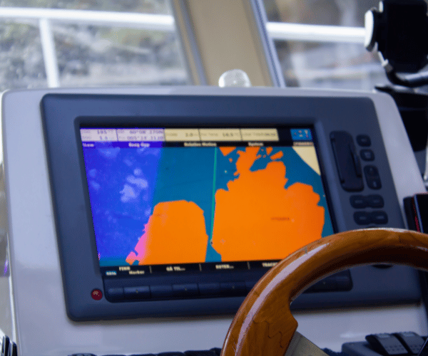
Chart plotting systems integrate depth contours from charts with your GPS position, showing your boat’s location relative to charted depths. Modern navigation apps display depth information overlaid on charts, allowing visualization of safe versus shallow water areas. Some apps integrate real-time tide predictions, updating depth displays as water levels change.
Real-time tide apps:
Smartphone applications provide detailed tide predictions for thousands of locations. Checking tide apps before and during trips provides accurate information for planning and real-time adjustments.
AIS and chart integration:
Advanced systems integrate automatic identification signals from other vessels with your charts, improving collision avoidance awareness in congested areas.
Community hazard reporting:
Modern navigation platforms include community-reported hazard information from other boaters. This crowdsourced data provides real-time awareness of shallow spots, debris, and obstacles that charts may not show.
Practical Tips for Safe Shallow Water Boating
Understanding shallow water navigation principles matters less than applying them consistently.
Plan trips around favorable tides.
Identify favorable tidal windows before boating. Plan departures during high tide for areas with shallow passages. Avoid boating at low tide in marginal-depth areas.
Reduce speed in shallow water.
Slower speeds reduce water displacement effects and provide time to react to unexpected shallows. Planing at high speed in shallow water dramatically increases grounding risk.
Learn to read water color.
Dark blue indicates depth. Light blue indicates shallows. Brown or tan suggests very shallow water. Practice reading water color until assessing depth visually becomes automatic.
Use electronic aids but don’t rely exclusively.
Depth sounders, charts, and navigation apps provide valuable information but aren’t infallible. Combine electronic information with visual assessment and caution.
Carry backup navigation.
Maintain paper charts and traditional tools even if your primary navigation uses electronic systems. Technology fails. Equipment breaks. Having backup navigation methods ensures safe boating when primary systems malfunction.
Never operate with zero clearance deliberately.
Accidental grounding happens. Deliberate operation with zero clearance courts disaster. Maintain positive under-keel clearance at all times.
Ask local boaters.
Marina staff, fishing guides, and local boaters know conditions other visitors miss. Ask questions about safe passages, areas to avoid, and current hazards.
Know what to do if you touch bottom.
Remain calm. Stop engine immediately to prevent propeller damage. Try backing out slowly if you’re touching bottom lightly. If solidly grounded, don’t force power. Call for assistance. Attempting to power off a hard grounding causes expensive damage.
Common Mistakes and How to Avoid Them
Understanding common mistakes helps you avoid repeating others’ errors.
Mistake 1: Relying on charted depth without accounting for tides.
Solution: Always check tide information. Calculate actual water depth by adding/subtracting current tide height from charted depth.
Mistake 2: Forgetting that draft changes with loading.
Solution: Measure draft with full fuel and supplies. Plan shallow water passages based on loaded draft, not light draft.
Mistake 3: Operating with zero clearance.
Solution: Maintain positive under-keel clearance at all times. Maintain minimum 20-50% additional clearance above your draft.
Mistake 4: Trusting only electronic depth sounders.
Solution: Use sounders as primary tools but verify with visual assessment and local knowledge. No single tool is infallible.
Mistake 5: Ignoring weather and water conditions.
Solution: Wave action reduces available water depth in shallows. Heavy rain or storms cause rapid depth changes. Account for conditions, not just static measurements.
Mistake 6: Failing to plan passages around tides.
Solution: Check tide predictions and plan trips to coincide with favorable tides. Timing passages around tidal cycles often makes the difference between safe passage and grounding.
FAQ
What’s the difference between draft and depth?
Draft is your boat’s underwater dimension from waterline to lowest point. Depth is water depth at a location. Safe navigation requires adequate depth compared to your draft plus clearance.
Can I tell how shallow my boat can run by looking at it?
No. Boat design dramatically affects draft. A 25-foot boat might draw 2 feet or 4 feet depending on design. You must measure or determine your specific boat’s draft.
How do I know my boat’s draft if it’s already in the water?
Measure from the waterline to the lowest point of your hull. Use a depth sounder or lead line if you can’t see your hull’s lowest point. Check your boat’s specifications from the manufacturer.
What if my boat touches bottom lightly?
Stop immediately. Put engine in neutral. Try backing out slowly. If you’re stuck hard, call for professional towing assistance. Don’t force power on a hard grounding.
Do all areas experience tides?
Coastal areas experience significant tides. Most inland lakes don’t. Check your boating area for tidal information. Even non-tidal areas experience some water level variation.
How far in advance should I check tides?
Check tide predictions the day before and morning of your boating trip. Water level changes predictably. Tide apps provide accurate predictions days in advance.
What’s the safest under-keel clearance?
Conservative boaters maintain 50% additional clearance above draft. Experienced shallow water boaters reduce this to 20-30% with careful navigation. Never intentionally operate with zero clearance.
Should I rely on my depth sounder completely?
Depth sounders provide valuable real-time information but aren’t infallible. Water conditions affect sounder accuracy. Always verify information with visual assessment and charts.
Conclusion
Knowing how shallow your boat can safely run depends on understanding draft, under-keel clearance, tidal changes, and real-time conditions. Combine knowledge of your boat’s specific draft with conservative clearance requirements and tidal information to calculate safe operating depths.
Blend traditional methods like paper charts and visual assessment with modern tools like depth sounders and navigation apps. Ask local boaters for current conditions and hazards. Time your passages to favor tides. Maintain positive under-keel clearance at all times.
Shallow water boating presents incredible opportunities for exploration and adventure. Understanding how shallow your boat can safely run transforms that adventure from anxiety-filled into confident navigation. Apply the principles in this guide consistently, and shallow water navigation becomes manageable, enjoyable, and safe.
Content
- Understanding Boat Draft
- Understanding Under-Keel Clearance (UKC)
- Accounting for Tidal Changes
- Step-by-Step: Calculating Safe Operating Depth
- Traditional Tools for Shallow Water Navigation
- Modern Tools for Shallow Water Navigation
- Practical Tips for Safe Shallow Water Boating
- Common Mistakes and How to Avoid Them
- FAQ
- Conclusion