- Launch Points to Consider
- Round Trip or One-Way?
- Choosing a Destination
- How to Read a Marine Chart
- Paper vs. Digital vs. App-Based Charts
- Chart Sources to Trust
- What Are Waypoints?
- Choosing Practical Stops
- How to Mark Them
- Know Your Speed in Knots
- Account for Variables
- Use Digital Tools to Calculate
- Marine Forecasts
- Tides and Currents
- Seasonal Patterns
- What These Apps Can Do
- Why They’re Helpful
- What to Include in a Float Plan
- Who to Share It With
- How to Keep It Updated
- Build Flexibility Into Your Route
- Factor in Hazards and Closures
- Plan for People Too
- Paper Charts and Tide Tables
- Compass and Manual Bearings
- Written Float Plan and Notes
- Know Your Boat’s Fuel Range
- Build in a Fuel Buffer
- Map Out Refueling Options
- Required Safety Equipment
- Communication and Navigation
- Quick Departure Checklist
- Download Offline Maps
- Pre-Check Dock and Fuel Availability
- Keep a Printed Snapshot of Your Plan
- Pad Your Timeline
How to Map a Boat Trip: A Step-by-Step Guide for Planning the Perfect Route
What Is Involved in Mapping a Boat Trip?
Mapping a boat trip means creating a planned route for your time on the water, using charts, navigation tools, and real-world conditions to guide your decisions. Instead of just launching and hoping for the best, you’re laying out where you’re going, how you’ll get there, where you’ll stop, and what you’ll need along the way.
A well-mapped trip takes into account fuel range, tide schedules, hazards, and backup options if conditions change. It’s how experienced boaters stay safe, avoid surprises, and make the most of their time on the water, whether it’s a short day trip or a multi-day journey.
Set Your Intentions and Choose a Trip Type
Before you start plotting your route, it’s important to define the kind of trip you’re planning. This step shapes everything that follows, from how far you’ll go to what gear you’ll need on board.
Are you heading out for a few hours of fishing close to shore? Planning a relaxing day cruise with family? Organizing a multi-stop weekend adventure that includes overnight anchoring or marina stays? Each of these scenarios requires different planning decisions, and knowing your intent early helps you map smarter.
Also consider who’s coming with you. A solo fishing trip has very different needs than a family outing or a group cruise. Your group’s experience level, comfort, and expectations all influence how you structure the day, including where you stop, how long you travel, and what type of waters you explore.
Finally, make note of your trip’s duration and timing. A weekday afternoon on the water can look very different than a Saturday in peak season. Being clear on your goals helps you make choices that match the vibe, conditions, and safety needs of your trip.
Choose Your Launch Site and Final Destination When Mapping a Boat Trip
Once you know what kind of trip you’re planning, the next step is selecting where you’ll begin and end your journey. This choice affects everything from your route planning to your logistics on land.
Launch Points to Consider
Your starting location could be a marina, public boat ramp, private dock, or anchorage. Choose a launch site that’s convenient for your crew, has the facilities you need, and allows access to the areas you want to explore. If you’re trailering your boat, factor in parking availability and local launch fees.
Round Trip or One-Way?
Decide whether your trip will return to the same location or end somewhere else. One-way trips require additional coordination, such as arranging transportation back to your vehicle or trailer, but can offer more freedom in how you map your route.
Choosing a Destination
Your destination might be a well-known cove, a specific marina, or just a general area you’d like to explore. The important thing is that it’s reachable within the time and fuel limits of your boat, and that you have at least one safe place to stop or anchor along the way.
Mapping your trip from launch to destination sets the foundation for building out the rest of your route with waypoints, fuel stops, and alternate plans.
Research Navigation Charts and Waterways
Accurate charts are essential when mapping a boat trip. They help you visualize the waterways, avoid hazards, and plan your route with confidence. Whether you prefer paper charts, digital systems, or boating apps, the key is knowing how to read and apply the information effectively.
How to Read a Marine Chart
Marine charts show more than just shorelines. They include depth contours, navigation aids, no-wake zones, restricted areas, underwater hazards, and channel markers. Learn to recognize symbols for rocks, wrecks, shallow water, and buoys so you can route safely through unfamiliar areas.
Paper vs. Digital vs. App-Based Charts
Paper charts, especially those from NOAA, are reliable and don’t depend on batteries or cell service. Digital chartplotters and GPS units offer zoomable displays and enhanced detail. Boating apps like Navionics, Aqua Map, and others combine the best of both worlds by allowing you to plan routes interactively on your phone or tablet, often with built-in tide data and hazard alerts.
Chart Sources to Trust
For paper options, NOAA charts are free and highly detailed. For digital and app-based tools, Navionics, iNavX, Aqua Map, and similar platforms offer downloadable maps and customizable route planning features. These tools are especially helpful for visualizing your route and adjusting it before launch day.
Using charts effectively gives you a complete picture of where you’re headed and what to expect along the way.
Mark Important Waypoints and Stopovers
Once you’ve chosen your launch and destination and reviewed your charts, the next step is to identify the key points along your route. These waypoints help break your trip into manageable sections and ensure you have what you need along the way.
What Are Waypoints?
Waypoints are specific locations you plan to pass or stop at during your trip. They might include fuel docks, anchorages, marinas, scenic spots, or landmarks that help with navigation. Each waypoint gives you a chance to pause, check progress, adjust your route, or refuel.
Choosing Practical Stops
When selecting stopovers, think strategically. Include fuel stops based on your boat’s range. Add marinas or protected anchorages for meals or overnight stays. If weather or tides might impact your route, include alternate options nearby in case plans change.
How to Mark Them
Most navigation apps and GPS devices let you drop pins or create custom waypoints. As you build your route, label each stop and note details like fuel availability, depth, hours of operation, or hazards. If you’re using a paper chart, highlight each point and write in any notes to reference on the water.
Waypoints turn a rough route into a detailed plan that helps you stay organized and in control throughout your trip.
How to Estimate Distance and Travel Time on the Water
One of the most important parts of mapping a boat trip is understanding how far you’ll travel and how long it will take. Unlike driving, boating speeds can vary based on weather, water conditions, and your vessel. Estimating time and distance helps you avoid delays, save fuel, and plan smarter stops.
Know Your Speed in Knots
Boating distances are typically measured in nautical miles, and speeds are expressed in knots. One knot equals roughly 1.15 miles per hour. Check your boat’s cruising speed and use that number to estimate how long each leg of your trip will take.
Account for Variables
Don’t expect to travel at a consistent speed. Headwinds, waves, idle-speed zones, strong currents, and detours can all slow you down. Always add a time buffer for each leg of your journey. A 20-minute leg on paper could take 30 to 40 minutes in real conditions.
Use Digital Tools to Calculate
Many navigation apps and GPS systems will automatically calculate distance between waypoints and even suggest estimated travel time based on your vessel settings. Use this feature to compare route options and stay realistic about your timeline.
By calculating distance and time in advance, you’ll avoid running late, running out of daylight, or worse, running out of fuel.
Weather, Wind, and Tides: What to Check Before Mapping a Trip
Weather and tides can turn a smooth boat trip into a rough one if you don’t plan ahead. Before you finalize your route, take time to review the conditions that could affect your timing, comfort, and safety on the water.
Marine Forecasts
Use reliable marine weather sources to check wind speed, wave height, storm activity, and precipitation. Apps like Windy, NOAA, or your favorite boating app often provide hourly forecasts specific to your location. Look beyond the current day. Check for trends across your entire planned trip.
Tides and Currents
Tide changes can drastically affect access to shallow areas, sandbars, or inlets. Strong currents can also slow you down or push you off course. Use tide tables or tide-tracking apps to check high and low tide times for key points along your route.
Seasonal Patterns
In some areas, afternoon storms or shifting wind patterns are common during specific seasons. Knowing what to expect helps you time your departure and route to avoid common hazards or uncomfortable conditions.
Smart boaters don’t just check the weather. They map around it.
Marine Navigation Apps for Mapping a Boat Trip
Marine navigation apps have become essential tools for modern boaters. They make it easier to map your trip, view real-time data, and stay flexible on the water. Whether you’re planning in advance or adjusting mid-journey, these apps add an extra layer of confidence and clarity.
What These Apps Can Do
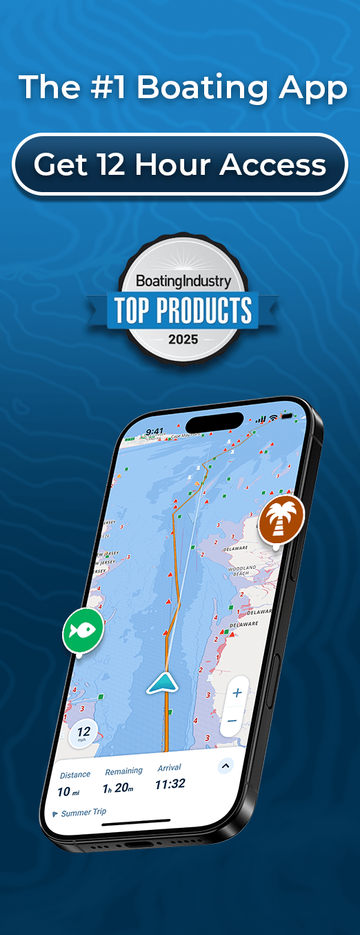
Navigation apps like Wavve Boating let you plot routes, drop waypoints, monitor weather and tides, and track your GPS position on the water. Many apps also show depth contours, hazard zones, and marina locations. Some even work offline if downloaded ahead of time.
Why They’re Helpful
Using a navigation app doesn’t replace seamanship, but it makes route planning more visual, interactive, and responsive to changing conditions. These tools are especially helpful when boating in new areas, managing tight schedules, or planning around tides and fuel stops.
A well-chosen app turns your paper route into a dynamic, smart plan

Creating and Sharing a Float Plan for Your Mapped Route
A float plan is one of the most important safety steps in trip preparation, yet many boaters skip it. If something goes wrong on the water, a float plan helps others locate you quickly and accurately.
What to Include in a Float Plan
A complete float plan outlines your route, estimated departure and return times, passenger list, vessel details, communication equipment, and emergency contacts. Include specific waypoints, expected fuel stops, and any alternate routes you might use if conditions change.
Who to Share It With
Share your float plan with someone who won’t be on the boat. This could be a friend, family member, marina office, or harbormaster. Let them know when to expect an update and what to do if you don’t check in on time.
How to Keep It Updated
If your plans change mid-trip, send an updated message if possible. Some boating apps allow you to share your route live or notify contacts if you go off-course or fall behind schedule.
A float plan isn’t just a formality. It’s your safety net if things go wrong.
Backup Plans and Alternate Routes While Mapping Your Trip
No matter how carefully you map a boat trip, conditions can change. That’s why every good route includes backup plans. Having alternatives ready keeps you flexible and prevents rushed decisions on the water.
Build Flexibility Into Your Route
As you map your trip, identify a few backup anchorages, marinas, or safe harbors along your route. If weather turns or fuel runs low, you’ll already know where to go. Even a five-mile detour can be a big help if you’ve pre-checked the area.
Factor in Hazards and Closures
Sometimes a marked channel may be temporarily closed, a fuel dock might be out of service, or a sudden storm could block your original path. Alternate routes should avoid risky areas and help you reach protected water or services quickly.
Plan for People Too
Not every backup needs to be about weather or fuel. If a passenger isn’t feeling well or your group decides to cut the trip short, a nearby marina or ramp can offer a faster return. Good planning balances safety with comfort.
A great boat trip plan doesn’t just show where you want to go. It prepares you for where you might need to go instead.
Offline Tools to Use When Mapping a Boat Trip
Even the best technology can fail. That’s why experienced boaters always bring offline navigation tools as a backup. If your phone dies, GPS loses signal, or a chartplotter malfunctions, you need a way to keep going safely.
Paper Charts and Tide Tables
Always keep printed charts on board for your route. These help you navigate if your electronics go down. Tide tables are also useful when you need to confirm water levels at key points in your trip without relying on an app.
Compass and Manual Bearings
A simple marine compass is a critical tool if visibility drops or you lose your GPS position. Know your headings for major legs of the trip so you can keep moving even without screens or signals.
Written Float Plan and Notes
Write down your waypoints, backup stops, and emergency contact information. If you’re relying on digital notes, make sure you have a printed copy as well. The more you can operate without a screen, the better prepared you’ll be if something goes wrong.
Offline tools aren’t just for old-school sailors. They’re a smart layer of protection for any mapped trip.
Fuel and Range Planning: Don’t Get Caught Short
Running out of fuel is one of the most avoidable problems on the water — and one of the most dangerous. When mapping your boat trip, planning your fuel usage is just as important as planning your route.
Know Your Boat’s Fuel Range
Understand how far your boat can go on a full tank at cruising speed. Check your fuel burn rate (usually measured in gallons per hour) and use that to calculate how many nautical miles you can travel comfortably and safely.
Build in a Fuel Buffer
Never plan a trip that pushes your tank to its limit. Plan to use only 70 to 80 percent of your available fuel. Conditions like wind, current, or detours can increase fuel usage more than you expect.
Map Out Refueling Options
Identify all available fuel stops along your route, including their hours of operation and accessibility for your boat. Even if you don’t plan to stop, knowing where fuel is available gives you more flexibility in case of delays or emergencies.
Fuel planning isn’t just a safety measure. It gives you peace of mind so you can enjoy the trip without constantly watching the gauge.
Safety Gear and Final Checklist for Your Boat Trip Map
Before you head out, double-check that your vessel is ready — not just with a solid route, but with the right equipment and essentials to support it. Even the best-mapped boat trip can go wrong without proper gear and a last-minute check.
Required Safety Equipment
Make sure you have all Coast Guard-required safety gear on board. This usually includes life jackets for every person, a throwable flotation device, sound-producing device (like a whistle or horn), visual distress signals (like flares), a fire extinguisher, and navigation lights.
Communication and Navigation
Bring a fully charged VHF marine radio, backup power for phones or tablets, and a physical chart in case your electronics fail. Make sure your navigation app or chartplotter is updated and that your planned route is loaded and saved.
Quick Departure Checklist
- Fuel tank is full (with a safety buffer)
- Float plan has been shared
- Route has been reviewed and saved
- Backup anchorages or stops noted
- Tide and weather forecasts checked again
- Everyone on board understands the plan
A final walkthrough ensures your boat, your gear, and your route are all aligned and that you’re fully ready to enjoy the trip.
Extra Tips to Make Mapping Your Boat Trip Easier
Even with all the major planning steps in place, a few simple tactics can make the process smoother and more reliable. These small details can save time, reduce stress, and help your trip go off without a hitch.
Download Offline Maps
Before you leave shore, download all the charts and routes you’ll need in case of limited signal. Most marine navigation apps offer offline access if maps are saved ahead of time.
Pre-Check Dock and Fuel Availability
Call marinas or fuel docks you plan to stop at to confirm they’re open and operating. Avoid showing up to a closed dock or a long wait you didn’t expect.
Keep a Printed Snapshot of Your Plan
Even if you’re relying on an app or GPS system, print a copy of your route with key waypoints, ETA estimates, and notes. If your electronics go down, this can make a huge difference.
Pad Your Timeline
Leave earlier than you think you need to. It gives you margin for delays, unexpected stops, or simply enjoying more time on the water without rushing.
Great boating trips often come down to what you did before you even launched.
Conclusion: Why Mapping a Boat Trip Makes All the Difference
Mapping a boat trip is more than just plotting points on a chart. It’s the process of thinking through your route, anticipating challenges, and preparing for the best and worst of what the water can bring. When done right, it adds structure, safety, and confidence to every trip — no matter how short or familiar the route may seem.
By taking the time to define your goals, plan your stops, prepare your equipment, and account for conditions, you’re not just protecting your boat and passengers. You’re setting yourself up for a smoother, more enjoyable experience.
Whether you’re a first-time boater or a seasoned navigator, mapping your route before leaving the dock is one habit that always pays off.