What’s the Difference Between Marine GPS and Chartplotter?
When you’re on the water, precision matters. Whether you’re navigating the open ocean, threading through shallow estuaries, or docking in a crowded marina, knowing where you are and what’s around you can be the difference between smooth sailing and a stressful day.
That’s why terms like marine GPS and chartplotter come up so often, but they’re not the same thing. While the two work closely together, they perform very different roles in your onboard navigation system.
And as boating technology evolves, many boaters are finding that they no longer need bulky hardware to do either. Modern marine navigation apps now combine the power of GPS accuracy with dynamic, chart-based route planning, all from a smartphone or tablet.
Let’s break down what’s the difference between marine gps and chartplotter, how they work together, and how the newest navigation apps bring them both into one simple, portable solution.
What a Marine GPS Actually Does
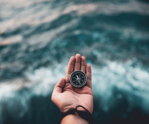
A marine GPS (Global Positioning System) is the foundation of your navigation setup. It connects to satellites orbiting the Earth to calculate your vessel’s precise location in real time.
In other words, GPS provides the coordinates that tell you exactly where your boat is. It also measures speed, direction, and heading. But while that information is essential, it doesn’t tell you much on its own.
A standalone GPS receiver simply reports data, usually as numbers or simple points on a grid. It can tell you that you’re at latitude -33.8523 and longitude 151.2108, traveling at 6 knots northeast. But it can’t show you where the shoals are, what the channel markers mean, or how to get to your next waypoint.
That’s where the chartplotter comes in.
Think of GPS as the “where” and the chartplotter as the “what.” The GPS pinpoints your position, while the chartplotter puts that position into context, overlaid on a digital nautical chart that shows depth contours, hazards, and routes.
How Marine GPS and Chartplotters Work Together Onboard
Although marine GPS and chartplotters serve different functions, they are designed to operate as a unified system. The GPS receiver continuously gathers satellite data to determine your exact position, speed, and heading. That information is then fed directly into the chartplotter, which overlays your location onto a detailed nautical chart. The result is real-time situational awareness: you can see your vessel moving across depth contours, approaching channel markers, or nearing shallow zones. Without GPS, a chartplotter has no live position data. Without a chartplotter, GPS data lacks context. Together, they create a complete navigation picture. Modern marine navigation apps like Wavve Boating replicate this same relationship digitally, combining internal GPS hardware with rich chart visualization so boaters get seamless positioning and mapping in one portable solution.
What a Chartplotter Adds to the Equation
A chartplotter takes your GPS coordinates and visualizes them on a digital marine chart. Instead of raw data, you see your position as a moving icon on a detailed map of the surrounding water, complete with depth zones, markers, tides, and hazards.
Chartplotters transform GPS data into something you can act on. They’re what let you follow a safe route, monitor depth, and spot danger before you reach it.
In many modern setups, the GPS and chartplotter are combined into a single device mounted on your console. These systems can cost thousands of dollars, require professional installation, and depend on periodic updates to stay current.
But today’s technology has changed the game. Mobile solutions like Wavve Boating now deliver the same functionality, live GPS tracking, detailed marine charts, and real-time depth and tide awareness, directly on your phone or tablet.
Chartplotters Are About Context, Not Just Location
The biggest advantage of a chartplotter is context. It translates GPS data into a visual understanding of your surroundings. You don’t have to interpret coordinates, you can see exactly where you are, what’s ahead, and where it’s safe to go.
With Wavve Boating, you get that same visual clarity with even greater convenience. The app overlays your live GPS location on vibrant, customizable charts designed specifically for Australian waters. You can plan, track, and share routes without the need for dedicated hardware.
That’s what modern chartplotting looks like: intuitive, accessible, and always up to date.
What’s The Difference Between Marine Gps And Chartplotter: Key Differences
Although marine GPS and chartplotters often come together, they’re built for different functions.
A marine GPS focuses on accuracy, calculating your coordinates, speed, and direction through satellite signals. It’s the backbone of navigation but offers little visual guidance on its own.
A chartplotter, on the other hand, focuses on interpretation, turning that raw GPS data into interactive maps that you can actually navigate by. It helps you plan safe routes, mark waypoints, and avoid hazards.
Together, they form a complete navigation system. But understanding where one ends and the other begins helps you decide what kind of setup you really need.
Functionality
A standalone GPS device is about positioning. It tells you where you are and how fast you’re moving. A chartplotter gives you that information visually, on a map that includes water depths, restricted areas, and markers.
In modern practice, most boaters use devices that combine both, either through dedicated marine electronics or through mobile apps like Wavve Boating that merge these features seamlessly.
Cost and Complexity
Conventional GPS and chartplotter setups typically involve professional installation and ongoing update expenses. While they’re ideal for offshore passages and commercial use, they can be more than what’s necessary for casual boaters and those sticking to coastal waters.
The Evolution: From Fixed Electronics to Marine Navigation Apps

What’s the difference between marine gps and chartplotter? The line between marine GPS and chartplotter used to be clear, one handled positioning, the other handled mapping. But in the last decade, that distinction has started to blur.
Smartphones and tablets now come equipped with powerful GPS sensors that rival standalone devices. Combine that with an app like Wavve Boating, and suddenly you have everything a traditional GPS/chartplotter combo offered, plus live weather, tides, and community data, all in your hand.
Instead of needing a mounted display and hardware updates, modern marine navigation apps give you complete freedom. You can plan a route from your couch, check tide levels before you launch, and track your position live once you’re on the water.
It’s the same core navigation capability, without the cost, cables, or maintenance.
How Marine Navigation Apps Replace Dedicated Units
Apps like Wavve Boating merge the essential features of both GPS and chartplotter systems:
- Live GPS tracking shows your real-time location and speed.
- Interactive charts visualize depth, markers, and routes.
- Weather and tide overlays give context for safe trip planning.
- Offline maps ensure you stay covered, even when cell service drops.
- Community insights add an extra layer of safety with real-world updates from nearby boaters.
What once required multiple expensive devices now fits in your pocket, updated automatically, accessible anywhere, and ready whenever you are.
When to Choose a Marine GPS, Chartplotter, or Navigation App
Now that you understand what’s the difference between marine gps and chartplotter, you need to understand that every boater’s needs are different. The best setup depends on how, where, and how often you get out on the water.
For professional captains, offshore cruisers, or long-distance sailors, traditional marine electronics still have a place. Dedicated GPS/chartplotter systems integrate directly with onboard sensors, AIS transponders, and radar equipment, perfect for complex navigation or open-sea conditions.
But for the majority of recreational and coastal boaters, a modern marine navigation app provides more than enough functionality. It’s cost-effective, portable, and designed to deliver the exact same GPS accuracy with intuitive visual charts.
When a Marine GPS System Still Makes Sense
If you’re traveling hundreds of nautical miles offshore or depend on radar overlays, a fixed marine GPS setup ensures redundancy and hardware-level reliability. Systems from brands like Garmin or Raymarine remain the gold standard for commercial fleets and offshore vessels.
When a Chartplotter Is the Better Choice
A chartplotter makes sense for boaters who want a permanent display, shared between multiple users, or integrated into helm electronics. However, these setups can cost thousands, and they require periodic updates to stay accurate.
When a Marine Navigation App Is the Smarter Option
For nearly everyone else, weekend cruisers, anglers, families, and sailing enthusiasts, apps like Wavve Boating combine the best of both worlds.
You get live GPS tracking, visual chart plotting, and integrated weather and tide data, all in a simple mobile experience.
Instead of paying for a new chart card or hardware update, you open an app and instantly see live conditions.
Wavve even lets you customize your chart colors based on your boat’s draft, so you can visually distinguish safe zones from shallow areas, a feature that most entry-level chartplotters don’t offer.
Why Marine Navigation Apps Like Wavve Boating Are the Future
Marine GPS and chartplotters changed boating forever, but their next evolution is already here. As technology gets lighter, smarter, and more connected, the future of marine navigation is clearly mobile.
Wavve Boating represents this shift. It takes everything that used to require hardware and simplifies it into one cohesive experience, accessible anywhere in Australia, from the Gold Coast to the Whitsundays.
Complete Navigation, Simplified
With Wavve Boating, you’re not managing separate tools for speed, charts, or weather. The app integrates:
- Live GPS tracking with real-time speed and heading.
- Dynamic marine charts tailored to Australian waterways.
- Built-in tide and weather forecasting, updated continuously.
- Community-powered insights that keep charts relevant and local.
Every feature works together, creating a complete picture of your surroundings without the clutter or complexity of traditional systems.
Accessible and Affordable
Marine navigation used to come with a steep price tag, not just for the devices themselves, but for software updates and chart licenses. Wavve Boating eliminates those barriers. You can download the app, explore its free chart viewer, and start navigating in minutes.<
Whether you’re in Sydney Harbour, cruising up the Murray River, or fishing in the Coral Sea, you’ll always have the latest chart data in your pocket.
Community-Powered Navigation That Keeps Evolving
One of the biggest advantages Wavve offers over fixed GPS systems is its living, community-driven map. Every day, Australian boaters contribute local knowledge, from shifting sandbars and updated speed zones to new marinas and safe anchorages.
This crowdsourced layer makes your map more accurate the more people use it, something no standalone chartplotter can match.
Built for Modern Australian Boaters
Wavve Boating isn’t a replacement for professional-grade systems, it’s the next step for everyday navigation. Designed for speed, clarity, and convenience, it gives Australian boaters what they actually need:
a clear, reliable, and easy-to-use navigation tool that doesn’t demand extra equipment.
What’s Changed in 2026: Navigation Is Now Seamless
In 2026, the distinction between marine GPS and chartplotter systems is smaller than ever. Modern navigation apps now combine precise satellite positioning with real-time chart visualization in one integrated platform.
Features like expanded offline maps, live wind and tide overlays, faster rendering, and easier route syncing have made mobile navigation more reliable and connected. Traditional marine electronics continue to evolve, but for most recreational and coastal boaters, today’s apps deliver the same core capability, accurate positioning paired with visual chart context.
Navigation is no longer about separate tools. It’s about seamless integration.
What’s The Difference Between Marine Gps And Chartplotter?
So, what’s the difference between marine gps and chartplotter?
A marine GPS gives you precise positioning.
A chartplotter turns that data into something visual and usable.
A marine navigation app like Wavve Boating brings both together, faster, simpler, and more accessible than ever.
You no longer need to choose between accuracy and convenience. Whether you’re an experienced skipper or new to boating, Wavve Boating offers the same GPS-grade precision and chartplotting clarity on the device you already own.
It’s the modern evolution of marine navigation, and it’s made for how Australians boat today.
Content
- What a Marine GPS Actually Does
- How Marine GPS and Chartplotters Work Together Onboard
- What a Chartplotter Adds to the Equation
- What’s The Difference Between Marine Gps And Chartplotter: Key Differences
- The Evolution: From Fixed Electronics to Marine Navigation Apps
- When to Choose a Marine GPS, Chartplotter, or Navigation App
- Why Marine Navigation Apps Like Wavve Boating Are the Future
- What’s Changed in 2026: Navigation Is Now Seamless
- What’s The Difference Between Marine Gps And Chartplotter?