The Miami-to-Bahamas crossing ranks among the most rewarding short offshore adventures accessible to recreational boaters. Just 48-50 nautical miles across the Gulf Stream separates South Florida from Bimini, offering crystal-clear Bahamian waters, world-class fishing, and island exploration in as little as 2-5 hours. This crossing suits powerboats, sailboats, and even organized jet ski groups including Sea-Doo riders, but demands careful planning due to strong currents, rapidly changing weather, and the shallow Bahamas banks.
While traditional chartplotters or basic GPS apps provide reliable positioning, modern all-in-one navigation platforms deliver significant advantages for this specific crossing. Understanding the unique challenges of Gulf Stream navigation and Bahamas shallow water operations helps ensure your trip remains safe and enjoyable rather than becoming a cautionary tale shared in marina bars.
For a closer look at how this works in real-world boating scenarios, see the Wavve Boating navigation platform overview.
Essential Planning Before Departure
Vessel Preparation and Safety Equipment
Proper vessel preparation separates successful crossings from dangerous situations. Your boat must be mechanically sound with sufficient fuel range for the crossing plus 30% reserve. The Gulf Stream’s 2-5 knot northward current means you’ll travel significantly farther over ground than the direct 48-mile distance suggests. Calculate fuel consumption at cruising speed, add distance for current offset, then include safety margin.
Required safety equipment includes:
- Coast Guard-approved life jackets for all passengers
- VHF marine radio (monitor Channel 16)
- EPIRB or PLB (emergency position indicating beacon)
- Flares and signaling devices
- First aid kit and seasickness medication
- Anchor and rode (Bahamas anchoring is frequent)
- Bilge pump and basic tools
- Drinking water (1 gallon per person minimum)
- Ditch bag with emergency supplies
Jet Ski and PWC-Specific Requirements:
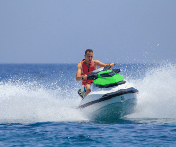
Personal watercraft crossing to the Bahamas need additional preparation. Install intake shut-off valves to prevent swamping in rough seas. Carry tow lines connecting all PWCs in your group, if one breaks down, others can assist. Most importantly, never attempt this crossing solo on a jet ski. Organize groups of at least three PWCs with a support boat if possible. Fuel range becomes critical, most jet skis consume 5-10 gallons per hour at cruising speed, requiring careful calculation for the 100+ mile round trip.
Weather Windows: The Most Critical Factor
Weather determines whether your crossing is pleasant or perilous. The Gulf Stream amplifies wave conditions, a north wind blowing against the northward current creates steep, dangerous seas out of proportion to wind speed. Winds over 15 knots from the north through east make the crossing uncomfortable and potentially unsafe.
Ideal crossing conditions include:
- Light winds from south or southwest (5-15 knots)
- Seas 2 feet or less in forecast
- No frontal systems approaching within 48 hours
- Clear visibility (avoiding fog or thunderstorms)
Specialized weather services like Marv’s Weather and Passage Weather provide Gulf Stream-specific forecasts superior to generic weather apps. These services analyze wind-versus-current interactions and recommend go/no-go decisions for the Miami-Bimini route.
Best Season:
April through October offers the most consistent weather windows, with calm conditions more frequent than winter months when cold fronts sweep through Florida regularly. Summer brings afternoon thunderstorms requiring early morning departures to avoid convective activity. Monitor weather obsessively in the 48 hours before departure, conditions change rapidly in South Florida.
Understanding marine weather patterns helps you interpret forecasts and make sound go/no-go decisions rather than relying on hope.
Boat Versus Jet Ski Considerations
Powerboats offer stability, enclosed cabin options, storage capacity, and range advantages. Most boats 20+ feet handle the crossing comfortably in good conditions. Center consoles, bay boats, and offshore fishing boats excel. Speeds typically range from 20-35 knots, completing the crossing in 2-4 hours.
Sailboats make the passage regularly, though slower speeds (5-8 knots) mean 6-10 hour crossings. The sail plan provides redundancy if engines fail. Sailboats handle rough conditions better than comparably-sized powerboats but require different routing to account for wind direction.
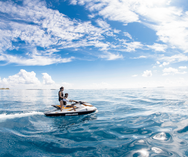
Jet Skis and PWCs complete the crossing faster than most boats, modern Sea-Doos and similar craft cruise 40-50 knots, finishing in 1.5-3 hours in flat conditions. However, PWCs offer no protection from spray, fatigue you more quickly, and provide minimal margin for mechanical issues. Only attempt this crossing on PWCs in near-perfect conditions with experienced riders and proper support. The speed advantage disappears if you’re forced to slow down due to sea state.
Bahamas Entry Requirements and Permits
Required Documentation
Every person aboard requires a valid passport for Bahamas entry, no exceptions. Passport cards don’t suffice; you need the book version. Enhanced driver’s licenses that work for Canada don’t apply to the Bahamas. Ensure passports remain valid for at least six months beyond your planned return date.
Cruising Permit for Vessels
All foreign pleasure vessels (including PWCs and jet skis) entering Bahamas waters must obtain a Cruising Permit. This permit allows you to travel throughout Bahamas waters for up to 12 months fees are structured by vessel length:
- Vessels under 50 feet: $500 annually
- Vessels for 50-100 feet: $1000 annually
- Additional fees: Fishing permit (if applicable), departure tax
You can apply online through the official Bahamas government portal at GoOutdoorsBahamas.com before departure, or obtain the permit at your first port of entry (typically Bimini). Processing at entry takes 30-60 minutes and requires cash payment, bring sufficient US dollars.
Customs and Immigration Clearance
Upon arrival in Bahamas waters, proceed directly to a designated Port of Entry without stopping elsewhere. Raise a yellow quarantine flag (Q flag) to signal you haven’t cleared customs yet. At Bimini, official ports of entry include Bimini Big Game Club, Blue Water Resort, and the government dock.
The clearance process involves:
- Tie up at the clearance facility dock
- Captain goes ashore alone to complete paperwork (crew remains aboard)
- Present passports for all passengers
- Complete Form C2A (vessel details and passenger manifest)
- Pay required fees (arrival tax is $20 per person for groups of 4+)
- Receive clearance stamp and cruising permit
- Lower yellow flag, raise Bahamas courtesy flag
Never anchor or go ashore before completing this process, Bahamas officials take illegal entry seriously, with penalties including vessel seizure.
PWC and Jet Ski Specifics
Personal watercraft follow identical permit and clearance requirements. Bring your vessel registration documents, insurance papers, and proof of ownership. Each PWC in your group needs individual documentation. The vessel registration must be current and match the operator’s name or show proper authorization for use.
Fishing Regulations
If you plan to fish in Bahamas waters, purchase a separate fishing license. Bag limits and size restrictions differ from US regulations. Spearfishing while using SCUBA is prohibited, freediving only. Certain species face protection (Nassau grouper, various sharks). Research current regulations before departure or risk substantial fines.
Popular Routes and Crossing Details
Miami/Fort Lauderdale to Bimini: The Primary Route
Distance: 48-50 nautical miles (varies by departure point)
Heading: Approximately 95° true (nearly due east)
Typical Duration: 2-5 hours depending on vessel speed and conditions
This represents the shortest and most popular Bahamas crossing from the US mainland. The route crosses the powerful Gulf Stream, which flows north at 2-5 knots, stronger in the center, weaker near edges. This current requires a southerly heading offset to compensate, or you’ll arrive miles north of Bimini.
Departure Points:
- Government Cut (Miami Beach): 48 nautical miles to Bimini
- Haulover Inlet (North Miami Beach): 50 nautical miles
- Port Everglades (Fort Lauderdale): 56 nautical miles
- Lake Worth Inlet (Palm Beach): 72 nautical miles
Most boaters favor Government Cut or Haulover for the shortest crossing distance. Time your inlet passage for slack tide when possible, strong currents in South Florida inlets create dangerous conditions when opposing wind or swell.
Gulf Stream Navigation Strategy:
The Gulf Stream’s northward flow means heading directly east (90°) results in arriving significantly north of Bimini. Experienced boaters use two primary strategies:
- Offset Course: Steer 10-20° south of east (heading approximately 110-120°) to compensate for current push. GPS track will show approximately 90° over ground despite heading south of east. This works well in moderate current.
- Point and Shoot: Head straight for Bimini (approximately 95°), accept the northward drift, then turn south once clear of the Stream and closer to the Bahamas. This method extends total distance but provides simpler navigation for less experienced crews.
Modern GPS navigation with track plotting shows your actual over-ground course versus heading, making current compensation visual and intuitive. Traditional dead reckoning required more skill and guesswork.
Alternative Routes
Miami to Gun Cay: 44 nautical miles, slightly shorter but Gun Cay offers minimal facilities compared to Bimini.
Miami to West End, Grand Bahama: 56 nautical miles, longer crossing but opens different cruising grounds.
Fort Lauderdale to Freeport: 65+ nautical miles, extended crossing suitable for faster vessels or overnight passage.
After clearing customs in Bimini, your cruising permit allows unrestricted travel throughout the Bahamas. Many boaters continue to Nassau, Berry Islands, Exumas, or other destinations after the initial crossing.
Jet Ski and PWC Route Specifics
Personal watercraft follow identical routes but require additional considerations. Launch from ramps at Crandon Park (Key Biscayne), Haulover Park, or Matheson Hammock. These facilities provide ample parking for trailers and convenient inlet access.
PWC groups should designate a lead rider with GPS and navigation capability. All riders maintain visual contact throughout the crossing. Carry waterproof VHF radios for communication, cell phones don’t work offshore. Agree on rally points before departure in case the group separates.
PWC crossing times range from 1.5-3 hours in calm conditions, but rider fatigue becomes significant. Plan for rest stops immediately after arrival rather than attempting to explore extensively before recovery.
Navigation and Safety Tools
Why Specialized Marine Navigation Matters
The Miami-to-Bahamas crossing presents unique navigational challenges beyond typical coastal cruising. The Gulf Stream’s variable current requires constant course monitoring and adjustment. Bahamas banks feature extensive shallow areas, depths change from 100+ feet to 6 feet within boat lengths. These conditions demand navigation tools providing real-time current compensation, precise positioning, and shallow water awareness.
Generic phone GPS apps show your position but lack marine-specific features. They don’t display nautical charts, don’t warn of shallow areas, and can’t overlay weather forecasts on your route. For offshore crossings and shallow Bahamas navigation, proper marine chartplotters or apps become essential safety equipment, not luxury additions.
Navigation Tool Comparison
Traditional Fixed Chartplotters (Garmin, Simrad, Raymarine):
Dedicated marine chartplotters provide reliable, waterproof navigation designed for harsh marine environments. Quality units display detailed charts, integrate with radar and autopilot systems, and offer bright sunlight-readable screens.
However, traditional chartplotters require professional installation, cost $500-2,000+ depending on features, and demand periodic chart update purchases. They’re mounted permanently, not useful for planning at home or reviewing routes before departure. For smaller boats or budget-conscious cruisers, the investment feels excessive.
Navionics and Similar Chart Apps:
Popular marine chart apps like Navionics provide detailed nautical charts on smartphones and tablets. These apps offer offline capability, autorouting, and community data at annual subscription prices ($40-60). They work well for general navigation and significantly outperform generic GPS apps.
Limitations include manual depth interpretation (you calculate whether charted depths are safe for your draft), separate apps needed for comprehensive weather, and basic tide displays that don’t integrate with chart depths. For the Bahamas where tides affect available depth in shallow areas, this integration gap creates safety concerns.
Wavve Boating: Comprehensive Navigation Platform:
Wavve Boating takes a different approach by integrating all navigation elements into one platform designed specifically for the challenges recreational boaters face. For the Miami-to-Bahamas crossing and Bahamas cruising, several features provide distinct advantages:
Official Chart Coverage: Access to 17,000+ charts worldwide includes complete Bahamas coverage with NOAA-based charts showing detailed depths, navigation aids, and hazards. No regional purchase requirements, worldwide access under one subscription.
Draft-Aware Depth Shading: Enter your vessel’s draft once (whether boat or jet ski), and Wavve automatically color-codes the entire chart. Blue areas are safe for your vessel, red zones indicate shallow water. This visualization updates in real-time as tides change, showing exactly where you can navigate safely right now.
For the Bahamas banks where depths vary from deep blue holes to skinny flats, this feature prevents groundings that damage boats and ruin trips. Instead of mentally calculating “chart shows 5 feet, low tide subtracts 2 feet, my boat draws 3 feet, do I fit?”, Wavve shows you the answer visually.
Integrated Marine Weather: Seven-day marine weather forecasts layer directly on your charts, showing wind speed, gusts, wave height, wave period, and conditions hour-by-hour. Review the forecast for your planned crossing route without switching apps or websites. Weather updates hourly from official meteorological sources.
Real-Time Tide Integration: Tides in the Bahamas affect available depth significantly. Wavve integrates tide predictions directly with chart depths, the depth shading automatically adjusts for current tide stage. A area marked red (too shallow) at low tide may turn blue (safe) at high tide.
Community Hazard Reports: Other boaters share real-time reports of hazards, good anchorages, and local conditions. These community updates complement official charts with current, practical information from people actively cruising the same waters.
Autorouting with Current Awareness: Plan routes considering your vessel’s draft. The routing algorithm avoids shallow areas unsafe for your boat and can factor in current information for better track predictions.
Offline Capability: Download chart regions before departure (all of Bahamas, for example). Once downloaded, full navigation functionality works without cell service. GPS operates independently of cellular connectivity, providing position tracking anywhere.
Sea-Doo Display Integration: For PWC riders, Wavve integrates directly with Sea-Doo BRP displays, showing charts and navigation data on the built-in screen. This integration eliminates the need for separate phone mounts or devices while riding.
At $59.99 annually, Wavve costs less than single chart update cards for traditional plotters while providing features dedicated hardware doesn’t offer. The platform works on any smartphone or tablet you already own, no additional hardware investment required.
For boaters seeking comprehensive navigation solutions beyond basic charting, the integrated approach simplifies trip planning and execution significantly.
Additional Safety Tools
VHF Marine Radio: Monitor Channel 16 continuously during crossings. Call “Coast Guard Station Miami” before departing to file a float plan. The Coast Guard monitors the crossing actively and responds to emergencies in the area.
EPIRB or PLB: Emergency beacons transmit distress signals with GPS position to rescue coordination centers. In offshore emergencies, these devices save lives when other communication fails. Register your beacon with NOAA before use.
Weather Services: Subscribe to specialized forecast services (Marv’s Weather, Passage Weather) for detailed Gulf Stream forecasts. These services cost $50-150 annually but provide decision support generic forecasts can’t match.
Backup Navigation: Carry a handheld GPS as backup to your primary navigation system. Electronics fail, redundancy prevents total navigation loss.
Quick Navigation Tool Comparison
| Tool | Annual Cost | Installation Required | Draft-Aware Depths + Tides | Weather on Chart | Best For |
| Traditional Chartplotter | Chart updates ~$100-150 | Yes (professional) | No | No | Larger vessels, permanent installation |
| Navionics/Chart Apps | $40-60 | No | No | Basic | Standard charting needs |
| Wavve Boating | $69.99 | No | Yes (automatic) | Comprehensive | Complete navigation, shallow water, PWC trips |
Top Destinations After Clearing Customs
Bimini: Your First Stop
Bimini serves as the primary entry point and offers excellent fishing, diving, and beach exploration. The island features marinas, restaurants, fuel docks, and provisioning. Alice Town provides the main settlement with historic bars frequented by Ernest Hemingway. The Bimini Road underwater rock formation attracts snorkelers and divers.
Honeymoon Harbour on the east side offers protected anchorage. Radio Beach on the north end provides beautiful swimming. The entire island measures only 7 miles long, making dingy or golf cart exploration easy.
Berry Islands
North of Nassau, the Berry Islands offer quiet anchorages, excellent fishing, and minimal development. Great Harbour Cay features a marina and small settlement. Smaller cays throughout provide secluded anchoring for those seeking solitude away from crowded areas.
Nassau and Paradise Island
If continuing east from Bimini, Nassau offers full provisioning, marinas, restaurants, and tourist activities. The cruising community congregates here, making it social hub. Exercise caution in Nassau Harbor, heavy commercial traffic, poor holding, and theft reports from anchored boats make marina dockage preferable.
Exumas
The Exuma chain stretches 120+ miles southeast of Nassau with hundreds of cays featuring pristine beaches, world-class diving, swimming pigs, and protected anchorages. This destination requires multi-day trips from Bimini but rewards adventurous cruisers with spectacular Bahamas cruising grounds.
Understanding popular boating destinations helps plan extended Bahamas trips beyond the initial crossing.
Pro Tips for Successful Crossings
Timing Your Departure
Leave early morning (6-8 AM) for daylight arrival in the Bahamas. This provides full day for clearing customs, settling into anchorage or marina, and getting oriented. Never attempt to arrive after dark, Bahamas navigation requires visual piloting in many areas, and unlit hazards present serious dangers.
Sunrise departure also avoids afternoon thunderstorms common in South Florida summers. Gulf Stream crossings typically feel calmer in morning hours before sea breezes build.
Use Community Intelligence
Connect with cruising communities online (Facebook groups, forums) before departure. Active Bahamas cruisers share current conditions, customs procedures, good anchorages, and hazard updates that official sources don’t provide. This intelligence proves invaluable for first-time crossers.
Jet Ski-Specific Strategies
Pack minimally, excess weight reduces range and increases fuel consumption. Wear appropriate safety gear including life jackets, kill switches, and sun protection. Bring waterproof bags for documents, electronics, and dry clothing. Schedule rest breaks every 30-45 minutes to combat fatigue.
Consider fuel consumption carefully. Most jet skis achieve 3-5 miles per gallon at cruising speed. The 100-mile round trip requires 20-33 gallons, verify your fuel capacity allows this with reserve margin.
Return Crossing Considerations
Don’t forget you must cross back. The same Gulf Stream that pushed you north on the outbound leg will push you north on the return. Plan accordingly and don’t wait until your last vacation day with questionable weather, you might get stuck waiting for conditions.
Clear out with Bahamas customs before departing. US Customs requires phone call notification before landing (use CBP ROAM app or call 800-432-1216). Arrive at a designated port of entry for US re-entry.
Frequently Asked Questions
How long does the Miami to Bahamas crossing take?
The Miami to Bimini crossing takes 2-5 hours depending on vessel speed and sea conditions. Most powerboats complete it in 2-3 hours. Sailboats take 6-10 hours. Jet skis and PWCs finish in 1.5-3 hours in calm conditions. The Gulf Stream current adds distance, so time varies with current strength.
Do jet skis need special permits for the Bahamas?
Jet skis and PWCs require the same Bahamas cruising permit as boats ($300-500 annually depending on length). All riders need valid passports. Each PWC needs current registration and insurance documentation. The same customs clearance procedures apply, proceed directly to a port of entry and clear before anchoring or going ashore.
What’s the cheapest way to get a Bahamas cruising permit?
Apply online through GoOutdoorsBahamas.com before departure to complete paperwork in advance. You’ll still pay fees at entry, but pre-registration saves time. Bring sufficient cash (US dollars accepted), credit cards aren’t always available at smaller ports of entry. The permit cost is fixed; no legitimate discount options exist.
Can I use phone GPS for the Miami to Bahamas crossing?
Basic phone GPS shows your position but lacks nautical charts, depth information, and marine-specific features essential for safe crossing. Use dedicated marine chartplotters or navigation apps with official nautical charts like Wavve Boating, which provides draft-aware depth shading, real-time tides, and integrated weather forecasts critical for Gulf Stream and Bahamas shallow water navigation.
How do I handle shallow water in the Bahamas?
Enter your vessel’s draft into navigation apps that provide draft-aware depth shading (like Wavve Boating), which automatically highlights safe versus shallow areas. Monitor tides carefully, many Bahamas areas navigable at high tide become impassable at low tide. Proceed slowly in unfamiliar areas, use visual depth clues (water color changes), and follow established routes marked on charts.
Is Wavve Boating good for jet ski trips to the Bahamas?
Yes. Wavve integrates directly with Sea-Doo BRP displays, showing navigation data on your PWC’s built-in screen. The draft-aware depth shading proves particularly valuable for jet skis navigating shallow Bahamas waters. Offline chart downloads ensure navigation works throughout the crossing and in areas without cell coverage. The platform costs $59.99 annually with no hardware investment required.
What weather conditions cancel the crossing?
Avoid crossing with north winds over 15 knots (creates steep Gulf Stream waves), forecast seas over 3 feet, approaching frontal systems, or thunderstorms in the area. Wait for light south or southwest winds, seas under 2 feet, and clear visibility. Never cross in marginal conditions hoping weather will improve, it rarely does.
Make Your Bahamas Crossing Safely
The Miami-to-Bahamas crossing represents an achievable adventure for properly prepared boats and jet skis. Success requires respecting the Gulf Stream’s power, understanding Bahamas shallow water navigation, obtaining correct permits, and choosing appropriate weather windows. These fundamentals separate enjoyable trips from emergency Coast Guard rescues.
For most boaters and Sea-Doo riders, Wavve Boating provides the safest and most convenient navigation solution for this crossing. The platform combines professional nautical charts with unique real-time safety features specifically designed for the challenges you’ll face, Gulf Stream current monitoring, automatic draft-aware depth shading for Bahamas shallows, integrated weather forecasting, and real-time tide adjustments. All this functionality works offline after downloading relevant chart regions, ensuring navigation capability throughout your trip regardless of cell coverage.
Traditional chartplotters work reliably but require expensive hardware installation and lack the integrated tide and weather features that transform navigation from stressful calculation to confident exploration. Basic GPS apps show position but miss the marine-specific features that prevent groundings and optimize routing.
Download Wavve Boating and start the free 14-day trial before your crossing. Plot your Miami-to-Bimini route, review integrated weather forecasts, and experience how draft-aware navigation works in the shallow Bahamas banks. The trial includes full access to all features with no credit card required, see for yourself why modern navigation no longer demands expensive dedicated hardware.
Your Bahamas adventure awaits. Proper preparation, appropriate equipment, and intelligent navigation tools turn the crossing from intimidating challenge to memorable journey. See you in Bimini.
Content
- Essential Planning Before Departure
- Bahamas Entry Requirements and Permits
- Popular Routes and Crossing Details
- Navigation and Safety Tools
- Quick Navigation Tool Comparison
- Top Destinations After Clearing Customs
- Pro Tips for Successful Crossings
- Frequently Asked Questions
- How long does the Miami to Bahamas crossing take?
- Do jet skis need special permits for the Bahamas?
- What’s the cheapest way to get a Bahamas cruising permit?
- Can I use phone GPS for the Miami to Bahamas crossing?
- How do I handle shallow water in the Bahamas?
- Is Wavve Boating good for jet ski trips to the Bahamas?
- What weather conditions cancel the crossing?
- Make Your Bahamas Crossing Safely