
Navionics vs. Aqua Map: Which One Should You Choose?
Introduction: What Sets These Apps Apart?
If you’re a boater looking for the best marine navigation app, chances are you’ve come across Navionics and Aqua Map. Both apps provide high-quality charts, essential navigation tools, and offline access for boaters of all kinds.
While Navionics is a well-known industry leader, Aqua Map has gained popularity for its detailed inland and coastal charts, affordability, and strong fishing-specific features.
But which one is right for you?
This in-depth comparison will break down the key differences between Navionics and Aqua Map, covering their chart accuracy, route planning, usability, and device compatibility to help you decide.
Navionics Overview

Image courtesy of: support.Garmin.com
What is Navionics?
Navionics, which is owned by Garmin, is one of the most popular marine navigation apps available. It offers high-quality nautical charts, frequent updates, and auto-routing features designed to help boaters plan routes and navigate more confidently on the water.
Key Features and Capabilities
- Worldwide chart coverage, including lakes, rivers, and coastal areas.
- Auto-routing technology that suggests the safest path.
- SonarChart HD bathymetric mapping for depth accuracy.
- Tide and current information for planning trips.
- Satellite overlays and relief shading for better chart visualization.
- Offline functionality to access charts without internet.
Subscription and Pricing Options
Navionics operates on a subscription-based model, offering plans based on geographic regions:
- Navionics+: Includes essential charts and navigation tools.
- Navionics Platinum+: Offers satellite imagery, relief shading, and 3D views.
Strengths of Navionics
- Excellent chart accuracy with frequent updates.
- Strong auto-routing features for easy trip planning.
- Large user community that contributes real-time data.
- Great integration with Garmin and other chart plotters
Drawbacks of Navionics
- Subscription required for full functionality.
- Interface can be overwhelming for new users.
- Some premium features require additional purchases.
Aqua Map Overview
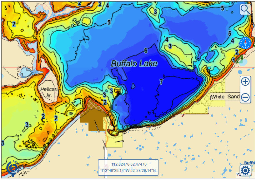
Image courtesy of: Aquamap.app
What is Aqua Map?
Aqua Map is a powerful, budget-friendly alternative to Navionics, known for its detailed bathymetric charts, fishing features, and inland waterway coverage. It’s popular among boaters who prefer affordable, one-time purchases over subscriptions.
Key Features and Capabilities
- Detailed bathymetric and depth shading maps for lakes, rivers, and coastal waters.
- AIS integration to track nearby vessels in real-time.
- Advanced route planning with waypoints and custom depth settings—avoid shallow areas or other hazards that may not be marked on traditional nautical charts.
- Anchor alarm monitors boat location within pre-set geofence.
- Real-time weather forecasts.
- Offline maps with downloadable charts for remote boating.
- US Army Corps of Engineers (USACE) maps for the Intracoastal Waterway (ICW).
Subscription and Pricing Options
Unlike Navionics, Aqua Map offers a one-time purchase option for charts, as well as a subscription for premium features:
- Aqua Map Standard: One-time chart purchase with updates for a year.
- Aqua Map Master: Subscription-based plan with AIS, anchor alarms, and advanced tools.
Strengths of Aqua Map
- One-time purchase option makes it more affordable long-term.
- Great for fishing and depth-based navigation.
- Intracoastal Waterway support for detailed inland boating.
- Offline mode with strong battery efficiency.
Drawbacks of Aqua Map
- No saltwater coverage.
- Limited to the U.S. and a few parts of Canada.
- Only works with Humminbird devices.
Navionics vs. LakeMaster: Key Differences
| Feature | Navionics | Aqua Map |
|---|---|---|
| Chart Accuracy | Excellent, updated daily | Great for depth shading |
| Auto-routing | Yes | No |
| Offline Access | Yes, with downloaded charts | Yes, strong batter efficiency |
| Fishing Features | Good | Excellent |
| AIS Integration | Limited | Available in Master version |
| One-time Purchase? | No | Yes |
| Best for Beginners? | Yes | Somewhat |
Which App Is Better for Coastal vs. Inland Boating?
When choosing between Navionics and Aqua Map, the type of water you boat on can make a big difference. Navionics is often preferred by coastal and offshore boaters thanks to its worldwide chart coverage, auto-routing capabilities, and strong integration with Garmin devices. Aqua Map, on the other hand, tends to appeal more to inland boaters and anglers who want detailed depth shading and specialized fishing features on lakes and rivers. If your boating adventures frequently include offshore routes or international waters, Navionics may be the better fit. But if you spend most of your time navigating inland waterways and want highly detailed depth information, Aqua Map can be a strong alternative.
Final Verdict: Which One is Better for You?
- Choose Navionics if you want automatic route planning, worldwide coverage, and Garmin compatibility.
- Choose Aqua Map if you need detailed depth charts, one-time purchases, and strong fishing features.
How Wavve Boating Compares
While both Navionics and Aqua Map are great choices, Wavve Boating offers a unique, user-friendly alternative that makes marine navigation easier than ever.
- Simplified navigation and auto-routing.
- Social features to share locations and explore with friends.
- Modern, clean interface perfect for new boaters.
- Battery-efficient offline mode for long trips.
If you’re looking for an intuitive and community-driven navigation app, Wavve Boating is a great alternative to both Navionics and Aqua Map.
Other Marine Navigation Apps to Explore
- C-MAP – Great for international sailors.
- LakeMaster – Best for freshwater anglers.
- Garmin ActiveCaptain – Designed for Garmin users.
FAQs
Which app is better for fishing?
Aqua Map has better depth shading and fish-specific features, but Navionics still provides solid sonar integration.
Does Aqua Map work for offshore navigation
Yes, but Navionics offers better global coverage.
Which app is more beginner-friendly?
Navionics is easier to use, while Aqua Map takes some learning.
Still Not Sure? Try Wavve Boating for Free!
If you’re looking for an easy-to-use navigation app with powerful features, Try Wavve Boating for free today and see why more boaters are making the switch.
Content
- Navionics vs. Aqua Map: Which One Should You Choose?
- Introduction: What Sets These Apps Apart?
- Navionics Overview
- Aqua Map Overview
- Navionics vs. LakeMaster: Key Differences
- Which App Is Better for Coastal vs. Inland Boating?
- Final Verdict: Which One is Better for You?
- How Wavve Boating Compares
- Other Marine Navigation Apps to Explore
- FAQs


