Table of Contents
- Why Australian Boaters Need a Dedicated Marine Navigation App
- What Makes the Best Marine Navigation App for Australia?
- Accurate and Up-to-Date Nautical Charts
- Real-Time Tide and Water Level Data
- Customisable Depth Contours for Your Vessel
- Integrated Weather Forecasts and Warnings
- Smart Routing and Auto-Routing Capabilities
- Community-Powered Maps and Points of Interest
- Offline Chart Access
- User-Friendly Interface and Cross-Platform Compatibility
- Wavve Boating: The Leading Marine Navigation App in Australia
- How Wavve Boating Enhances Your Australian Boating Adventures
- Conclusion: Navigate Australia’s Waters with Confidence
The Best Marine Navigation App Australia: Your Ultimate Guide
Australia, with its vast and stunning coastline, iconic harbours, and countless inland waterways, offers an unparalleled paradise for boaters. From the sun-drenched beaches of Queensland to the rugged beauty of Western Australia, navigating these diverse waters requires precision, reliability, and local knowledge.
While traditional chartplotters have long been the standard, a new generation of mobile-first solutions is transforming how Australians explore their marine environment. The question many boaters are asking is: what is the best marine navigation app Australia has to offer?
For modern boaters seeking accuracy, ease of use, and community-driven insights, Wavve Boating stands out as the leading choice. It combines official hydrographic data with real-time updates and a user-friendly interface, making it the ultimate companion for both seasoned sailors and weekend cruisers across the continent.
Why Australian Boaters Need a Dedicated Marine Navigation App
Australia’s waters present unique challenges and opportunities. The sheer scale of the coastline, the variations in tide, the presence of coral reefs, and the rapidly changing weather demand a navigation tool that is not only accurate but also dynamic. Here’s why a dedicated marine navigation app is essential for Australian boaters:
- Vast and Diverse Waterways: Australia boasts the world’s third-largest exclusive economic zone, encompassing everything from tropical reefs to temperate coasts and extensive river systems. A versatile app is needed to cover all these varied environments.
- Rapidly Changing Tides: Many Australian coastal areas experience significant tidal swings, which can expose shallow areas and sandbars. Real-time tide and water level data are critical for safe passage.
- Dynamic Weather Conditions: From sudden southerly busters in Sydney to tropical cyclones in the north, Australian weather can be unpredictable. An integrated weather forecast within a navigation app is a lifesaver.
- Unique Hazards: Coral reefs, submerged rocks, and shifting sand formations require up-to-date and detailed charts.
- Growing Boating Community: As more Australians take to the water, access to shared local knowledge becomes increasingly valuable for discovering new spots and avoiding unforeseen issues.
Traditional paper charts and even older electronic systems often fall short in providing the real-time, dynamic information required for safe and confident navigation in these conditions. A modern marine navigation app Australia like Wavve Boating addresses these gaps directly.
What Makes the Best Marine Navigation App for Australia?
Choosing the right app means looking beyond basic charting. The best marine navigation app Australia has should offer a comprehensive suite of features tailored to the unique demands of its waters. Here’s a checklist of essential capabilities:
Accurate and Up-to-Date Nautical Charts
The foundation of any good navigation app is its chart data. It must use official hydrographic sources (like those from the Australian Hydrographic Office) and provide frequent updates to reflect changes in depths, aids to navigation, and coastline. This ensures you’re always working with the most reliable information.
Real-Time Tide and Water Level Data
Given Australia’s significant tidal ranges, knowing current and forecasted tide levels is non-negotiable. The app should automatically adjust charted depths to the actual water level, providing a true picture of the water beneath your keel.
Customisable Depth Contours for Your Vessel
Different boats have different drafts. The ability to input your boat’s specific draft and have the charts visually adapt to highlight safe vs. shallow areas is a critical safety feature, preventing costly and dangerous groundings.
Integrated Weather Forecasts and Warnings
Wind, waves, and storms dictate whether it’s safe to go out. The app needs to provide detailed, marine-specific weather forecasts, including wind speed, wave height, and small vessel warnings, directly overlaid onto your navigation charts.
Smart Routing and Auto-Routing Capabilities
Planning a trip should be effortless. The app should allow you to plot routes, automatically calculate safe paths avoiding hazards, and provide estimated times of arrival (ETAs).
Community-Powered Maps and Points of Interest
Local knowledge is invaluable. The ability for users to mark and share points of interest – like hidden anchorages, productive fishing spots, or newly identified hazards – enriches the charting experience beyond what official data can provide.
Offline Chart Access
Reliable mobile service isn’t guaranteed, especially in remote Australian waters. The option to download charts for offline use ensures you always have navigation data, even without an internet connection.
User-Friendly Interface and Cross-Platform Compatibility
The app must be intuitive for all skill levels and seamlessly run on both iOS and Android devices, turning your smartphone or tablet into a powerful navigation tool.

Wavve Boating: The Leading Marine Navigation App in Australia
Wavve Boating consistently delivers on all these fronts, making it the standout contender for the best marine navigation app Australia. It’s engineered specifically for today’s boater, combining cutting-edge technology with a deep understanding of what makes a safe and enjoyable trip.
Here’s how Wavve Boating elevates your Australian boating experience:
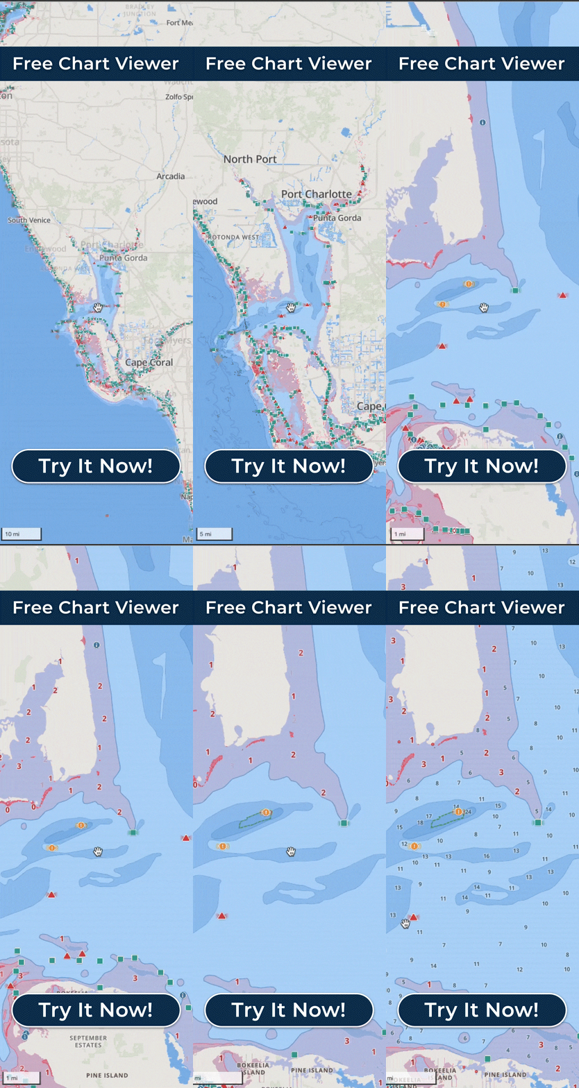
- Next-Generation Nautical Charts: Wavve’s charts are clean, clear, and derived from trusted sources. With options for satellite view, dark mode, and 3D, you get unparalleled situational awareness. You can explore a live demo of the charts here.
- Dynamic Depth and Tide Adjustment: Input your boat’s draft once, and Wavve dynamically colours the chart to show safe areas in blue and shallow areas in red. This feature, combined with real-time tide data, provides critical information to avoid running aground.
- Integrated Weather Centre: Get live wind, wave, temperature, and pressure data directly on your map. Multi-day forecasts and small vessel warnings empower you to make informed decisions about when and where to go.
- Intelligent Autorouting: Plan your trips effortlessly. Wavve’s autorouting calculates the safest and most efficient path, taking into account depths, channels, and hazards, complete with ETA reporting.
- Community-Powered Insights: This is where Wavve truly shines. Thousands of users contribute to the boating community maps, sharing valuable local knowledge on anchorages, fishing spots, and hazards. This collective intelligence ensures you always have up-to-date, real-world information.
- Offline Accessibility: Download charts for your chosen regions before you depart, ensuring you have reliable navigation even in areas without mobile coverage.
- User-Centric Design: Wavve Boating is celebrated for its intuitive interface, making advanced marine navigation accessible to everyone. Learn more about its features here.
In essence, Wavve Boating transforms your mobile device into a sophisticated yet simple-to-use chartplotter, packed with features specifically designed for the Australian boating environment.
How Wavve Boating Enhances Your Australian Boating Adventures
Let’s look at some popular Australian boating scenarios and how Wavve Boating makes them safer and more enjoyable:
Navigating Sydney Harbour
Sydney Harbour is a stunning but busy waterway. Wavve Boating helps you weave through ferry traffic, identify safe channels, and find the best spots to anchor near iconic landmarks or explore hidden bays.
The dynamic depth contours adjusted to your boat’s draft are crucial in areas with varying depths. Looking for Sydney Harbour dining? Wavve helps you find boat-friendly restaurants Sydney has to offer with nearby marina access.
Exploring the Whitsundays and the Great Barrier Reef
For tropical adventures, precise charting is paramount. Wavve’s detailed maps of the Whitsundays and parts of the Great Barrier Reef help you navigate around coral, identify safe anchorages, and explore breathtaking coves.
The offline mode is essential here, as mobile service can be patchy in remote areas. Community insights might even point you to the best snorkelling spots or secluded beaches.
Fishing in Port Phillip Bay, Victoria
Anglers in Port Phillip Bay can benefit immensely from Wavve Boating’s combined features. Use the depth data to find structure, check real-time tides to understand current flow, and leverage community-reported fishing hotspots.
Integrated weather helps you pick the perfect window for a successful catch, avoiding unexpected chop or wind.
River Cruising on the Murray River
Inland waterways like the Murray River can have shifting sandbars and varying depths. Wavve’s accurate charts and community updates are invaluable for river cruising locations, helping you avoid grounding and navigate safely through intricate sections.
The ability to mark and save your favourite riverbank stops means you can easily revisit those peaceful spots.
Getting Started with Wavve Boating in Australia
Ready to experience the best marine navigation app Australia has to offer? Getting started with Wavve Boating is simple:
- Download the App: Wavve Boating is available for both iOS and Android.
- Create Your Account: You can easily create an account to access all features.
- Set Your Boat’s Draft: Input your vessel’s draft once to get customized depth highlighting on all charts.
- Explore and Plan: Start exploring charts, checking weather, and planning your next trip. Download maps for offline use if you’re heading to remote boating destinations Australia.
Wavve Boating offers a free chart viewer to get you started, with premium subscriptions unlocking all advanced navigation, weather, and community features. You can find more helpful articles and tips on the Wavve Boating blog or access support if you have any questions.
Conclusion: Navigate Australia’s Waters with Confidence
Australia’s waterways are a national treasure, offering endless opportunities for exploration and enjoyment. To make the most of every trip, boaters need a reliable, accurate, and user-friendly navigation tool. Wavve Boating delivers exactly that, combining robust charting with dynamic real-time data and the invaluable insights of a vibrant boating community.
From the bustling activity of major harbours to the serene beauty of remote coves, Wavve Boating ensures you have the information you need to navigate safely, plan efficiently, and discover unforgettable experiences.
If you’re searching for the best marine navigation app Australia, look no further. Download Wavve Boating today and embark on your next Australian aquatic adventure with ultimate confidence.
