
Finding the right chart viewer is crucial for boaters seeking reliable navigation tools, especially with the decommissioning of the Navionics Chart Viewer. This guide highlights the top free chart viewers and best alternatives, providing up-to-date options for route planning and safe navigation. Whether you’re preparing for a boating exam or planning your next adventure, we offer practical insights to help you make informed decisions.
What to Look for in an Online Chart Viewer
Choosing the right online chart viewer can significantly enhance your marine navigation experience. The most effective tools offer essential features like detailed nautical maps, tidal data, depth contours, and user-friendly interfaces for route planning. A marine chart viewer should also provide seamless compatibility with various devices and platforms, ensuring you can access charts on your smartphone, tablet, or computer, regardless of your operating system.
When comparing free and paid options, it’s crucial to consider what features you need. A free chart viewer may provide basic functionality, such as viewing maps and plotting simple routes. However, advanced capabilities like real-time GPS integration, weather overlays, and offline access are often found in paid versions. Tools that serve as alternatives to the decommissioned Navionics chart viewer strike a balance between affordability and functionality, offering robust navigation tools without sacrificing ease of use. Whether you’re a seasoned boater or new to the waters, selecting a reliable online marine chart viewer tailored to your needs ensures safe and enjoyable journeys.

Offline Access and Reliability: Why It Matters More Than Ever
One of the biggest factors boaters overlook when choosing an online chart viewer is offline reliability. While many platforms perform well with a strong internet connection, signal coverage can quickly drop in coastal inlets, remote lakes, or offshore waters. A chart viewer that allows downloadable maps and offline route access ensures you can still navigate safely without relying on cellular service. Today, more boaters are prioritizing tools that combine web-based planning with dependable offline functionality on mobile devices. Whether you’re cruising beyond signal range or conserving data, offline capability adds an extra layer of security and confidence that purely browser-based viewers may not provide.
The Best Online Chart Viewers
Navigating the waters requires reliable tools, and today, there’s no shortage of online chart viewers catering to all kinds of boaters. Whether you’re looking for a free chart viewer to get started or a premium tool with advanced features, there are plenty of options to choose from. Here, we’ll explore some of the best online marine chart viewers available today, from free solutions like OpenCPN and OpenSeaMap to premium options such as the Wavve Boating App, C-MAP, and Savvy Navvy.
Top Free Chart Viewer Options
If you’re looking for a no-cost solution, here are some of the best free chart viewers available:
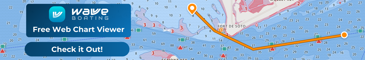
Wavve Boating: This tool brings the brand’s user-friendly design and innovative features to everyone at no cost. With clear, intuitive maps, the ability to view depth contours, Wavve Boating’s free chart viewer makes marine navigation more accessible than ever. 
OpenCPN: An open-source marine chart viewer ideal for navigation enthusiasts. It offers GPS integration, route planning, and support for offline charts.
iBoating: A simple yet feature-rich online chart viewer that provides basic navigation tools for casual boaters.
OpenSeaMap: Known for its crowd-sourced charts, OpenSeaMap is a free online marine chart viewer that’s continually updated by its global community.
Premium Chart Viewers Worth Considering
For those seeking advanced features, premium chart viewers are the way to go. Here are three popular choices:
Wavve Boating App: A user-friendly tool with intuitive charts, social sharing features, and custom map overlays tailored for recreational boaters.
C-MAP: A comprehensive navigation tool offering high-resolution charts, tide data, and route optimization, suitable for both recreational and professional use.
Savvy Navvy: Designed for simplicity, Savvy Navvy combines weather, tides, and charts in a seamless interface for efficient trip planning.
Comparison of Key Features and Pricing
Wavve Boating App: Known for its ease of use and engaging interface, this app includes features like depth adjustments, no-wake zones, and community-driven updates. It’s competitively priced for boaters of all levels.
C-MAP: Offers extensive coverage with detailed charts available in subscription tiers. Its premium features, like real-time weather updates, make it a great option for experienced boaters.
Savvy Navvy: A newer player in the market, Savvy Navvy offers a straightforward approach to navigation, although it comes at a slightly higher price point compared to others.
Each of these online marine chart viewers caters to different needs, from basic navigation to highly detailed marine planning. Whether you’re a weekend boater or a seasoned sailor, finding the right chart viewer ensures smooth sailing ahead.
Navionics Chart Viewer Alternatives: The Top Contenders
The decommissioning of the Navionics chart viewer left many boaters searching for reliable replacements. Thankfully, several excellent alternatives have emerged, offering both free and premium solutions for marine navigation. Here’s an overview of the top contenders, their strengths, weaknesses, and how they compare to the legacy features of Navionics.
Overview of Popular Navionics Alternatives
Wavve Boating: offers an intuitive interface designed for recreational boaters. Its new free chart viewer complements its premium app, making navigation tools accessible to all users.
Key Features: Customizable maps, depth contours, community-shared points of interest, and real-time navigation insights.
Best For: Boaters who value ease of use and a strong community-oriented platform.
C-Map: provides detailed charts with advanced features for serious navigators. With weather overlays, routing options, and a professional-grade platform, it’s a top contender in the marine navigation space.
Key Features: Detailed chart data, weather integration, and route optimization.
Best For: Long-distance cruisers and professional mariners.
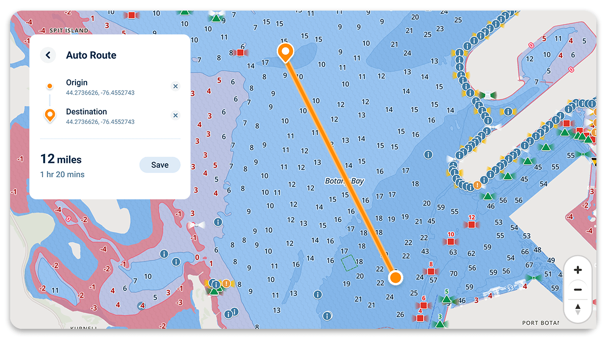
Savvy Navvy: Marketed as the “Google Maps for boats,” Savvy Navvy simplifies navigation by combining chart data, weather forecasts, and route planning into one seamless tool.
Key Features: Auto-routing, tidal data, and cross-platform compatibility.
Best For: Boaters who want an all-in-one planning and navigation solution.
OpenCPN: A trusted free chart viewer, OpenCPN is an open-source solution for navigators who prefer to customize their tools.
Key Features: GPS integration, route planning, and offline chart capabilities.
Best For: Tech-savvy boaters who enjoy tinkering with software to fit their needs.
Strengths and Weaknesses of Each Alternative
Wavve Boating: Strengths include an easy-to-use interface and community features, but it may lack some of the advanced functionalities needed by professional mariners.
C-Map: Offers powerful features and detailed maps, but its premium cost may deter casual users.
Savvy Navvy: Great for comprehensive trip planning, though it relies heavily on an internet connection for its features.
OpenCPN: A highly customizable free option, but it has a steeper learning curve compared to other alternatives.
How These Tools Compare to Navionics’ Legacy Features
The original Navionics chart viewer was known for its user-friendly interface, detailed chart data, and seamless integration with GPS devices. While no single replacement perfectly replicates its functionality, tools like Wavve Boating and C-Map come close by combining chart detail with modern features like community sharing and route optimization. Free options like OpenCPN also provide great value for tech-savvy boaters, while Savvy Navvy excels in streamlining navigation with its innovative auto-routing capabilities.
Each of these tools brings unique strengths to the table, ensuring that former Navionics users can find a suitable replacement tailored to their needs and preferences. Whether you prioritize simplicity, advanced features, or affordability, there’s a chart viewer out there for every boater.
Free Marine Chart Viewers: Are They Good Enough?
In recent years, free marine chart viewers have gained popularity among boaters looking for cost-effective navigation tools. But how do they stack up against premium options? Here, we explore the pros and cons of free chart viewer solutions, highlight the best ones for recreational users, and discuss the limitations you should keep in mind.
Pros and Cons of Free Chart Viewer Solutions
Pros:
Cost Savings: The most obvious advantage is that these tools are free, making them accessible to everyone.
Ease of Use: Many free chart viewers, such as OpenSeaMap and iBoating, are designed with simplicity in mind, catering to casual or beginner boaters.
Community Contributions: Some free options, like OpenSeaMap, rely on crowd-sourced data, which means they’re constantly updated by users.
Device Compatibility: Free chart viewers often work across multiple platforms, including desktop and mobile devices, ensuring accessibility on the go.
Cons:
Limited Features: Free tools may lack advanced features like weather overlays, route optimization, or tidal data found in premium alternatives.
Data Accuracy: Some crowd-sourced options may not always provide the same level of detail or reliability as official charting systems.
No Offline Access: Many free marine chart viewers require an internet connection, which can be a drawback for boaters venturing into remote areas.
Best Free Chart Viewers for Recreational Users
Wavve Boating Free Chart Viewer: recently introduced a free version of its chart viewer, making it one of the top choices for recreational users. With its user-friendly interface and community-shared points of interest, it’s perfect for casual boaters.
OpenCPN: A highly regarded open-source marine chart viewer, OpenCPN is great for those who want customization and offline capabilities. It supports GPS integration and basic route planning, making it ideal for DIY navigators.
OpenSeaMap: is a crowd-sourced online marine chart viewer that’s continuously updated by its global community. It’s an excellent choice for those who want access to basic navigation charts at no cost.
iBoating: offers a straightforward interface and essential navigation tools. While its features are more basic, it’s reliable for recreational boaters needing quick chart access.

How to Transition from Navionics Chart Viewer
Switching from the Navionics chart viewer to a new chart viewer involves several steps to ensure a smooth transition while retaining key functionality and data. Here’s a guide to help you make the change effectively:
1. Choose a New Chart Viewer
Start by selecting a chart viewer that meets your needs. Look for one with similar or better features than Navionics, such as detailed charts, route planning, and offline capabilities. Consider the new viewer’s compatibility with your devices and any advanced features like weather integration or custom routes.
2. Test the New Viewer in Familiar Waters
Before heading out on a long trip, try the new viewer on a familiar route or location. This will help you get comfortable with the tools and ensure everything works as expected. Pay attention to features like GPS sync, route plotting, and offline charts.
Conclusion:
Selecting the best chart viewer comes down to how and where you boat. Free options work well for occasional or recreational users who only need essential mapping and simple navigation features. But if you rely on tools like live weather overlays, detailed route building, and downloadable charts for offline use, upgrading to a paid platform can make a significant difference. Premium viewers typically provide more precise data, customizable routing, and stronger compatibility with onboard marine systems. The right choice ultimately aligns your budget with the level of performance and reliability you expect on the water.
Content
- What to Look for in an Online Chart Viewer
- Offline Access and Reliability: Why It Matters More Than Ever
- The Best Online Chart Viewers
- Top Free Chart Viewer Options
- Premium Chart Viewers Worth Considering
- Comparison of Key Features and Pricing
- Navionics Chart Viewer Alternatives: The Top Contenders
- Overview of Popular Navionics Alternatives
- Strengths and Weaknesses of Each Alternative
- How These Tools Compare to Navionics’ Legacy Features
- Free Marine Chart Viewers: Are They Good Enough?
- Pros and Cons of Free Chart Viewer Solutions
- Best Free Chart Viewers for Recreational Users
- How to Transition from Navionics Chart Viewer
- Conclusion:


