
In 2024, Garmin officially decommissioned the Navionics Chart Viewer website, a decision that has raised questions among boating enthusiasts and navigators. As boating safety and navigation play a significant role in licensing and certification tests, this update is particularly important for both novice and experienced boaters alike. The Navionics Chart Viewer was a widely used resource for accessing detailed nautical charts and planning routes, but now users are seeking clarity on why the service was shut down and what this means for their navigation tools moving forward. This article will dive into what happened with the decommissioning of the Navionics Chart Viewer, how it impacts your boating experience, and what alternatives are available for those who rely on accurate charting for their daily navigation.
Why Was the Navionics Chart Viewer Decommissioned?
The Navionics Chart Viewer, a tool widely used by boaters for route planning and charting, was decommissioned by Garmin in July 2024. This decision was part of a broader integration of Navionics’ resources into Garmin’s platform. The updated Garmin Chart Viewer provides users with access to charts and map coverage information, but without the route planning features that were previously available in the web-based Navionics Chart Viewer.
While Garmin’s transition may have left some users frustrated—especially those who relied on the web version for planning trips—it also encourages them to switch to other Garmin-supported apps and services for route planning, like the Boating app. This app allows users to continue planning routes, syncing data, and even sharing routes across devices
The move marks a shift in how Garmin is streamlining its tools, focusing on more mobile-centric solutions while removing web-based features that many boaters once found convenient. For those still in need of PC-based planning, Garmin suggests exploring other compatible software options
This change highlights the evolving nature of boating technology and the impact of corporate decisions on user experiences.

Background on Navionics and Garmin
Navionics has long been a key player in the field of marine navigation, providing detailed digital charts, navigation systems, and map updates for boaters. Founded in 1984, Navionics became a trusted name in the marine industry by offering solutions for electronic charting and software designed for navigating waterways. The company’s products have been widely used for route planning, GPS navigation, and understanding tides and currents, all crucial aspects of safe boating.
In 2017, Garmin, a global leader in GPS technology, acquired Navionics, integrating its offerings into Garmin’s expanding range of marine and outdoor products. This acquisition allowed Garmin to enhance its capabilities, incorporating Navionics’ high-quality charts and features into their ecosystem. Garmin continued to offer Navionics products alongside its own devices, such as chartplotters, to further enrich the boating experience. However, following the acquisition, Garmin has increasingly streamlined its platform and introduced mobile-centric solutions, such as the Garmin Boating app, while also making strategic decisions like decommissioning the Navionics Chart Viewer, which had been a popular tool among boaters. This move reflects Garmin’s shift toward consolidating services and focusing on user-friendly mobile applications.
What Is the Navionics Chart Viewer?
The Navionics Chart Viewer was an online tool provided by Navionics that allowed users to view detailed nautical charts for marine navigation. The platform offered easy access to interactive maps featuring bathymetric data, navigation aids, and points of interest, such as marinas and hazards. The Chart Viewer allowed boaters, sailors, and navigational enthusiasts to explore both nearshore and offshore waters, aiding in route planning, understanding water depths, and staying informed about geographical features. Its digital charts were derived from Navionics’ extensive and regularly updated database, which was essential for making informed decisions during boating and sailing activities.
The Chart Viewer was widely relied upon by recreational boaters, fishermen, and professional mariners for pre-trip planning, as well as real-time navigation support. It was especially popular among those seeking a quick, browser-based tool for examining detailed charts without needing a dedicated device or app. With the decommissioning of the Chart Viewer, many users who had previously relied on this easy-to-access tool for its convenience and functionality are now seeking alternative options. Those relying heavily on digital charting for both casual navigation and professional applications are looking to Garmin’s integrated platforms, which combine features from the acquired Navionics data into new offerings like the Garmin Boating app.
2026 Update: What Has Changed?
The decommissioning of the Navionics Chart Viewer by Garmin in 2024 marked a significant shift for marine navigators who relied on the web-based tool for route planning and chart viewing. Garmin’s decision was part of an effort to consolidate resources and streamline services under their brand. The new Garmin Chart Viewer integrates both Navionics and Garmin marine charts, offering users updated map information, coverage details, and chart options, but notably, it removed route planning functionality that was available in the Navionics tool
For users who want to continue planning routes and accessing detailed chart data, Garmin now offers alternative solutions through their Boating app, which provides route creation, syncing across devices, and export/import functionality for chart plotters.
While this update brings a more unified platform, the absence of the previous route planning feature has been a point of frustration for some experienced boaters who valued the web-based, pre-boarding convenience of the Navionics Chart Viewer
As Garmin evolves its offerings, users can adapt by leveraging new tools and mobile apps for a seamless navigation experience, even as they transition away from the former Navionics Chart Viewer platform.

Key Details About the Decommissioning Process
The decommissioning of the Navionics Chart Viewer was announced in 2024, with Garmin officially discontinuing the service by the end of the year. Garmin communicated this change through multiple channels, including official statements on their website and direct notifications to users. The company cited the decision as part of an effort to consolidate services and improve user experiences under its existing Garmin brand. Users were informed well in advance, allowing for a transition period where they could adapt to the new systems
To support users during this transition, Garmin introduced alternatives such as the Garmin Boating App, which includes updated charts and navigation tools. However, the removal of the chart viewer’s route planning functionality was a notable change that caused some dissatisfaction among users accustomed to the web-based tool. Garmin has provided resources and FAQs to assist users in transitioning, including guides on using new platforms for chart viewing and route planning
These steps aimed to ensure users could continue to access reliable navigation tools, although some features from the Navionics Chart Viewer are no longer available.
2026 Alternatives to the Navionics Chart Viewer
In 2024, Garmin’s choice to retire the Navionics Chart Viewer led many boaters to look for new navigation solutions. Previously, the Navionics Chart Viewer was a widely used free web tool that allowed users to view detailed nautical charts, plan routes, check depths, and explore coastal waters with ease. With its discontinuation, Garmin has incorporated much of the Chart Viewer’s functionality into their own offerings, such as the Garmin Boating App, which now provides real-time charting and route planning similar to the capabilities previously available in the Navionics Chart Viewer.
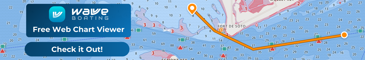
Wavve Boating has also introduced its own web-based Chart Viewer, providing boaters with an intuitive and user-friendly alternative for planning their trips. Designed to offer seamless access to nautical charts and route planning, Wavve Boating’s Chart Viewer is a valuable tool for those who relied on the Navionics Chart Viewer. With a modern interface and real-time data integration, users can explore waterways, check depth information, and customize their navigation experience from any desktop web browser. This new chart viewer ensures that boaters can continue to plan and navigate with confidence, without the need for additional hardware or app installations.

In addition to Garmin’s integrated solutions, third-party alternatives have risen to fill the gap left by the Navionics Chart Viewer. Tools such as iNavX and Aqua Map offer similar chart viewing and route planning capabilities, often incorporating Navionics charts into their platform. These apps allow boaters to continue using Navionics data for navigation and provide added features like offline access, further enhancing the user experience. While the Navionics Chart Viewer was a free and easy-to-use tool, many users are adapting to these more robust, feature-packed alternatives that require either a paid subscription or additional devices for access
For boaters used to the simple and efficient functionality of the Navionics Chart Viewer, the shift to more comprehensive solutions may seem challenging. However, the updated tools from Garmin and third-party developers offer more detailed and dynamic navigation capabilities that could enhance the boating experience. Although users will need to adapt to new platforms, the functionality offered by these alternatives continues to make Navionics data available and accessible, ensuring boaters can navigate safely and efficiently on the water.
Choosing the Right Chart Viewer for Your Boating Needs
When selecting a chart viewer for your boating adventures, it’s important to consider your specific needs and preferred workflow. Some boaters prioritize a web-based interface that’s accessible from any device, while others prefer mobile apps with offline capabilities for remote areas. Features like real-time depth overlays, tide information, route planning, and community-sourced insights can make navigation safer and more efficient. Tools like Garmin’s Boating App and Wavve Boating’s web-based Chart Viewer offer a range of functionalities, from live charts to customizable routes, allowing boaters to choose a platform that matches their skill level, boating style, and desired level of detail. Evaluating these factors ensures that you pick a charting solution that enhances your confidence and enjoyment on the water.
How to Transition to New Tools
For boaters accustomed to using the Navionics Chart Viewer, the decommissioning of the tool in 2024 has required a shift to new navigation platforms. Transitioning from the Navionics Chart Viewer to alternatives may seem daunting at first, but with the right steps, users can easily adapt and continue enjoying seamless navigation on the water.
One of the first steps is migrating any saved routes or preferences from the Navionics Chart Viewer. Some alternatives, like Garmin’s own navigation apps, allow for importing Navionics data directly, which can simplify the transition. It’s important to check whether the new tool supports these imports or if you will need to manually recreate routes and settings. Another tip for a smooth transition is to familiarize yourself with the new platform’s features. Many of the new tools are packed with advanced features like offline mapping and real-time updates, so investing time in learning these features will pay off in the long run. Garmin provides tutorials, training materials, and user communities to help you get up to speed quickly, ensuring you won’t miss the simplicity of the Navionics Chart Viewer.
For those looking for a simple yet powerful alternative, Wavve Boating’s new web-based Chart Viewer offers an easy-to-use solution for planning and navigating on the water. Unlike some alternatives that require additional downloads or hardware, Wavve Boating’s Chart Viewer is accessible directly from your web browser, providing seamless access to nautical charts and route planning. With an intuitive interface and real-time data integration, it’s designed to make the transition from the Navionics Chart Viewer as smooth as possible. Whether you’re charting a new course or checking water depths, Wavve Boating’s web Chart Viewer ensures you have the tools you need to navigate with confidence. Try it today and experience a hassle-free way to plan your next boating adventure!

Community Response and Feedback to the Navionics Chart Viewer Decommissioning
The decommissioning of the Navionics Chart Viewer in 2024 has generated mixed reactions within the boating community. Many long-time users expressed frustration over losing a tool that was simple, reliable, and accessible. The Navionics Chart Viewer was especially popular for its user-friendly interface and dependable charting, and now, boaters are seeking similar alternatives.
While some concerns focus on the loss of features and the potential costs associated with Garmin’s new systems, others have embraced the transition. Garmin’s newer products offer advanced tools, including live updates and more detailed charts, though they come with a steeper learning curve. Support has been available through tutorials and community forums, and some users are hopeful that these changes will lead to a more powerful navigation experience in the long run.
Conclusion:
The decommissioning of the Navionics Chart Viewer marks the end of an era for many boaters who relied on its straightforward interface and dependable functionality. While Garmin’s new systems offer more advanced features, the change has left some users nostalgic for the simplicity of the Navionics Chart Viewer. As the transition continues, many boaters are finding new tools that to replace the Navionics Chart Viewer like Wavve Boating’s New Chart Viewer. However, there is still a learning curve associated with these new solutions, particularly for those accustomed to the familiar setup of the Chart Viewer.
Looking ahead, the future seems promising for Garmin and Navionics users, as the shift to more sophisticated charting tools could bring improved navigation capabilities. The integration of advanced features, real-time updates, and increased accuracy suggests that while the Navionics Chart Viewer is no longer available, boaters can expect an overall more robust and future-proof navigation experience. However, this change will require time, patience, and adaptability from the boating community.
Content
- Why Was the Navionics Chart Viewer Decommissioned?
- Background on Navionics and Garmin
- What Is the Navionics Chart Viewer?
- 2026 Update: What Has Changed?
- Key Details About the Decommissioning Process
- 2026 Alternatives to the Navionics Chart Viewer
- Choosing the Right Chart Viewer for Your Boating Needs
- How to Transition to New Tools
- Community Response and Feedback to the Navionics Chart Viewer Decommissioning
- Conclusion:


