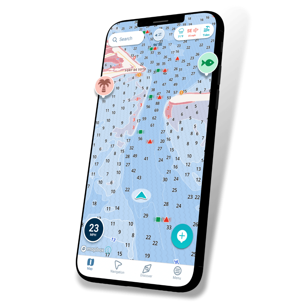
Smarter Nautical Charts
See shallow areas with depth data that’s based on local water stations. Easily preview high & low tide and use satellite, dark & 3D map layers for the best view possible
*Wavve Boating is not available in all areas. Please check chart coverage near you at wavveboating.com/map
![Top User Friendly Boat GPS App & Marine Navigation App easiest-to-use-boat-navigation-app](https://www.wavveboating.com/wp-content/uploads/2024/04/Features-1.png)
What Other Boaters Are Saying:
![Review-3](https://www.wavveboating.com/wp-content/uploads/2024/03/Review-3.png)
![Review-2](https://www.wavveboating.com/wp-content/uploads/2024/03/Review-2.png)
![Review-1](https://www.wavveboating.com/wp-content/uploads/2024/03/Review-1.png)