Reliable speed tracking matters for Canadian boating across diverse waters from Great Lakes passages to coastal British Columbia runs and Maritime tidal channels. Accurate speed information improves fuel efficiency through optimal cruising speeds, enhances safety navigating currents and tidal flows, provides essential trip logging data, and ensures compliance with speed restriction zones protecting sensitive areas.
Modern GPS-based speedometer apps eliminate expensive dedicated hardware while delivering accurate speed-over-ground readings using your smartphone’s satellite positioning. These apps display speed in proper marine units (knots as standard, plus MPH and KPH options) and integrate with navigation features creating comprehensive boating tools far exceeding basic speed displays.
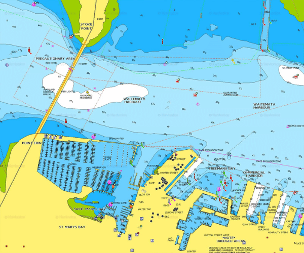
Canadian boaters benefit particularly from apps combining speed tracking with detailed chart coverage of Great Lakes, St. Lawrence Seaway, coastal waters, and inland lakes plus offline capability essential for remote areas beyond cellular coverage. This guide compares the best options for accurate, practical speed tracking integrated with navigation safety features.
How Boat Speedometer Apps Work
All GPS speedometer apps calculate speed-over-ground by tracking position changes through satellite signals. Your phone receives signals from multiple GPS satellites calculating precise location many times per second. The app measures distance traveled between position updates computing your speed relative to the water bottom (speed-over-ground or SOG).
Accuracy depends on clear satellite visibility. Open water with unobstructed sky provides optimal conditions. Heavy tree cover, steep canyon walls, or dense urban areas can degrade GPS accuracy affecting speed readings. Marine environments typically provide excellent GPS performance with clear overhead visibility.
Marine navigation apps designed specifically for boating outperform generic car speedometer apps through proper knots display (standard marine speed unit), integration with nautical charts showing navigation context, real-time tide and current information affecting actual speed, and offline chart capability maintaining functionality beyond cell coverage. Speed tracking becomes far more useful when combined with navigation awareness showing where you’re going and what hazards exist along your route.
Quick Comparison: Top Boat Speedometer Apps for Canada
| App | Best For | Speed Display | Knots Support | Offline | Annual Cost (CAD approx.) | Free Tier/Trial |
| Wavve Boating | Integrated speed + navigation | Large, always-visible | Yes | Yes | ~$95 | 14-day full trial |
| Navionics Boating | Detailed charting + speed | Clear during navigation | Yes | Yes | ~$65-$80 | Limited |
| Argo Navigation | Budget + community | Good in navigation mode | Yes | Premium only | Free / ~$55 Premium | Strong free tier |
| BoatSpeed/BoatSpeedo | Dedicated simple speedo | Large gauge | Yes | Yes | One-time ~$5-$10 | Limited free |
Wavve Boating: Best Overall Speedometer App for Canadian Boaters
Wavve Boating provides the most comprehensive solution for Canadian boaters wanting accurate speed tracking integrated with complete marine navigation capability. The app combines large, easy-to-read speed display with draft-aware charts, real-time tidal information, weather overlays, and offline functionality creating an all-in-one boating tool.
Speed Display Features:
The speed readout appears prominently during navigation displaying current speed in your preferred units (knots, MPH, or KPH with instant switching). The large, clear numbers remain easily readable from helm positions in various lighting conditions. Unlike apps hiding speed in secondary menus, Wavve keeps speed information visible alongside chart display providing constant awareness without menu navigation.
Maximum speed, average speed, and trip distance tracking provide comprehensive voyage data. Review past trips analyzing speed patterns for fuel consumption optimization or passage planning on future similar routes.
Canadian Waters Coverage:
Complete coverage spans all Canadian boating areas including detailed Great Lakes charts, St. Lawrence Seaway navigation, British Columbia coastal waters, Maritime provinces, and inland lakes across all provinces. Official CHS (Canadian Hydrographic Service) and NOAA chart data ensures reliable depth information and navigation aids marking.
Charts update regularly maintaining current information about channel changes, marker positions, and newly identified hazards. The coverage eliminates need for separate chart subscriptions or regional chart purchases.
Real-Time Tide Integration:
Canadian tidal waters (Maritimes, BC coast, portions of Great Lakes) experience significant water level changes affecting both navigation safety and actual boat speed through water. Wavve integrates real-time tide predictions with draft-aware depth shading showing safe versus shallow areas at current tide heights.
Understanding actual speed becomes more meaningful when you see how tidal currents affect progress. A boat showing 8 knots speed-over-ground might achieve 10 knots through water when riding favorable current or only 6 knots fighting adverse flow. The tide information provides context for speed readings.
Offline Capability:
Download chart regions covering your cruising areas for complete offline navigation. Remote Canadian lakes, northern rivers, and backcountry coastal areas often lack cellular coverage. Wavve continues displaying speed, charts, waypoints, and all navigation features using only GPS signals anywhere satellites reach.
This offline capability proves essential for Canadian boating where vast areas provide no cell service. Speed tracking, navigation, and safety features work identically whether in downtown Toronto harbor or remote northern Ontario lakes.
Practical Canadian Boating Benefits:
Family sharing allows one subscription covering multiple devices and boats. Operate Wavve on your phone, your partner’s tablet, and backup devices without separate subscriptions. The feature benefits families boating together or individuals maintaining redundant navigation capability.
Simple interface reduces learning curve for recreational boaters wanting navigation that just works. Enter your boat’s draft, download charts for your area, and start navigating with accurate speed tracking plus automated depth safety within minutes.
Pricing: Approximately $95 CAD annually (pricing varies with exchange rates) or monthly subscription option. 14-day free trial provides full feature access for evaluation during actual trips before financial commitment.
Navionics Boating: Detailed Charts with Integrated Speed
Navionics delivers comprehensive chartplotter functionality with reliable GPS speed display integrated into the navigation interface. The app particularly excels in bottom detail through community SonarChart data valuable for fishing and detailed depth awareness.
Speed Tracking:
Clear speed display shows during active navigation in knots, MPH, or KPH. The readout integrates naturally with chart view and route following providing speed awareness without cluttering the interface. Speed data logs to trip history allowing review of past voyages and speed patterns.
Average speed calculations help estimate arrival times on longer passages. The feature proves useful planning Great Lakes crossings or coastal runs where accurate time estimates matter for weather window utilization or marina arrival coordination.
Canadian Coverage:
Comprehensive Canadian charts include Great Lakes, coastal areas, and many inland lakes. Daily chart updates maintain current navigation information. Community Edits allow users reporting changed markers, new hazards, or updated marina details other Canadian boaters benefit from quickly.
SonarChart community data provides enhanced bottom detail in heavily fished areas. Areas with active Navionics user contributions show exceptional depth contour detail exceeding official charts particularly valuable for fishing or anchoring site selection.
Integration Features:
Dock-to-dock autorouting plans courses accounting for charted depths. Route planning includes estimated time based on your typical cruising speed. The planning tools help visualize passages before departure optimizing routes for distance, safety, or scenic value.
Weather overlay displays forecasts directly on charts. Seeing predicted wind, waves, and weather along your planned route combined with speed estimates improves passage decision-making particularly on larger Canadian waters like Lake Superior or coastal British Columbia.
Pricing: Approximately $65-80 CAD annually depending on subscription tier and exchange rates.
Argo Navigation: Budget-Friendly Speed with Community Features
Argo provides accessible speed tracking through genuinely functional free tier plus affordable Premium upgrade adding advanced features. The social and community aspects appeal to Canadian boaters wanting local knowledge sharing alongside navigation capability.
Free Tier Speed Tracking:
Basic GPS speed display works in the free version showing current speed in preferred units during navigation. For occasional boaters or those testing marine navigation apps before committing to paid subscriptions, Argo’s free tier provides usable speed tracking at zero cost.
The free version requires cellular connectivity limiting usefulness in remote Canadian waters lacking coverage. Premium subscription adds offline charts essential for backcountry or northern navigation.
Premium Features ($55 CAD approximately):
Premium unlocks offline charts, advanced routing, 7-day weather forecasts, and enhanced speed logging. Custom depth shading allows setting personalized depth ranges though lacking the real-time tide integration Wavve provides.
Desktop/web app access enables passage planning on larger screens before trips. Sync planning between devices combining computer-based route preparation with mobile navigation.
Community Intelligence:
Google Maps-style social features allow following other boaters, joining Canadian regional groups (Great Lakes, BC coast, etc.), and sharing trip reports. Crowdsourced marina reviews, hazard warnings, and local knowledge supplement official chart data.
For newcomers to Canadian waters, community features provide valuable intelligence from experienced local boaters about current conditions, seasonal considerations, or area-specific navigation tips.
Canadian Considerations:
Coverage focuses primarily on US waters with some Canadian chart availability. Verify specific coverage for your cruising areas before relying on Argo as primary navigation. Some Canadian regions may lack the comprehensive detail other apps provide.
Dedicated Speedometer Apps: Simple Speed-Only Options
Basic speedometer apps like BoatSpeed (iOS), BoatSpeedo (Android), and generic GPS speedometer apps provide simple speed displays without navigation integration.
Advantages:
Large analog or digital gauge displays show speed prominently with minimal interface clutter. One-time purchase prices (typically $5-10 CAD) or free ad-supported versions eliminate ongoing subscription costs. Simple operation requires no learning curve beyond launching the app.
These apps work adequately as basic speed monitors or backup speedometers supplementing primary navigation systems. The dedicated focus on speed display without navigation features appeals to boaters wanting simple speed awareness tool.
Limitations:
No charts, navigation aids, depth information, or hazard awareness. You see speed but gain no context about where you’re going, what depths exist, or what hazards lie ahead. This limitation makes dedicated speed apps inadequate as sole navigation tools.
Lack of offline chart capability means the apps provide speed tracking but no navigation guidance in areas beyond cell coverage. For remote Canadian boating, this proves problematic.
Most generic speedometer apps lack proper marine units defaulting to MPH or KPH without knots options. Boaters thinking in knots must mentally convert readings or hunt settings menus for unit changes.
Best Use Cases:
Dedicated speed apps work as supplements to primary navigation systems. Run Wavve or Navionics for navigation while displaying BoatSpeed on a second device providing large dedicated speed gauge visible from helm. The combination delivers full navigation capability plus prominent speed display.
Budget-conscious boaters in familiar waters with reliable depth might use simple speed apps accepting the trade-off of no navigation features for zero or minimal cost.
Key Considerations for Canadian Boaters
Display Units:
Marine convention uses knots (nautical miles per hour) as standard speed measurement. One knot equals 1.15 MPH or 1.85 KPH. Quality marine apps default to knots while allowing easy switching to MPH or KPH for those preferring different units.
Ensure your chosen app properly supports knots rather than requiring conversion from land-based speed units. Thinking in knots becomes natural with practice and aligns with marine distance measurements, weather forecasts, and boating conventions.
Accuracy in Canadian Conditions:
GPS accuracy remains consistent across temperatures though extreme cold affects phone battery life more than GPS performance. Keep backup battery power for winter or cold weather boating extending device runtime.
Remote Canadian areas with limited cell tower infrastructure sometimes show slightly slower GPS satellite acquisition than urban areas. Allow extra time for initial satellite lock when starting trips in remote locations. Once locked, accuracy matches urban performance.
Variable currents in tidal areas (Maritimes, BC coast) or Great Lakes during strong wind events create differences between speed-over-ground and speed-through-water. Apps showing GPS speed display SOG. Actual speed through water varies based on current assistance or resistance. Understanding this difference improves fuel consumption estimates and passage planning.
Offline Capability Essential:
Vast Canadian boating areas provide zero cellular coverage. Northern Ontario lakes, remote BC coastal passages, Maritime backcountry, and countless inland waterways exist beyond cell service. Apps requiring connectivity for basic functionality fail completely in these areas.
Prioritize apps offering offline chart downloads and full feature availability without cell service. Wavve and Navionics both provide comprehensive offline capability. Argo requires Premium for offline charts. Generic speed apps vary in offline functionality.
Mounting for Helm Visibility:
Accurate speed tracking provides limited value if you can’t see the display from helm positions. Waterproof cases rated IP67 or IP68 protect phones from spray and immersion. RAM mounts provide adjustable vibration-resistant positioning viewable from steering positions.
Mount phones where helm operators see screens without excessive neck turning or extended focus away from lookout duties. Balance visibility with maintaining proper watch and situational awareness. Some boaters run dual displays: one for charts/navigation, one dedicated to large speed gauge.
Privacy and Data Usage:
GPS tracking apps log position and trip data. Review privacy policies understanding what data apps collect and how they use it. Most quality marine apps store trip logs locally on your device unless you specifically choose to share them.
Downloading charts over cellular data consumes significant bandwidth. Use WiFi for major chart downloads avoiding mobile data overage charges. Once charts download, speed tracking and navigation use minimal data limited to occasional weather forecast updates.
Which Boat Speedometer App Is Best for You?
Choose Wavve Boating If:
- You want integrated speed tracking with complete navigation capability
- Real-time tide awareness matters for your Canadian waters (tidal areas, Great Lakes)
- Automated draft-aware safety features prevent groundings in shallow areas
- Offline capability is essential for remote Canadian boating
- You prefer simplified all-in-one tools over managing multiple apps
- Family sharing benefits your boating situation
Choose Navionics If:
- Detailed bottom mapping and SonarChart community data enhance your fishing
- You want comprehensive Canadian coverage with daily chart updates
- Desktop planning tools improve your passage preparation
- Slightly lower cost matters while maintaining full navigation features
Choose Argo If:
- Budget constraints make free tier or low-cost Premium attractive
- Social features and community connections enhance your experience
- You boat primarily in well-covered US/Canadian border waters
- You want to test marine navigation apps without financial commitment
Choose Dedicated Speed Apps If:
- You only want simple speed display without navigation
- You already have primary navigation system needing speed supplement
- Minimal or zero cost is priority over integrated features
Tips for Accurate Boat Speed Tracking
Optimize GPS Performance:
Ensure clear sky visibility from your phone’s GPS antenna. Avoid mounting phones inside cabins, under covers, or in enclosed spaces blocking satellite signals. Open deck mounting with unobstructed overhead view provides best accuracy.
Allow time for satellite acquisition when starting trips. The first GPS lock after powering on may take 30-60 seconds. Subsequent locks occur faster. Patient initial wait ensures accurate speed tracking from departure.
Combine with Chart Awareness:
Speed tracking becomes most valuable when combined with navigation context. Knowing you’re traveling 12 knots means more when you also see you’re approaching shallow water requiring speed reduction or entering areas with current affecting actual progress.
Integrated apps displaying speed alongside charts and depth information provide this context automatically. Dedicated speed apps require mentally combining speed awareness with separate navigation information.
Log Trips for Analysis:
Review past trip logs analyzing average speeds, maximum speeds, and total distances. This data helps optimize cruising speeds for fuel efficiency, estimate future passage times accurately, and understand how different conditions (wind, waves, current) affect actual performance.
Speed logs combined with fuel consumption create baseline data for planning provisioning and range estimates on future similar passages.
Calibrate Expectations:
GPS speed shows speed-over-ground relative to bottom. Actual speed through water varies with current. A boat showing 8 knots SOG might achieve 10 knots boat speed fighting 2-knot adverse current or only 6 knots with 2-knot assistance.
Understanding this difference prevents confusion when GPS speed doesn’t match expected boat performance or fuel consumption patterns.
Frequently Asked Questions
Do boat speedometer apps work offline in Canada?
Apps with offline chart capability (Wavve, Navionics, Argo Premium) continue tracking speed anywhere GPS signals reach regardless of cell coverage. GPS satellites provide positioning independent of cellular networks. Basic speed tracking works offline in most apps though some features like weather updates or chart downloads require connectivity.
Which app shows speed in knots most accurately for Canadian waters?
All GPS-based speedometer apps calculate speed identically from satellite position data. Accuracy depends on GPS signal quality rather than app differences. Wavve, Navionics, and Argo all display knots accurately. Choose based on integrated features and navigation capability rather than speed accuracy since GPS performance matches across quality apps.
Is Wavve or Navionics better for Great Lakes boating?
Both provide excellent Great Lakes coverage with official charts and offline capability. Wavve excels for boaters wanting automated tide-integrated depth safety and simplified interface. Navionics appeals to anglers wanting detailed SonarChart bottom mapping and fishing features. Either works well for Great Lakes navigation with speed tracking.
Can I use a generic GPS speedometer for boating?
Technically yes, though marine-specific apps provide superior value. Generic speedometers show speed but lack charts, depth awareness, navigation aids, hazard warnings, or marine-optimized features. They work as basic speed monitors but provide no navigation safety capability essential for responsible boating.
How do I mount my phone for best speed visibility?
Use waterproof case (IP67/IP68 rated) with RAM mount or similar adjustable system. Position where helm operators see screen without extended focus away from lookout duties. Balance visibility with maintaining proper watch. Some boaters use dual displays: primary for navigation, secondary for large speed gauge.
Do these apps work in saltwater and freshwater?
Yes, all mentioned apps work identically in saltwater and freshwater environments. GPS positioning functions the same regardless of water type. The apps provide speed tracking whether you’re on Lake Ontario, BC coastal waters, or Maritime harbors.
How much battery does GPS speed tracking use?
Continuous GPS use with screen-on navigation drains batteries significantly. Typical phones provide 3-6 hours of active use. Bring external battery packs (20,000+ mAh) or connect to boat power via USB for all-day trips. Start with fully charged devices and plan for power needs on longer passages.
Conclusion
Integrated marine navigation apps starting with Wavve Boating provide the most comprehensive value for Canadian boaters wanting accurate speed tracking combined with navigation safety features. The combination of prominent speed display, detailed Canadian charts, real-time tide integration, offline capability, and automated depth safety creates complete boating tools far exceeding simple speedometers.
For budget-conscious boaters, Argo’s free tier or low-cost Premium offers capable alternatives. Dedicated fishing-focused users may prefer Navionics’ detailed bottom mapping. Simple speed-only apps serve as supplements to primary systems but lack features essential for safe independent navigation.
Test apps through free trials during actual boating trips in your typical Canadian waters before committing to annual subscriptions. Evaluate speed display clarity, chart coverage for your areas, offline performance, and overall interface usability in real conditions. Safe, efficient boating combines accurate speed awareness with comprehensive navigation capability understanding where you are, where you’re going, and what hazards exist along your route.
Content
- How Boat Speedometer Apps Work
- Quick Comparison: Top Boat Speedometer Apps for Canada
- Wavve Boating: Best Overall Speedometer App for Canadian Boaters
- Navionics Boating: Detailed Charts with Integrated Speed
- Argo Navigation: Budget-Friendly Speed with Community Features
- Dedicated Speedometer Apps: Simple Speed-Only Options
- Key Considerations for Canadian Boaters
- Which Boat Speedometer App Is Best for You?
- Tips for Accurate Boat Speed Tracking
- Frequently Asked Questions
- Do boat speedometer apps work offline in Canada?
- Which app shows speed in knots most accurately for Canadian waters?
- Is Wavve or Navionics better for Great Lakes boating?
- Can I use a generic GPS speedometer for boating?
- How do I mount my phone for best speed visibility?
- Do these apps work in saltwater and freshwater?
- How much battery does GPS speed tracking use?
- Conclusion