
The short answer: Yes, modern smartphones work effectively as marine GPS for most recreational boating situations. Phones contain the same GPS receiver technology as dedicated marine units, accessing identical satellite positioning systems. Combined with marine navigation apps providing official charts, your phone delivers capable navigation at a fraction of traditional marine GPS costs.
Understanding how phone GPS actually works, recognizing limitations, and implementing proper setup transforms smartphones into reliable marine navigation tools. This guide covers everything boaters need to know about using phones for on-water GPS navigation.
Every smartphone manufactured since the early 2010s includes GPS receivers that communicate with positioning satellites orbiting Earth. These satellites continuously broadcast timing signals allowing devices to calculate precise location through triangulation.
Your phone simultaneously receives signals from multiple GPS satellites (typically 4-8 or more). By measuring the time signals take to reach the device from each satellite, the GPS receiver calculates your exact position through geometric mathematics. This happens continuously, updating your location many times per second.
Modern phones access multiple satellite systems beyond the original GPS constellation. GLONASS (Russia), Galileo (Europe), and BeiDou (China) supplement American GPS satellites, providing additional positioning sources. More satellites mean faster location fixes and better accuracy, particularly in challenging environments like canyons, heavy tree cover, or urban areas with tall buildings.
The GPS receiver operates independently of cellular networks. Your phone calculates position using only satellite signals, no cell towers, no internet connection required. This independence means GPS continues functioning anywhere satellites remain visible, including remote waters far beyond cellular coverage.
GPS Accuracy for Marine Navigation
Positioning accuracy from phone GPS rivals or exceeds basic marine GPS units, making smartphones suitable for typical recreational navigation needs.
Under clear sky conditions with good satellite visibility, modern smartphones achieve accuracy within 10-15 feet horizontally. Premium phones with dual-frequency GPS receivers (available in higher-end models from recent years) improve accuracy to 5-10 feet or better. This precision exceeds what most recreational boaters require for safe navigation.
Factors affecting accuracy include satellite visibility (reduced by heavy weather, dense tree cover, or obstructions), atmospheric conditions creating signal delays, and multipath errors where signals bounce off surfaces before reaching the receiver. Despite these variables, phone GPS maintains adequate accuracy for coastal cruising, lake navigation, and typical recreational boating.
Compared to dedicated marine GPS, phones perform similarly for basic positioning. Dedicated units sometimes include features like WAAS (Wide Area Augmentation System) improving accuracy to 3-5 feet, though this precision rarely matters for recreational use. The practical difference between 10-foot and 5-foot accuracy is negligible when navigating channels, avoiding hazards, or finding marinas.
Phone GPS vs Dedicated Marine Units
Understanding genuine differences between phones and purpose-built marine GPS helps set realistic expectations.
Dedicated marine GPS units provide always-on reliability without battery management concerns. The unit simply works whenever boat power exists. Screens designed for marine environments maintain visibility in intense sunlight and heavy spray. Physical buttons allow operation with gloves or in rough conditions where touchscreens frustrate. Rugged construction withstands constant vibration, saltwater exposure, and physical impacts better than consumer electronics in cases.
However, phones offer significant advantages. Lower costs eliminate expensive chartplotter hardware purchases. Your existing phone plus a navigation app subscription costs far less than dedicated marine electronics. Automatic chart updates keep information current without manual downloads or annual update fees. Portability means the same device works across multiple boats, kayaks, or other watercraft. Modern features like community hazard reporting and automated depth safety often exceed dedicated unit capabilities.
The hybrid reality for many boaters: primary navigation via phone with paper charts or a basic handheld GPS as backup. This combination provides modern features and convenience while maintaining redundancy for safety.
Choosing Marine Navigation Apps
The GPS receiver provides positioning, navigation apps turn that position into usable marine guidance by overlaying your location on charts and adding navigation features.
Quality marine navigation apps include several essential capabilities. Official chart coverage from recognized sources (NOAA, CHS, UKHO) ensures reliable depth and hazard information. Offline functionality allows downloading charts for use without cellular connectivity. Real-time features like tide predictions, weather forecasts, and hazard warnings enhance safety beyond static charts.
App selection depends on your boating patterns and priorities. Apps emphasizing automated safety features like draft-aware depth shading help recreational boaters navigate shallow waters confidently. Others focus on fishing with detailed bottom contours and community fishing spot databases. Some target sailors with weather routing and departure planning tools.
Testing apps during free trial periods reveals which interfaces feel intuitive and which features actually benefit your specific boating. Most quality apps offer week-long or longer trials providing adequate time for on-water evaluation.
Waterproofing and Physical Protection
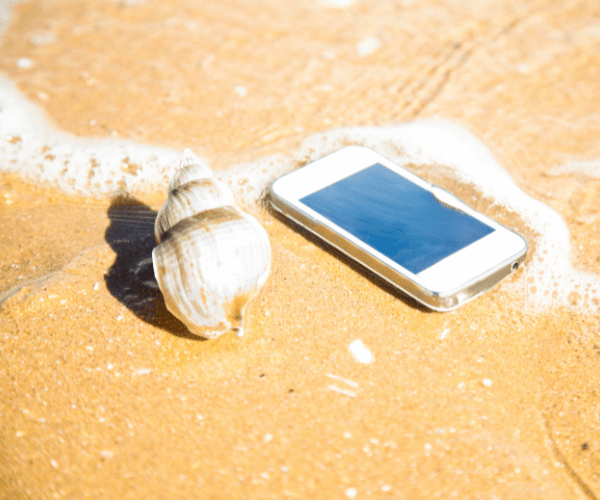
Protecting phones from marine environments requires proper cases and mounting, consumer electronics don’t survive direct water exposure or constant spray without protection.
Waterproof cases rated for submersion (IP67 or IP68 ratings) provide essential protection. Look for cases maintaining full touchscreen functionality while sealed, allowing complete phone operation without opening protective enclosures. Quality marine cases include lanyard attachments preventing loss overboard and often float if dropped in water.
Popular waterproof case options include purpose-built marine cases from brands like Lifeproof, Otterbox, and Pelican, dry bags with touchscreen windows suitable for phones and small tablets, and universal waterproof pouches for budget-conscious boaters willing to accept reduced functionality.
Testing waterproof seals before trusting them matters. Seal your phone in the case, submerge in a sink or bucket for 30 minutes, then check for any water intrusion. Better discovering seal failure at home than on the water when your phone floods.
Mounting solutions keep phones visible and accessible. RAM mounts provide adjustable, vibration-resistant mounting with quick-release capabilities. Suction cup mounts work for temporary installations on smooth surfaces. Adhesive mounts create semi-permanent installations on consoles or dashboards. Position mounts where helm operators easily see screens without glare while maintaining access for interaction.

Power Management Strategies
GPS receivers, bright screens, and continuous app operation drain phone batteries quickly, addressing power becomes essential for all-day navigation.
Typical phones provide 3-6 hours of continuous GPS navigation before battery depletion depending on screen brightness, app efficiency, and phone age. This limitation proves inadequate for full-day trips requiring reliable navigation throughout.
Several strategies extend battery life. Reduce screen brightness to the minimum level maintaining visibility, bright screens consume substantial power. Enable airplane mode when cellular connectivity isn’t needed, phones drain batteries even when towers don’t exist. Close unnecessary background apps and disable features like Bluetooth when not required.
External power provides the most reliable solution. USB power connections to boat electrical systems supply continuous charging during operation. Portable battery banks (20,000+ mAh capacity) provide multiple full charges for phones and tablets. Solar chargers work for sunny day trips though output remains limited. Car adapter cables connected to boat accessories outlets or cigarette lighter sockets deliver power on boats with 12V systems.
Always start trips with fully charged devices. Bring backup power solutions. Consider power requirements for your longest typical trips and plan accordingly. Running out of battery mid-trip leaves you without navigation exactly when you need it most.
Offline Functionality and Chart Downloads
GPS satellite signals work anywhere, but marine navigation requires charts showing your position relative to land, hazards, and navigation aids. Downloading charts before departure enables complete offline navigation.
Quality navigation apps allow downloading chart regions covering your cruising areas. Download over WiFi before leaving the dock, cellular data downloads consume substantial data allowances and become impossible beyond cell coverage anyway.
Download coverage areas larger than your planned routes accounting for weather diversions, exploring side areas, or emergency situations requiring navigation to alternate destinations. Storage space on modern phones accommodates extensive chart libraries, download generously rather than discovering missing coverage when needed.
After downloading, verify offline functionality while still at the dock or in WiFi range. Enable airplane mode, open your navigation app, and confirm charts display properly with GPS positioning working. Better discovering problems before departure than realizing mid-trip that downloads didn’t complete properly.
Update downloaded charts periodically. Navigation hazards change, channels shoal, markers shift position, new hazards appear. Regular updates maintain current information improving safety.
Practical Setup and Usage Tips
Successfully using phones as marine GPS involves more than installing apps. Practical setup and operating habits improve reliability.
Test systems before relying on them. Take your phone on actual boating trips while still maintaining alternative navigation methods. Verify waterproof case seals, confirm mounting stability, test power solutions, and familiarize yourself with app operation in real conditions before depending on phone navigation exclusively.
Carry backup navigation capability. Even reliable systems fail. Phones break, cases leak, mounts fail, batteries die. Maintain paper charts for your cruising area, carry a basic handheld GPS as backup, or run navigation apps on multiple devices (phone and tablet) for redundancy.
Learn your app’s features before needing them in challenging situations. Practice marking waypoints, creating routes, interpreting depth information, and accessing weather forecasts while still at the dock or during calm conditions. Familiarity prevents fumbling with unfamiliar menus when conditions demand quick action.
Adjust screen settings for marine environments. Maximum brightness helps visibility in intense sunlight though it accelerates battery drain. Anti-glare screen protectors reduce reflections. Dark mode or night color schemes preserve night vision during evening navigation.
Limitations and Realistic Expectations
Honest assessment acknowledges situations where phones prove inadequate or where dedicated marine electronics provide genuine advantages.
Extended offshore passages benefit from dedicated GPS with features like radar integration, AIS target tracking, and sophisticated passage planning tools. Commercial operations requiring absolute reliability favor redundant dedicated systems over consumer devices. Extremely rough conditions where constant spray or physical impacts exceed even good waterproof case capabilities demand rugged marine hardware.
Phone GPS excels for coastal cruising, lake navigation, bay exploration, inland waterways, and typical recreational boating. These applications represent the majority of boating activity where phones with proper protection and good marine apps provide everything necessary for safe, confident navigation.
Setting realistic expectations prevents disappointment. Phones require battery management, proper protection, and occasional troubleshooting. They won’t survive direct submersion if cases fail. Screen visibility in extreme sunlight may frustrate despite best efforts. Recognizing these limitations while implementing solutions maintains phone GPS as reliable navigation tools.
Legal and Safety Considerations
Understanding regulations and maintaining prudent safety practices keeps phone GPS use appropriate and legal.
No federal regulations prohibit using smartphones as marine GPS for recreational boating. Navigation equipment requirements apply only to commercial vessels and specific vessel types, not recreational boats where phones work perfectly legally as primary navigation.
However, prudent seamanship demands backup navigation capability. Relying exclusively on any single electronic device (phone or dedicated unit) creates vulnerability if that device fails. Maintain alternative navigation through paper charts, backup GPS, or secondary apps on different devices.
Navigation aids supplement situational awareness but don’t replace it. Watch for visual navigation markers, maintain proper lookouts, monitor depth sounders, and navigate defensively regardless of what GPS indicates. Technology aids navigation decisions but doesn’t eliminate the need for seamanship and common sense.
Some boaters use apps like Wavve Boating that combine GPS positioning with automated safety features like draft-aware depth shading showing safe versus shallow water based on your boat’s specific measurements and real-time tides. These modern capabilities can actually exceed traditional marine GPS safety features while working on standard smartphones.
Making Your Decision
Determining whether phones work as marine GPS for your situation requires honest assessment of your boating patterns, comfort with technology, and willingness to implement proper protection and power solutions.
For most recreational boaters navigating coastal waters, lakes, bays, and inland waterways, phones with quality marine apps provide entirely adequate GPS navigation capability. The combination costs substantially less than dedicated marine electronics while offering features traditional units lack.
Boaters making extended offshore passages, operating commercially, or who strongly prefer purpose-built marine hardware may find dedicated GPS units worth the additional investment. These represent a minority of the overall boating population despite being well-represented in marine electronics marketing.
The practical reality: try phone GPS during your free trial period for whichever navigation app interests you. Test it during actual boating trips while maintaining backup navigation. Evaluate whether the combination meets your needs. Most boaters discover phones work perfectly well, saving thousands compared to traditional marine electronics while providing modern capabilities dedicated units can’t match.
Your boating. Your equipment choices. Make decisions based on the navigation you actually need for the boating you actually do, not marketing designed to sell expensive hardware you may not require.
Conclusion
Modern smartphones function effectively as marine GPS for the vast majority of recreational boating applications. The GPS receivers in phones access identical satellite systems as dedicated marine units, delivering comparable positioning accuracy. Combined with quality marine navigation apps providing official charts and modern safety features, phones transform into capable navigation tools costing far less than traditional marine electronics.
Success requires proper implementation: waterproof protection, reliable power solutions, offline chart downloads, and backup navigation capability. Boaters following these practices discover phones deliver everything necessary for safe, confident navigation across typical recreational boating scenarios.
The technology exists. The apps work reliably. The cost savings prove substantial. For most boaters reading this, the answer to “Can I use my phone as marine GPS?” is absolutely yes, with the understanding that proper setup and realistic expectations about limitations make the difference between frustration and success.


