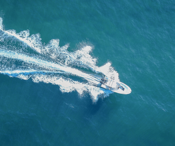
Key West sits at the southern tip of Florida, surrounded by three distinct bodies of water and offering some of the most varied boating in the continental United States. To the north lies Florida Bay and the shallow backcountry. To the south and east, the Atlantic and Hawk Channel run along the reef line. To the west, the Gulf of Mexico opens wide. Each side behaves differently, demands different navigation skills, and rewards boaters who understand the local conditions.
That variety is part of what makes Key West boating so compelling. You can anchor at a remote sandbar in waist-deep water one hour and be in the Gulf Stream in another. You can fish the backcountry flats in the morning and have dinner tied up at a downtown marina in the evening. But the same geography that makes Key West exceptional also makes it unforgiving for unprepared boaters. Shifting sandbars, strong tidal currents, extensive no-wake zones, and shallow unmarked water are real hazards here, and they catch visitors every season.
This guide covers what you actually need to know: the two main navigation routes, the most popular sandbars and anchorages, the key marinas, the hazards that matter, and the practical rules that apply before you cast off.
Image courtesy of https://unsplash.com/photos/a-view-of-a-beach-with-palm-trees-in-the-foreground-oPRG3kitrxM
Understanding the Navigation Routes
Key West boating revolves around two primary routes, and choosing correctly for your vessel draft and destination is one of the most important decisions you will make.
The Inside Route: Florida Bay and the Backcountry
The inside route runs north and west of the Keys through Florida Bay and the backcountry. This is a spectacular environment of mangrove islands, tidal creeks, seagrass flats, and remote anchorages, but it demands respect. Water depths are consistently shallow, often ranging from one to four feet at low tide across large stretches. Shoaling is common, and many of the channel markers are widely spaced. Reading water color is as important as reading your chart here. Dark blue to blue-green typically indicates deeper water. Light green and white indicate sand and increasingly shallow ground. Brown or olive tones signal seagrass or mud.
The inside route is the natural choice for shallow-draft vessels: skiffs, bay boats, flats boats, and kayaks. Deeper-draft vessels should plan routes carefully and consult current charts rather than relying on memory or outdated information.
The Outside Route: Hawk Channel
The outside route runs along the Atlantic side of the Florida Keys through Hawk Channel, the navigable water between the Keys and the offshore reef line. Depths are generally more forgiving here, ranging from eight to fifteen feet through most of the channel, making it accessible for deeper-draft cruising boats.
Hawk Channel is the main thoroughfare for sailboats, trawlers, and anyone moving between Key West and the Upper Keys. It is marked and well-charted, but the reef line to the south is unforgiving. Staying inside the reef markers is not negotiable.
Key Channels and Passes
The Northwest Channel is the primary deep-water entrance to Key West from the Gulf side. It is well-marked and carries sufficient depth for most vessels. The Southwest Channel provides another Gulf approach and is used regularly by commercial traffic.
Moser Channel, which runs under the Seven Mile Bridge, connects the Gulf and Atlantic sides at the Upper Keys and is the standard transit point for vessels moving between the two routes north of Key West.
The “Red Right Returning” rule applies in the Keys when heading north or east, which is considered the inbound direction. When heading south or west, red markers pass on your left. This can feel counterintuitive in the Keys because the waterway geography runs at angles, so understanding the convention before you arrive is worth the time.
Tidal currents in Key West can run two to three knots at peak in some channels and passes, which is significant for smaller or slower vessels. Plan your passages and anchorage exits with the tide in mind.
Popular Sandbars and Anchorages
The sandbars west and north of Key West are among the most popular day destinations in the Florida Keys. They are the right kind of beautiful: clear turquoise water, soft sand, and enough depth at the right tide to anchor comfortably and step off the bow into waist-deep water.
Marvin Key
Marvin Key is located in the Turkey Basin area west of Key West and is one of the most visited sandbars in the region. The surrounding shallows and shoals shift frequently, particularly after storm events, and the navigation to it is not straightforward. The area rewards boaters who check current charts before visiting rather than relying on a route that worked the last time. The east side of the island sits in the lee of the prevailing trade winds and tends to be the calmer side.
Snipe Point
Snipe Point and the nearby Snipe Keys are located in the backcountry northwest of Key West. This area is remote and tends to attract fewer boats than the more accessible sandbars. The surrounding flats are popular fishing ground, and the anchorage offers good protection depending on wind direction.
Woman Key
Woman Key lies about 13 miles west of Key West and sits within the Key West National Wildlife Refuge. The sandbar at Woman Key is a place of quieter beauty than some of the more popular spots closer to town. The wildlife refuge designation means the area has specific rules around landing and disturbing wildlife, particularly nesting birds. Check current FWS regulations before anchoring or going ashore here.
Boca Grande Key
Boca Grande Key is located just east of Woman Key and is another popular destination for day trips. The shallow water around it provides good swimming and anchoring conditions at appropriate tide stages.
Content Keys
The Content Keys sit further into the backcountry, northwest of Key West. They offer more seclusion than the sandbars closer to town and are a natural fit for boaters who want to escape the weekend crowds that gather at Marvin Key and similar spots.
General Sandbar Rules
Anchor only in sand, never over seagrass or coral. Seagrass beds are protected habitat and prop scarring is a violation. Pack out everything you bring. Strong currents run along the edges of many sandbars, so keep swimmers aware of the flow, especially children. Sandbars are at their most accessible and safest during high tide or the incoming tide. At low tide, approaches that were clear can become hazardous quickly.
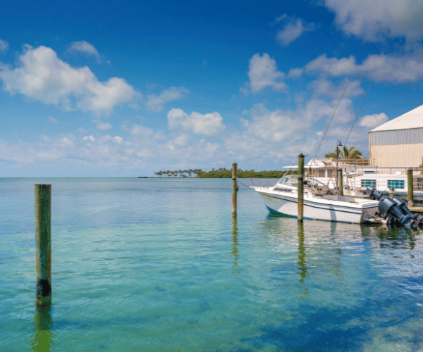
Marinas and Facilities
Key West has a range of marinas serving everything from day boats to long-range cruisers. The most relevant for visiting boaters are concentrated around the Key West Bight and on Stock Island.
A&B Marina
A&B Marina is located at 700 Front Street in the heart of Old Town Key West. It is one of the most centrally placed marinas in the Keys and can accommodate vessels up to 140 feet. The location puts you within walking distance of Duval Street and the historic district. It offers wet slips, pump-out facilities, a swimming pool, and laundry. For transient boaters who want to be in the middle of the action, it is a well-regarded option.
Key West Bight Marina
Key West Bight Marina sits at the opposite end of the Key West Bight from A&B Marina and offers a slightly different atmosphere. It is considered a practical and reasonably priced option for transient dockage in a central location. A Duval Loop bus stop is close by, making it easy to get around town without moving the boat.
City Marina at Garrison Bight
The City Marina at Garrison Bight on the north side of Key West, at 1801 N Roosevelt Blvd, is the home of the Key West Historic Charter Boat Row and offers 245 slips along the Palm Avenue Causeway. It serves live-aboard, recreational, and transient boaters. Transient dockage starts at $2.53 per foot per day. Note that the privately operated dry storage facility on the island bearing the Garrison Bight name has been undergoing redevelopment and has had operational changes in recent periods, so confirm current availability directly with each marina before planning your trip.
Stock Island Marina Village
Stock Island Marina Village is located at 6000 Peninsular Avenue just off the main island and is one of the largest marinas in the area, with 220 slips accommodating vessels up to 300 feet. It features a full-service boatyard, fuel dock, and dining options on site. Stock Island has become increasingly popular as a base for visiting boaters who want practical facilities and proximity to Key West without downtown marina pricing.
Perry Marina (Stock Island)
The Perry Hotel Marina on Stock Island is the largest deep-water marina in the Florida Keys, with 288 slips and the ability to accommodate vessels up to 400 feet. It offers a full-service boatyard, fuel, dining, a pool, and shuttle service to Key West. It is the right option for larger vessels or boaters looking for a full-amenity experience.
Mooring Field
Key West maintains a mooring field on the north side of the island between Fleming Key and Garrison Bight, with 149 moorings for full-time and transient vessels. Daily mooring fees are currently around $18 per day. All of Key West’s surrounding water is a no-discharge zone, meaning pump-out is required for all waste water.
Hazards and Safety Considerations
Shallow Water and Shifting Sandbars
The single most common hazard in Key West waters is shallow ground. Sandbars shift, particularly after storms, and areas that were navigable on a previous visit can be significantly shallower or shaped differently. Never approach an unfamiliar area at full speed. Polarized sunglasses help enormously with reading water color. Come in on the high tide when exploring new areas, and leave before it drops significantly if your draft is at all marginal.
Manatee Protection Zones
Manatee slow speed zones and idle speed zones are enforced throughout Key West waters. These are not optional. The specific boundaries change periodically, so always check current Florida Fish and Wildlife Conservation Commission (FWC) manatee zone maps before entering areas you are unfamiliar with. Violations carry significant fines.
Coral and Seagrass Protection
The Florida Keys National Marine Sanctuary covers the reef and surrounding waters. Anchoring on coral is illegal. Prop dredging through seagrass is illegal. Both carry substantial penalties and both cause long-term damage that takes years to recover. If you cannot see the bottom clearly, do not assume you can anchor. When in doubt, move.
Weather
Quick-developing afternoon thunderstorms are common from late spring through early fall. The Gulf Stream to the south creates its own weather patterns, and conditions can change faster than a standard marine forecast captures. Always have a weather plan and a shelter plan before leaving the dock. Lightning is a serious and underappreciated hazard in the Keys.
Navigation Apps and Updated Charts
Given how much the bottom changes in Key West waters, running current charts is not a suggestion. Updated navigation apps with real-time tidal data make a meaningful difference when you are crossing unfamiliar shallow ground. Wavve Boating offers draft-aware depth shading that automatically adjusts to current tides, which is particularly useful in an environment like the Keys where a few inches of tide can change whether a passage is safe.
Regulations and Practical Tips
Florida requires a Boating Safety Education Identification Card for anyone born on or after January 1, 1988, operating a motorized vessel of 10 horsepower or more. The card does not expire once issued and must be carried along with a government-issued photo ID.
Life jackets are required on board for every person. Children under six must wear a life jacket at all times while underway on a vessel under 26 feet.
All of Key West’s surrounding waters are a no-discharge zone. Use pump-out services for all waste water, both grey and black.
File a float plan before leaving the dock on any significant trip. Leave it with someone ashore who knows when to call for help if you do not check in.
Fuel range is worth thinking about in the Keys. Marina options thin out considerably once you move into the backcountry. Know your range and plan accordingly.
Frequently Asked Questions
Do I need a boating license to boat in Key West?
Florida does not issue a traditional boating license. Instead, anyone born on or after January 1, 1988, who operates a motorized vessel of 10 horsepower or more must have a Florida Boating Safety Education Identification Card and carry a government-issued photo ID.
What is the best tide for visiting Key West sandbars?
High tide or the incoming tide is generally the safest window for approaching sandbars and shallow anchorages. Many approaches that are clear at high tide become too shallow or hazardous at low tide. Always check the tidal cycle for your specific destination on the day you plan to visit.
Are the sandbars near Key West crowded?
The more accessible spots like Marvin Key can get busy on weekends, particularly during peak season. Heading out mid-week or arriving early in the morning before the crowds build gives you a significantly more enjoyable experience. More remote spots in the Content Keys and backcountry are quieter by nature.
Can I anchor anywhere in Key West waters?
No. You cannot anchor over coral or seagrass at any time. Anchoring in no-anchor zones within the Florida Keys National Marine Sanctuary carries substantial penalties. Anchor only in sand.
What should I watch out for when navigating the backcountry?
Shallow water, shifting sandbars, unmarked shoals, and tidal current are the primary hazards. Read water color, use polarized sunglasses, run current charts, come in on the rising tide when exploring new areas, and never assume that what was safe last season is still safe today.
What is the no-discharge zone in Key West?
All of the water surrounding Key West is a designated no-discharge zone. This means no waste water, grey or black, can be discharged overboard. Use marina pump-out facilities before and after your time on the water.
Is the reef accessible from Key West?
Yes. The offshore reef system is accessible by boat from Key West and offers excellent snorkeling and diving. Mooring buoys are available at many reef sites within the Florida Keys National Marine Sanctuary. Use them rather than anchoring to protect the reef.
What is the best season to boat in Key West?
Winter and spring offer the most reliable weather conditions: lower humidity, steadier winds, and fewer afternoon thunderstorms. Summer brings warm water and good diving conditions but also daily risk of lightning storms in the afternoon. Fall is transition season. Avoid boating during active tropical weather events regardless of season.
Key West is one of the most rewarding boating destinations in the country, but it demands preparation. Understanding the two navigation routes, respecting the shallow and dynamic bottom, knowing the environmental rules, and staying current on tides and weather are what separate a great trip from a frustrating one. Get those things right and the Keys will give you the kind of day on the water you will talk about for years.
Content
- Understanding the Navigation Routes
- Popular Sandbars and Anchorages
- Marinas and Facilities
- Hazards and Safety Considerations
- Regulations and Practical Tips
- Frequently Asked Questions
- Do I need a boating license to boat in Key West?
- What is the best tide for visiting Key West sandbars?
- Are the sandbars near Key West crowded?
- Can I anchor anywhere in Key West waters?
- What should I watch out for when navigating the backcountry?
- What is the no-discharge zone in Key West?
- Is the reef accessible from Key West?
- What is the best season to boat in Key West?