Is There a Google Maps for Boating?
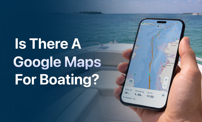
There isn’t a Google Maps app for boating, but several marine navigation apps like Wavve Boating are built to serve that exact need. Wavve Boating is one of the most popular tools offering a Google Maps–like experience on the water, with easy GPS tracking, clean charts, and route planning designed for boaters.
Unlike road travel, boating requires apps that handle water depth, tides, navigation markers, and hazards. Google Maps doesn’t provide any of this, which is why boaters turn to apps made specifically for marine environments. In this article, we’ll explore what makes Google Maps so appealing, why it falls short on the water, and which boating apps do the best job of replicating its simplicity, speed, and clarity for marine use.
What Makes Google Maps Appealing and Why Boaters Want It
Google Maps has become the go-to navigation tool because it’s fast, simple, and deeply reliable. It provides real-time location tracking, smart routing, traffic updates, and points of interest, all wrapped in a clean, responsive interface. That combination of clarity and intelligence is exactly what boaters want from a marine navigation app.
The idea of a Google Maps-style boating app is appealing because it removes friction. Instead of staring at complex charts or toggling between multiple data overlays, users want something that just works. They want an app that shows where they are, where they’re going, what’s nearby, and how to avoid trouble along the way. That’s why platforms like Wavve Boating are gaining traction. They deliver on this expectation without the complexity of old-school marine tools.
Marine Navigation Apps in 2026: Smarter and More Connected Than Ever
In 2026, marine navigation apps have become faster, more intelligent, and better integrated with modern boating technology. Many platforms now combine real-time GPS navigation with live data layers such as wind direction, tide forecasts, depth awareness, and hazard alerts directly on the map. Improvements in offline chart storage and faster map rendering also make navigation more reliable when boating outside of cellular coverage. Apps like Wavve Boating continue to focus on simplifying the experience by presenting complex marine data in a clear, mobile-friendly interface that feels familiar to anyone used to map apps on land. These updates highlight a broader shift toward navigation tools that are easier to use while still providing the critical information boaters need to travel safely and confidently.
Why Google Maps Doesn’t Work for Marine Navigation
Google Maps is built for road travel, not water. It doesn’t include marine charts, water depth information, tide data, or navigation markers, all essential for safe boating. While the app can show your general GPS location, it won’t display any of the critical details needed to avoid hazards or plan a safe route on the water.
Unlike roads, waterways don’t follow fixed paths. Navigation requires real-time information about shifting sandbars, no-wake zones, submerged obstructions, and legal boating channels. Google Maps simply isn’t equipped to handle any of this. Relying on it while boating could mean running aground, missing a safe passage, or traveling through restricted areas without even knowing it.
For true marine navigation, boaters need an app designed specifically for the water, one that understands the variables and risks of navigating off land.
Do Boaters Still Use Traditional Marine Charts?
Even with the rise of mobile navigation apps, many boaters still rely on traditional marine charts as a backup or complementary navigation tool. Paper charts and official digital nautical charts provide detailed information about waterways, including depth contours, navigation markers, and restricted zones. While modern apps simplify this data into an easier-to-read format, the underlying information still comes from the same charting sources used by professional mariners. Experienced boaters often recommend understanding basic chart reading skills in addition to using navigation apps. Combining traditional chart knowledge with a modern, Google Maps–style boating app gives you the best mix of simplicity, reliability, and safety on the water.
What’s the Closest Thing to Google Maps for Boating?
Many marine navigation apps try to match the simplicity and user-friendly design that Google Maps provides on land, but Wavve Boating comes closest to delivering a similar experience on the water. The app includes GPS navigation, simple route planning, tide and depth overlays, and a sleek, intuitive interface that feels familiar to anyone who regularly uses Google Maps.
Other options like Argo, Savvy Navvy, and KnowWake also offer map-based navigation, but each app takes a slightly different approach. Argo focuses on community-sourced routes, while KnowWake highlights points of interest and no-wake zones. Savvy Navvy markets itself as Google Maps for boats, but its interface leans more toward traditional charting.
Wavve Boating stands out by combining map simplicity with marine-specific intelligence. It filters chart data based on your boat’s draft, shows relevant markers without clutter, and allows you to share your location with friends in real time — all features that feel intuitive to anyone familiar with mobile navigation apps.
Marine Navigation Apps That Feel Like Google Maps
Several marine apps aim to offer the simplicity that boaters expect from a Google Maps-style experience. Among them, Wavve Boating stands out for combining modern design with marine-specific functionality, making it a strong choice for anyone who wants clear, real-time navigation on the water.
Wavve offers a clean, customizable chart display based on your boat’s draft, GPS tracking, and real-time location sharing. Its interface is straightforward, helping boaters stay focused on where they are and where they’re going without unnecessary complexity.
Other apps, like Argo, Savvy Navvy, and KnowWake, include some similar tools, such as route planning or points of interest. However, each has limitations in chart clarity, social features, or usability that make them feel more like specialized tools than fully streamlined navigation apps.
For boaters who want something that works like Google Maps but built for the water, Wavve Boating delivers that balance of simplicity and purpose.
Wavve Boating: The Most Google Maps-Like Boating App
If you’re looking for a marine navigation app that feels as intuitive and reliable as Google Maps, Wavve Boating checks all the boxes. It’s designed specifically for recreational boaters who want fast, clear access to everything they need on the water without dealing with the complexity of traditional marine chartplotters.
The app provides real-time GPS tracking, customizable charts based on your boat’s draft, and clean route planning that adjusts to your location. Boaters can also share their live position with others using the Fleets feature, making group trips safer and easier to coordinate.
What really sets Wavve apart is its interface. It doesn’t just layer marine data over a confusing chart, it simplifies it. Depth, tides, markers, and hazards are all displayed in a way that’s easy to understand at a glance. The experience is fast, fluid, and familiar, especially for anyone used to navigating with mobile maps.
What to Look For in a Boating App Like Google Maps
If you’re searching for a boating app that feels like Google Maps, it’s important to look beyond just map visuals. Marine navigation comes with a unique set of needs, and the best apps combine those with a clean, intuitive experience.
Key features to look for include:
- Real-time GPS tracking to show your exact position on the water
- Simple, responsive interface that’s easy to read while underway
- Customizable charts based on your boat’s draft and preferences
- Clear route planning with automatic adjustments and safety warnings
- Tide, depth, and hazard overlays that are well-labeled and unobtrusive
- Offline functionality for when you’re beyond cell coverage
- User-generated data or community sharing for local insights
Whether you’re navigating a busy waterway or exploring new coastlines, having these tools built into a single app makes boating safer and far more enjoyable.
Can You Use Google Maps for Boating at All?
Technically, yes — but only in the most limited sense. Google Maps can show your GPS location on the water and help you get a general sense of direction. However, it lacks the essential marine navigation tools that make boating safe and effective.
You won’t find water depth information, channel markers, tide data, or marine hazards on Google Maps. It also doesn’t adapt to your boat’s draft or show restricted areas. That means you could easily stray into shallow water, run aground, or violate local navigation rules without realizing it.
For planning a general route or looking up waterfront restaurants, Google Maps might be useful. But for real boating, it simply isn’t enough. Dedicated marine navigation apps are built for the job and offer the accuracy and context that Google Maps cannot provide.
What Is the Easiest Marine Navigation App to Use?
The easiest marine navigation apps are the ones that balance simplicity with function. They provide the essential features boaters need, such as GPS tracking, route planning, and depth awareness, without overwhelming you with technical data or outdated interfaces.
Wavve Boating is widely considered one of the easiest apps to use in this space. Its interface feels familiar to anyone who has used mobile maps before, and it’s designed specifically for recreational boaters who want to navigate with confidence, not confusion.
Charts are automatically filtered to show relevant information based on your boat’s draft. The layout is clean, the tools are intuitive, and the learning curve is minimal. Whether you’re planning a day trip or exploring somewhere new, you can open the app and get going right away.
Which Boating App Is Most Like Waze?
If you’re searching for a boating app that feels most like Waze, Wavve Boating stands out as the top choice. It offers the same kind of real-time GPS functionality, smart routing, and user-friendly interface that make apps like Waze so popular on land — but adapted specifically for life on the water.
With features like community-sourced markers, live location sharing, and route planning based on your boat’s draft, Wavve Boating delivers a navigation experience that’s both powerful and easy to use. The layout is clean and intuitive, making it simple to understand conditions at a glance and stay informed as you move.
Among marine navigation apps, it’s the one that most closely mirrors the convenience and responsiveness of Waze, tailored for recreational boating.
Closest Alternatives to a Google Maps-Style Experience for Boaters
If you’re hoping to find a navigation app that mirrors the simplicity and functionality of Google Maps, a few marine apps come close, but only one stands out.
Wavve Boating is the closest match in terms of look, feel, and ease of use. It provides real-time GPS tracking, clean visuals, community-shared insights, and smart route planning tailored to your boat’s draft. The experience is designed to be just as intuitive as opening a map app on your phone and getting going.
Other apps may offer individual features like detailed charts or AIS overlays, but they often come with clunky interfaces or a steep learning curve. Wavve’s ability to combine helpful features into a simple, modern experience makes it the best overall alternative to a Google Maps-style app for boating.
How to Choose the Right Marine Navigation App
The best marine navigation app for you depends on your boating habits, your level of experience, and where you plan to go. Some boaters want the most advanced features possible, while others prioritize simplicity and speed.
When comparing apps, consider the following:
- Is GPS tracking reliable and real-time
- Are the charts easy to understand
- Does the app offer information on tides, depths, and local hazards
- Can you plan routes based on your boat’s size or draft
- Will it work offline if you’re out of cell range
- Is the interface clean and mobile-friendly
It’s also worth looking into whether the app includes community-generated data or integrates with other devices you use. Ideally, you want something that adds confidence to your time on the water, not complexity.
Final Thoughts — What to Use Instead of Google Maps for Boating
Google Maps isn’t built for boating. While it might help you see the shoreline or plan a drive to the boat ramp, it lacks the marine-specific data and tools needed to safely and confidently navigate on the water.
That’s why boaters turn to dedicated marine navigation apps instead. These apps offer nautical charts, GPS tracking on the water, hazard markers, tides, and even social features designed specifically for boaters. Whether you’re cruising, fishing, or exploring a new coastline, a purpose-built boating app gives you what you need to plan and adapt in real time.
If you’re looking for something that feels familiar, easy to use, and tailored to boating, there are modern options available that far surpass what Google Maps can offer on the water.
Content
- Is There a Google Maps for Boating?
- What Makes Google Maps Appealing and Why Boaters Want It
- Marine Navigation Apps in 2026: Smarter and More Connected Than Ever
- Why Google Maps Doesn’t Work for Marine Navigation
- Do Boaters Still Use Traditional Marine Charts?
- What’s the Closest Thing to Google Maps for Boating?
- Marine Navigation Apps That Feel Like Google Maps
- Wavve Boating: The Most Google Maps-Like Boating App
- What to Look For in a Boating App Like Google Maps
- Can You Use Google Maps for Boating at All?
- What Is the Easiest Marine Navigation App to Use?
- Which Boating App Is Most Like Waze?
- Closest Alternatives to a Google Maps-Style Experience for Boaters
- How to Choose the Right Marine Navigation App
- Final Thoughts — What to Use Instead of Google Maps for Boating