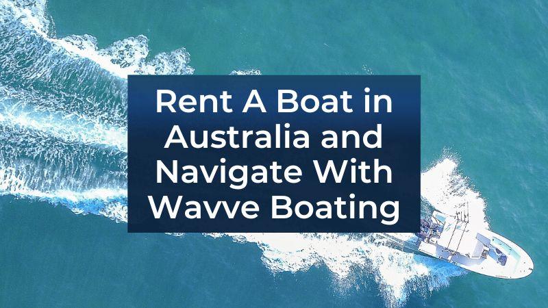
See Real-Time Depth, Tide, and Navigation Data for Australia’s Coastlines, Free to Explore Before You Download the App.
Experience Wavve Boating’s powerful marine chart technology firsthand with the Free Chart Viewer. You can explore real-time water depth, tides, and navigation layers for Australia’s most popular boating regions, all without signing up or downloading anything.
Whether you’re planning a trip through Sydney Harbour, the Whitsundays, or Port Phillip Bay, the Free Chart Viewer lets you preview how Wavve Boating transforms complex navigation data into clean, easy-to-read marine maps. It’s a simple way to see the same accurate charts trusted by thousands of Australian boaters using the full Wavve Boating App.
Experience Australia’s Marine Charts Instantly
Discover the Power of Wavve Boating’s Chart Technology Without a Subscription.
The Official Free Chart Viewer (Australia) gives you instant access to Wavve’s interactive marine maps, built for clarity, precision, and usability on any device. Each chart shows real-time depth contours, marina access points, and safe boating zones across Australia’s coastal and inland waterways.
With the Wavve Boating Chart Viewer, you can:
- Explore detailed depth shading that adjusts visually by region.
- See nearby anchorages, channels, and popular routes at a glance.
- Test the same clean, intuitive chart style found inside the Wavve Boating App.
It’s the fastest way to understand how Wavve’s maps deliver accuracy and ease in every detail, from shallow coves to open-water passages.
Try the Free Chart Viewer (Australia) Before You Download
Explore Accurate Marine Charts, Tide Layers, and Navigation Tools With No Signup Required.
Get hands-on with Wavve Boating’s Free Chart Viewer (Australia), the easiest way to experience professional marine charts built for Australian boaters. There’s no login, no payment, and no installation needed. Just open the chart viewer and start exploring real marine environments in seconds.
You’ll see live data overlays, tide layers, and navigation zones that show exactly how Wavve Boating helps you plan safer routes across Australia’s coastlines.
Access It Instantly on Any Device
Use the Free Chart Viewer (Australia) right from your desktop or mobile browser. The map loads quickly, so you can explore detailed charts without waiting or downloading files.
Preview the Full Wavve Boating Experience
See how Wavve Boating integrates tides, depths, and marina data in one view. You’ll get the same visual clarity and chart accuracy available in the full app.
Explore Australia’s Waters Without Limits
Zoom into Sydney Harbour, the Gold Coast, or the Whitsundays to test real chart coverage. Every map within the Free Chart Viewer (Australia) gives you a true sense of how Wavve Boating simplifies marine navigation.
See Why the Free Chart Viewer (Australia) Sets a New Standard for Marine Charts
Preview the Clarity, Precision, and Smart Data That Power Wavve Boating’s Navigation System.
Wavve Boating’s Free Chart Viewer (Australia) demonstrates exactly what makes its charts stand apart, smarter visuals, deeper data, and effortless usability. Built using professional hydrographic sources and continuously updated with modern chart design, it’s trusted by thousands of Australian boaters for reliable marine insight.
Color-Coded Depth Shading for Safer Routes
Every map in the Free Chart Viewer (Australia) displays depth variations in clear, contrasting tones. Instantly see safe navigation zones and shallow areas tailored to your boat’s draft.
Real-Time Tide and Water Level Data
Wavve Boating integrates live tide and water level updates directly into each chart, giving you awareness of current and forecasted conditions before heading out.
Built-In Marine Weather Visualization
Wind, wave, and visibility data appear seamlessly within the chart interface, no need to switch apps. You can view forecasted conditions for your region with complete accuracy.
With the Free Chart Viewer (Australia), you’re not just testing a feature, you’re previewing the same advanced technology that powers Wavve Boating’s full marine navigation platform.
Explore Any Waterway in Australia With the Free Chart Viewer (Australia)
From Sydney to the Whitsundays, See How Wavve Boating Brings Every Region to Life.
Australia’s coastline is vast, and the Free Chart Viewer (Australia) lets you explore it with precision and clarity. Whether you’re mapping a trip through urban harbours or planning a remote coastal journey, Wavve Boating’s free online tool provides the same accurate data trusted by real boaters.
Preview Coverage for Popular Regions
Discover real marine chart detail for Sydney Harbour, Gold Coast waterways, and the Great Barrier Reef. The Free Chart Viewer (Australia) reflects Wavve Boating’s nationwide data network, so you can confidently preview routes before downloading the app.
See Real Depth and Navigation Layers
From sandbars to deep channels, every contour is displayed with professional-grade depth shading. It’s the same mapping foundation that powers the Wavve Boating App, simply presented in an interactive, web-based preview.
Plan Safer Adventures Before You Set Sail
The Free Chart Viewer (Australia) helps you visualize upcoming trips, understand changing water levels, and identify safe anchorages, all before stepping on board.

Switch Seamlessly From the Free Chart Viewer (Australia) to the Wavve Boating App
Take the Same Charts, Tide Data, and Local Insights With You on the Water.
Once you’ve explored Wavve’s Free Chart Viewer (Australia), bringing those same maps onto your phone is effortless. The Wavve Boating App lets you navigate with full GPS tracking, live weather overlays, and offline access, everything you previewed, now working in real time.
Access Charts Anywhere, Even Offline
Unlike traditional viewers, the Wavve Boating App allows you to download charts for offline use. It’s ideal for areas where signal drops, like offshore islands or remote bays.
Enjoy Integrated Weather and Tide Awareness
All the conditions you saw in the Free Chart Viewer (Australia), tides, wind, and wave forecasts, are built into the live app experience. That means you can plan confidently as conditions shift.
Benefit From Community-Driven Updates
The Wavve Boating App adds a social layer to your maps. Boaters across Australia contribute local hazard reports, anchorage reviews, and tips, giving you a constantly improving navigation experience.
Wavve Boating makes it simple to go from exploring online to navigating in real life, the Free Chart Viewer (Australia) is just the beginning of a smarter way to explore the water.
Discover Real Boater Insights Through the Free Chart Viewer (Australia)
Experience a Community-Enhanced View of Australia’s Coastlines and Waterways.
The Free Chart Viewer (Australia) isn’t just a static map, it’s powered by real experiences from the Wavve Boating community. Each user contribution helps refine the accuracy and detail of the charts, turning local boating knowledge into a shared navigation resource.
See Live User Updates and Shared Knowledge
From new hazard markers to recently added marinas, community input helps you see what’s really happening on the water. The Wavve Boating Blog also features location guides, trip planning ideas, and safety insights based on real user feedback.
Local Data, Nationwide Accuracy
Every chart in the Free Chart Viewer (Australia) blends verified hydrographic data with local insights. This means what you see isn’t just accurate on paper, it’s verified by people who actually boat there.
The result is a smarter, more connected charting experience that evolves with every update.

Australia’s Official Free Chart Viewer Is Live Now
Start Exploring Wavve Boating’s Interactive Marine Maps Today.
The Free Chart Viewer (Australia) gives every boater the opportunity to experience Wavve Boating’s smart marine navigation technology before downloading the app. It’s a powerful, no-cost preview of the same depth data, tide tracking, and intuitive chart visuals that define Wavve’s trusted navigation system.
Whether you’re testing coverage in your region or getting familiar with Wavve’s chart interface, the Free Chart Viewer (Australia) delivers a complete look at how simple and precise boating navigation can be.
You can explore directly through the Free Chart Viewer, learn about Wavve Boating’s app features, or browse the support page to discover how to get started.
Wavve Boating brings professional marine charting and real community insight together, and it all starts with the Free Chart Viewer (Australia).
Content
- See Real-Time Depth, Tide, and Navigation Data for Australia’s Coastlines, Free to Explore Before You Download the App.
- Experience Australia’s Marine Charts Instantly
- Try the Free Chart Viewer (Australia) Before You Download
- See Why the Free Chart Viewer (Australia) Sets a New Standard for Marine Charts
- Explore Any Waterway in Australia With the Free Chart Viewer (Australia)
- Switch Seamlessly From the Free Chart Viewer (Australia) to the Wavve Boating App
- Discover Real Boater Insights Through the Free Chart Viewer (Australia)
- Australia’s Official Free Chart Viewer Is Live Now