Every boater encounters nautical charts whether planning trips on paper charts spread across the table or viewing digital versions on phones and chartplotters. Understanding how to read these charts transforms colored shapes and cryptic symbols into clear navigation guidance preventing groundings, identifying safe anchorages, and building confidence exploring new waters.
Modern navigation apps provide powerful tools, but boaters who understand underlying chart fundamentals make better decisions on the water. This guide breaks down nautical chart reading into practical skills any recreational boater can master, explained through real-world examples and beginner-friendly language.
The Basics: What a Nautical Chart Shows
Nautical charts serve as specialized maps designed specifically for marine navigation, showing water depths, navigation aids, hazards, bottom characteristics, and coastal features boaters need for safe passage.
Chart Title Block:
Every chart includes a title block (usually top or bottom) containing critical information. The title identifies the specific geographic area covered. Chart number provides reference for ordering or discussing specific charts with other boaters. Scale shows the ratio between chart distance and real-world distance. Edition and date indicate when the chart was produced and last updated.
The datum (like WGS84 or NAD83) specifies the coordinate system used. Modern GPS units typically use WGS84 datum. Older charts may use different datums creating small position errors if not accounted for. Most digital navigation apps handle datum conversions automatically.
Units of Measurement:
Depth soundings (numbers showing water depth) appear in feet, fathoms (6 feet), or meters depending on chart region and vintage. US coastal charts typically use feet or fathoms. Check the title block or legend confirming which unit your chart employs. Assuming feet when the chart uses fathoms creates dangerous 6x depth errors.
Distance measurements at sea use nautical miles (6,076 feet) rather than statute miles (5,280 feet) used on land. One nautical mile equals one minute of latitude making chart measurement straightforward using the latitude scale on chart edges.
Colors and What They Mean
Nautical charts use standardized colors communicating depth and land information at a glance.
Water Depths by Color:
White areas represent deep water safe for navigation by typical recreational boats. The exact depth where white begins varies by chart scale and region but generally indicates water deep enough that most boats won’t concern themselves with bottom clearance.
Light blue shading indicates shallow water where depth becomes relevant for navigation. The specific depth varies (commonly 18-30 feet on recreational charts) but light blue warns “pay attention to actual depth here.” Boats with significant draft need to verify exact depths in light blue areas before proceeding.
Dark blue or blue-green represents very shallow water where grounding risks run high. These areas often dry completely at low tide or provide minimal clearance even at high tide. Avoid dark blue zones unless you know your boat’s draft allows safe passage at current tide height.
Green shading shows intertidal zones that cover with water at high tide but expose at low tide. Beaches, mudflats, and rocky shores appear green. These areas should be avoided by boats except perhaps for very shallow draft vessels at high tide who understand local tidal ranges.
Tan or yellow indicates dry land above high tide line. Darker brown represents higher terrain.
Practical Depth Awareness:
Learn your boat’s draft (how deep the deepest part sits below waterline). A boat drawing 4 feet needs at least 4 feet of water depth, preferably 5-6 feet providing safety margin for waves, tidal errors, or chart inaccuracies.
Light blue areas on charts demand attention. Check actual depth numbers in these zones confirming adequate clearance for your draft. Dark blue areas should ring alarm bells. Verify depths carefully and consider whether passage at that specific tide height provides safety.
Understanding shallow water navigation requires knowing your draft, reading depth soundings accurately, and accounting for current tide stage when evaluating charted depths.
Depth Soundings and Contour Lines
Numbers scattered across water areas show depth soundings indicating water depth at that specific location when the chart was surveyed. These soundings provide the fundamental depth information boaters use for navigation planning.
Reading Soundings:
Verify the unit (feet, fathoms, or meters) from the chart title or legend. A sounding of 6 in fathoms means 36 feet of actual water depth. Soundings typically represent depth at Mean Lower Low Water (MLLW) or similar low tide datum. Actual depth at high tide will be greater by the tidal range amount.
Dense soundings (lots of numbers close together) indicate areas surveyed in detail. Sparse soundings suggest less thorough surveys where uncharted shallow spots might exist between sounding locations. Exercise extra caution in sparsely sounded areas particularly when navigating shallow draft boats.
Contour Lines:
Depth contour lines connect points of equal depth similar to elevation contours on land maps. Closely spaced contours indicate steep drop-offs or rapid depth changes. Widely spaced contours suggest gradual sloping bottom.
Contours help visualize underwater topography. Steep underwater walls show as tightly packed contours. Gradual slopes display widely spaced contours. Understanding bottom contours aids anchoring site selection (gradual slopes often provide better holding than steep drop-offs) and fishing (contour changes concentrate fish).
Following a specific contour line allows navigating around an area while maintaining constant depth. Boats wanting to stay in 20 feet of water can follow the 20-foot contour maintaining that depth even as surrounding bottom varies.
Key Symbols and Navigation Markers
Nautical charts use standardized symbols representing buoys, lights, hazards, and features critical for safe navigation.
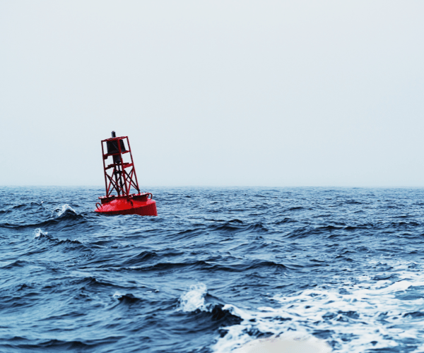
Buoys and Markers:
Red buoys appear as red geometric shapes (triangles, diamonds) with “R” designation and numbers. When returning from sea to harbor, keep red markers on your right (starboard) side. The memory aid “red right returning” helps remember this fundamental rule.
Green buoys show as green shapes (often squares) with “G” designation and numbers. Keep green markers on your left (port) side when returning from sea. Red and green markers work together defining channels. Stay between them for safe passage in marked channels.
Yellow buoys typically mark special purposes like swim areas, fish havens, or traffic separation zones. Their meaning requires checking the chart legend or light list.
Lights and Navigation Aids:
Light symbols show position and characteristics of lighted aids. A magenta circle with radiating lines indicates a lighted beacon or buoy. The notation includes light color (R for red, G for green, W for white), pattern (Fl for flashing, Q for quick flashing, Iso for isophase), and interval (Fl 6s means flashing every 6 seconds).
Learning basic light abbreviations allows identifying lights at night matching them to chart positions for position confirmation. “Fl R 4s 15ft” translates to: red light flashing every 4 seconds, located 15 feet above water level.
Hazards and Obstructions:
Wreck symbols show sunken vessels or major debris. Some wrecks appear above water at low tide (shown differently than always-submerged wrecks). Wrecks often attract fish but also create navigation hazards particularly for boats with deep draft or sailboats with deep keels.
Rock symbols indicate rocks awash (covered at high tide, exposed at low tide) or submerged rocks. The notation shows depth over the rock or whether it uncovers at low water. Give rocks wide berth accounting for position inaccuracies and wave action.
Dotted lines show overhead cables (power lines, communication cables) crossing waterways. The minimum clearance height appears in the notation, critical for sailboats or boats with tall outriggers.
Underwater cable or pipeline routes appear as dashed lines, typically forbidden anchoring zones to prevent damaging critical infrastructure.
Compass Rose and Direction
The compass rose (circular design with degree markings) provides reference for plotting courses and understanding chart orientation.
True vs Magnetic North:
Compass roses show both true north (actual geographic north pole) and magnetic north (where compasses point). The difference between them is called magnetic variation or declination.
The outer circle shows true bearings. The inner circle (often offset) shows magnetic bearings accounting for local magnetic variation. When plotting courses on charts, use true bearings. When steering by compass, convert to magnetic bearings using the variation shown.
Most modern GPS units and navigation apps display true bearings matching chart orientation. Older boats with magnetic compasses require applying variation to convert between chart courses and compass headings.
Latitude and Longitude Grid:
Charts include latitude (horizontal grid lines measuring north/south position) and longitude (vertical lines measuring east/west position). The grid allows determining exact position coordinates.
Modern GPS units display position in degrees, minutes, and decimal seconds or decimal degrees. Match your GPS coordinate format to the chart notation format for accurate position plotting.
The latitude scale on chart edges provides distance measurement. One minute of latitude equals one nautical mile. Measure distances by transferring chart distances to the latitude scale using dividers or parallel rules.
Practical Navigation Tips
Plotting Courses:
Identify departure and destination points on the chart. Draw a straight line between them using a ruler or straight edge. Measure the course angle where your line crosses the nearest compass rose using parallel rules or plotting tools.
Check for hazards along your route (shoals, rocks, wrecks). Shallow areas may require routing around rather than straight-line courses. Plan waypoints where course changes occur around obstacles.
Measure total distance along your route using the latitude scale. Convert distance to estimated time based on your boat’s typical cruising speed accounting for currents or tidal flows.
Scale Considerations:
Small-scale charts show large areas with less detail (1:80,000 scale shows 80,000 feet of real distance in one foot of chart distance). Use these for planning overall routes and understanding regional geography.
Large-scale charts show small areas with more detail (1:20,000 scale provides much more detail in the same chart space). Use these for navigating complex areas, entering harbors, or navigating shoal-filled waters requiring precise positioning.
Carry appropriate scale charts for all portions of your planned route. A small-scale chart adequate for offshore passages won’t show the detail needed for harbor entrance navigation.
Updating Chart Information:
Paper charts become outdated as channels shoal, markers move, or hazards appear. Check publication dates and review Notice to Mariners bulletins announcing chart corrections and updates for your area.
Digital chart apps typically update automatically providing current information without manual chart correction. However, even updated charts may not reflect very recent changes like new sandbars after storms or markers moved within recent days.
Local knowledge supplements chart information. Other boaters, harbor masters, and fishing reports often reveal current conditions charts don’t yet reflect.
Digital Apps Enhance Traditional Chart Reading
Modern marine navigation apps build upon traditional chart fundamentals while adding real-time capabilities paper charts can’t provide.
Apps display official chart data identical to paper charts but overlay GPS position showing exactly where you are in real-time. This electronic position eliminates manual plotting but requires understanding underlying chart information for safe navigation.
Advanced apps add features like real-time tide height integration, community-reported hazards, weather overlays, and automated depth alerts. While these features enhance safety, they work best when the boater understands basic chart reading rather than blindly following electronic guidance.
Some apps like those designed for shallow water boating add automated draft-aware depth shading updating as tides change. These tools complement chart reading skills rather than replacing them.

Common Mistakes to Avoid
Assuming Depth Units:
Always verify whether soundings show feet, fathoms, or meters. Assuming feet when the chart uses fathoms creates 6x depth errors leading to groundings.
Ignoring Tidal Height:
Charted depths typically reference low tide datum (MLLW in the US). Actual depth at high tide will be greater. More critically, actual depth at lower tides may be less than charted providing inadequate clearance even when chart depths appear adequate.
Overlooking Scale:
Using inappropriately scaled charts for navigation creates safety risks. Small-scale charts lack the detail needed for navigating complex shallow areas, harbor entrances, or reef-filled waters.
Neglecting Magnetic Variation:
When working with magnetic compasses, failing to apply variation between true and magnetic north creates course errors increasing with distance traveled.
Not Cross-Referencing Multiple Information Sources:
Relying solely on chart depths without checking current tides, verifying with depth sounders, or considering local knowledge creates unnecessary grounding risk.
Chart Reading Skills Checklist
✓ Understand color coding (white deep, light blue shallow, dark blue very shallow, green intertidal, tan land)
✓ Read depth soundings and verify units (feet, fathoms, meters)
✓ Interpret contour lines recognizing steep versus gradual bottom slopes
✓ Identify red right returning buoy patterns for channel navigation
✓ Recognize common symbols for lights, wrecks, rocks, cables
✓ Use compass rose for course plotting (understand true vs magnetic)
✓ Measure distances using latitude scale
✓ Verify chart scale appropriateness for navigation detail needs
✓ Account for tidal height when evaluating depth clearances
✓ Update or replace outdated charts maintaining current navigation information
Frequently Asked Questions
What do the different colors mean on marine charts?
White indicates deep water, light blue shows shallow water requiring attention, dark blue or blue-green represents very shallow water with high grounding risk, green shows areas that dry at low tide, and tan/yellow indicates land above high water. The colors provide instant visual depth awareness.
How do I know if depths are in feet or fathoms?
Check the chart title block or legend specifying the depth unit. US coastal charts commonly use feet or fathoms (6 feet). Never assume the unit. Mistaking fathoms for feet creates 6x depth errors causing groundings in water you thought was safe.
What does “red right returning” mean?
When returning from sea to harbor, keep red navigation markers on your right (starboard) side and green markers on your left (port) side. This fundamental rule helps navigate marked channels safely maintaining the boat in deep water between markers.
Are charted depths at high tide or low tide?
Most charted depths reference Mean Lower Low Water (MLLW) or similar low tide datum. Actual depth at high tide will be greater by the tidal range amount. At lower tides, actual depth may be less than charted, requiring tidal height calculations for safe passage.
Can I use my phone instead of paper charts?
Yes, quality marine GPS apps using official chart data provide the same information as paper charts with added real-time position tracking. However, carry backup navigation (paper charts or backup devices) in case electronics fail.
What’s the difference between latitude and longitude?
Latitude measures position north or south of the equator (horizontal grid lines on charts). Longitude measures position east or west of the Prime Meridian (vertical grid lines). Together they provide precise location coordinates for any point on Earth.
How often should charts be updated?
Paper charts should be corrected using Notice to Mariners bulletins or replaced every few years depending on how actively the area changes. Digital chart apps typically update automatically but check your app settings confirming updates download regularly. Areas with active channels or frequent changes need more frequent updates than stable offshore areas.
What scale chart do I need for harbor navigation?
Large-scale charts (1:20,000 or larger scale numbers meaning smaller area coverage) provide the detail needed for navigating harbors, complex channels, or reef-filled waters. Small-scale charts (1:80,000 or smaller scale numbers meaning larger area coverage) work for offshore passages but lack detail for intricate navigation.
Conclusion
Reading nautical charts combines understanding standardized symbols, colors, and depth information with practical navigation skills. Master the basics (color coding for depth, sounding interpretation, buoy patterns, common symbols) then practice applying these skills on actual trips in local waters.
Modern apps enhance chart reading through real-time position tracking and additional safety features, but the underlying chart fundamentals remain essential. Boaters who understand what charts show make better navigation decisions whether using paper charts spread across the table or digital charts displayed on phone screens.
Start with charts for your home waters. Study them before trips identifying channels, hazards, and routes. Compare chart information to what you see on the water building confidence in chart interpretation. With practice, nautical charts transform from confusing colored pages into clear navigation guides expanding your cruising range and confidence exploring new waters.
Content
- The Basics: What a Nautical Chart Shows
- Colors and What They Mean
- Depth Soundings and Contour Lines
- Key Symbols and Navigation Markers
- Compass Rose and Direction
- Practical Navigation Tips
- Digital Apps Enhance Traditional Chart Reading
- Common Mistakes to Avoid
- Chart Reading Skills Checklist
- Frequently Asked Questions
- What do the different colors mean on marine charts?
- How do I know if depths are in feet or fathoms?
- What does “red right returning” mean?
- Are charted depths at high tide or low tide?
- Can I use my phone instead of paper charts?
- What’s the difference between latitude and longitude?
- How often should charts be updated?
- What scale chart do I need for harbor navigation?
- Conclusion