Choosing between marine navigation apps means comparing not just features and pricing, but understanding which platform truly addresses your specific boating needs. Navionics and Savvy Navvy represent two distinctly different approaches to marine navigation, one established and traditional, the other modern with advanced weather routing capabilities. This comprehensive comparison examines pricing, features, user experience, and real-world value to help determine which app better serves your navigation requirements.
Head-to-Head Pricing Comparison
Cost represents the starting point for most app decisions. Both platforms use subscription models, but pricing structures differ significantly.
Navionics pricing:
- US and Canada charts: $49.99 annually
- Regional coverage: Pricing varies by region
- One subscription covers all devices with same login
- App download free, subscription required for functionality
Savvy Navvy pricing:
- Free plan: Basic features, US waters only
- Premium: $169 annually for global coverage and advanced features
- Premium+: Higher cost tier with additional tools
- Free plan available indefinitely with limitations
Savvy Navvy’s free plan provides decent functionality. Navionics does not offer a free plan. Boaters outside the US face higher Navionics costs for multiple regions, while Savvy Navvy Premium provides worldwide coverage at flat rate. For budget-conscious boaters, Navionics wins on base price. For boaters wanting to test before paying, Savvy Navvy’s free tier advantage matters.
Charts and Coverage Comparison
Professional-grade charts form the foundation of marine navigation apps. Both use official hydrographic data but present information differently.
Navionics charts:
- Licensed from NOAA, IHO, and other national hydrographic agencies
- Vector charts based on official government sources
- SonarChart community data from user-contributed depth information
- Coverage essentially worldwide
- ActiveCaptain community overlays with user-contributed information
- Updates included with subscription, frequency varies by region
Savvy Navvy charts:
- Licensed from UKHO, NOAA, and other official hydrographic offices
- Vector-based Savvy Charts designed for clean presentation
- Worldwide coverage with regular updates
- Simplified chart design prioritizing readability over complexity
- Official data maintained by Savvy Navvy team rather than community
Both apps provide professional-grade accuracy based on official sources. Navionics’ charts feel more traditional, resembling paper chart styling. Savvy Navvy’s charts emphasize modern simplicity and readability. For boaters preferring familiar chart presentation, Navionics aligns with traditional expectations. For those wanting cleaner, less cluttered displays, Savvy Navvy appeals more.
Routing and Planning Features
How apps handle route planning reveals significant differences in target audiences.
Navionics routing:
- Basic route creation marking start and end points
- Autorouting calculates path avoiding major obstacles
- Routes can be followed during navigation
- Basic planning tools for shorter trips
- Integration with Garmin hardware for advanced planning
Savvy Navvy routing:
- Smart automatic routing accounting for weather, wind, and current
- Departure scheduler identifies optimal departure times based on forecasts
- Course to Steer provides automatic heading adjustments for conditions
- Tidal routing considers tidal flows in route calculations
- Weather-integrated planning optimizing passages around conditions
- Designed specifically for sailors and passage makers
This difference reveals target audiences clearly. Navionics serves boaters making casual day trips and short passages. Savvy Navvy targets sailors and passage makers optimizing multi-day cruises around weather windows. For weekend boating, Navionics’ basic routing suffices. For sailors planning 50+ mile passages, Savvy Navvy’s weather routing becomes invaluable.
Weather Integration
Modern marine navigation requires reliable weather forecasting integrated with planning tools.
Navionics weather:
- Basic weather overlay on maps showing wind and conditions
- Weather alerts for dangerous conditions
- Marine-specific forecasts
- Integration with other weather sources available
- Weather data updates when connected
Savvy Navvy weather:
- Advanced marine-specific forecasting with wind, swell, visibility
- 14-day detailed forecasts for passage planning
- Visual weather display with trend graphs
- Departure scheduler using weather data
- Cloud and rain overlay options
- Multiple weather data sources for comprehensive forecasts
Savvy Navvy’s weather capabilities exceed Navionics significantly. Sailors planning passages benefit immediately from Savvy Navvy’s detailed forecasts and scheduling integration. Power boaters checking conditions casually find Navionics’ basic weather adequate.
Tides, Currents, and Depth Information
Water level changes affect navigable depths constantly, especially in coastal and tidal waters.
Navionics tides:
- Tidal height bars showing predictions over time
- Tidal arrows showing current direction and strength
- Animation showing tide progression through day
- Animated depth changes showing how water level affects charted depths
- Integration with online tide resources
Savvy Navvy tides:
- Data from 8,000 tidal stations worldwide
- Tidal height graphs for visual reference
- Tidal stream overlays showing current direction and strength
- Current-aware routing incorporating tidal flows
- Real-time tide predictions with visual graphs
Both apps provide adequate tidal information. Savvy Navvy’s 8,000 station coverage exceeds Navionics’ database. Savvy Navvy’s tidal integration with routing provides tangible advantage for sailors accounting for tidal windows. Power boaters checking tidal information casually find either app adequate.
Offline Capability
Navigation frequently ventures into areas without cellular coverage. Offline functionality proves essential.
Navionics offline:
- Download chart regions for offline access
- Downloaded charts remain functional indefinitely
- Subscription required to maintain updates
- Offline GPS positioning works without data service
- Routes and waypoints function offline
Savvy Navvy offline:
- Download chart packs for offline access
- Weather data can download for offline use
- Updates require reconnection to refresh data
- GPS positioning works without service
- Premium tier includes offline features
Both apps handle offline navigation capably. Once charts download, both function completely offline. Navionics feels slightly more straightforward for offline preparation. Savvy Navvy requires Premium tier for offline features, limiting free plan users.
User Interface and Ease of Use
Navigation apps require quick information access during actual boating. Interface design significantly impacts real-world usability.
Navionics interface:
- Familiar chart presentation resembling paper charts
- Multiple menu options offering customization
- Touch controls responsive and reliable
- Learning curve exists for first-time users
- Extensive features sometimes feel overwhelming
Savvy Navvy interface:
- Modern, minimalist design with clean presentation
- Simplified menu structure with fewer options
- Intuitive touch controls
- Less learning curve for casual users
- Emphasizes essential features over options
Savvy Navvy wins on immediate usability. The simplified interface allows new boaters becoming productive quickly. Navionics requires more exploration understanding menu structures. For experienced boaters valuing extensive customization options, Navionics appeals more.
Community and Local Knowledge
Boating communities share valuable information about local conditions and hazards.
Navionics community:
- ActiveCaptain system allowing user contributions
- User-reported points of interest, hazards, and reviews
- Reviews and photos for marinas and anchorages
- Community connections sharing location data with friends
- Long-established user base providing rich historical data
Savvy Navvy community:
- Marina and anchorage information with amenities
- Waterway Guides integration providing location details
- Smaller but growing user community
- Social features for sharing routes and trips
- Real boater testimonials on app stores
Navionics’ established user base and ActiveCaptain system provide more accumulated community knowledge. Savvy Navvy’s community remains smaller but growing. For areas with deep user bases, Navionics’ community data proves more valuable. For developing boating regions, the differences matter less.
Device Support and Synchronization
Modern boating involves multiple devices across platforms.
Navionics:
- iOS and Android support
- Synchronization across all devices with same account
- Works on iPad, tablets, and phones
- Chart updates sync across devices
- Waypoints and routes sync automatically
Savvy Navvy:
- iOS and Android support
- Synchronization across up to 5 devices per account
- Works on phones, tablets, and devices
- Data syncs automatically between devices
- Offline chart packs sync across devices
Both apps handle multi-device synchronization well. Savvy Navvy explicitly supports 5 devices per account. Navionics’ device limit remains unclear but works across multiple devices in practice. For boaters using phones, tablets, and backup devices, both provide adequate support.
Hardware Integration
Some boaters own compatible hardwired chartplotters. Integration capabilities matter significantly.
Navionics:
- Integrates tightly with Garmin hardware systems
- Routes and waypoints transfer to compatible Garmin units
- Subscription syncs with Garmin device subscriptions
- ActiveCaptain connects with Garmin systems
- Designed specifically for Garmin ecosystem integration
Savvy Navvy:
- Limited hardware integration currently
- GPX export allows manual transfer to compatible units
- Not designed for specific hardware ecosystem
- Focuses on standalone app experience
- Expanding integration possibilities over time
This significantly favors Navionics for boaters owning Garmin chartplotters. If your boat has Garmin navigation hardware, Navionics integration becomes invaluable. For standalone phone and tablet navigation, this advantage disappears.
Cost Comparison for Different Boating Patterns
Real-world value depends on actual boating activities.
Weekend lake boater: Navionics’ $49.99 cost provides adequate functionality at reasonable price. Savvy Navvy’s $169 premium pricing seems excessive for simple navigation.
Coastal day boater: Both apps provide adequate features. Navionics costs less. Savvy Navvy’s weather routing proves unnecessary.
Sailor making 50-100 mile passages: Savvy Navvy’s smart routing and weather integration justify premium pricing completely. Navionics’ basic routing feels limited.
Multi-month cruiser navigating diverse regions: Savvy Navvy’s worldwide coverage at flat $169 rate feels better than Navionics’ regional pricing. Weather routing provides value for various regions and conditions.
Angler navigating shallow coastal waters: Neither app provides draft-aware safety, but Navionics’ SonarChart community data appeals to fishing-focused users.
Pros and Cons Summary
Navionics pros:
- Established platform trusted by millions
- Tight Garmin hardware integration
- Traditional chart presentation familiar to experienced boaters
- SonarChart community depth data for fishing
- Lower base subscription cost
- Extensive customization options
Navionics cons:
- Recent price increases reducing value perception
- Basic routing capabilities versus modern alternatives
- Steeper learning curve for casual users
- Limited weather routing sophistication
- Regional pricing adds cost for multi-area boating
Savvy Navvy pros:
- Advanced weather routing for passage planning
- Departure scheduler optimizing timing
- Clean modern interface easier for new users
- Global coverage at flat Premium price
- Strong tidal data and current integration
- Generous free tier for testing
Savvy Navvy cons:
- Premium pricing higher than Navionics
- Limited hardware integration for dedicated chartplotters
- Smaller established user community
- Free tier restricted to US only
- Overkill features for casual boaters
FAQ
Which app has better charts overall?
Both use official hydrographic sources providing identical underlying accuracy. Navionics feels more traditional. Savvy Navvy emphasizes modern simplicity. Accuracy is equal.
Can I use both apps together?
Absolutely. Many experienced boaters use multiple apps for cross-reference and backup. This increases navigation confidence.
If I own a Garmin chartplotter, which should I choose?
Navionics integrates seamlessly with Garmin hardware. This integration becomes highly valuable if you want your phone and plotter synchronized.
Which costs less overall?
Navionics at $49.99 costs less annually. Savvy Navvy’s free plan provides decent functionality. Navionics does not offer a free plan.
Which has better weather forecasting?
Savvy Navvy’s weather capabilities significantly exceed Navionics. Sailors and passage makers benefit substantially.
Do both work completely offline?
Yes, both function fully offline after downloading chart regions. GPS positioning works without service in both.
Which is better for fishing?
Navionics’ SonarChart community depth data appeals to anglers. However, neither provides automatic draft-aware safety valuable for shallow-water fishing.
What about customer support?
Navionics offers support through Garmin resources. Savvy Navvy has dedicated support teams responding to inquiries promptly.
Final Verdict
Navionics and Savvy Navvy serve different boating communities effectively.
Choose Navionics if:
- You own compatible Garmin hardware
- You prefer traditional chart presentation
- You boat primarily locally minimizing cost
- You want fishing-specific depth community data
- You prioritize lower subscription cost
Choose Savvy Navvy if:
- You plan multi-day passages optimizing around weather
- You value sophisticated routing features
- You boat globally across different regions
- You want modern interface design
- You prioritize weather routing for passage planning
Many experienced boaters maintain subscriptions to both. Test each app’s free or trial offerings on actual boating trips. Most boaters discover clear preferences within a few weeks of use. Your ideal choice depends entirely on your specific boating patterns and priorities.
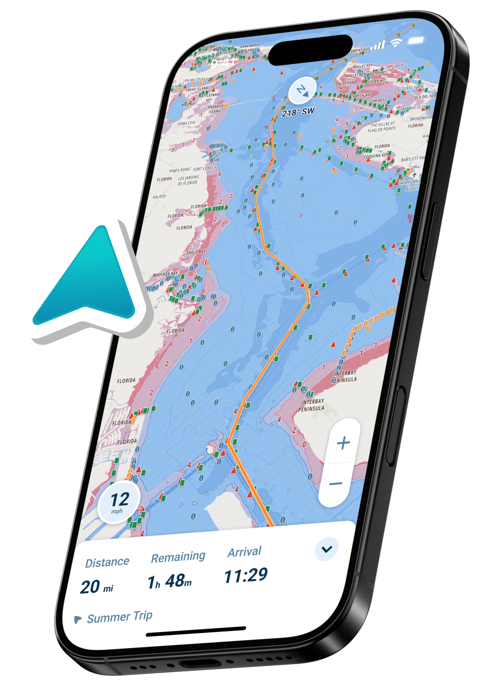
With all this in mind, there’s another option. Wavve Boating offers a better experience than both Navionics and Savvy Navvy because you get the best of all worlds.
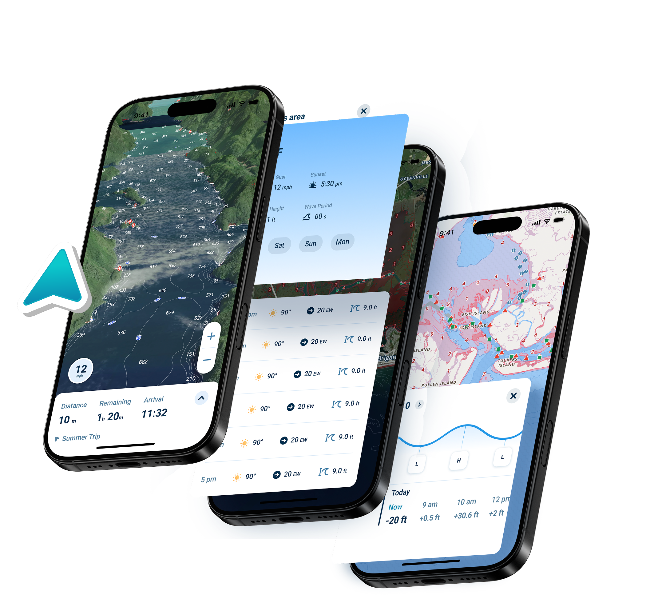
With Wavve Boating you can:
- Navigate effortlessly. View the current water level, easily see shallow areas and avoid other dangers in real time.
- Mark areas of interest on the water, and then share them with the community.
- View tide height, weather, and more…like satellite layers, dark mode, and innovative auto-routing which feels just like using google maps.
Navionics and Savvy Navvy are both excellent options for navigation, but it’s important to remember that they aren’t the only options. For more info, be sure to check out this great article about how to choose a marine gps app.